


 544 km
 8-11 days
 2191m
2191m 362m
362m 0 %
0 % 0 %
0 % 2
2 100 %
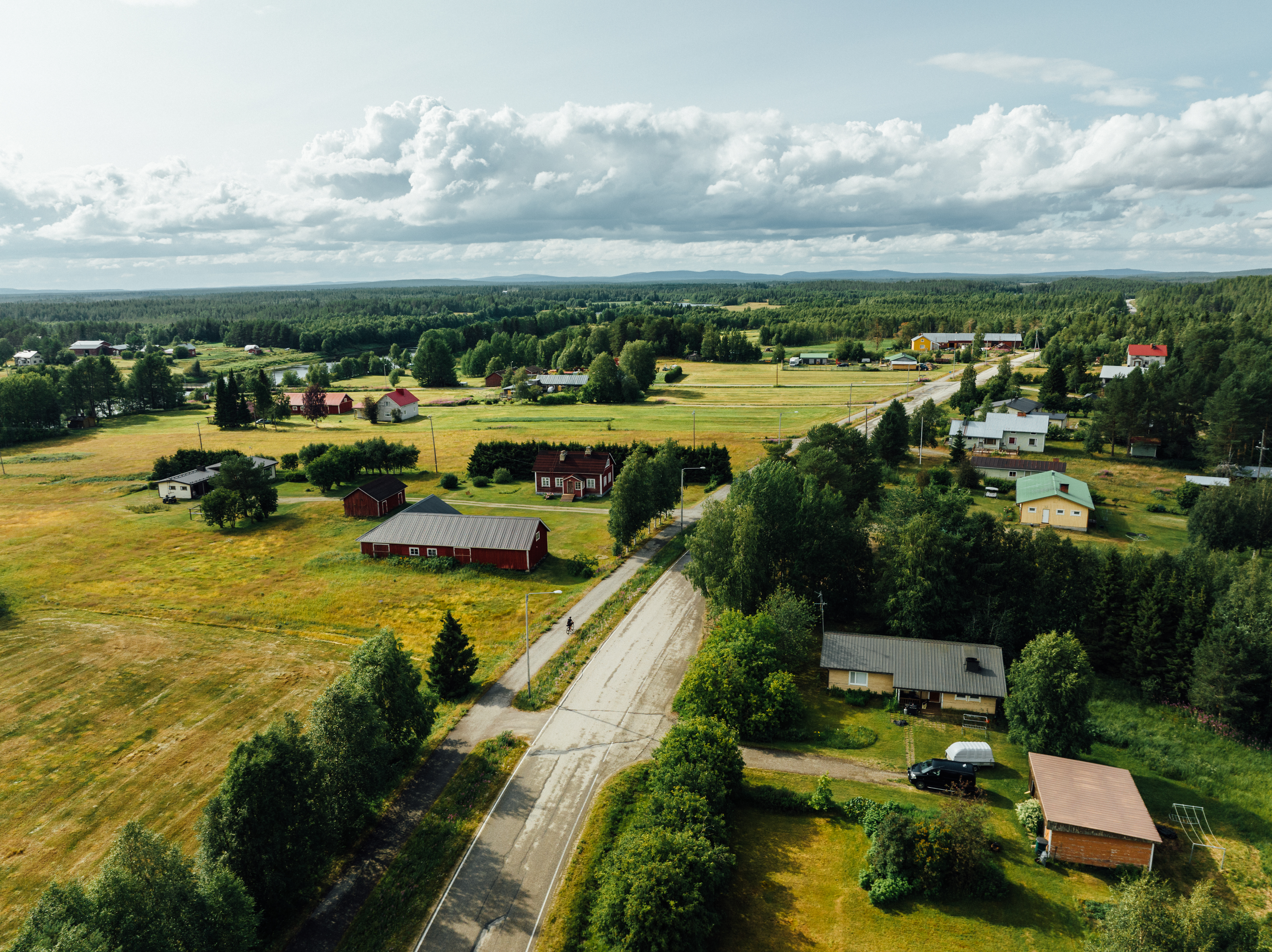
100 %The Eurovelo 13 Northern Section gives you the endless possibilities of experiencing Finnish nature both on and off the saddle.
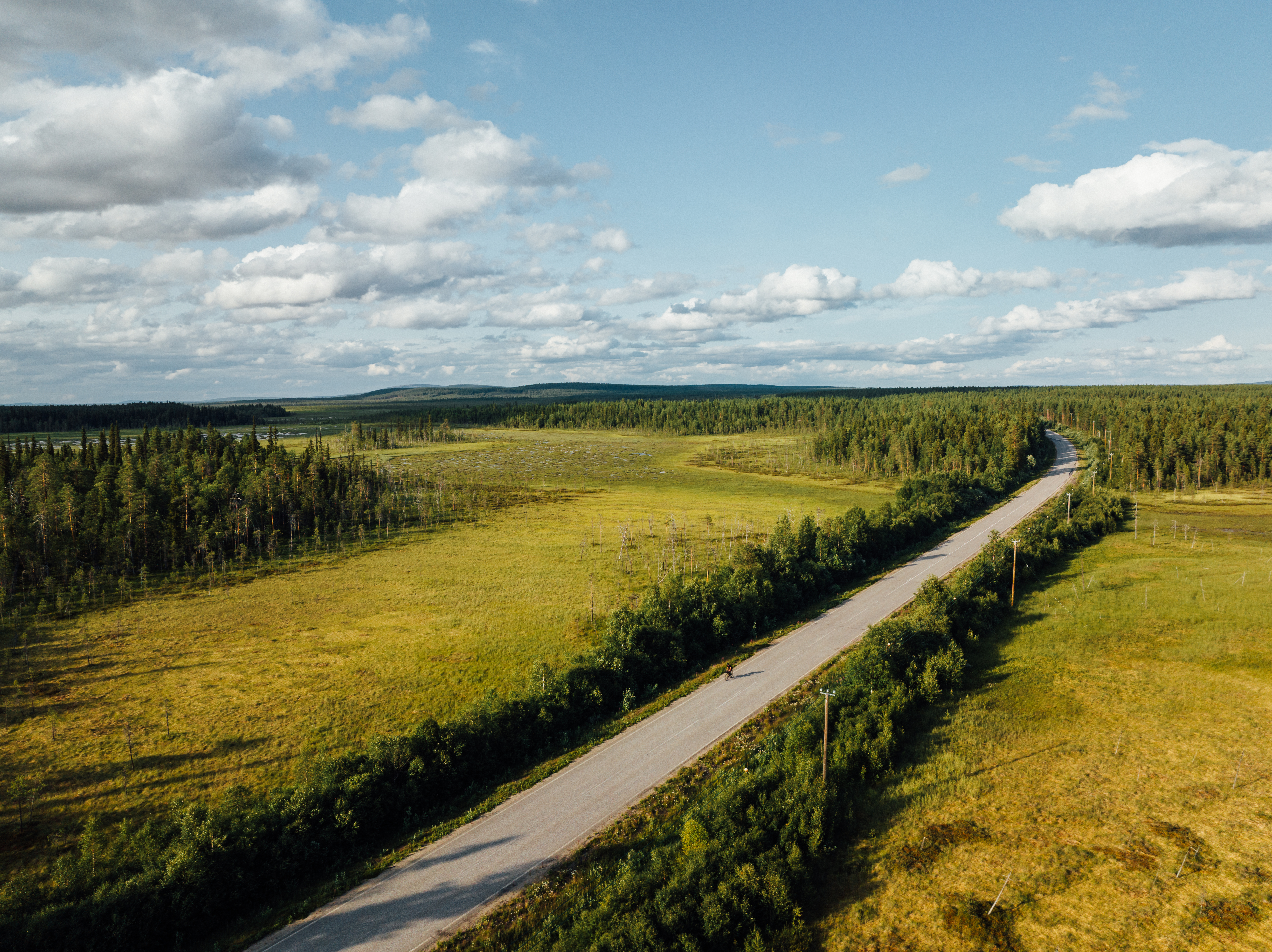
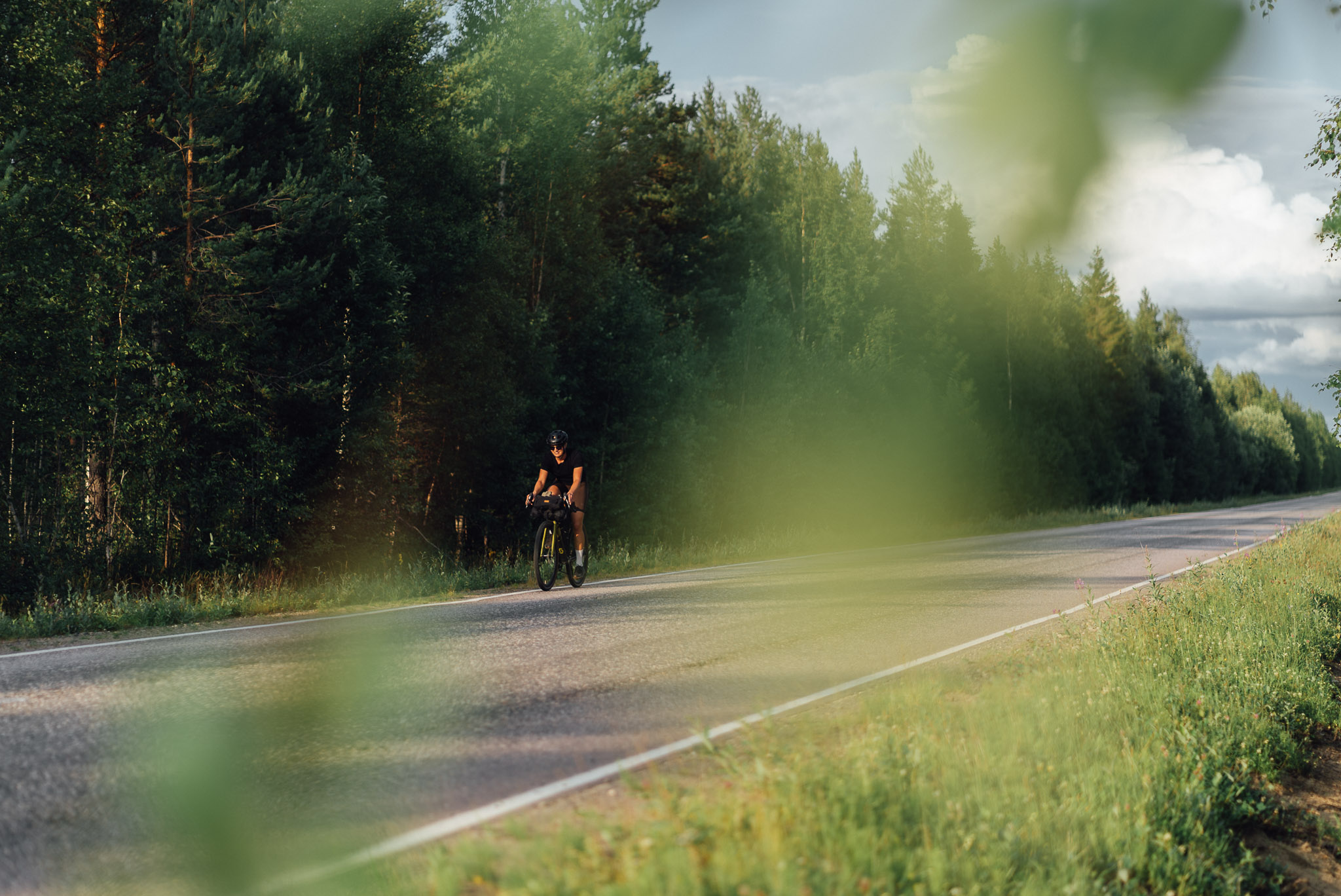
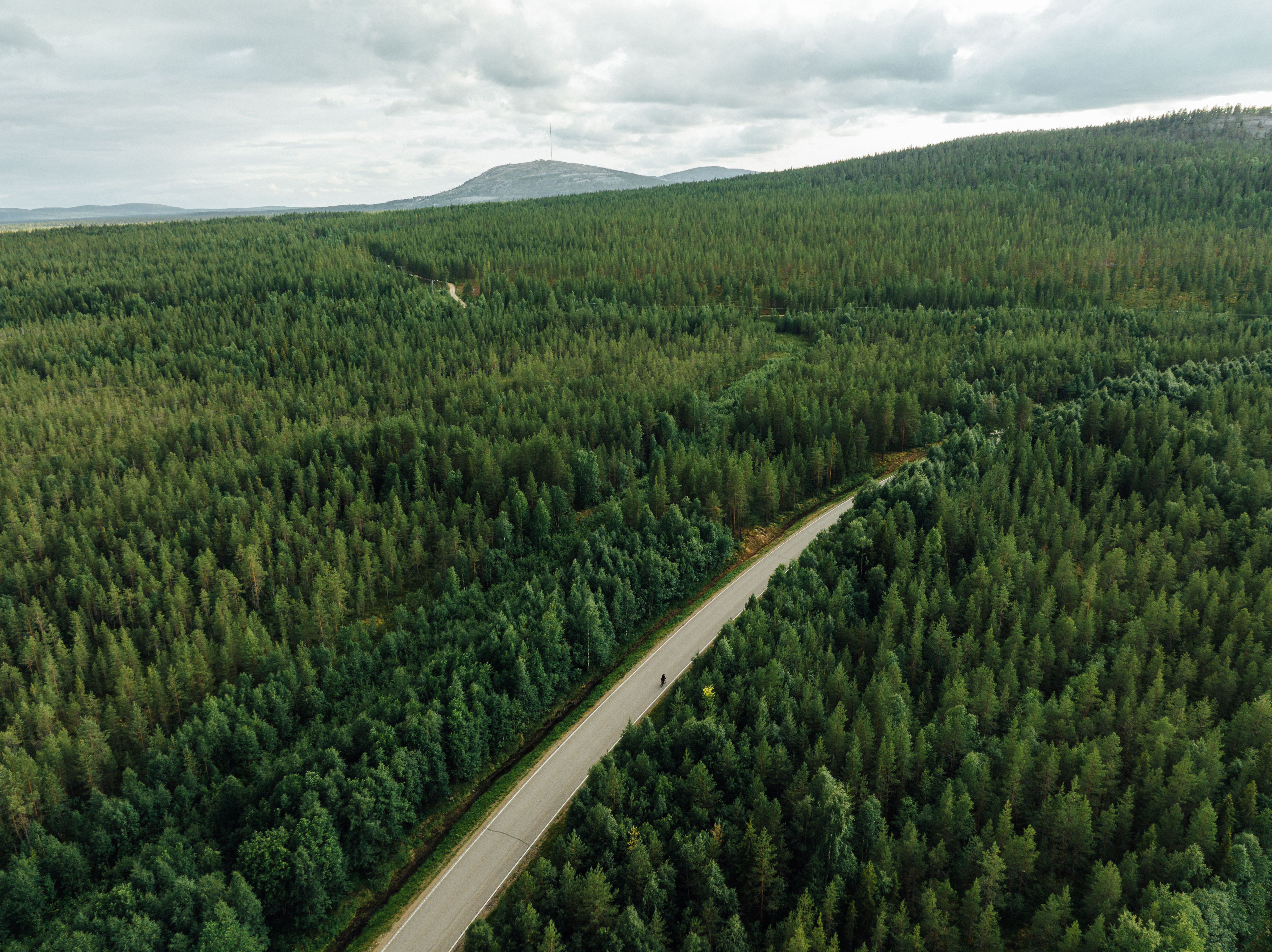
For much of the journey the route passes through isolated woods and moorland where you really get a feel for Finland’s vastness. You bike through vast wilderness areas where your companions for several hours are varying birds and an occasional reindeer. Nature in many shapes and forms is very much present. Lush, green forests, open marshlands, swamps and bogs, rivers and streams flowing at varying paces, ponds and lakes in every size punctuate the route and change the scenery as you cycle along.
Hopping off the saddle you can follow trekking routes into the many National Parks and zoom into nature up close or take a wider perspective from atop one or more of the many fells! Or you can take a cruise on Lake Inari or a boat trip up Lemmenjoki River to seek gold or kayak on the many rivers around Inari and Ivalo. Saariselkä, Pyhä, Luosto and Salla provide excellent mountain bike trails if you are up to the challenge!
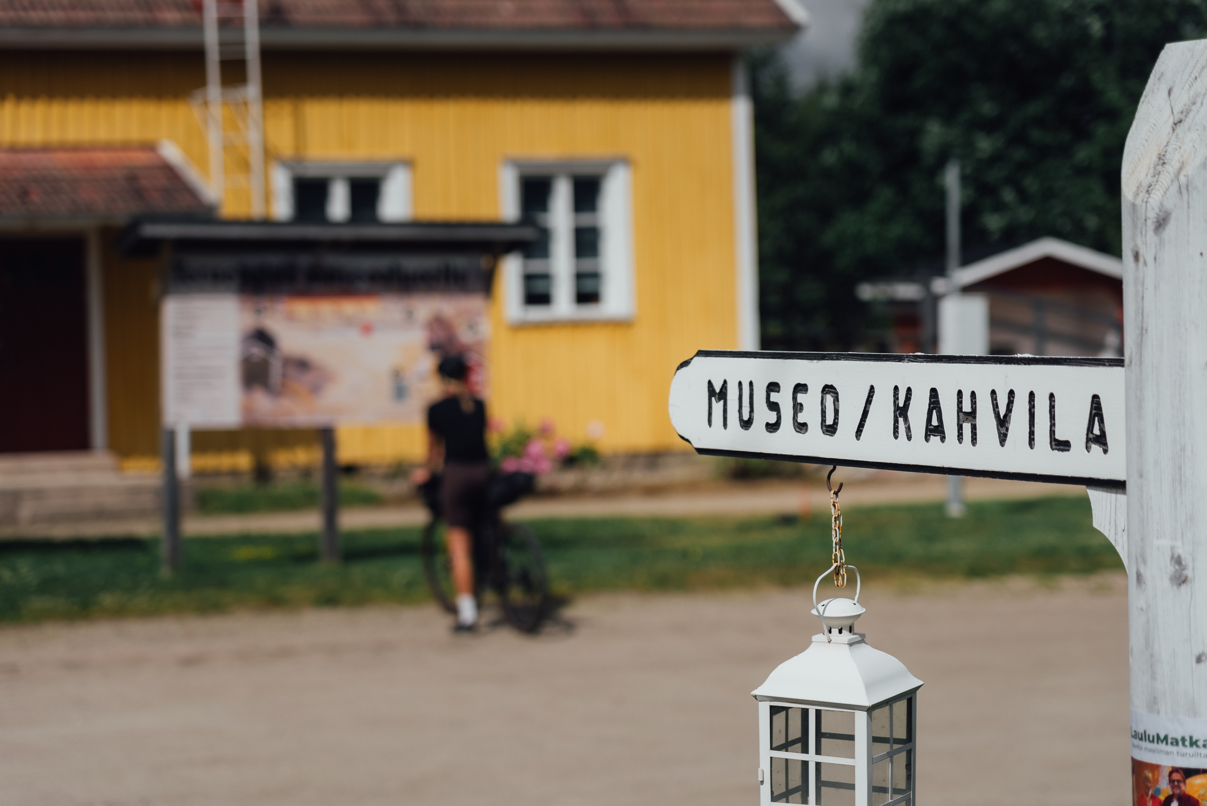
On the way you visit many interesting towns and villages with an interesting cultural or historical heritage. In the north, the history and culture of the Sámi peoples is very much present at Sevettijärvi and Inari. The indoor and outdoor museums acquaint you with the history of the Sámi and their way of living and the gold digging history of the area around Inari and Ivalo.
The years of war and their effects on the people and daily living are visible along the route and towns. The wartime history of the areas around Savukoski and Salla are depicted in museums but also in the landscape, anti-tank obstacles are still very much visible in strategic places. The southern part of the EuroVelo 13 route in Finland, around towns such as Kuhmo, Imatra and the area between Lappeenranta and Virolahti, have even more museums focusing on the history of defending Finland’s borders.
Summer months between May and August at these geographical levels are full of light. In the northern part of the route the Midnight sun enables you to cycle around the clock if you so desire! Journeying in May and early June will give you the awakening of summer, buds turning into leaves, wild flowers starting to bloom, and rivers flowing abundantly. July is warm, but also enjoyed by the mosquitoes and other flying friends. The end of August and September is a blaze of autumn colors and wild berries ripe for picking as nature begins its preparations for winter.
- Lappish summer and Midnight Sun
- The wilderness and the peacefulness between Näätämö and Inari
- Sámi Museum & Nature Centre Siida
- Amazing harsh and rugged nature with marks of Ice Age, especially around Sevettijärvi, Inari, Saariselkä and Luosto-Pyhä National Park
- War memorials and museums and anti-tank obstacles around Savukoski and Salla
- Panning for gold in Lemmenjoki river and Gold Museum at Tankavaara (south of Saariselkä)
- In late August and September the autumn colors and berries ripe for picking
- Make sure you pack a first-aid kit. Hospitals, medical centers and pharmacies are scarce in the wilderness, you are most often in a 50-150 km radius of professional help. Main hospital is in Rovaniemi, medical centers at Inari, Ivalo, Sodankylä, and Salla. Local groceries have a small first-aid cabinet, typically with bandages and painkillers.
- If you face an emergency, e.g. get lost, get injured or observe wildfire, call national emergency phone number 112 and report an emergency. More information on how to act in an emergency. You can also download an application ”112 Suomi”, which when used has the benefit of your location being forwarded to the public safety answering point.
- Charge your phone to the maximum just before the ride and protect your phone from getting wet. Turn off data when riding as there are areas of bad or non-existent reception so your phone will not use up battery trying to find reception. Generally reception is better higher up than in valleys when riding in the wilderness.
- If you plan to camp outside camping facilities, carry a power bank with you.
- Lappish summer begins with a quick shift from winter to summer at the end of May and early June. In just a few warm days, the rivers and lakes free themselves of their icy covering and tree leaves burst into different shades of green. In June and July the wild flowers are in bloom and all around is full of lushness.
- In late August and early September, nature begins preparations for the autumn and approaching winter, and suddenly the intense arctic summer is over. The autumn colors are one last magical show before winter, the colors ranging from yellow, orange, red, and purple.
- Summer in Lapland is intense and the air is fresh. The average temperature in May is 5-10 degrees with nights going still below zero degrees Celsius. In June, average temperatures are between 10-15, nights average 5 degrees Celsius. July is typically the warmest month, temperatures on average 15 during the day and 10 in the night. August is similar to June, September is similar to May. You can experience anything from sleet to tropical heat waves. In early May and late September you might even encounter snow in the northern part of the route.
- Check the weather forecast and dress according to the weather, layered clothing is always a good option.
- Drinking water and toilet paper are good to carry along on the daily cycling routes or when trekking in the National Parks..
- The Midnight Sun begins in northern Lapland after mid-May and continues until after mid-July . During that time, the sun does not set below the horizon but shines throughout the day and night, daylight is available 24/7 for approximately 60 days. Even in southern Finland daylight is 19 hours at Finnish midsummer festivities around the 24th of June! The warm, golden light casts a beautiful glow over the Arctic landscape. Watching the sun dip towards the horizon, only to rise again moments later, is a truly unforgettable experience. The midnight sun is a testament to the incredible power and beauty of nature. The downside is the lack of darkness when sleeping, so if you are sensitive to light when sleeping maybe have a sleep mask with you.
- In July the insects are out, mosquitoes, wasps, horseflies, gadflies,blackflies (Simuliidae) and biting midges (Ceratopogonidae). Cover your skin properly; light colored clothing attracts them less, make sure the cloth has a tight weave. Use insect repellent if necessary. Have medication available if you are sensitive to insect bites. In Lapland, the infamous arctic räkkä (the high population of various insects) starts usually by late June and lasts usually till mid August, making the early June or from mid-August till September the ideal time to ride the route. Luckily cycling speed is usually fast enough to keep them away when on the move. During the peak times, a net hat and long sleeve shirt and pants are recommended for other activities such as hiking.
- August and September are the peak seasons for collecting berries and mushrooms.Wild superfood is abundant in nature all around Lapland – blueberries, lingonberries, billberries, and cloudberries.
- If you encounter reindeer, keep as clear from them as you can and move slowly by them. Do not attempt to touch them. This is very important in August-September when the rutting season is on.Read more about meeting reindeer here.
- Cycling on this route requires caution. The route follows Finland's main and secondary road network with quite heavy traffic, including trucks taking goods to the northern services. The roads do not have any specific shoulder for cyclists and there are only very short cycling tracks along the way in connection with bigger towns.For this reason this route is not recommended for children nor junior cyclists. We also highly recommend using safety vests and helmets.
- The route runs through wilderness areas and areas with very scarce inhabitation. Thus services of any kind are scarce and the distance between them range from 30-55 kms. Even then the quality and quantity of the services is not what you may be used to back home. We have tried to note the availability of services in the trail notes.
- Bears, wolfs and wolverines are not an issue at all when wild camping as the arctic predators avoid human contact to all cost. There are practically no encounters, ever. Therefore, there is no need to have a bear bell on handlebars, bear safe food containers or hand your food in a tree for the night
- Accommodation services are scarce and the distances between the services are long on this route that runs in the wilderness and sparsely inhabited areas. Check the trail notes for recommended accommodation and the distances between them so you are prepared. Pyhä, Inari, Ivalo and Saariselkä offer an abundance of accommodation, so make use of them and stay for several nights to enjoy the activities the towns offer!
- In a few route parts there are only 1-2 options for accommodation, e.g. Savukoski, Peurasuvanto, Vuotso, and the sector between Kaamanen – Näätämö.
- The legal concept of “Everyman’s Right” in Finland extends freedom to roam but comes with some responsibilities. You can camp for a night anywhere in nature when you keep at least a 150 meter distance to buildings or people's yards and agricultural lands and you do not cause any harm to people nor the land. You can swim in lakes and rivers if you are not disturbing others or using private shore areas. Picking berries and mushrooms is allowed. The outdoor enthusiast’s golden rule requires a desire to preserve and protect the unspoiled beauty and wonder of nature for future generations to enjoy. National Parks and other restricted areas have stricter rules, read more at luontoon.fi
- If the forest fire warning is in effect, do not light any fires, not even in constructed campfire places. This prohibition does not apply to cooking shelters or other fireplaces with a flue.
- Check the situation for forest and grass fire warnings en.ilmatieteenlaitos.fi/warnings.
- On state-owned lands in the very northern Lapland, you are allowed to use fallen branches and sticks from the ground for making a campfire. It is recommended to use a campfire place which has been previously used, if you find one.
- Using a camping cooker is possible at all times and locations.
- Check the opening times of accommodation you plan to use, especially camping sites with services. In Finland camping facilities start to close in August for the season.
- If you are interested in hiking and camping in the National Parks, check luontoon.fi web page for instructions and guides as well as maps.
- Services are scarce and the distances between the services are long on this route that runs in the wilderness and sparsely inhabited areas.
- Restaurants are available at most of the recommended lodging along the route, except at Nitsijärvi, where you need to make sure you have your own food for the evening and morning. Check all opening hours from the service webpages!
- During most of the days you have 1-2 cafes on the route for lunch, exceptions are on route to Savukoski, Pyhä, and Nitsijärvi.
- Grocery stores are at Näätämö, Inari, Ivalo, Saariselkä, Sodankylä, Luosto, Pyhä, Pelkosenniemi, Savukoski and Salla; mini-markets at Sevettijärvi and Kaamanen.
- Finnish tap water is very good in Lapland and perfectly safe to drink and carry with you.
- As services are scarce you need to carry with you the water & drink you need for the day.
- There are along the route many creeks, rivers, and lakes, but the cleanliness of the water can not be guaranteed. Usually running water (creeks and rivers) is better for drinking than still water. Do not use any water which runs through grazing lands or residential/industrial areas. It is highly recommended to purify the water if you use natural water. Purify by boiling or using filters or purification tablets.
- Measures should be taken in advance to avoid taking unnecessary waste into the area. Take all waste out of the area and recycle when at waste services. Do not litter nature! Biodegradable waste should be placed in a toilet or composter, when available, and small amounts of clean paper and cardboard can be used as kindling in a campfire.
- The EuroVelo 13 Northern Section in Lapland runs in the wilderness and sparsely populated areas of Finland where distances between services are long and lonely. The route is thus for an experienced cyclist wanting to experience a long distance cycling trip through vast areas of nothing but wilderness, but with awesome scenery leaving you dazzled.
- The route is mainly paved, with only very short unpaved sections. This way the route is suitable for various types of bicycles and those wanting to ride long distances over continuous days. However, due to the almost non existing shoulders of the Finnish roads and the route running on main roads, it is also hazardous and requires extra caution.
- There are bike renting possibilities, but because of the limited services, you need to know how to carry out minor repairs on your bike. E-bike is definitely a nice and easy option for those not in tip-top shape.
- There are buses operating from and between Rovaniemi, Kemijärvi, Kuusamo, Ivalo, and Inari. From these towns you have connections to many points of the route. Rovaniemi and Ivalo are main hubs. For example, there are bus connections from Rovaniemi to Salla and Rovaniemi to Inari.
- Check Matkahuolto web pages for the time schedules and destinations to buying your ticket.
- For some buses you need to communicate directly with the route operator for reserving space for your bike, for example Jbus and Eskelinen operating between Näätämö-Inari.
- Direct train connections run to Kemijärvi daily; other train stations are at Rovaniemi and Kolari.
- For tickets check here. For bringing your own bicycle on the train, read more here.
- Airports in northern Finland are situated at Kittilä, Kuusamo, Rovaniemi, and Ivalo.
- Check Finnair web pages for details to buying tickets. For instructions about bringing your own bicycle on the airplane, read more here.
- From the airports there are many options to catch connecting buses.
- From Rovaniemi airport, from Ivalo airport and from Kuusamo airport you can connect to Salla and Sallatunturi fell.
- Another option is to combine cycling with a cruise and end your trip at Kirkenes, the harbor town for the Hurtigruten cruises.
- If you are traveling with your own bicycle by bus, train or airplane, reserve the place for the bike well in advance and note that ebikes are not allowed on airplanes at all.
- Notice that in the more remote areas in the sector between Näätämö-Inari and around Salla, the bus connections may be one per day! So plan your itinerary according to them.
- Tip: If you want to minimize cycling on the main E75 route, consider taking a bus from Sodankylä to where you want to continue cycling. Check the route schedules between Sodankylä-Inari from Matkahuolto web pages. You can hop off e.g. at Saariselkä.
Welcome to Salla, in the middle of nowhere! Sallatunturi is the starting point of the northern part of the EuroVelo 13 route in Finland. From Sallatunturi you head to the village of Salla on the road 950 and you have a bicycle path all the way. You have Sallatunturi fell on your right and Ruuhitunturi fell on your left rear as you make your way the 10km distance to the village. A few marshlands dot the scenery, otherwise rather open forest views.
2km before arriving at Salla, you see the first signs of war, the huge boulders of rocks in a line formation on the side of the road. This is a remnant of the Salpalinja, the Salpa Line, a bunker line on the eastern border of Finland. It was built in 1940–1941 during the Interim Peace between the Winter War and the Continuation War between Finland and Soviet Union by nearly 35 000 workers, both men and women. The Salpa Line was built further in 1944 to defend Finland against a possible Soviet invasion. The line is 1,200 kilometers long, stretching from the Gulf of Finland to Petsamo (now Pechenga in Russia). It never saw military action as the Soviet army was stopped at the Karelian isthmus in 1944.
Numerous lakes, marshes and small rocks were also incorporated in the defense line. What you see at Salla and later on at Savukoski are some of the altogether 225 km of anti-tank obstacles.
If you are interested in war time history and how the Finns rebuilt the land after the wars, visit Salla’s Museum of War and Reconstruction. The museum is located approximately 600 meters towards the northeast on road 82 on your way to Savukoski. In addition to the exhibition spaces, there is a museum shop and café located in the museum building. The museum also has outdoor exhibitions and Salla’s Rajakievari tavern.
At Salla you have the S and K market grocery stores, so make use of them before continuing on to the road 82 so that you have lunch, snacks and plenty to drink on the route. The next services of any kind are at Savukoski 80km away! Welcome to the wilderness areas of Finland!
After 20 km of cycling from Salla, you turn off to road 965 towards Savukoski. This is where you are closest to the border between Finland and Russia, under 5 km to the border! Most of the fells on your right hand side are on the Russian side of the border, but in many places the vegetation hinders open views. A good spot is after 15km on route 965.
You will pass a small intersection to Naruska, typically the coldest place in Finland almost every winter!
On the route to Savukoski there isn't really much to see, the route meanders through very sparsely inhabited areas and you will come across signs of villages, where only some 3-10 houses are grouped together with no services. You have marshland, forests and fells in the background, and you cross 2 rivers, Kuolajoki river flowing from Russia to Finland and Tenniöjoki River, which will keep you company on the left all the way to Savukoski. You will also have a 4 km long straight stretch of road, where, if lucky, the activity will be a lonely reindeer. So keep focused!
Before Savukoski you also cross Kemijoki, the longest river in Finland with 550 km of flowing water from the northeastern fells to its delta at the town of Kemi. At Kuosku, 13 km before Savukoski you have a monument commemorating the partisan victims. And about 1 km before Savukoski you again see the Salpa Line anti-tank obstacle, similar to the one on Salla. This is the northernmost point of the entire line and a strategic point in a narrow section. The purpose of this point was to cut off the connection from Salla, the road 965 you have been traveling on. In the Winter War Soviet tanks had advanced along this route all the way to Pelkosenniemi, where Finns were able to stop them and make them retreat in December 1939.
Hop off the saddle here or come in the evening to walk on the Salpa Line walking trail, renovated in 2017 and suitable for all ages. And yes, Korvatunturi fell (486m) actually exists! Santa’s home fell is located in Savukoski, in the wilderness at the border of Finland and Russia, in the Urho Kekkonen National Park. Few have been there, but it is possible to reach after a distance of 135 km from the village and having a border zone permit to get to the top! There is no road to the Korvatunturi and the distant location is obvious, because otherwise Santa, Mrs. Claus and the elves would have to entertain visitors constantly. The shape of the fell resembles the ears of a fox or wolf. There is a good reason for this odd shape: these ears can hear even the smallest whispers carried by the north wind.
At Savukoski you have a grocery store (Sale) and 2 accomodation options, one in the village (Samperin savotta) and one at Kuosku (Lomakylä Kelloniemi).
Day 2: Savukoski - Pyhätunturi (67 km)
Starting off you today first follow 965 road towards Pelkosenniemi. If yesterday the straight road was long, then today you have a 14 km long straight road ahead of you! The landscape is a typical one to these areas, rather dense forest with spots of open marshland on both sides.
The Sokanaapa bird tower might be a nice place to have a break and stretch your legs. After 33 km of riding, you are about midway. The route to the tower is 1.2 km one way, but use caution as it is in need of repair, as is also the tower. Nevertheless, you might be rewarded with sightings of many birds nesting in the area, but at least the silence and the vastness of the marshland and bog area is bound to be something you have not experienced before.
Crossing over the Kitinen river and turning left to E63/5 you arrive at Pelkosenniemi. The services include pharmacy, K-market, SEO cafe. Across the street from the grocery store is the very small cultural attraction of the town, namely the statue of Andy McCoy, rock musician of the Hanoi Rocks band, aka Antti Hulkko, born and bred in Pelkosenniemi.
Continue on the E63/5 until you come to the intersection of road 9621 (Pyhäntie road) and take a right towards Pyhätunturi. The route between Pelkosenniemi and Pyhä is flat and lush with housing visible every now and then. When you arrive at lake Pyhäjärvi, you have a beautiful view to Pyhätunturi across the lake. Cycling around the lake you come to 962 road and turn left onto the 5km bicycle route to Pyhätunturi (=Holy fell).
Accommodation, restaurants, and grocery store are available at Pyhä.
We recommend taking a day off at Pyhä-Luosto area for trekking to Isokuru gorge and Aittakuru amphitheater, maybe doing a round of disc golf or canoeing the waters or even trying your luck at the Lampivaara Amethyst mine, next to Luosto fell. Hiking up Luosto fell (514m) will be a trek with some 575 steps, but it will give you a beautiful view of the environs. Another top is Kultakero fell (also in its 500's) at Pyhä. There is a bus connection between Pyhä and Luosto.
Visitor Centre Naava is located in the center of Pyhä, just next to the round-about along the Pyhä-Luosto road. Naava offers tourist information as well as more information about the Pyhä-Luosto National Park. The Pyhä-Luosto National Park consists of Finland's oldest National Park (Pyhätunturi National Park established already in 1938) and of the Luosto area northwest of Pyhätunturi Fell. These were combined at the beginning of 2005 to form a new National Park. The area has many functions; it is for conserving nature, preserving indigenous people's culture and serving as a destination for hiking and tourism.
Next accommodations and grocery stores are at Luosto and Sodankylä.
Day 3: Pyhä - Luosto - Sodankylä (59 km)
Today you first have the 5 km bicycle route to where you came from, and continue on road 962 towards Luosto.
You will notice the beautiful old forests, narrow fir trees that can carry a huge snow load during the winter time. The Pyhä-Luosto National Park is behind the fells of Luostotunturi and Pyhätunturi, but the scenery along the road is very much similar to the park itself. In addition to the fir trees you see beautiful pines and the grey pines or ”kelo” still strong in the landscape although they are not alive anymore. Finland’s southernmost fell chain forms the main zone of the National Park. The fell chain is a collage of treeless peaks and deep ravines. Lush forests, some of them herb-rich forests, flourish in the area’s valleys and along brook banks. In the southwest areas of Ukko-Luosto Fell and Lampivaara Hill, forests have not been logged and some trees are as old as 400 years. The Luosto area is known for its majestic old-growth pine forests and Pyhätunturi for its geology and Forest Sámi history.
Between Luosto and Pyhä there is the Kopara Reindeer farm, 8 km from Pyhä, 1 km to the side of 962 on a gravel road. It is a nice place, but sadly open only in the autumn season and winters. In any case, around this point remember to look back every now and then for a view back to the Pyhätunturi fells!
Luosto has some restaurants for lunch, next options are at Sodankylä.
Before Luosto is the intersection towards the Amethyst mine, tickets are sold in the cafe close by and a worthwhile place to visit. It is a 1 km ride uphill to the parking place (also for bikes) and a 2.5 km walk. But the coffee and doughnut (”munkki” in Finnish) are worth it, oh yes, and mine and the scenery. Check to route instructions here.
After Luosto, turn to road 19746 that routes you to Alakitisentie road. It is a nice meandering paved road, with some housing here and there, also the Jaakkola Reindeer farm. In the beginning you coast down, and coming closer to the E75/4 main road you need to put effort and tackle an uphill.
At Aska, you turn towards Sodankylä on Sillankorvantie before joining the E75/4 road. Now you need to pay attention to the passing traffic! E75/4 road is a main road stretching the whole length of Finland from Helsinki to Utsjoki. There is more traffic than you have experienced so far, so take all precautions when cycling. This will be your ”home road” until you reach Kaamanen. Take use of the short bicycle route at Aska.
You will notice that the vegetation is very lush and more varied than earlier. Birch trees grow taller, meadows and wildflowers more abundant. The route is nice and easy the closer to Sodankylä you get. You meet up again with the Kitinen river and follow its banks. About 5.5 kms before Sodankylä you get the pleasure of biking on the bicycle path all the way into Sodankylä. Before town you cross Jeesiöjoki river.
If interested, the Sodankylä Local History Museum is a spectacular site at a beautiful riverside location where the Jeesiö and Kitinen rivers meet. The crown of the courtyard is the main building rescued from the village of Riesto, which was submerged under the Lokka artificial lake reservoir. Visiting the museum you will understand how Finns lived in the Sodankylä area during the early 1900's. The museum comprises 13 buildings forming a courtyard from those days. The museum has its own application in English, German and French, but you can also ask for guidance.
Visit the Sodankylä Old Church, standing by its own cemetery in a beautiful little forest on the banks of the River Kitinen. It is one of Finland’s oldest preserved wooden churches. The church is quite small, dark and made of wood with a glorious tar scent. The old church is not open for visitors, but it is still worth stopping by to admire it from the outside. The church was built in 1689 for the people of central Lapland. The building was restored in 1926, and between 1992 and 1995 the National Board of Antiquities repaired the wooden shingle roof and the surface board work. The old church has retained its authentic character and feeling through the centuries. In the summer prayers are held in the church, and it is a popular wedding venue.
In Sodankylä you have 2 hotel options, 1 B&B and camping for accommodation. Grocery stores (K-market, S-market, Lidl), pharmacy, restaurants and pizzerias are key services available.
Should you decide to continue your day trip, the next accommodation is at Peurasuvanto, another 55 km.
Day 4: Sodankylä - Peurasuvanto (55 km)
Today you are entering the Sámi region, so in Sámi language they say Buorre matki, meaning have a good journey; in Finnish we say Hyvää matkaa!
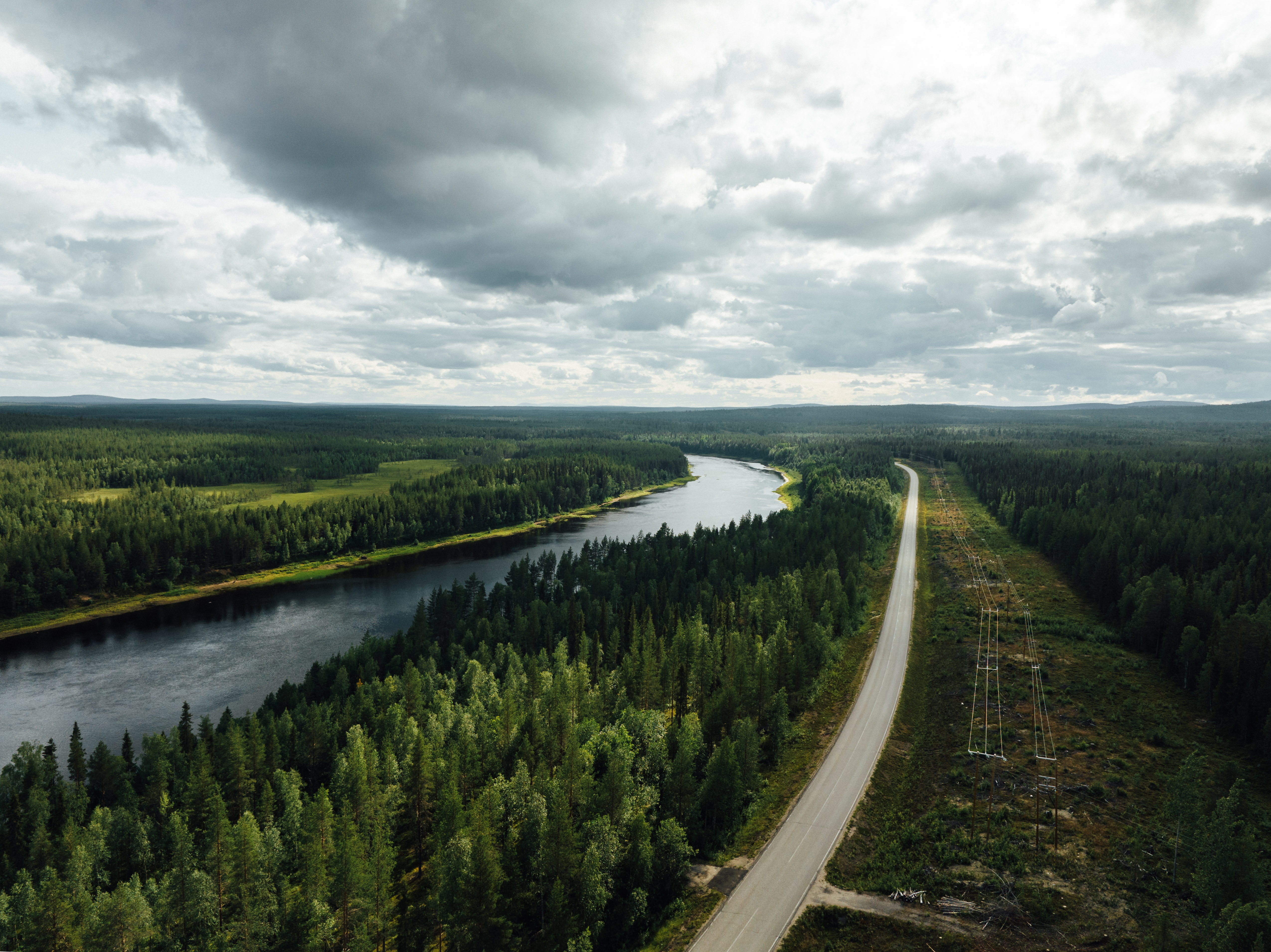
Setting off again on E75 towards Ivalo, the first 10 kilometers you have the luxury of a bicycle path alongside the river Kitinen, your companion for today, sometimes closer, sometimes a bit further away. Kitinen is the fourth largest river in Finland, a 235 km long tributary of the Kemijoki river.
You can take the Sattasentie road right by the Kitinen as a more pleasant road that joins E75 right before you cross over the river Sattanen. Here you have a nice open area of the two rivers.
The cycling is easy and the road is for the most part rather straight. Large areas of marshland and meadows allow the gaze to wander far. As before, you see many houses but still there are no services.
If you want to stretch your legs, the Viiankiaapa Mire Reserve is a fascinating destination to admire diverse mire nature and a wide range of bird species. The circular Viiankiaapa Nature Trail (4.3 km) can be accessed at the northern end of the village of Kersilö, after 21 km from Sodankylä. The trails have duckboards and signposts. A dry toilet can be found at the starting point of the trail. Along the trail, by the lake Viiankiaapajärvi, is a campfire hut, and next to it you will find a shed and a dry toilet. Might this be your lunch spot?
If interested in this nature trek, turn off the E75 at Kersilö and cycle over the river onto Moskuvaara road. After 1 km turn right to Viiankiaavantie road. Again after 1 km, the road Viiankiaavantie turns left from the crossroads and after 500m you will be at the starting point for the nature trails. Just 17 km before arriving at Peurasuvanto is also a nice place to have a break. Summer cafe Harianna offers a good selection of salty and sweet snacks. From the cafe you have an open view over the river Kitinen and its inlet.
Following the river banks you arrive at Peurasuvanto Lomakylä camping. You have a choice from different size cottages with cooking facilities. Check the web pages for lunch and cafe opening times. This might be a good evening for the sauna to relax the body and mind.
After Peurasuvanto, accommodation is available on the route at Kiveliön kala (12 km to go) and Vuotso, another 36 km to go.
Day 5: Peurasuvanto - Vuotso (36 km)
This is a nice, easy day with varying scenery. The E75 road is in parts long and straight and you have a little bit wider area on the shoulder of the road to cycle in. Forests are today's gold for Finland, so you will have your share of them today as well.
On this section of the route you will see more housing than before. The settlement of this area goes back 7000 years. Some 30 stone age findings have been dug along the Kitinen river. In the area to the north of the artificial lakes, findings date settlement in two phases, the older during 1300 BC – 300 AD and the more recent settlement between 1200-1600. The main means of livelihood have been deer and fowl hunting and fishing.
You will also see lakes and rivers, especially when you cross over a section of Porttipahta, one of 2 artificial lakes in the area. Along the route of Kitinen are 7 hydro-electric power plants and several artificial lakes, the largest of them is Porttipahta.
Porttipahta and Lokka were created in the 1960's to create electricity. As a result, 640 people lost their homes. Lokka artificial lake is 417 sq.km and its filling up started in 1967, Porttipahta (216 sq.m) in 1970. The two lakes were combined together by a canal in 1981 by means of which the water level is regulated. This canal is the Vuotso canal which you will cross when arriving at Vuotso!
Despite its history, the crossing of the Porttipahta water is grand! On the southern side of the bridge is a small cafe just perfect for a short break, Zippi ja Suhaus. A good opening for a discussion is what their name means! Enjoy the Finnish “lettu” or “lätty”, same thing meaning thin pancake. Sugar and jam and you have the energy to cycle again! Another service, Kiveliön kala is just close by earlier, where local fish can be brought to go or enjoyed for lunch. They also provide camping and basic cabins.
Cycling into Vuotso you have a bicycle road starting from the grocery store over the canal.
In Vuotso the recommended accommodation is at Vuotson Maja B&B, which is a part of the Welcome Cyclist-program and have a history of providing services for cyclists over 70 years. Rest in good hands.
As an evening activity, take a stroll along the canal and enjoy the smoothness of the sandy beaches.
For any food stuff you may need, you have the small grocery store on the other side of the canal from Vuotson Maja.
From Vuotso is another 40 km to Saariselkä, where the next possible accommodation and dining services are available. One in between is at Tankavaara gold museum.
Day 6: Vuotso - Saariselkä (40 km)
Another day in the saddle on E75. Make use of the short bicycle road heading out of Vuotso alongside E75 and then cycle on the Kuusikiekeröntie for a short while on a smaller road.
The ride to Saariselkä will be a leisurely ride. The landscape is the familiar variety of forests, but also meadows and marshlands keeping the visibility wide. The terrain has some leisurely uphills to warm you up, and downhills to give you speed.
After 11 km of cycling you will find the Tankavaara Gold Prospector Museum. This is a nice place to stop and have a break and try your luck in the gold panning area.
There are stories of the famous gold rivers and the legendary gold diggers of the North. The first gold rush took place on the Ivalojoki River in 1869 and the rush to Lemmenjoki River close to Inari started in 1945. Men returning from the war were tempted to try their luck in the goldfields. Gold-diggers still reside in the area, and every now and then some lucky chap finds a nugget or two.
The Gold Museum in Tankavaara is the only international museum in the world displaying the past and present of gold panning and prospecting. There are indoor and open-air museum areas, café-restaurant Wanha Waskoolimies and its accommodation services in the Gold Village section. The nature trails of the National park circulate in the Tankavaara terrain. The trails lead to the beautiful forests and lookout spots of the Tankavaara hills. The War Historical trail presents the remnants of the Lapland War, the last actions of the Second World War in Finland.
Nearing Saariselkä, use the smaller road network on your right. There is less traffic and the speed limit for cars is lower. At Laanila, 4 km before Saariselkä, turn right into Viskitie road (=Whisky road!) to head towards Savottakahvila cafe. At the cafe and passing the hotel Laanihovi, join Laanilantie. Follow this until you intersect with Saariseläntie road 9693. This will take you into the center of Saariselkä.
If you are interested in the gold and logging history of the area, take a stop at the Savottakahvila cafe and Laanila Savottamuseum. The cafe is a part of the Welcome Cyclist – program. There are also a few nice trekking trails around Laanila where remains from the activities are still visible.
Saariselkä village is the tourist center of Inari municipality, with 323 inhabitants, but the number of visitors is in the thousands. The compact village offers a wide range of accommodation, restaurants, and a grocery store. Saariselkä is a popular cross-country skiing center during the winter time with additional activities being mountainbiking, husky rides and snow scooter rides. During the summer time trekking in the wilderness and mountain biking are the most popular activities.
The accommodation options at Saariselkä are numerous so you are bound to find a suitable one, igloos, hotel rooms, B&B, cottages, and camping. The recommended accommodation is at Holiday Club Saariselkä, part of the Welcome Cyclist-program.
Should you wish to pass Saariselkä and make it a longer cycling day, next accommodation alternatives are at Ivalo (another 30 km to go), where camping is also possible. Before you go, take use of the Saariselkä services, if needed.
We recommend staying at Saariselkä for 2 nights so that you can enjoy the fells at your leisure, hiking or renting a mountain bike to tour the area. Visiting Kiilopää is a good target, you can relax your muscles in the traditional Finnish smoke sauna and swim in the Kiilopuro creek. The atmospheric smoke sauna and cool water swimming guarantee complete relaxation. Check out the times when the sauna is warm from Kiilopää.
Smoke saunas are to some Finns the one and only sauna, at least all saunas heated with wood are better than electric saunas. Remember that there are more saunas in Finland than cars, so this is an important topic for a majority of Finns.
Here you can find evening reading on varying topics related to sauna. This comic strip showcases the essentials of sauna and Finns.
Day 7: Saariselkä - Ivalo (30 km)
If you didn't visit Kaunispää fell during your stay at Saariselkä, then do it today!
There is a paved car route (9692, Kaunispääntie) all the way to the top of the Kaunispää fell (height at top 438 m), awarding you with a 360 degree view of the surroundings, the largest fell upland in Northern Europe. Take the challenge, it is definitely worth the sweat! Plus there is the added bonus of a nice cafe-restaurant, do try the local ”munkki” or doughnut and Lappish berry juice made from crowberries.
At the top you see in the east the Urho Kekkonen National park fell area, in the west the Kuttura Sámi village and the Hammastunturi wilderness area and the glowing Ivalojoki river, in the north the Lutto backwoods with fells and rivers. In the vast Urho Kekkonen National Park (Mr Urho Kekkonen was Finland's President between the years 1956-1982, a man of the great outdoors) the unspoilt, beautiful nature and the silence of the fells provide room to calm down. From the top of Kaunispää you have on a clear day visibility to Sokosti (718m) highest peak in the National Park and Saariselkä area, and Kuikkapää at 678 meters. Both fells are within a 42 km radius from Kaunispää and very popular trekking destinations. Many return to these harsh and rugged, but at the same time fascinating and beautiful areas over and over again. Paradise gorge and Devil's gate, already the names portray images of what the scenery is like.
At the top of Kaunispää is a lookout tower, a triangulation tower built in 2011 to serve as a memorial to Finnish triangulation and surveying. Finnish mapping has been based on a triangulation network covering the entire country. At its peak the network had over 2000 triangulation points. Since then almost all towers have disintegrated or been taken down and satellite positioning (GPS) has replaced traditional methods. After your visit to the top, coast down and join with E75. Even on the lower levels of Kaunispää fell, you will still see open fells as far as the eye can see. These big hills used to be mountains before the Ice Age molded them round and perfect. Here you can admire the infinite chain of fells rolling in the horizon.
Following E75, this part of the road is called ”Kultainen tie”, Golden road, named after the history of the area as you saw at Tankavaara and Laanila. The fells slowly simmer down into forests and coming closer to Ivalo, you meet up with Ivalojoki river and you have nice views every now and then on the width of this river. Ivalojoki river, known as the gold river but also a wilderness river, provides an abundance of trout and grayling.
Cycling into Ivalo you have a good 7km of cycle path starting from Tolonen, intersecting with road 19892.
Ivalo is the administrative and commercial center of the municipality of Inari with a population of 3247 people. The town center has a grocery store (S-Market and K-market), pharmacy, hospital, privately owned medical center, Hotel and restaurant Ivalo, Hotel and restaurant Kultahippu, and a beach. Finland’s northernmost airport is also located in Ivalo.
The recommended accommodation in Ivalo is at Arctic River Resort or Xwander Nordic, both a part of the Welcome Cyclist -Program. Camping is possible at Ivalo River Camping. Arctic River Resort and the Ivalo River Camping are nice places by the river and offer a wide range of services.
Should you wish to pass Ivalo and make it a longer cycling day, next accommodation alternatives are at Inari (another 40 km to go) and 10 km from Ivalo at the lakeside Ukonjärven Lomakylä.
Day 8: Ivalo - Inari (40 km)
Back in the saddle! Is your camera ready? Today you will definitely need it!
Over the river and up the hill and head towards Inari. After 10 km you come to a lovely spot by Ukonjärvi lake, where it seems like the road continues to the water. Close by is also a camping and cottage area, Ukonjärven Lomakylä https://www.ukolo.fi/ but they do not have any food services.
For a long time you cycle beside the water's edge. Talk about an infinity pool! You pass rivers and rocky lake shores, bays stretching more or less inlands – picture moments as you ride! At the end of the lake you find a spot to take one last view and picture of this beautiful area.
After another 12 km you come to the Karhunpesäkivi cafe, situated on a magnificent place by a lake. You can stretch your legs and do a workout - climb the 200 meters and count the numerous stairs (---256, 257,...oops, lost count) to an old bear's nest (karhu = bear). The legend tells an exciting tale of a man seeking shelter from a winter storm and waking to heavy breathing at dawn....a bear having sought shelter for hibernating! In any case, you are halfway to Inari, so maybe it is time for lunch here at the cafe!
The rest of the route to Inari is a leisurely ride, some hills, many bends. Water is very much present on this ride, especially as you come to the shores of lake Inarijärvi. There are good options for small breaks.
Lake Inarijärvi and the 3.5 km bicycle path leads you into Inari. Inari is the largest municipality in Finland and one of the most international tourism destinations. Inari is located in the northernmost corner of the European Union, in the middle of the Northern Polar Cap. It covers 5 percent of the total surface area in Finland.
Inari is also the name of the small village by the lake of the same name, lake Inari. The population of Inari municipality was 7047 (in 2022) and Inari village 783.
Lake Inari is the third largest lake in Finland, at over 1080km² with over 3300 islands. With shallow coves as well as vast deep areas, this pearl of the north is a fisherman’s dream. Catches of the day are typically trout, arctic char, white fish, grayling, pike, perch, vendace and lake salmon.
The accommodation options are wide in Inari, from camping, to B&B to aurora igloos, rooms and apartments, cottages, and high-quality hotels.
For more information: inarilapland.fi
Inari has some excellent restaurants where the culinary delights stem from local ingredients. There are several grocery stores (S-Market, K-Market, Sale) to choose from to stock up on the food stuff you may need. Sámi culture and the tradition of their arts & craft is reflected in local everyday goods, art objects and jewelry, available in many small boutiques and souvenir shops
We recommend Inari as a place to take 1-2 days off from biking and experiencing the areas around the village. There is so much to see and do!
Recommended activities are:
cruise on lake Inari and seeing the Ukonsaari island, or just Ukko (=old man)
The island is situated about 11 km east-northeast from the village of Inari. It is a strange-looking rocky island, tall and hunchbacked, 300 meters long, 100 meters wide and 30 meters high. The role of Ukonsaari island as a sacred place of worship for the Inari Sámi people rapidly changed when the Sámi people were Christianised in the 17th century. The conversion work culminated in the construction of Inari's first church at Pielpajärvi in 1646. Nevertheless, some of the Inari habitants preserved their own beliefs or parts of it alongside Christianity. Individual people and families made sacrifices on Ukonsaari until the 19th century, and it is known that reindeer antlers were still brought to the sacrificial site in the 1870s. According to a local legend, fishermen used to throw a coin in Lake Inarijärvi close to Ukonsaari island and wish fair winds. The coins thrown by tourists onto the boulder fields are signs of a new custom related to tourism.
Today, Ukonsaari is an ancient relic site protected by the Antiquities Act. It has been proposed that Ukonsaari be made into a UNESCO World Heritage Site for its cultural values. Visitors must pay their respects to the island's cultural significance.
Siida, the Sámi Museum & Nature Centre Siida; if anything, visit this museum! Siida is the Sámi museum and nature center giving you an insight into Sámi culture and northern nature. Nordic nature lives in a state of continuous change: the increase and decrease of sunlight, the rise and fall of temperatures, summer and winter. There are a total of eight seasons in Lapland, and this polar year calendar is the basis for the rhythm of life for the Sámi.
Siida was the old Sámi society structure, and the word siida was used for a community formed by certain families, and for the area that the community prevailed.The inhabitants of other siidas could practice fishing and hunting in the area of another siida only by renting the right to do so. These areas were mostly formed in the Middle Ages, when marking the boundaries of the siidas in the terrain and documenting them began. The arctic region was divided into tax districts according to the siidas and, since the peace treaty in 1751, the state borders also followed the boundaries of the siidas. Sweden, Finland and Russia tried for two hundred years to draw the borderline in the Varanger Fjord and the River Paatsjoki area so that trade and access to the Arctic Sea would be possible. However, since the Second World War, Finland has had no connection to the Arctic Sea.
Sámi Museum & Nature Centre Siida is also a part of the Welcome Cyclist-program.
Should you wish to pass Inari and make it a longer cycling day, the next accommodation alternative is at Kaamanen (another 30km).
Day 9: Inari - Nitsijärvi (80km)
Today, you are now coming to the most beautiful area of the whole length of route 13! The route has nice, long uphills and downhills, but at a leisurely pace they are nice and easy. The landscape and scenery is more open with views across rivers and lakes to the fells. Here you see various sizes of rocks scattered throughout the landscape, again the doings of the Ice Age. This will be your landscape all the way to Näätämö.
But if you did not stop by the Siida museum yesterday, then this is your last chance and turn right after the Juutuanjoki river to the parking place.
You have couple options if you do not need any services at Kaamanen, turn to 971 road to Näätämö. The intersection is 3.5 km before Kaamanen. Note that there are no food services until Sevettijärvi and Kirakkajärvi. Next accommodation alternatives are at Nitsijärvi (another 59km), Sevettijärvi (94km) and Kirakkajärvi (110km).
Four is a symbolic number for Kaamanen. This little Sámi village is known as the borderland of four tribes and the crossroads of four important roads with connections north, east, south, and west. Kaamanen has a strong fishing and hunting culture. Trout and grayling migrate along the Kaamasjoki River and other waterways in the region. Abundant with wild fowl, the district is internationally renowned among ornithologists and the area has received praise from bird photographers as being a dream location. At the feeding spots in Kaamanen, you can sort many species of Arctic birds, and the chances of spotting these elsewhere are very slim. The wilderness district of the Muotkatunturi fell highland opening up to the west of Kaamanen does not have any marked hiking trails, but more experienced hikers have the chance to enjoy beautiful landscapes with fells and winding rivers.
As you approach Kaamanen, the Kaamanen kievari is on your left, one of the first bigger establishments you see. This is the recommended accommodation. They have dining possibilities and they also have a small mini-market, last shopping before Sevettijärvi mini-market (94 km to go) and Näätämö grocery store (126 km to go).
As an evening activity you can walk (or bike) circa 2.5 km north on the main road to cafe Sininen fillari (=blue bike, also a part of the Welcome Cyclist -Program) and further on to the memorial of Lapish War between Finland and Germany during 1944-1945. The war started when the Germans would not leave willingly after the Moscow peace treaty. As the Germans retreated, they burnt Rovaniemi and demolished everything in Lapland. The last of the some 215 000 German troops retreated to Norway on April 27th,1945. “House martins could not find their nesting sites, The way they flew helplessly around the ruined chimneys of the houses where they used to nest is a detail about the new Lapland I could never forget.” Ilmari Hustich 1946.
The first day on route 971 gives you a more closed scenery with birch trees alongside the road on both sides. Every now and then you still see marshlands and swamps, lakes and small rivers, and the moors with many exceptional pine trees lining both sides of the route like guards. These more open areas give you a wider view of the surroundings. Keep a look out for the lichen on the pines and firs, black and green lichen is a sign of clean air!
On both sides of the road are 2 wilderness areas, Kaldoaivi to the north and Vätsäri to the south. There are 12 wilderness areas in Finland, all of them in this very northern part and together they cover 15,000 sq. km of land area. Kaldoaivi is the largest wilderness area in Finland, 2943 sq.kms. These wilds are vast, roadless areas that have remained in a near natural state. They are meant to stay that way, and only traditional means of livelihood, such as hunting, fishing and reindeer husbandry, can be practiced in the wilderness areas. There are only a few trails and the distance between cabins is long; these wilderness areas are only for the experienced hikers who have excellent orienteering skills and master daily activities in harsh conditions. Their reward is being one with nature and meeting no one for days. This area is mainly highland in about the altitude of 200 - 300 meters, totally treeless or just short and thin fell birch. For fishermen this wilderness area is a dream destination: there is an abundance of fish in the many rivers, brooks and lakes.
On this part of the route it is easy to find nice spots for breaks, but remember that there are no services until you reach Sevettijärvi! While cycling, and especially when you stop to snack, keep an eye out for the Siberian Jay (Perisoreus infaustus), the good luck charm of the Sámi and the wanderer in the wilderness. These birds, Kuukkeli in Finnish, are curious and keen on sharing your snacks with you. It is said that if the Siberian Jay comes to rest on your palm, then you have good luck on your journey. You can lure your good luck charm by stretching your arm out and having something to eat on your palm, for example a piece of bread, biscuits, nuts, dried berries. Kuukkeli will even eat sausages!
The recommended accommodation is at Nitsijärvi cabins. Arriving at Partakko you will see the Nitsijärvi cabins sign pointing to the right, and the cabins by the lake. Note that there are no food services here at the cabins, nor anywhere else in this area. The water from the tap is drinkable, though. This is also a good place to buy your camping spot as you can make use of the showers, WC, and electricity.
As an evening activity you might want to try to catch your own dinner from the lake! At least have an evening and morning swim to get a feel for the nordic waters. Should you wish to make it a longer cycle, next accommodation alternatives are at Sevettijärvi and Kirakkajärvi.
Day 10: Nitsijärvi - Sevettijärvi - Kirakkajärvi (51 km)
Start by checking that your camera is easy to reach!
Cycling onwards on 971 you again have a beautiful meandering road through changing scenery of moors with sturdy, old pine trees standing tall and the gray, dried ones usually tilted to the ground. The Finnish language has many words for pine trees, the grey ones are called “kelo” and they are used also as building material for cabins, although more expensive than normal timberware.
Passing lovely lakes and stretches of road with water on both sides, you reach nice places to stop beside lakes. At Supru the lake shores are sandy and it is easy to walk around and stretch your legs. Approximately 12 km before Sevettijärvi is another lake area lovely to sit down and get your energy restored. Close by you see a fencing area for the round-up of reindeer.
Lapland is very much the reindeer husbandry area in Finland. Reindeer are semi-wild herd animals that are allowed to graze freely in the area regardless of land ownership. There are signs on main roads remind of the reindeers, and you will also notice fences that relate to the cooperatives. The fences prevent reindeer from crossing over between cooperatives as they search for food. The reindeer husbandry area in Finland covers almost all of Lapland, as well as the northern parts of the North Ostrobothnia and Kainuu regions.
The rights and responsibilities related to reindeer husbandry are set in the Finnish Reindeer Husbandry Act. In 1898, the state ordered reindeer owners to establish herding cooperatives with geographic boundaries. Each reindeer owner belongs to one cooperative. For evening reading to learn more about reindeers, herding, round-ups, visit paliskunnat.fi
You will notice that every now and then there is a sign that you think would mean a village is coming up, and as you go along you encounter maybe 1-2 houses, if at all. The names are of places and happenings in the past, signs of life, a piece of history.
After 32 km you arrive at Sevettijärvi, the center of Skolt Sámi. The Skolt Sámi were evacuated from Pechenga during the last war and were settled in Sevettijärvi after the war in 1949. The Skolt Sámi rich cultural heritage and traditions are visible in the life of the village and the services offered to tourists. Sevettijärvi is one of the only places in the world where you can still hear Skolt or the Eastern Sámi language being spoken every day.
At Sevettijärvi do take a moment to explore the Skolt Sámi Heritage House and outdoor museum and the Orthodox Church with its charming cemetery. The Sámi Heritage House is small but with very interesting information on the settling of the Sámi in this area as a result of the evacuation from Pechenga on the Kola Peninsula in 1949. The house is an old homestead with buildings introducing the typical summer place back in Pechenga. Nature, reindeer and fishing have provided living in the area for millennia. Nowadays it is almost impossible to find authentic and unique Sámi and reindeer villages such as Sevettijärvi.
The Sevetin Baari cafe is across on the other side of the main road, next to the beach. It is a nice place to have something to eat and drink before continuing onwards. The cafe has provided food and drink since 1949. It also has a small mini-market with some very basic foodstuffs (mainly preservatives, not fresh). This is your last mini-market of any kind before Näätämö. Today it is easy to bring goods to Sevettijärvi and Näätämö shops, but think about the time before the first road to Sevettijärvi, the one you are cycling on, was built - the road was not built until the late 1960's! Before the road, the distances were done on foot or by pulkka's (sleighs) drawn by reindeer! Today, locals are used to diving anything between 50-200 kilometers for food, pharmaceuticals, and all the services they need.
The next 19 km will be the highlight of the journey! It is easy to see the remnants of the Ice Age as you cycle along, they are so visible and numerous. The landscape is rough and harsh but still captivating!
A picture-moment is definitely at Jänisjärvi lake after approximately 13 km from Sevettijärvi.
The stony shores of the lakes were earlier the bottom of a much bigger lake. The eastern edge of the last continental ice lay on top of the area of Sevettijärvi. As the ice receded, it created various moraine formations visible in the terrain as mounds and ridges and the surface is littered with rocks and boulders.
Näätämö river flows about north of the 971 road, in the Kaldoaivi wilderness area, onwards to the Norwegian side of the border. There is the village of Neiden known for cast net fishing of salmon. The Skolt Sámi have fished with such a cast net, also known as käpälä (“the paw”), on the River Neiden for centuries. In the middle of the day in July, people start to gather on the rocky banks of the Skoltefossen falls in good time for the performance. When three men throw the net from the right spot on the bank, the net flies and spreads out like a Sámi lasso, and the salmon are caught in the paw-like seine. Two stay on the shore, ready to pull the net. The name of the net – “the paw seine” – comes from the bear’s paw, with which the bear catches salmon in the middle of the river. The Skolt Sámi have cast the paw net on the river Neiden ever since the 1500’s.
Each summer, the casting period lasts for 20 days. Each person entitled to participate in cast net fishing is allowed to take a maximum of 40 kilos of salmon. Not all of the salmon are taken but, for example, the biggest female fish are let back into the river. There are many cast shifts in a day, but not every shift takes the catch. The activity is not just about keeping traditions alive, but bringing the small village together. In honor of the first casts, local inhabitants gather at the fishing cabin in the vicinity to eat the salmon soup meant for the whole village.
As you come closer to Kirakkajärvi lake, you turn to the 1.5 km cycle on Kirakkajärventie gravel road on a stretch of land between two lakes. The gravel road leads you to the recommended accommodation at the local reindeer farm, Porotila Toini Sanila. The endearing Toini and her staff will accommodate you well and you have a hard decision for what to have for dinner between reindeer stew or salmon from the Näätämö river. If you have not encountered reindeer yet on this journey then you will see them here!
Should you wish to make it a longer cycle, next accommodation alternatives are at the Norwegian side as there are no accommodation options at Näätämö.
Day 11: Kirakkajärvi - Näätämö (20 km) Note: Näätämö - Kirkenes, Norway (55 km)
The last day and section of the EuroVelo13 route in Finland, land of a thousand lakes. Even in this vast wilderness area you have lakes! The ride onwards is a pleasant one with no big hills. The landscape is open and rounded with a nice view to the fells. The trees are quite small and you see the tell-tale signs of the Ice Age again in various rock formations. Lakes dot the green and gray area with a note of blue, swamps and bogs add in some white from the cotton rush (Eriophorum vaginatum). Have your camera available for some picture moments!
At the small community of Näätämö, you find a small grocery store for some basic needs. If you are planning on doing some camping before Kirkenes, this is your last chance to stock up on food and drink from a grocery store. If you are looking for a place to buy some snacks, take a beeline also to the grocery store.
From Näätämö it is a short 3 km to the border between Finland and Norway. From there you have a distance of 55 km to Kirkenes, the harbor town for the Hurtigruten cruises. Kirkenes has a population of 3,500, the majority of which are of Norwegian descent but also include Sami, Finnish and Russian minorities. The Norway-Russia border was one of only two land borders between the Soviet Union and NATO territories during the Cold War and, as a result, it was heavily guarded by both sides.
This is now the end point of the EuroVelo 13 route in Finland. So we say in Sami language Giitu and Buorre matki, thank you for visiting and have a safe journey home!