


Arctic by Cycle: Pallas-Yllästunturi National Park Gravel Loop
 278 km
 3-5 days
 2581m
2581m 477m
477m 67 %
67 % 6 %
6 % 3
3 100 %
100 %
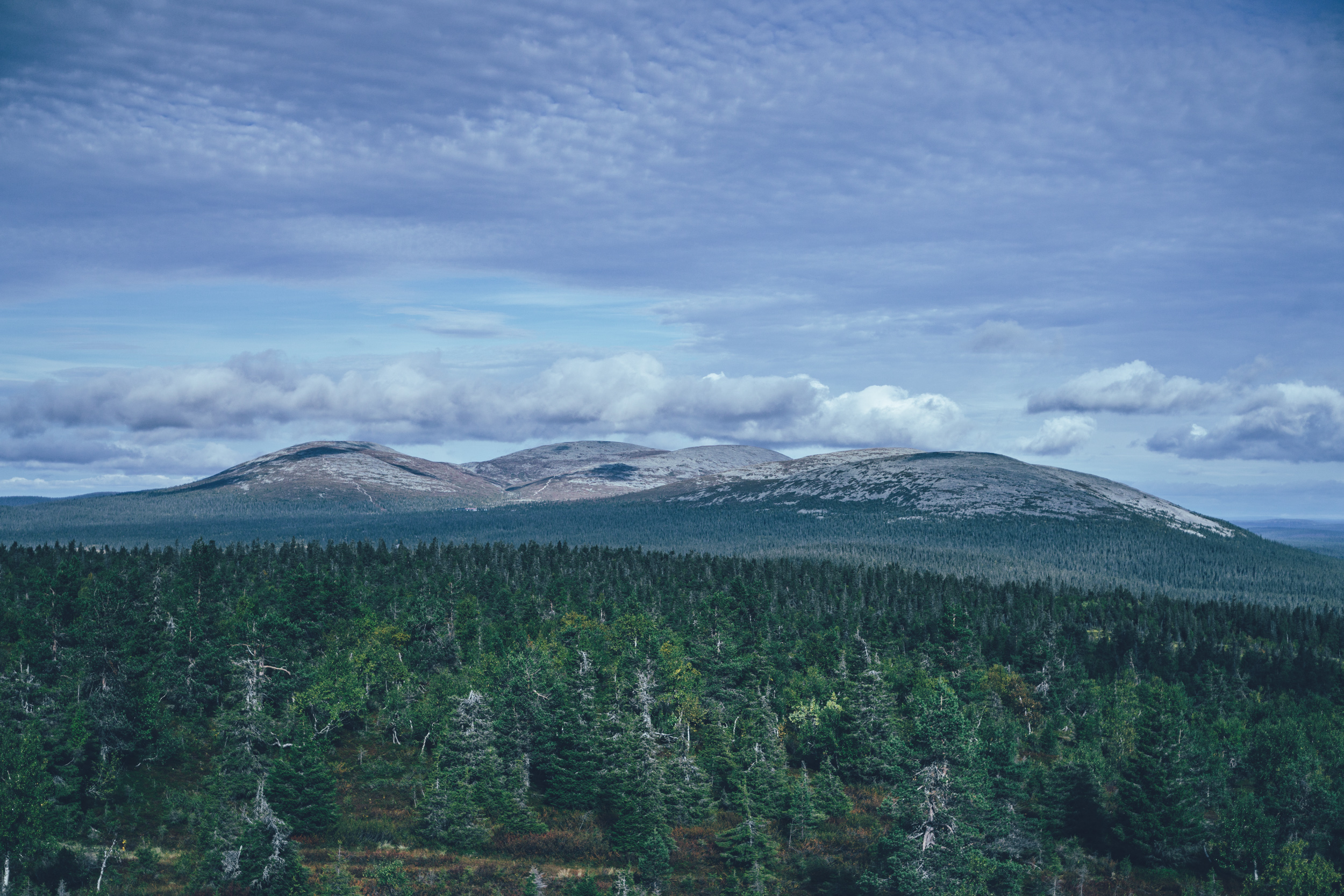
The initiative of protecting public lands for preservation and the enjoyment of the people was made first time in the Nordics by the Finnish-Swedish explorer Adolf Erik Nordenskiöld in 1880. In Finland, Nordernskiöld’s initiative started a 60-year public debate and a process of tackling the legal obstacles on the way of creating protected public lands. Finally in 1938, the first four national parks and six biological reserves were established. One of the first national parks in Finland was the Pallas-Yllästunturi National Park, as its name stands today. The national park is known mostly for it’s continuous south-east lined fells, consisting of some of the highest fell peaks in the country with treeless rocky tops with views far to the arctic taiga.
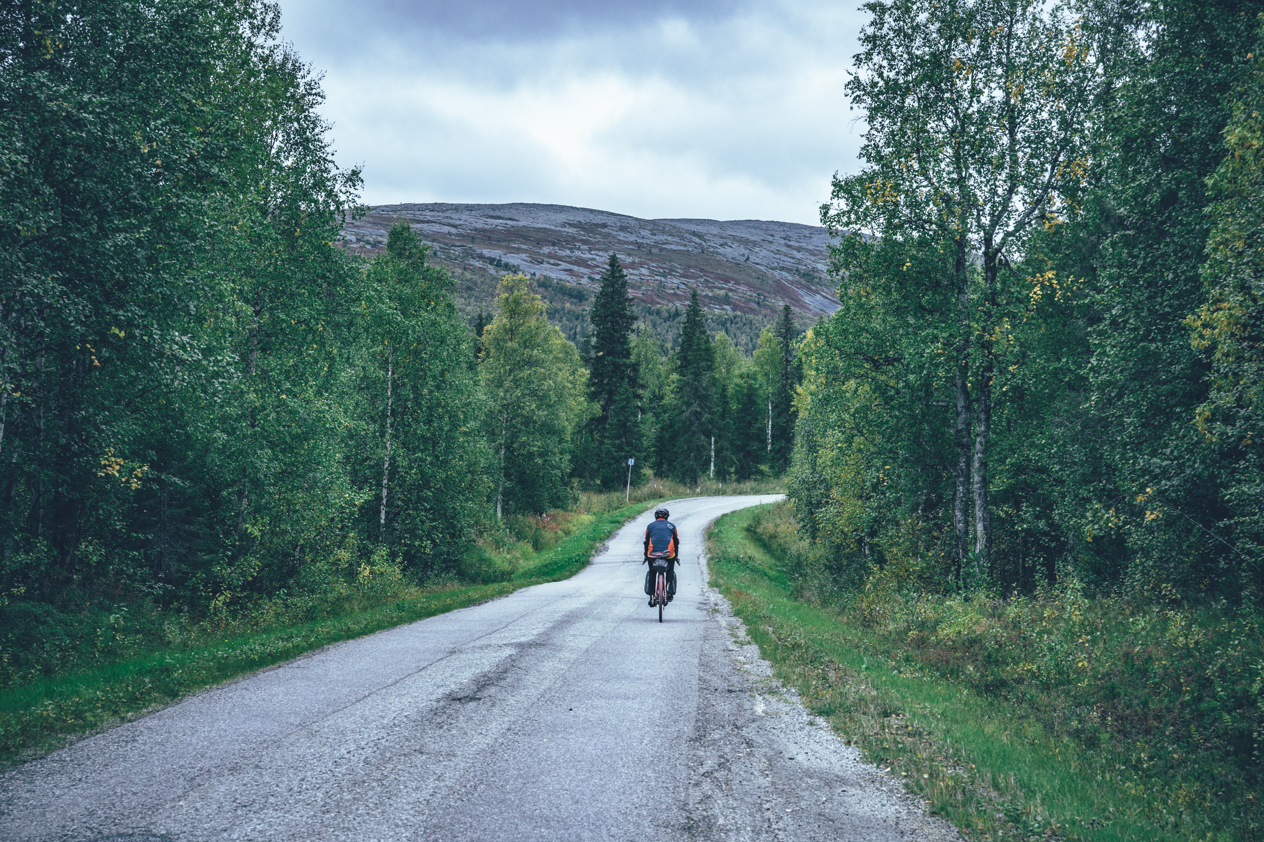
The Arctic Post Road MTB Route is the best way to experience the high fells bikepacking, but the route is physically and technically very demanding and not for everyone. Luckily, there are some fantastic gravel roads in and around the Pallas-Yllästunturi National Park as well, which can be combined into a 278 km and 3-5 day loop hopping from the holiday village to another with some pristine and tranquil nature in between service centers.
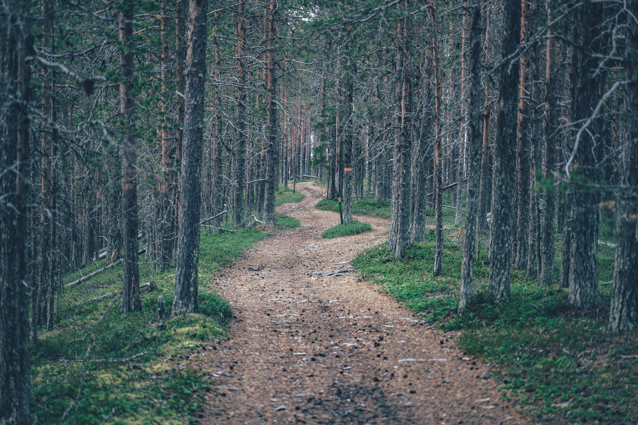
The route starts from the village of Sirkka, which hosts the holiday center of Levi, and follows the gravel-rig-friendly parts of the Ylläs-Levi MTB Route until reaching relatively traffic-free paved side road through the southern part of the Pallas-Ylläs National Park area. The holiday village of Äkäslompolo by the Ylläs fell offers a nice set of services and ales, before the route takes rougher forest road and just-about-rideable single track out of the village along the River Äkäs and then deep into reindeer herding areas between Ylläs and Muonio on some varying conditions gravel roads.
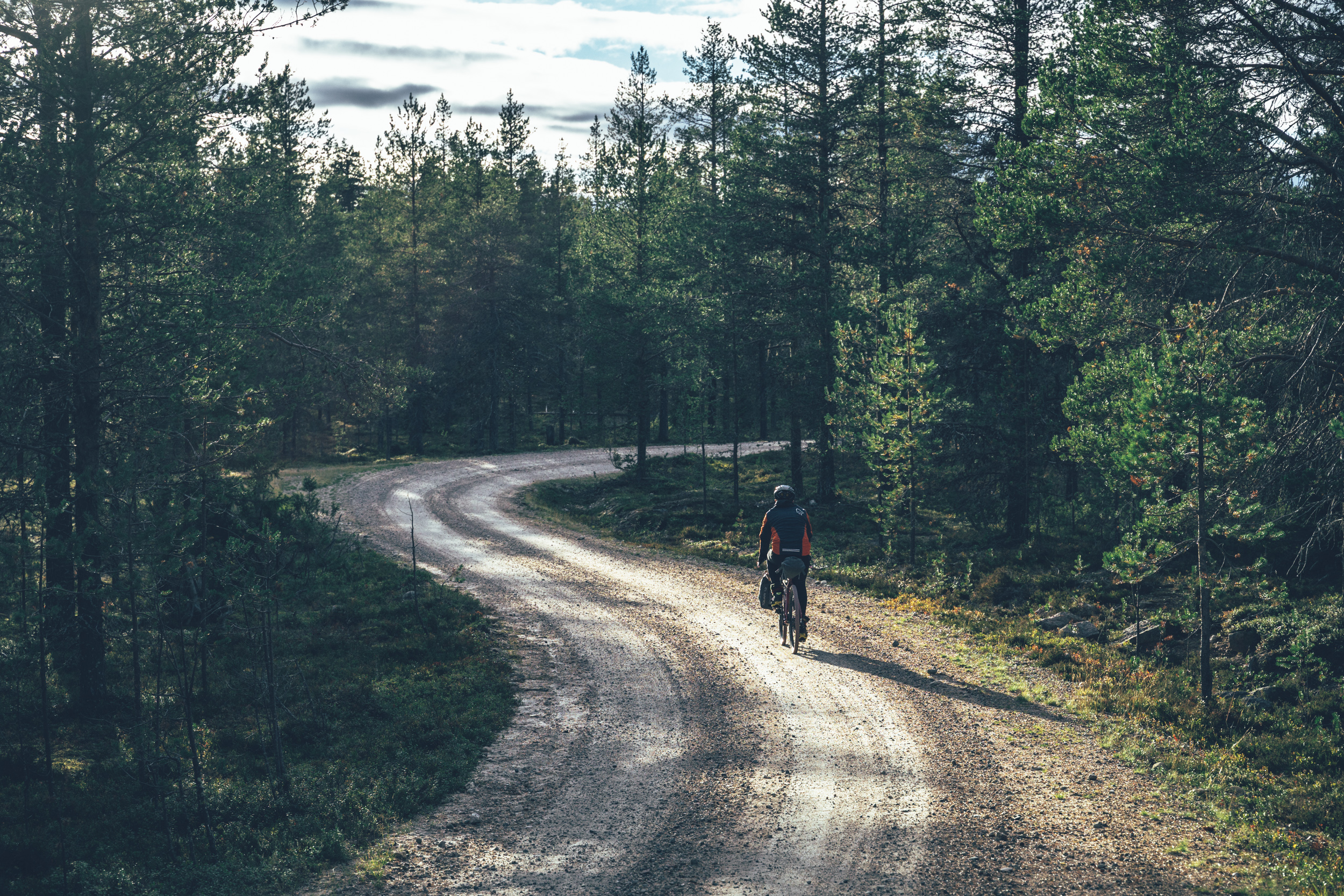
Out of the national park, the occasionally straight forward logging road sections are rewarded with crystal clear spring lakes for a swim and publicly managed fire rings for a break and enjoying a campfire. Harjujärvet, a little before reaching the services of the Muonio village at the Finnish-Swedish border, offers excellent camping by a lake, if you’re not continuing to the village for the night.
The highest point of the route at 475m is located in the national park and just about at the treeline at Mustavaara with great views to the Pallas area fells, if you’re not heading to the Pallas Hotel itself, which is located spectacularly right at the Pallas fells. Pallas fells as well as the Lake Pallas next to it are very famous day-trip destinations, but leaving the Lake Pallas, you’re unlikely to see anyone again for a half-a-day until reaching the buzz of the Levi area again.
Overall, the route offers a well-balanced and logistically easy riding with some spectacular nature and occasionally remote-feeling back roads while still having high quality services regularly on the way. It’s also one of the shortest routes of the Arctic by Cycle Bikepacking Route Network, so if getting on a loaded bike for the first time, this one is pretty hard to beat…
Read more about the route and what it has to offer in the Trail notes below.
- The old growth-forests and the views to the high prominent fells of the Pallas-Yllästunturi National park.
- High quality services of the well-known holiday centers and occasionally in between as well
- Gravel-rig-friendly trails of the Ylläs-Levi MTB Route are a really nice ride and there are some pleasant wilderness huts on the way too
- Remote-feeling gravel roads between the service centers are pretty remote as well and they don’t have much traffic at all
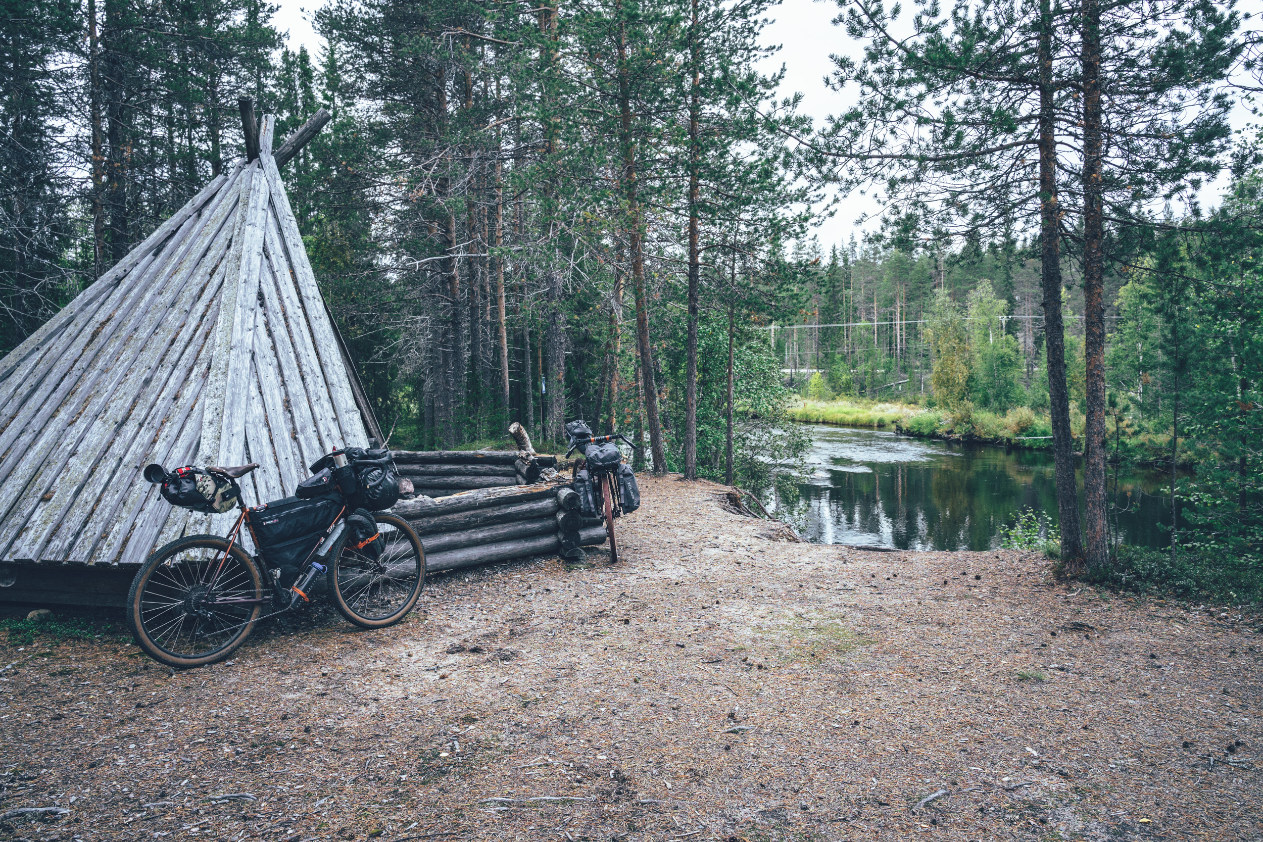
- Hannukainen lean-to and Harjujärvi offer fantastic camping, though by the everyone’s right allows camping pretty much anywhere outside the national park, where camping is strictly forbidden outside the official sites.
- The route is fully open from early June till the 15th of September, by the request of the local reindeer herding community. After 15th of September reindeer round-ups start in the section south of the Äkäslompolo area. See more info on the Reindeer Herding & Route Opening Time info box above.
- The gravel routes in the arctic are usually open from early June after the routes have dried and hardened up after winter. However, the climate crisis makes seasons more unpredictable than before so the season start and end can vary year to year by a couple of weeks.
- The infamous arctic räkkä (the high population of mosquitos, black flies, biting midges and horse flies) starts usually by late June and lasts usually till mid August, making the early June or from mid-August till October ideal time to ride the route.
- The route can be ridden with any bike, as long as the tire size is a minimum of 40 mm and you have smaller gears as well. Though having a beefier tire does not make any harm at all as there are some rough bits and easy single track as well.
- There is an Easy Access version of the route suitable for touring with a trailer or three- or four-wheeled bicycle. See the route link and additional information at Difficulty.
- The route is e-Bike friendly or least in theory possible with some planning in advance and flexibility. The longest distance between guesthouses is 75km, which though might be too much for older bikes fully loaded. Also the daily distances vary a lot as the bettery life defines more your spot for the night rather than where you would like to end up.
- Temperatures during the snowless season vary a lot and week-to-week but expect the spot-on daytime temperatures of 15-23 Celsius from mid-June to late August with nights in the range of 0-10 Celsius. Early June could be warm too but could be significantly colder as well. In late August and September, the temperatures start to drop significantly week by week and the first snow is not uncommon in late September. Especially late in the season, in late September and early October, be prepared for daytime temperatures of 5-10 Celsius and nights getting below freezing.
- When choosing a sleeping bag, you should assume that the night temperatures can drop to 0 Celsius even during the mid-summer months and then even colder later the season gets. The classic -7 C/ 20 F sleeping bag works like a charm in Lapland, too, with the lower limit low enough for the late-season exploits.
- The midnight sun or “the nightless night” lasts from around 6 weeks in Southern Lapland to up to 3 months in Northern Norway. Getting used to the 24h sun can take a while to get used to…
- The best time to see the northern lights is roughly starting from September and as the nights get darker and longer towards the end of the season, chances are getting better week by week. It’s not uncommon to see the auroras multiple times a week at the end of the season, given that the weather gods are on your side and the sky is clear.
- The route has only digital navigation; for instructions and tips for successful navigation, see here.
- Always stay on the routes and aim to only use the recommended spots marked on the route map.
- The mobile phone network does not cover the whole route area: in case of an emergency in Finland, call 112 or use the 112 app, which automatically shares your location to the emergency services as well. In case of an emergency in Norway, call 113 or use the 113, which similarly shares the location automatically, making finding you fast and easy.
- The route is located in a traditional reindeer herding area, please read more about the etiquette of traveling in the reindeer herding land here.
- High quality lodging options are a regular treat on the route and the route can be done without a tent as well.
- Camping is allowed and free of charge along the route by Everyone’s Rights, however, due to the fragile and slow-growing arctic flora, you should always aim to use only the campsites marked on the route map. Also, camping is strictly prohibited outside the recommended camp spot in the Ylläs-Pallastunturi National Park.
- There are 12 wilderness shelters along the way, which serve as official camping areas of the route as well. The best ones for camping are Iso Harjujärvi lean-to, Hannukainen lean-to, Äkäsaivo campfire hut and Pyhäjärvi open wilderness hut.
- All the camp spots are next to a high-quality water source, unless stated otherwise.
- The grocery stores for restocking are located in Levi, Äkäslompolo and Muonio, so you get away with carrying just 1-1.5 days worth of food, depending on where you sleep.
- There are restaurants or cafés available in the villages of Levi, Äkäslompolo and Muonio. Additionally, some of the hotels in between have a restaurant too.
- Water is most of the time drinkable straight from streams, ponds, and lakes, but you never know if there is a reindeer carcass upstream, so better to be safe than sorry: water treatment is recommended.
- Sources of water are plentiful, so you’ll get away with carrying just 1-2 liters of water. The best spots for refills are marked on the route map.
- All the camp spots are next to a high-quality water source, unless stated otherwise.
- Tap water is always drinkable and the locals are happy to fill your bottle
- When cooking in the camp, know that making a fire is strictly prohibited during the forest fire warming period. See the local restrictions in Finland here.
- The route is mostly very easy riding and due to the regular services it is logistically straight forward as well. Though there are a couple of more challenging parts, physically and technically, which increase the difficulty a little, though overall it stays on the easy side. It is one of the shorters of the Arctic by Cycle routes as well, making it very suitable for first touch of bikepacking in the arctic. The route can be ridden to both directions and riding direction does not affect it’s difficulty.
- Thinking of tire size, you get away with 40mm tires, like mentioned above, but the route gets a little easier with 45mm or 50mm tires. Fast XC tires are not an overkill on this one either, though that could be arguable and depends a lot on personal preference.
- In terms of technical difficulty the route earns 6/10 due to the occasional single track and rough forest road sections between Levi and Ylläs and the old forest road and single track section south of Äkäslompolo. Out of those, the route is technically very easy riding. The harder section, despite being a little harder with a gravel bike, are mostly doable without any mountain bike skills at all.
- In terms of physical difficulty, there are some tough climbs on rough surfaces, especially the climb to Mustavaara in the northern part of the route is really steep, though luckily rewarded with great views as well. Also, the section from Äkäslompolo to Muonio is surprisingly hard, first tackling the single track and forest road and then having a long fake flat on rough gravel. This grands the route 7/10 in physical difficulty.
- Logistically the route is a breeze and as it’s quite short on the Lapland standards, it get’s 4/10 in bikepacking challenge. Overall the route gets 6/10 in difficulty, making it one of the easiest of the Arctic by Cycle Bikepacking Route Network.
- Bikepacking is usually the more comfortable the less you carry, and that is mostly the case on this route as well. The lighter you go, the easier the harder sections get physically and technically. Though, overall the route can well be ridden with either bikepacking setup or panniers, or anything in between. As the sleeping options are regular, you can go credit card style as well, of course.
- Easy access (for family touring and wider rigs)
- There is an Easy access version of the route, which avoids the tricky single track, rocky and rooty sections and steep climbs, when ever possible. Note, that there are still sections with small rocks and roots here and there, which are likely to be ok if just going slow.
- If hauling a trailer and a kid, the bigger tires the trailer has the better. Trailer suspension is a fantastic addition too.
- Lapland is generally easy for family touring because you are allowed to camp basically anywhere by all man's right. So not hitting the daily target is completely all right. Most of the recommended campsites are located by a water source, so if you think you can't make it for the night, just carry a little more for the night and evening.
- One blue route section was left on the route is the Harjujärvet camping areas trail. Despite being marked as single track, the trail is wide enough to pass, though with occasional roots and rocks. It's pretty and short so makes sense to take it if camping in the area. The best place to camp is at the Pieni Harjujärvi southern lean-to, but it has a duck board access only, which is impossible for a trailer, but luckily there is quite good camping elsewhere in the area too. Really steep short trail to the morraine ridge. So you might need two people to push the trailer to the top of the ridge, but once you're on top it's all right and rideable slowly again.
- Other blue section left on the route is the arrival to the Levi/Sirkka holiday village. It's all great riding with a trailer on wide routes though you just need to slow down a little every now and then for roots and small rocks.
- There is an overnight train connection to Kolari and Pello (16 hours from Helsinki) multiple times a week, with a bus connection to Levi and Äkäslompolo at Ylläs. Both function as natural starting points for the route. For train schedules and purchasing tickets, see vr.fi
- There are flights from Helsinki to Kittlä multiple times a day, and Levi is located 15 minutes from the Kittilä Airport by bus.
- There is a daily bus connection between Muonio and Levi, but generally no bus connection at all between Äkäslompolo and Levi or Äkäslompolo and Muonio. For bus schedules and purchasing tickets, see matkahuolto.fi
Day 1, Levi to Lapland Hotels Pallas (75km, 1100m of climbing)
The route starts from the slopes of the Levi Ski Resort north first 10km on pavement and then follows the river side road of the Ounas River on fast hard-packed gravel. The route makes a visit to the Perhejärvi campfire hut, but unless you want a peaceful spot by a pond deep in the woods for a mid-ride break or you’re heading there for the night, you can just skip it and head on toward Lake Pallas. After leaving the Ounas River valley the gravel road gets smaller and a little rougher, but the progress is still fast.
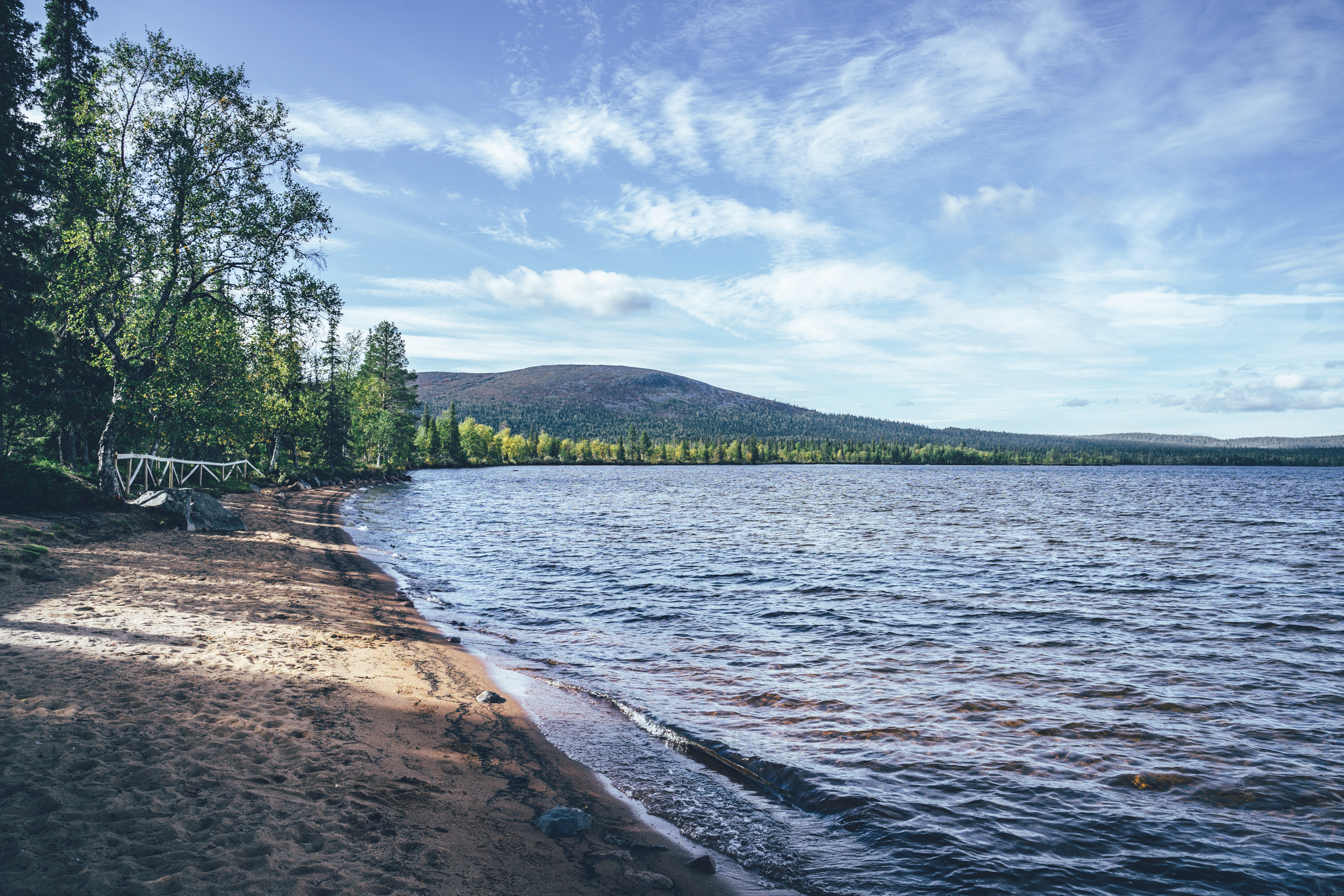
Punainen hiekka day trip hut is located by red sand beaches of Lake Pallas in the Pallas-Yllästunturi National Park with spectacular views over the lake to some of the higher fells in Finland. The spot has become one of the most visited in Lapland during the corona years, so don’t expect to share the view and the hut alone. It’s a splendid area to camp if you don’t mind other campers, though the area allowed for camping is limited and the site can be full.
The first riding day finishes with a long gradual paved climb to the treeline of the Pallas fells, where the Lapland Hotels Pallas is located. The Pallas area offers great views of the southern part of the national park, especially so if you make a hike to some of the summits right next to the hotel. The Pallastunturi visitor Centre is also worth a visit with information about the fauna and flora of the area.
Day 2, Lapland Hotels Pallas to Hotel Harriniva (42km, 600m of climbing)
If aiming to hit some of the premium lodging options, day two is relatively short. The day starts with a long downhill from the fells back to the main road and then taking the old post road over the Mustavaara fell to Lake Jerisjärvi. Mustavaara summit is right next to the route on the highest point of the old gravel road with great views to the Pallas fells. Both uphill and downhill to the Mustavaara fell are extremely steep, but rewarding. The arrival to Lake Jerisjärvi is on a wide single track with occasional roots and rocks, but mostly a lot of fun with a gravel rig and skinny tires too.
The Arctic Sauna World and the Hotel Jeris is located 16km and roughly 300m of climbing into the day. The hotel has a restaurant, though the Arctic Sauna World opens only in the afternoon (opening times 3-10pm in 2023). The way to Muonio village is a combo of fast pavement, cross country skiing tracks routes and some nice one-car wide gravel paths. Lapland Hotels Olos by the Fell Olos is located on the way with a couple of restaurant options and a hotel at the Olos Ski Resort, before the epic forest approach to the village.
The municipal center of Muonio by the Swedish border has the first grocery stores on the route as well as a Swiss bakery cafe. Hotel Harriniva is located by the Finland-Sweden border river, River Muonio and it’s a great place for the night with it’s restaurant and sauna.
Day 3, Hotel Harriniva to Äkäslompolo (82km, 620m of climbing)
The third day starts on the paved main road in the lack of gravel options by the border river. This section has some lorry traffic too, but at least 5km in there is a nice viewing point to the Äijäkoski rapids of the Muonio River. The route leaves the main road finally at the Kangosjärvi, where the local village association offers accommodation in an old village school. The detour via Harjujärvi lakes is beautiful with a double track on a ridge between the two lakes. One of the nicest campsites of the whole route is located here as well, at the southern Pieni-Harjujärvi lean-to.
The gravel road toward Äkäslompolo is mostly great riding in remote pine forests. The 60m deep Pakasaivo ravine lake is surrounded by up to 60m high cliffs with a fire ring and a viewing platform. After a break there, the gravel route continues to the River Äkäs valley and the Saivojärvi spring lake, which is a great spot for a quick swim in qin clear water. The approach to the Äkäslompolo village is on double tracks, forest roads and single track spicing up the arrival of the Ylläs area, in the southernmost part of the Pallas-Yllästunturi National Park. Multiple lodging options and a nice pub in the village.
Day 4, Äkäslompolo to Levi (61km, 540m of climbing)
The first half of the last day on the route is straightforward on mostly low-traffic paved roads. Äkäsaivo spring lake (behind a little detour though) and the Peurakaltio wilderness café are the first spots for a break. 20km later the passes Aakenuspirtti, an old logging worker’s cabin as well, which is the last café before the route gets on the more remote Ylläs-Levi MTB route back to Levi. The last 23km of the route are spectacular first on small gravel roads and then on easy and fast double track and wide single track with nice two refugios on the way, both worth a visit unless you’re in a hurry to hit the pub in the Alpine style Levi downtown.