


 1623 km
 14-28 days
 7400m
7400m 69m
69m 8 %
8 % 0 %
0 % 2
2 100 %
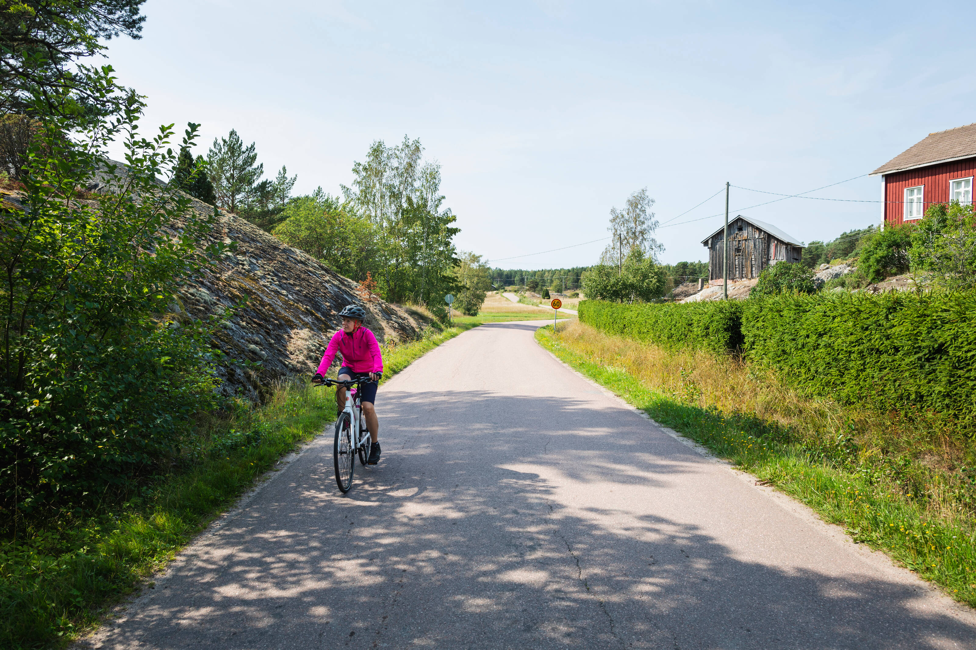
100 %Kesäkuukaudet Suomessa tarjoavat valoa, leudon sään ja mainiot pyöräilyolosuhteet. Kaupungit ja kylät ovat eloisia, ja EuroVelo 10 -reitti on hieno tapa kokea kotimaan kesä, luonto ja rannikkokulttuuri hieman uusin silmin.
Suomen osuus reitistä alkaa Torniosta, jonne EuroVelo 10 reitti saapuu Ruotsista.Tornionjoki laskee Itämeren pohjoisimpaan kolkkaan, Perämereen. Itämeri on yksi maailman suurimmista murtovesialtaista, jonka valuma-alue on moninkertainen sen pinta-alaan nähden.
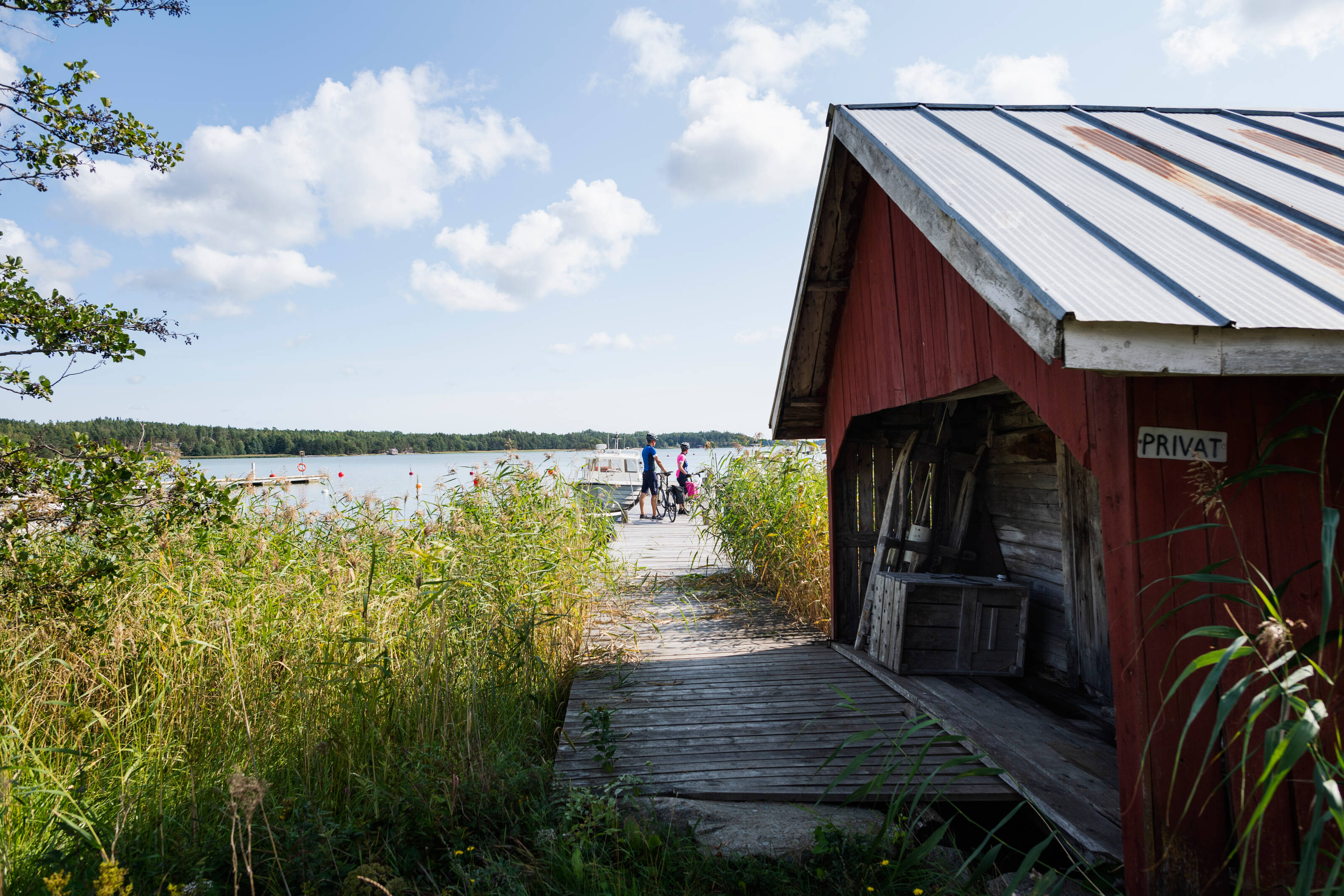
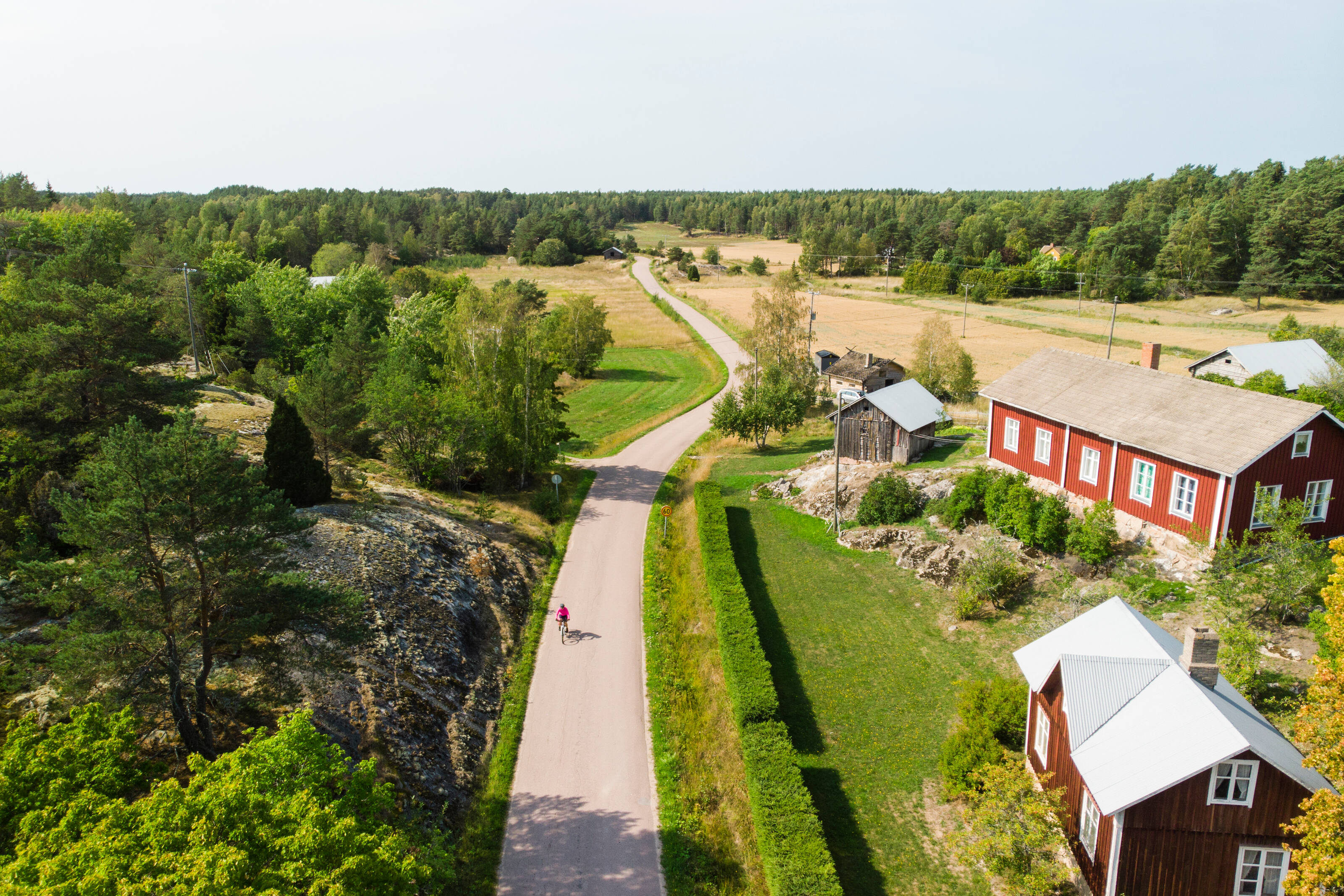
Matka etelää kohti kulkee rannikkoa pitkin ja vie läpi pienten ja suurten kaupunkien. Oulu on reitin ensimmäinen isompi keskus ja tunnettu erityisesti talvipyöräilyn pääkaupunkina. Kalajoen hiekkasärkät tarjoavat avaruutta ja meri-ilmaa, ja Kokkolassa sekä Pietarsaaressa pääsee tutustumaan kauniisiin, 1700-luvulta säilyneisiin puutalokortteleihin. Tällä osuudella reitti kulkee ensi kertaa myös ulkosaaristoon — seitsemän sillan yli saarelta toiselle.
Vaasassa kannattaa varata aikaa sivupistolle ainutlaatuiseen Merenkurkun saaristoon, joka tunnetaan maankohoamisilmiöstä ja on myös Suomen ainoa luontokohde Unescon maailmanperintölistalla.
Hiljaiset maaseututiet johdattavat yhä etelään. Vaasasta eteenpäin EuroVelo 10 -reitti on merkitty virallisin EuroVelo -opastekyltein aina Vaalimaalle saakka. Reitin varrelle osuvat muun muassa Uusikaupunki, Rauma, Pori ja Kristiinankaupunki – kaikki merihenkisiä kaupunkeja, joissa yhdistyvät vanhat puukaupungit, saaristo ja läheisyys Selkämeren kansallispuistoon.
Naantalista alkaa kehitetty osuus, joka kulkee Turusta Helsinkiin. Tällä välillä reitti seuraa osin Kuninkaantietä – historiallista postitietä, joka kulki aina Bergenistä Viipuriin asti. Tarkemmat reittikuvaukset Turku–Helsinki-reitistä löydät sen reittisivulta.
Kehitetty reittiosuus päättyy Helsinkiin, mutta matkaa voi jatkaa itään Porvoon tunnelmallisille kujille, Loviisan puutarhakaupunkiin sekä Kotkan ja Haminan seudulle, jossa näkyvät yhä idän ja lännen vuosisatainen kamppailu. Alueella on useita linnoituksia, kuten Haminan ympyrälinnoitus ja Kotkan Kyminlinna, jotka muistuttavat rajaseutujen historiasta.
Reitin Suomen osuus päättyy Virolahden Vaalimaalla. Koska Venäjän raja on tällä hetkellä suljettu, jatkoyhteyttä etelään suositellaan lautan kautta Helsingistä Tallinnaan.
Yksityiskohtaiset reittikuvaukset Tornion ja Turun sekä Helsingin ja Vaalimaan välille ovat työn alla. Reitti on ajettavissa kumpaankin suuntaan, mutta suosittelemme etenemään pohjoisesta etelään!
- Pitkät kesäpäivät tekevät pyöräilystä leppoisaa
- Maaseudun rauha ja pienet merenrantakaupungit puutaloalueineen
- Upeita jääkauden jättämiä jälkiä voi nähdä Merenkurkussa ja Perämerellä
- Vanha Rauma - Unescon maailmanperintökohde, jossa kapeat kujat, koristeelliset puutalot ja käsityöläisperinne luovat ainutlaatuisen aikamatkan vuosisatojen taakse
- Marjoja evääksi – metsät ovat täynnä vadelmia, mustikoita ja puolukoita kesän lopulla
- Reitti soveltuu hyvin kaikille retkipyörille, joissa on vähintään 32 mm leveät renkaat. Kokeneet pyöräilijät voivat pärjätä myös kapeammilla renkailla.
- Paras aika pyöräillä reitti on toukokuusta syyskuuhun. Suurin osa palveluista on avoinna toukokuun puolivälistä elokuun puoleenväliin – tarkista aukioloajat etukäteen.
- Vettä ja eväitä kannattaa aina kuljettaa mukana, sillä palveluita on pääosin kaupungeissa ja taajamissa 27–55 km välein.
- Reitti on merkitty maastoon opastein Vaasa-Vaalimaa välillä, mutta suosittelemme GPX-reitin lataamista ja digitaalisten navigointityökalujen käyttöä. Löydät vinkkejä Bikeland-blogista.
- Matkapuhelinverkko toimii hyvin koko reitin varrella. Hätätilanteessa soita 112 tai käytä 112 Suomi -sovellusta.
- Sähköpyörille ei ole erillisiä latauspisteitä, mutta moni majoituspaikka tai kahvila saattaa sallia lataamisen omalla laturilla – kannattaa kysyä.
- Reitin varrella on runsaasti majataloja, hotelleja ja Airbnb-majoituksia, mutta ne sijaitsevat pääosin kaupungeissa ja suuremmissa taajamissa (Kotka, Hamina, Loviisa, Porvoo, Helsinki, Turku, Rauma, Pori, Vaasa ja Oulu). Joissakin pienemmissä paikoissa majoitusvaihtoehtoja saattaa olla vain yksi tai kaksi.
- Majoitus kannattaa varata etukäteen ja varmistaa pyörän turvallisen säilytyksen mahdollisuus ennen saapumista.
- Jokamiehenoikeuksien mukaan telttailu on sallittua, mutta mukana tulee myös vastuita. Luonnossa saa yöpyä yhden yön teltassa, kunhan pitää vähintään 150 metrin etäisyyden rakennuksiin, pihoihin ja viljelysalueisiin, eikä aiheuta häiriötä tai vahinkoa luonnolle tai ihmisille. Lisätietoa löytyy esim. luontoon.fi sivuilta.
- Jos metsäpalovaroitus on voimassa, avotulen teko on kielletty myös rakennetuilla nuotiopaikoilla. Kielto ei kuitenkaan koske keittokatoksia tai hormilla varustettuja tulisijoja. Ajantasaiset varoitukset löytyvät osoitteesta ilmatieteenlaitos.fi/metsapalovaroitukset.
- Reitin varrella, erityisesti taajamissa ja kaupungeissa, on säännöllisesti ravintoloita, kahviloita ja kauppoja. Palvelut ovat yleensä avoinna toukokuun puolivälistä elokuun puoliväliin – tarkista aukioloajat aina etukäteen.
- Pyöräilijäystävälliset yritykset tunnistat Welcome Cyclist -tunnuksesta.
- Päivän tarpeisiin riittävä määrä vettä ja eväitä kannattaa pitää mukana, sillä palveluita ei ole jatkuvasti tarjolla.
- Ravintolat ja kaupat täyttävät usein pyöräilijän juomapullon mielellään.
- Jos täytät pullosi reitin varrella olevista puroista, joista tai järvistä, muista puhdistaa vesi aina ennen käyttöä keittämällä, suodattamalla tai puhdistustabletteja käyttämällä.
- Älä roskaa – vie kaikki roskat mukanasi ja kierrätä asianmukaisissa pisteissä.
- Metsäpalovaroituksen aikana myös leirintäalueiden nuotiopaikoilla on avotulen teko kielletty. Retkikeittimen käyttö on kuitenkin aina sallittua. Ajantasaiset varoitukset löydät osoitteesta ilmatieteenlaitos.fi/metsapalovaroitukset.
- Reitti kulkee pääosin päällystettyjä teitä pitkin, mutta mukana on myös hyväkuntoisia soratieosuuksia sekä paikoin yksittäisiä kuoppia. Se sopii kaikille retkipyörille, joissa on vähintään 32 mm leveät renkaat – kokeneet pyöräilijät voivat pärjätä myös kapeammilla.
- Reitti kulkee enimmäkseen vähäliikenteisillä maaseututeillä, ja vilkkaammilla alueilla on pyöräteitä turvallisen ja miellyttävän ajokokemuksen takaamiseksi. Joillain osuuksilla reitti kulkee Suomen pää- ja seututeillä, joilla liikenne voi olla vilkasta eikä erillistä leveää piennarta ole – tällöin pyöräily vaatii erityistä varovaisuutta.
- Maasto on kumpuilevaa, ja matkalla on lyhyitä mutta jyrkkiä nousuja. Reitti soveltuu kuitenkin kaikentasoisille pyöräilijöille. Pienet vaihteet helpottavat ylämäissä ja ovat näin suositeltavia retkiajoon. Kuten millä tahansa pyöräretkellä, myös kevyt varustus lisää ajomukavuutta.
- Vaikeustasoltaan reitti on 1/5, eli helposti lähestyttävä kaiken tasoisille pyöräilijöille. Sen voi ajaa kumpaan suuntaan tahansa.
- Suorilla junayhteyksillä esimerkiksi Ouluun, Kemiin, Tornioon, Vaasaan, Poriin, Turkuun ja Kotkaan. Aikataulut ja liput löytyvät osoitteesta vr.fi.
- Linja-autot liikennöivät reitin varrella säännöllisesti. Tarkista aikataulut ja liput osoitteesta matkahuolto.fi. Joihinkin busseihin voi varata pyöräpaikan etukäteen, toisinaan järjestelyt tehdään suoraan kuljettajan kanssa.
- Lentokenttiä löytyy mm. Oulusta, Kemistä, Porista, Helsingistä ja Turusta, ja ne tarjoavat hyvät yhteydet eri puolille Suomea.
- Jos matkustat oman pyörän kanssa bussilla, junalla, lentokoneella tai lautalla, muista varata pyöräpaikka ajoissa. Sähköpyörien kuljettaminen lentokoneessa ei ole sallittua.
- Ruotsin ja Viron EuroVelo 10 -reitin osuuksille pääset laivalla Helsingistä, Turusta ja Vaasasta. Reittejä ja aikatauluja voit tarkistaa esimerkiksi Tallink Siljan, Viking Linen, Eckerö Linen, Finnlinesin tai Wasalinen sivuilta.
- Vinkki: Onko aika kortilla tai haluatko pyöräillä vain tietyillä osuuksilla? Yhdistä pyöräilyyn juna- tai bussimatka ja keskity suosikkialueisiisi.
Kemin ja Oulun välillä reitti kulkee Perämeren kansallispuiston tuntumassa. Oulu on tunnettu pyöräilykaupunki, joka tunnetaan toripoliisista ja talvipyöräilystä.
Oulun eteläpuolella Kalajoki, Kokkola ja Pietarsaari edustavat rannikkoseutujen ja puutalokaupunkien perinnettä. Näillä main kuljetaan myös Seitsemän sillan tietä (tie 749), joka tarjoaa ensimmäisen vierailun ulkosaaristoon.
Vaasaa lähestyttäessä kannattaa tehdä pisto Merenkurkun saaristoon – Suomen ainoassa luonnon maailmanperintökohteessa – jossa maankohoaminen näkyy erityisen selvästi. Puoliväli alkaa lähestyä, kun ohitetaan Kaskinen, Ahlainen ja muut pienet rannikkokaupungit.
Länsirannikon Kristiinankaupunki, Uusikaupunki, Pori ja Rauma tarjoavat merellistä tunnelmaa, puutalokortteleita ja historiaa. Raumalla pääset vierailemaan Unescon maailmanperintökohteissa Vanhassa Raumassa ja Sammallahdenmäellä sekä tutustumaan pitsiperinteeseen. Yyterissä voit rentoutua dyyneillä, mäntymetsissä ja luonnonsuojelualueella aivan meren tuntumassa. Pori tunnetaan myös jazz-festivaalistaan, ja Reposaaressa voi nähdä 1930-luvun rannikkopuolustuksia.
Etelään jatkaessa saavutaan Naantaliin, joka tunnetaan Muumeista ja presidentin kesäasunnosta. Turkuun tullessa ollaan Suomen vanhimmassa kaupungissa – joenvarren puistot, kahvilat ja keskiaikaiset nähtävyydet värittävät kaupunkikuvaa. Naantalista pääset myös Saariston rengastielle, retkipyöräilyn klassikkoreitille.
Turun itäpuolella reitti kulkee Salon kautta Teijon kansallispuiston kupeeseen Mathildedaliin ja edelleen Tammisaareen. Pääkaupunkiseutua lähestyttäessä pyöräillään Inkoon, Siuntion, Kirkkonummen kautta aina Espooseen, jossa yhdistyvät luonto, teknologian historia ja oppilaitokset. Espoossa ja Helsingissä on yhteensä yli 180 km rantareittejä, ja EuroVelo-reitin kehitetty osuus päättyy siellä kauppatorille. Kauppatorilta pääset helposti vierailemaan myös Unescon maailmanperintökohteessa Suomenlinnassa.
EuroVelo 10 jatkuu Itään aina Vaalimaalle asti. Reitti on opastettu, mutta osuudelle ei ole vielä saatavilla tarkempia reittikuvauksia.
Idempänä Porvoo tarjoaa vanhan kaupungin kujia ja 1700-luvun rakennuksia. Loviisa hurmaa puutarhoillaan ja Strömforsin ruukilla. Tie 170 kulkee peltojen ja rannikkokylien halki Kymijoen suistoon ja edelleen Kotkan ja Haminan seudulle, jossa näkyvät idän ja lännen vaikutteet sekä linnoitushistoria. Salpalinja – 1200 kilometrin mittainen toisen maailmansodan puolustuslinja – kulkee Virolahden ja Miehikkälän kautta.
Reitin Suomen osuus päättyy Vaalimaalla, Venäjän vastaisella rajalla. Koska raja on tällä hetkellä suljettu, jatkoyhteydeksi etelään suositellaan lauttayhteyttä Helsingistä Tallinnaan.