


 1593 km
 15-40 days
 4842m
4842m 362m
362m 5 %
5 % 0 %
0 % 3
3 100 %
100 %The starting point on the border of Finland and Norway is Karigasniemi village. Cycling in between the 2 vast wilderness areas, Paistunturi and Muotkatunturi fells wilderness areas, you truly are alone with nature – and reindeer, arctic foxes, birds, and fowl. Cycling through Giellajohka and Kaamanen you arrive in Inari, the largest town in the area and providing an extensive range of services, museums, and activities. Siida, the Sami museum and nature center, is worth a stop to learn more of the Sami culture and northern nature.
From Inari you head southward through Ivalo, Saariselkä, and Sodankylä to Rovaniemi, all with good services available. The Inari-Ivalo section is a beautiful cycle close to lakes and magnificent resting places. Ivalo is the administrative and commercial center of the municipality, by the Ivalojoki river, which the route follows. At Saariselkä you come to the area where there are open fells as far as the eye can see. These big hills used to be mountains before the Ice Age molded them round and perfect. There is a paved car route all the way to the top of the Kaunispää fell (438m), awarding you with a 360 degree view of the surroundings, the largest fell upland in Northern Europe.
The road south is called ”Kultainen tie” (=Golden road) named after the history of the area. The first gold rush took place on the Ivalojoki River in 1869 and the rush to Lemmenjoki River close to Inari in 1945. Men returning from the war were tempted to try their luck in the goldfields. With good luck you can pan your own gold at the Gold Prospector Museum in Tankavaara, 30 km south from Saariselkä, the only international museum in the world displaying the past and present of gold panning and prospecting.
Rivers keep you company as you cycle southward. You first join with the river Kitinen, the fourth largest river in Finland, as it flows towards Sodankylä, from where it leads you onwards towards Rovaniemi and crossing of the Arctic Circle. From Rovaniemi the Kemijoki river in turn takes you to Kemi, at the northern edge of the Bothnian Bay. The Baltic Sea is one of the largest brackish water areas in the world, and its drainage area is about four times larger than its surface area, and as you cycle around the bay you cross many rivers that contribute fresh water to the bay. Cycling around the Bay you arrive at Oulu, the fifth largest city in Finland. You then head inland again and around lake Oulujärvi.
Remember that Finland is the land of thousands of lakes – 168 000 to be exact! So you probably guess the scenery on your way through the lake district taking you to Kuopio, in the middle of the lake district, and then to Jyväskylä, city of Alvar Aalto architecture and home to two of Finland’s seven UNESCO World Heritage Sites. From Jyväskylä the EuroVelo 10 route will offer you a beautiful route where you cycle on the 9 km long Pulkkilanharju esker ridge that dates back to the Ice Age and over 3 bridges with sweeping views to lake Päijänne. The area around Lahti is full of these interesting Ice Age formations!
Arriving at Helsinki, capital of Finland, and the neighboring cities of Espoo and Vantaa, you are in the bustling metropolitan area with approximately 1.5 million inhabitants. Here the Baltic Sea is very much present. The Helsinki city area has over 300 islands, many of which are accessible by a bridge or a ferry. The Suomenlinna-Sveaborg Sea Fortress is a Unesco World Heritage Site located just a short 15 minute ferry crossing over from the Market Place and Old Market Hall.
Summer months between May and August are at these geographical levels full of light and the temperatures perfect for cycling. There is great variation in the temperatures between the northern and southern part of this route. Read more from the Need to know section at the bottom of the page. Click here or scroll down for the map of this beautiful route through the diverse landscapes of Finland and plan your next cycling holiday acquainting yourself with the Sámi culture and way of life, the natural formations of the Ice Age, UNESCO heritage sites, and charming cities and towns along the EuroVelo 11 route!
- Land of thousands of lakes - 168 000 to be exact!
- Daylight for more than 15 hours between May and August in the southern part of the route, and the Midnight Sun in Lapland from mid May to end of July
- Crossing the Arctic Circle at Rovaniemi
- Amazing wilderness areas and nature with marks of Ice Age - rounded open fells around Saariselkä, beautiful lakes and rivers, 9 km long Pulkkilanharju ridge across Päijänne lake
- Suomenlinna Sea Fortress, Unesco World Heritage Site located just 15 minute ferry crossing from Helsinki Market Square
- Jyväskylä UNESCO World Heritage Sites - Petäjävesi Old Church and Oravivuori Triangulation Tower
- In late August and September, the autumn colors and berries ripe for picking
- Make sure you pack a first-aid kit. Hospitals, medical centers and pharmacies are located in the cities and larger towns, you are most often in an approximately 50 km radius of professional help. Hospitals are in Helsinki, Lahti, Jyväskylä, Kuopio, Oulu, Kemi, Rovaniemi, Sodankylä and Ivalo. Medical centers are located in all the cities and large towns along the route.
- If you face an emergency, e.g. get lost, get injured or observe wildfire, call national emergency phone number 112 and report an emergency. More information on how to act in an emergency. You can also download an application ”112 Suomi”, which when used has the benefit of your location being forwarded to the public safety answering point.
- Charge your phone to the maximum just before the ride and protect your phone from getting wet. Turn off data when you don't need it so your phone will not use up the battery trying to find reception. Generally reception is adequate on smaller roads but there may be areas with no reception. If you plan to camp outside camping facilities, carry a power bank with you.
- In Lapland the summer begins with a quick shift from winter at the end of May and early June. In just a few warm days, the rivers and lakes free themselves of their icy covering and tree leaves burst into different shades of green. In late August and early September, nature begins preparations for the autumn and approaching winter, and suddenly the intense arctic summer is over. The autumn colors are one last magical show before winter, the colors ranging from yellow, orange, red, and purple.
- In southern Finland, the average temperature varies greatly as the route extends many different climate sectors. May can be quite chilly, day temperatures in the 10-15 range and nights can be at or below 0 degrees Celsius. In June and July the difference is not that great along the route, but nights can still be cool, even close to 0, average temperatures between 15-20 degrees Celsius. In August the humidity increases and average temperatures drop some 3-5 degrees throughout the route. You can experience anything from sleet to tropical heat waves during the Finnish summer. In April and early May, as well as late September, you might even encounter snow in the northern part of the route.
- The Midnight Sun begins in northern Lapland after mid-May and continues until after mid-July. During that time, the sun does not set below the horizon, but shines throughout the day and night. Daylight is available 24/7 for approximately 60 days. Even in southern Finland daylight is 19 hours at Finnish midsummer festivities around the 24th of June! The warm, golden light casts a beautiful glow over the Arctic landscape. Watching the sun dip towards the horizon, only to rise again moments later, is a truly unforgettable experience. The midnight sun is a testament to the incredible power and beauty of nature. The downside is the lack of darkness when sleeping, so if you are sensitive to light when sleeping maybe have a sleep mask with you.
- Check the weather forecast e.g. from Ilmatieteenlaitos and dress according to the weather, layered clothing is always a good option.
- Drinking water and toilet paper are good to carry along on the daily cycling routes or when trekking in the National Parks.
- If you encounter reindeer, keep as clear from them as you can and move slowly by them. Do not attempt to touch them. This is very important in August-September when the rutting season is on. Read more about meeting reindeer here.
- In July the insects are out, mosquitoes, wasps, horseflies, gadflies,blackflies (Simuliidae) and biting midges (Ceratopogonidae). The amount of insects varies on the route. Cover your skin properly; light colored clothing attracts them less, make sure the cloth has a tight weave. Use insect repellent if necessary. Have medication available if you are sensitive to insect bites. The infamous arctic räkkä (the high population of various insects) starts usually by late June and lasts usually till mid August, making the early June or from mid-August till September the ideal time to ride the route. Luckily cycling speed is usually fast enough to keep them away when on the move. During the peak times, a net hat and long sleeve shirt and pants are recommended for other activities such as hiking.
- Late July, August and September are the peak seasons for collecting berries and mushrooms, wild superfood abundant in nature – blueberries and lingonberries, even billberries.
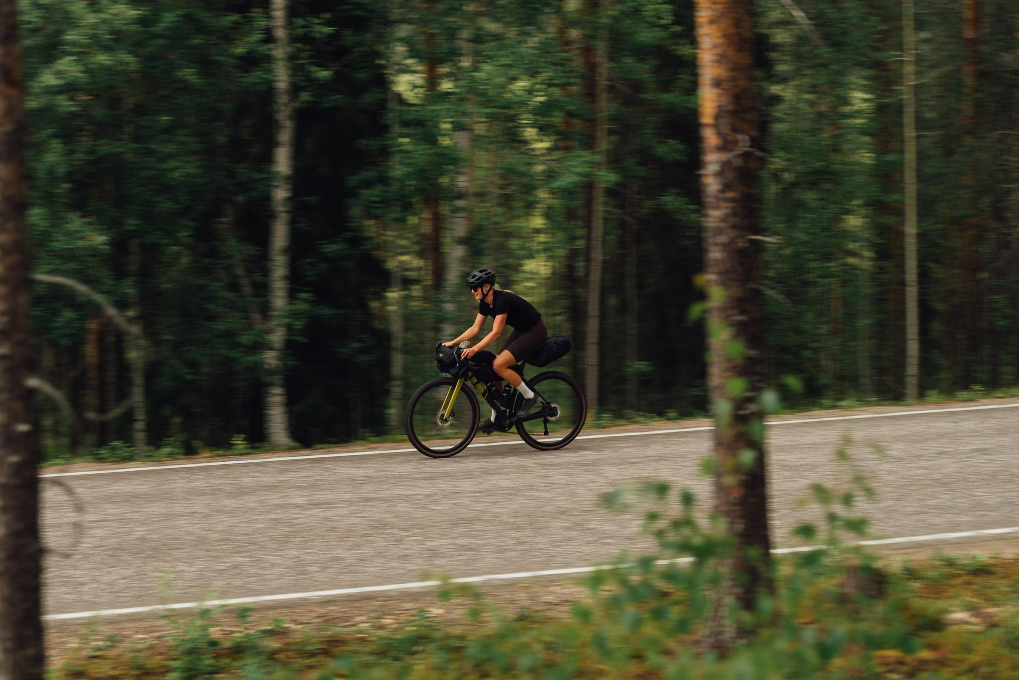
- Cycling on this route requires caution. The route follows Finland's main and secondary road network with heavy traffic in some sections. The roads do not have any specific shoulder for cyclists and there are only very short cycling tracks along the way in connection with bigger towns. We also highly recommend using safety vests and helmets.
- The route runs through the wilderness areas in Lapland and in central Finland through countryside with scarce inhabitation. The services are mainly in the towns and cities along the EuroVelo 11 route, approximately every 30-55 kms. Even then the quality and quantity of the services is not what you may be used to back home.
- Bears, wolfs and wolverines are not an issue at all when wild camping as the arctic predators avoid human contact to all cost. There are practically no encounters, ever. Therefore, there is no need to have a bear bell on handlebars, bear safe food containers or hand your food in a tree for the night.
- Accommodation services are mostly in the cities and larger towns. An abundance of accommodation is available at Inari, Ivalo, Saariselkä, Rovaniemi, Oulu, Kuopio, Jyväskylä, Lahti and Helsinki, so make use of them and stay for several nights to enjoy the activities the cities offer! In some of the smaller towns and villages there are only 1-2 options for accommodation.
- Check the opening times of accommodation you plan to use, especially camping sites with services. In Finland camping facilities start to close in August for the season.
- The legal concept of “Everyman’s Right” in Finland extends freedom to roam but comes with some responsibilities. You can camp for a night anywhere in nature when you keep at least a 150 meter distance to buildings or people's yards and agricultural lands and you do not cause any harm to people nor the land. You can swim in lakes and rivers if you are not disturbing others or using private shore areas. Picking berries and mushrooms is allowed. The outdoor enthusiast’s golden rule requires a desire to preserve and protect the unspoiled beauty and wonder of nature for future generations to enjoy. National Parks and other restricted areas have stricter rules. More information here.
- If you are interested in hiking and camping in the National Parks, check these web pages for instructions and guides as well as maps.
- If the forest fire warning is in effect, do not light any fires, not even in constructed campfire places. This prohibition does not apply to cooking shelters or other fireplaces with a flue. Check the situation of forest and grass fire warnings.
- Using a camping cooker is possible at all times and locations.
- Restaurants are available along the route, but not at regular intervals. During most of the days you have 1-2 cafes/restaurants on the route for lunch. Check all opening hours from the service webpages!
- Grocery stores are in larger towns and cities. Make use of them to stock up on snacks, drink and food you may need, especially if you are planning to do camping.
- Finnish tap water is very good and perfectly safe to drink and carry with you.
- It is recommended that you carry with you the water & drink you need for a day. Thus you are always prepared.
- There are along the route many creeks, rivers, and lakes, but the cleanliness of the water can not be guaranteed. Usually running water (creeks and rivers) is better for drinking than still water. Do not use any water which runs through grazing lands or residential/industrial areas. It is highly recommended to purify the water if you use natural water. Purify by boiling or using filters or purification tablets.
- Measures should be taken in advance to avoid taking unnecessary waste into the area. Take all waste out of the area and recycle when at waste services. Do not litter nature! Biodegradable waste should be placed in a toilet or composter, when available, and small amounts of clean paper and cardboard can be used as kindling in a campfire.
- The difficulty assessment will be added once daily segments have been developed.
- There are buses operating between all the major cities on the route. In the north you can connect by bus between Ivalo and Karigasniemi (via Inari). This bus is operated by Eskelinen bus. Check Matkahuolto web pages for the time schedules and destinations to buying your ticket. Communicate directly with the route operator for reserving space for your bike.
- Direct train connections are possible form Helsinki and Jyväskylä, Kuopio, Oulu, Kemi, Tornio, and Rovaniemi.For tickets check vr.fi website and for bringing your own bicycle on the train.
- Airports are situated at Helsinki, Jyväskylä, Kuopio, Oulu, Kemi, Rovaniemi, and Ivalo. Check Finnair web pages for details to buying tickets and for instructions about bringing your own bicycle on the airplane.
- From the airports there are many options to catch connecting transportation. Check from the Finavia webpages the local connections for the airport you are interested.
- Another option is to combine cycling with a cruise! Helsinki,Turku, and Vaasa are the harbors for boats between Sweden, Åland Islands, and Finland. From Helsinki you can also connect between Sweden, Germany, Poland, and Estonia! Check the schedules and routes: Tallink-Silja, Viking Line, Eckerö Line, Finnlines or Wasaline.
- If you are traveling with your own bicycle by bus, train or airplane or boat, reserve the place for the bike well in advance and note that ebikes are not allowed on airplanes at all.
- Tip: If you want to minimize cycling, consider taking a bus to cover a part of the journey and concentrate cycling to those sectors you are most interested in
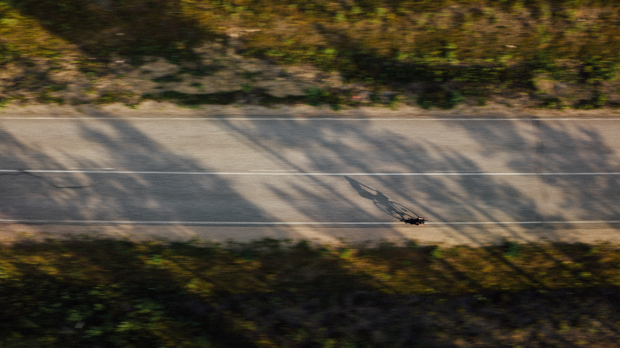
Cycling in between the 2 vast wilderness areas, Paistunturi and Muotkatunturi fells wilderness areas, you truly are alone with nature - and reindeer, arctic foxes, birds, and fowl. While cycling, and especially when you stop to snack, keep an eye out for the Siberian Jay (Perisoreus infaustus), the good luck charm of the Sámi and the wanderer in the wilderness. These birds, Kuukkeli in Finnish, are curious and keen on sharing your snacks with you. It is said that if the Siberian Jay comes to rest on your palm, then you have good luck on your journey. You can lure your good luck charm by stretching your arm out and having something to eat on your palm, for example a piece of bread, biscuits, nuts, dried berries. Kuukkeli will even eat sausages!
Inari is the largest town in the area and provides an extensive range of services, accommodation, restaurants, grocery stores, museums, and activities. Inari is the largest municipality in Finland and one of the most international tourism destinations. The population of Inari municipality was 7047 in 2022 and Inari village 783. There are many outdoor activities in Inari, but at least hop off the saddle and visit
Siida, the Sami museum and nature center giving you an insight into Sami culture and northern nature. There are a total of eight seasons in Lapland, and this polar year calendar is the basis for the rhythm of life for the Sámi. Siida was the old Sámi society structure, and the word siida was used for a community formed by certain families, and for the area that the community prevailed.
From Inari you head southward through Ivalo, Saariselkä, and Sodankylä to Rovaniemi, all with good services available. The Inari-Ivalo section is a beautiful cycle close to lakes and magnificent resting places. Ivalo is the administrative and commercial center of the municipality, by the Ivalojoki river, which the route follows. At Saariselkä you come to the area where there are open fells as far as the eye can see. These big hills used to be mountains before the Ice Age molded them round and perfect. There is a paved car route all the way to the top of the Kaunispää fell (438m), awarding you with a 360 degree view of the surroundings, the largest fell upland in Northern Europe. Here you can admire the infinite chain of fells rolling in the horizon. Take the challenge, it is definitely worth the sweat! Plus there is the added bonus of a nice cafe-restaurant, do try the local ”munkki” or doughnut and Lappish berry juice made from crowberries.
There are stories of the famous gold rivers of the North, some of which you will see on your journey, but for long stretches the rivers and lakes keep you company and provide nice places to stop and rest. Forests are today's gold in Finland and on your way south you will see varying types of forests as well. The beautiful coniferous forests and moors, lush birch trees, but also meadows and marshlands keeping the visibility wide.
The road is, nevertheless, called ”Kultainen tie”, named after the history of the area. The first gold rush took place on the Ivalojoki River in 1869 and the rush to Lemmenjoki River close to Inari in 1945. Men returning from the war were tempted to try their luck in the goldfields. With good luck you can pan your own gold at the Gold Prospector Museum in Tankavaara, 30 km south from Saariselkä, the only international museum in the world displaying the past and present of gold panning and prospecting, Before Sodankylä the small villages of Vuotso and Peurasuvanto offer accommodation and food, otherwise you are on your own in the nature.
At Vuotso you cross a canal, which regulates the water between 2 artificial lakes, Porttipahta and Lokka. You cross over a section of Porttipahta with a rather grand view. You join with the river Kitinen, the fourth largest river in Finland, 235 km long tributary of Kemijoki river as it flows towards Sodankylä. Along the route of Kitinen are 7 hydroelectric power plants and several artificial lakes, the largest of them is Porttipahta. You see many houses but still there are no services. This is very typical for Finland in the central and northern parts where people live very far apart from each other and the ”villages” are anything between 2-20 houses.
The river Kitinen leads you out of Sodankylä towards Rovaniemi. You will notice that the vegetation is very lush and more varied than earlier. Birch trees grow taller, and in the summertime the meadows and wildflowers are more abundant. The fells lower down to hills, and the landscape is not so harsh anymore.
At Rovaniemi you cross the Arctic Circle. It marks the southernmost latitude where the sun can stay continuously below or above the horizon for 24 hours – these phenomena are known as the Midnight Sun in the summer and Polar Night (”kaamos'' in Finnish) in the winter. You can also pay a visit to Santa Claus. From Rovaniemi the Kemijoki river takes you to Kemi, at the northern edge of the Bothnian Bay.
The Baltic Sea is one of the largest brackish water areas in the world, and its drainage area is about four times larger than its surface area, and as you cycle around the bay you cross many rivers that contribute fresh water to the bay. The Bothnian Bay National Park is only a boat's ride away. The first island came above the water level some 1000 years ago and now there are 30 small islands and new ones being born all the time. The rocky shores, flower meadows and juniper moors offer perfect nesting areas for the birds migrating to the area. This area has been known for centuries as a good place for fishing and seal hunting, traditional means of livelihood since the 1500's until the beginning of the 1900's.
At the most northern part of the Baltic Sea, you come to Oulu, the fifth largest city in Finland. In Oulu the area around the Market Place and Market Hall and the pedestrian street Rotuaari are nice areas to check what the locals are up to. The little statue of a policeman (=Toripoliisi) guarding the market is the favorite of all. Should you ever come back in the winter, remember that Oulu is renowned as the world's winter cycling capital. 600km of bike and walking paths are maintained throughout the year, keeping cycling's modal share at 20% despite temperatures averaging -15°C!
You then head inland again and around lake Oulujärvi towards Kuopio and Jyväskylä. Remember that Finland is the land of thousands of lakes – 168 000 to be exact! So you probably guess the scenery on your way through the lake district taking you to Kuopio, in the middle of the lake district, and then to Jyväskylä, city of Alvar Aalto architecture and home to two of Finland’s seven UNESCO World Heritage Sites. Take time to tour the atmospheric Petäjävesi Old Church and the stunning views to Lake Päijänne from the Oravivuori Triangulation Tower on the Struve Geodetic Arc.
From Jyväskylä you could cruise along the canal routes in the Päijänne all the way to Lahti, but the EuroVelo 11 route will offer you a beautiful route on roads 610 and 612 to Sysmä and road 314 to Vääksy. This route takes you through forests, hills, and waterways you never imagined! At the southern end of Päijänne lake, you cycle on the 9 km long Pulkkilanharju esker ridge that dates back to the Ice Age and over 3 bridges with sweeping views to lake Päijänne. The ridge is formed of a chain of islands and underwater ridges, and is very important in terms of its geological value and natural beauty.
The area around Lahti is full of these interesting Ice Age formations – a unique and diverse landscape of ridges, kettle holes, steep slopes and raised beaches. Salpausselkä UNESCO Global Geopark is worth the visit to learn more. Lahti harbor and market square are places where the locals like to spend free time. Lahti Sports Center and the Motorcycle Museum are also interesting sights to see.
Arriving at Helsinki, capital of Finland, and the neighboring cities of Espoo and Vantaa, you are in the bustling metropolitan area with approximately 1.5 million inhabitants. Helsinki was established in 1550, but it was not until 1812 when it became the capital under Russian rule. In 1827 the university was moved here due to the raging fire in Turku.
Here the Baltic Sea is very much present. The Helsinki city area has over 300 islands, many of which are accessible by a bridge or a ferry. The Suomenlinna-Sveaborg Sea Fortress is a Unesco World Heritage Site located just a short 15 minute ferry crossing over from the Market Place and Old Market Hall. The island is also a suburb of Helsinki with around 800 residents. The view of downtown Helsinki from the sea is definitely worth seeing also. The church towers are prominent in the Helsinki skyline, but one church is hard to see as it is almost fully inside the rock - the Temppeliaukio church is beautiful with light shining through the windows and reflecting in granite. A must see, and no wonder it is the 3rd most popular sight in Helsinki!
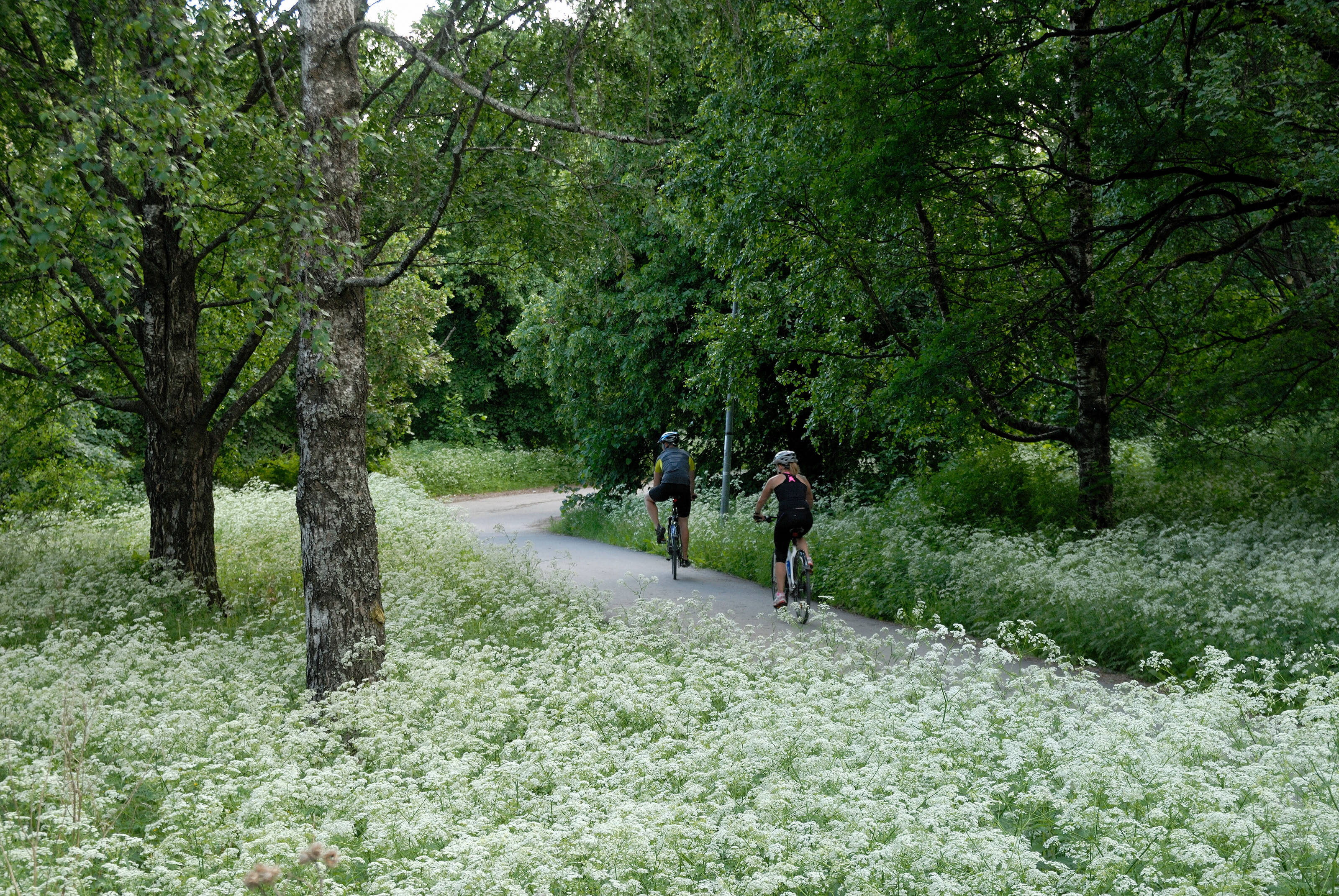
Helsinki and Espoo have together over 180 kilometers of shoreline, part of which is a cycle path. Cycling in the metropolitan area is rather nice as there are bikeways almost everywhere. Espoo, the second largest city in Finland, is right next door to Helsinki. Espoo is the home of Nokia, Angry Birds, Nuuksio National Park, and the Otaniemi campus area housing 6 different universities.