


 309 km
 3-5 days
 2149m
2149m 374m
374m 79 %
79 % 1 %
1 % 3
3 100 %
100 %
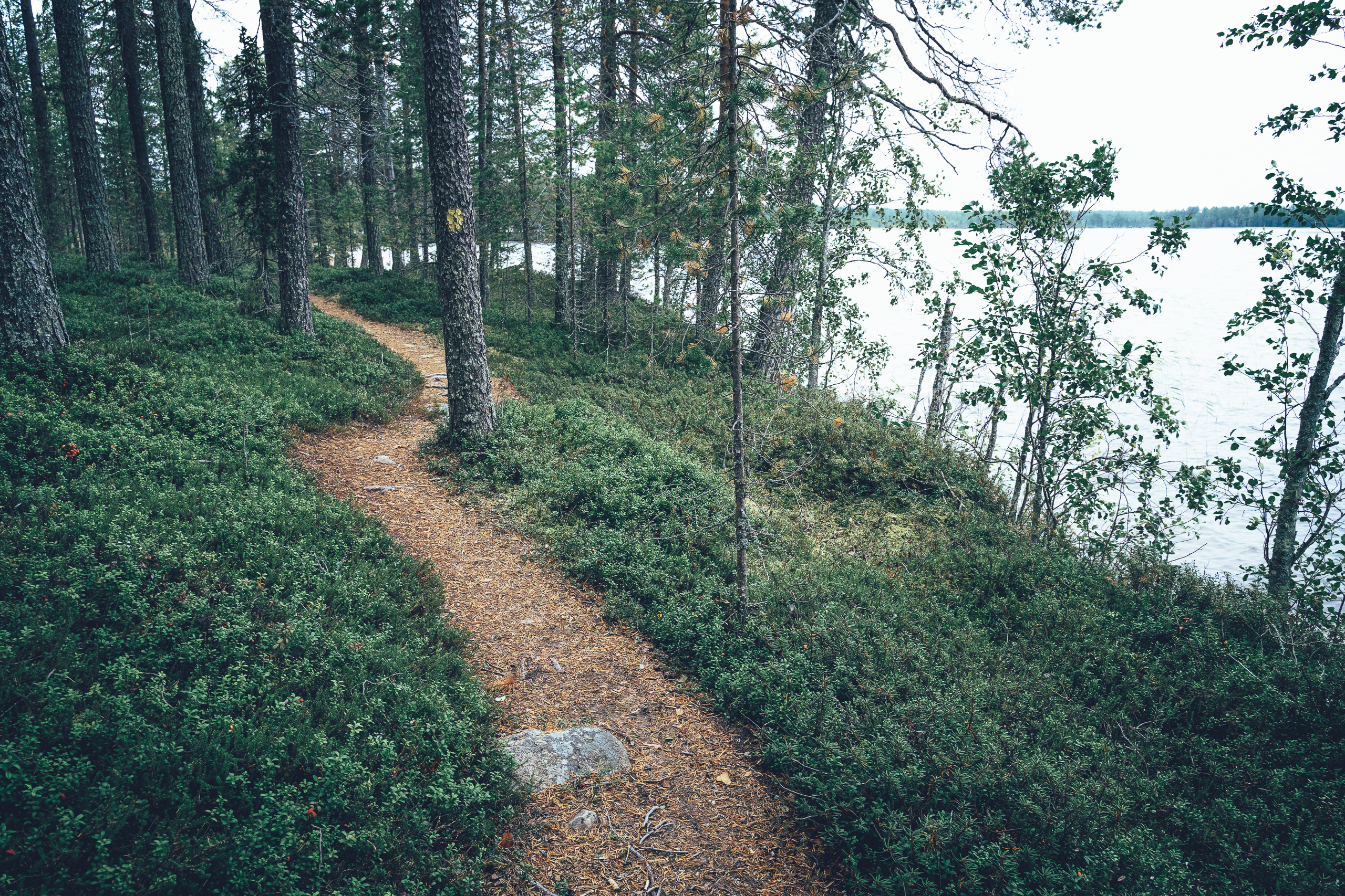
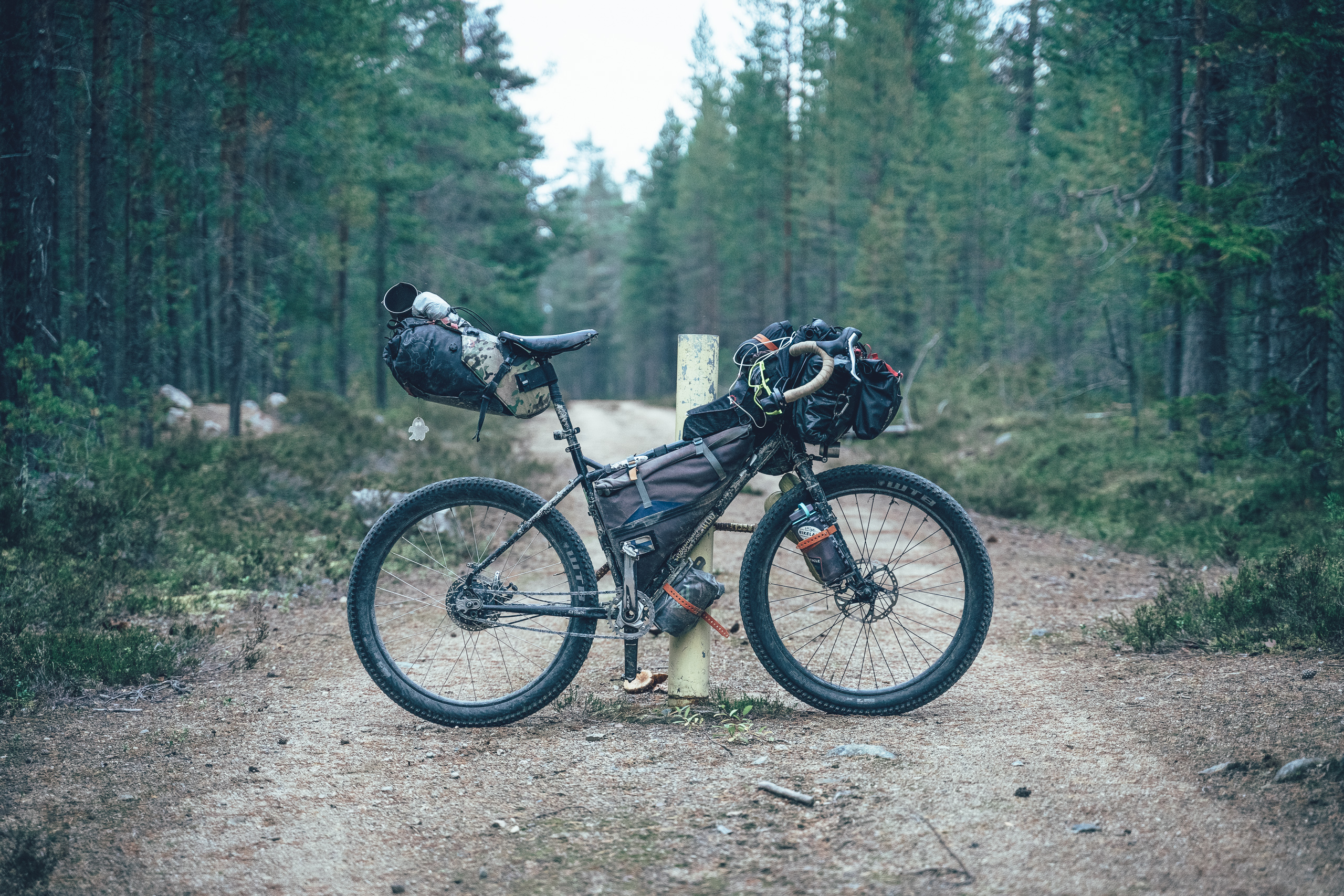
The loop begins in the centre of Posio with a short but impressive singletrack section on Kotivaara, offering an immediate taste of the area’s esker ridges and forest landscapes. After an unavoidable main-road link, the route quickly settles down as it turns toward Yli-Suolijärvi and continues on quiet gravel roads through old villages toward the northern side of Riisitunturi. Here the feeling becomes genuinely remote: the road along the national park’s northern edge is among the least trafficked in Posio, and at times views open through the forest toward Riisitunturi’s fells and old-growth-covered slopes.
Day one culminates in the route’s most striking climb: roughly five kilometres inside Riisitunturi National Park, followed by a steep ascent of about 150 vertical metres to the saddle between Noukavaara and Alimmainen Noukavaara. From the highest point (around 370 m), a long and rewarding descent drops back toward Lake Kitkajärvi and Kitkan Riisi, a natural place to end the day—either camping or staying indoors by the lake scenery.
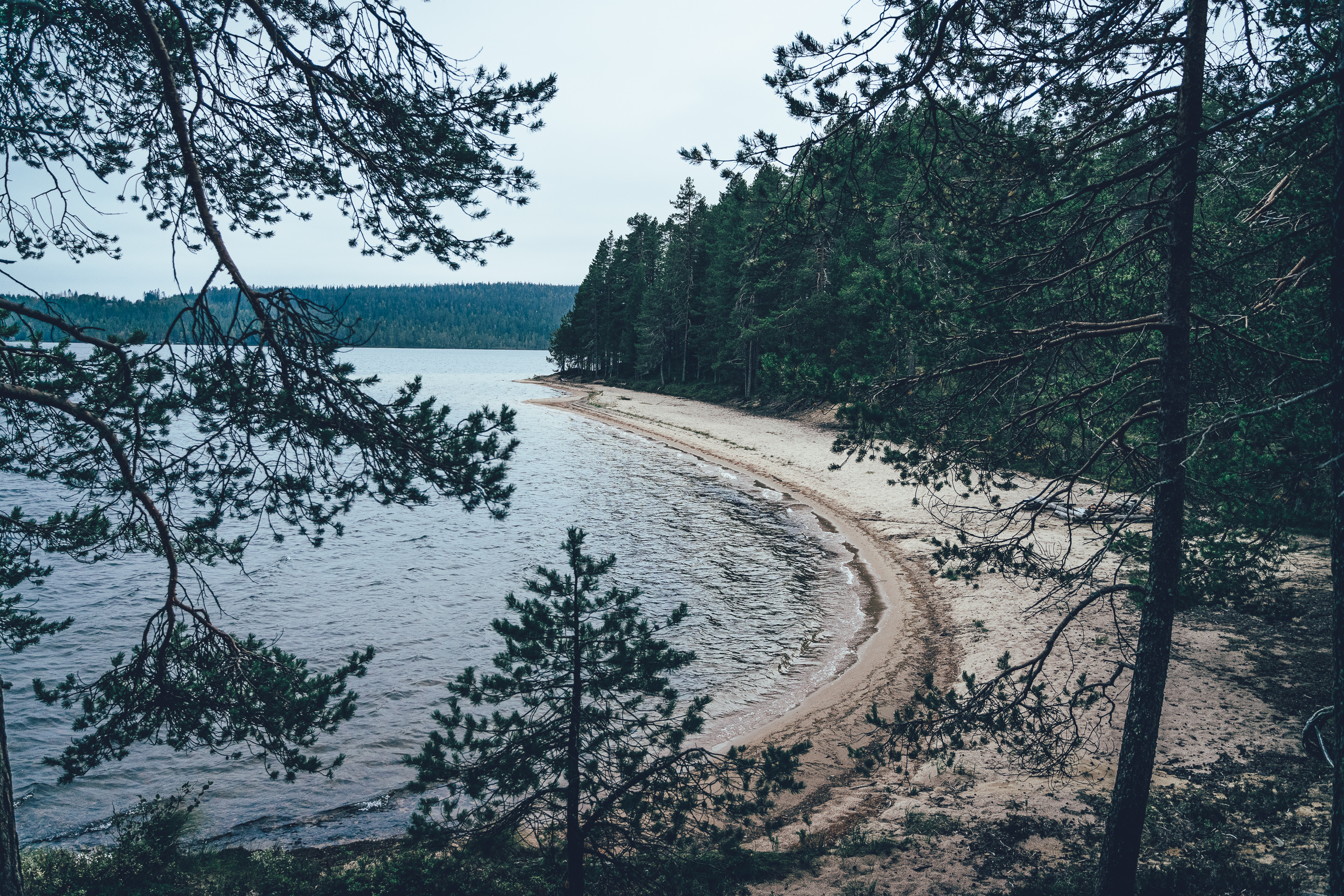
Over the following days, the route continues along the shoreline landscapes of the Kitka Lakes toward Käylä and Oulanka, detours to the iconic rapids scenery of Oulanka National Park, and heads on to Ruka—where services provide a welcome contrast to the silence of remote gravel roads. On the return toward Posio, the loop once again reaches the Livojärvi area: esker roads, old-growth forests, sandy beaches and a short rowing-boat crossing make the final days both calm and truly unique.
Welcome to enjoy Posio’s bikepacking routes!
- Riisitunturi National Park: old-growth forests, the climb to the Noukavaara saddle, and the exceptionally remote and quiet roads on the northern side
- Lake scenery of Yli- and Ala-Kitka on gravel roads and peaceful asphalt stretches, including the esker road at Pikku-Rävä
- A stop in the village of Käylä: Taikapankki café and a grocery store
- Oulanka National Park and a visit to Myllykoski (bike must be left at Basecamp Oulanka)
- Ruka: extensive accommodation and dining options
- Winding old forest roads on the way back from Ruka to Livojärvi
- Livojärvi recreation area: esker roads, sandy beaches, trails, and excellent camping/rest spots
- The route can be ridden without a tent by staying from guesthouse to guesthouse, provided you book accommodation in advance.
- Despite a reasonably good service rhythm, there are long stretches with no services; be prepared to be self-supported (food, water, equipment).
- Depending on the day, you will typically need 2–3 litres of water-carrying capacity, and you must be prepared to treat natural water before drinking.
- The route is suitable for any bike that fits tyres of at least 50 mm. Experienced riders may manage with 45 mm, but the ideal tyre width is 50 mm or wider.
- The gravel season around Posio usually starts by early June, once roads have dried and hardened after spring thaw, and typically ends in late September as autumn rains increase and temperatures drop below freezing. First snow usually arrives in early October, though annual variation is significant. Day rides are generally enjoyable even during Lapland’s infamous räkkä (insect season), but if you want to avoid the worst of it, plan your trip from mid-August to late September.
- The route is digital navigation only; it is not signposted on the ground. Navigation is done using a GPS device such as a watch, smartphone or bike computer.
- Stay on the recommended route and use only the suggested camping and rest spots.
- Mobile coverage may not extend to the entire route area. In an emergency, call 112 (or use the 112 app) whenever you have signal.
- Carry basic first-aid supplies and bike repair tools.
- Lapland weather can change quickly, so layering and waterproof gear are strongly recommended.
- The route works best as a 4–5 day bikepacking loop, combining services with official camping spots.
- With a four-night rhythm, suggested overnights are: Kitkan Riisi (Day 1), Oulanka National Park campsite (Day 2), Ruka (Day 3), and Kaatami lean-to / Hirsiniemi lean-to (Day 4).
- The high number of shelters and huts—especially between Oulanka National Park and Posio—also enables slower and more flexible progress. The facilities along the shores of Livojärvi are particularly well suited for camping.
- Kellinniemi is one of the finest tenting areas in the region, and it is worth aiming for an overnight stay there whenever possible.
- Grocery stores are located in Käylä and Ruka.
- Restaurants and cafés are in Käylä, at the Oulanka campsite, at Basecamp Oulanka, in Ruka, and on Livojärvi’s sandy spit.
- Clear springs are not necessarily available regularly—be prepared to carry water and treat natural sources when needed.
- A water-carrying capacity of 2–3 litres is typically required, depending on the day.
- Overall, the route is moderate to demanding depending on staging, load and weather. The challenge comes especially from long stages (particularly Day 4), remoteness and service gaps (Day 1), variable road surfaces (Days 1, 3 and 4), and the sometimes steep climb to the Riisitunturi saddle.
- If ridden in three days, the physical load increases significantly; for most riders, 4–5 days is more realistic and more enjoyable.
- The route starts and ends in the centre of Posio, making logistics straightforward.
- The easiest way to reach Posio is to take a day or night train to Rovaniemi and continue by coach for about two hours. Several Helsinki–Rovaniemi train services run daily, typically including one night train.
- Bicycle spaces can sell out during the holiday season, but because there are multiple departures per day, train tickets do not necessarily need to be booked far in advance—unless you specifically plan to travel on the night train.
- Only a few bicycles fit on the Rovaniemi–Posio coach services at a time, but on most departures it is possible to reserve a bicycle space in advance via Matkahuolto.
- As some of Posio’s gravel routes require logistical support, a new transport service is planned for summer 2026 to handle rider logistics and potential evacuations. Using the transport service, the Riisitunturi National Park loop can be finished at Korpihilla.
The Kitka Loop begins with a short but beautiful trail section on Kotivaara, before an unavoidable main-road link to a quiet gravel road toward Yli-Suolijärvi. The route circles the old villages around Yli-Suolijärvi before moving to the northern side of Riisitunturi National Park. This road connection along the park’s northern edge is among the most remote and least trafficked in Posio, with occasional views toward the fells and old-growth-covered slopes. The day culminates in roughly five kilometres inside the national park and a steep ascent of about 150 vertical metres to the saddle between Noukavaara and Alimmainen Noukavaara. The high point is around 370 m, followed by up to seven kilometres of descent to Lake Kitkajärvi and Kitkan Riisi.
DAY 2, Kitkan Riisi – Oulanka National Park campsite (53 km / 430 m)
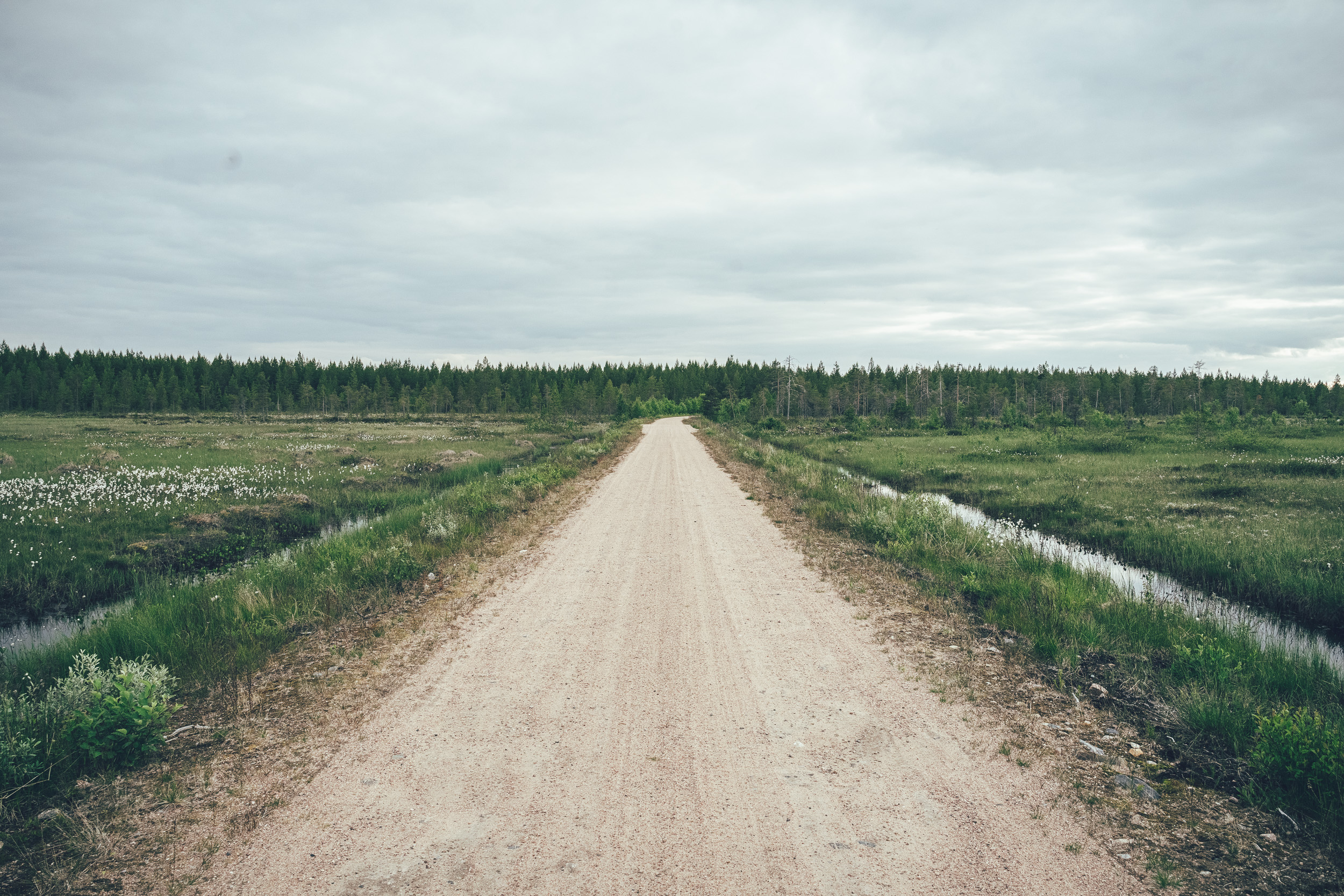
Day two is easy-going progress through the landscapes of Yli- and Ala-Kitka, alternating between gravel and short asphalt sections. On the way to Käylä, the esker road along the shore of Pikku-Rävä adds a scenic highlight. In Käylä, Taikapankki café is an excellent stop before continuing toward Oulanka National Park, and the village also has a grocery store. The day ends at the services of the Oulanka National Park campsite.
DAY 3, Oulanka National Park campsite – Ruka (54 km / 700 m)
On day three, you reach Ruka partly by following sections near the Bear’s Trail (Karhunkierros) and partly on gravel roads around Ruka. The day’s highlight is a visit to Myllykoski in Oulanka National Park—however, due to park rules the bike must be left at Basecamp Oulanka. Ruka offers a wide range of accommodation and dining options.
DAY 4, Ruka – Kaatami lean-to (78 km / 800 m)
This stage can also be split into two parts: 1) Ruka – Könkäänniemi kota lean-to (25 km) and 2) Könkäänniemi kota lean-to – Kaatami lean-to (53 km). Other good tent spots include the beach at Hirsiniemi lean-to (no shelter in easterly or south-easterly winds) and especially Kellinniemi lean-to, which is 95 km and 950 m of climbing from Ruka.
Day four is longer than the previous stages, but can be divided as above. From Ruka, a short shortcut leads to the renovated Könkäänniemi kota lean-to, after which the route continues toward Livojärvi on old forest roads. Progress under the forest canopy is slow but fun. The forests around Lohiranta offer some of the most varied and interesting riding on the entire route—apart from the Livojärvi trails. Livojärvi as a whole is an outstanding cycling experience: old forests, an esker-top forest road, sandy beaches and forest trails are hard to match. The day’s key highlight is a short rowing-boat crossing of about 100 m over the strait to Hirsiniemi. Livojärvi has several high-quality camping and rest spots; here the first stop is Kaatami lean-to. If you still have energy, you can continue to Hirsiniemi lean-to or even all the way to Kellinniemi. Kellinniemi is off-route, but worth visiting—especially for camping.
DAY 5, Kaatami lean-to – Posio (57 km / 690 m)
The 57 km includes a 16 km out-and-back detour to Kellinniemi for a lunch stop. If you need to skip it, the distance from Kaatami lean-to to Posio is 41 km.
From the Kaatami camping area, what remains is the magnificent Hirsiniemi esker road, a visit to Kellinniemi, and then a return to Posio via forest roads and the main road.