


Arctic by Cycle: Teno River Valley Route
 144 km
 2-3 days
 0 %
0 % 0 %
0 % 1
1 100 %
100 %
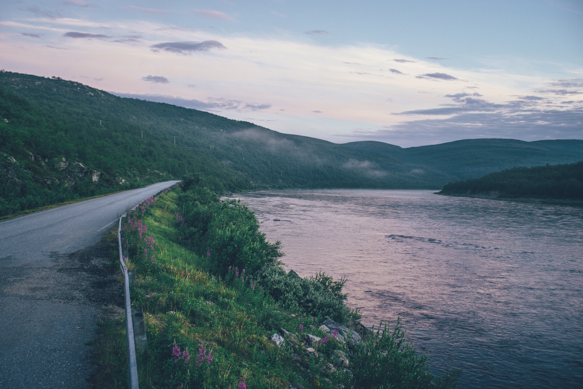
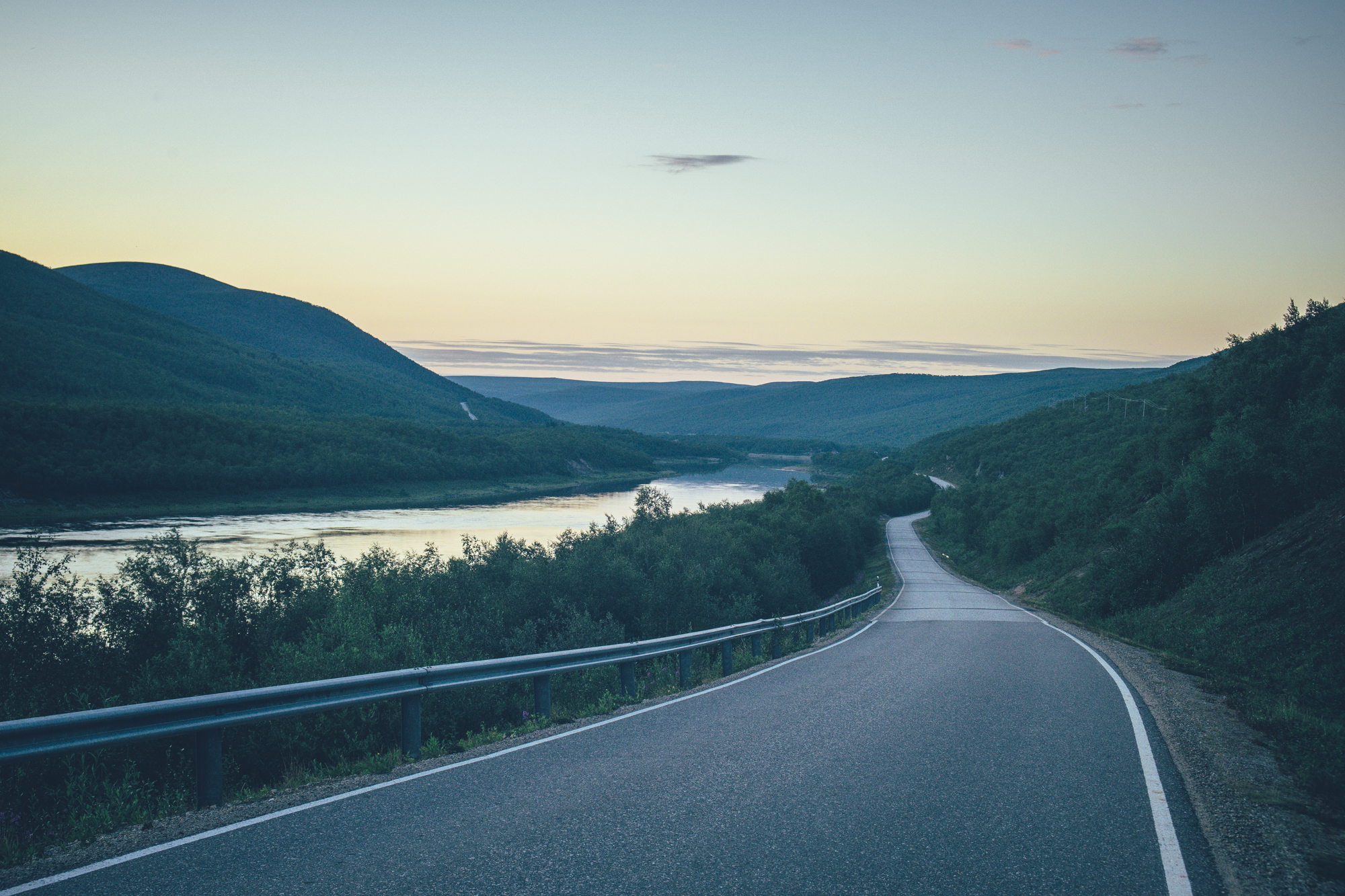
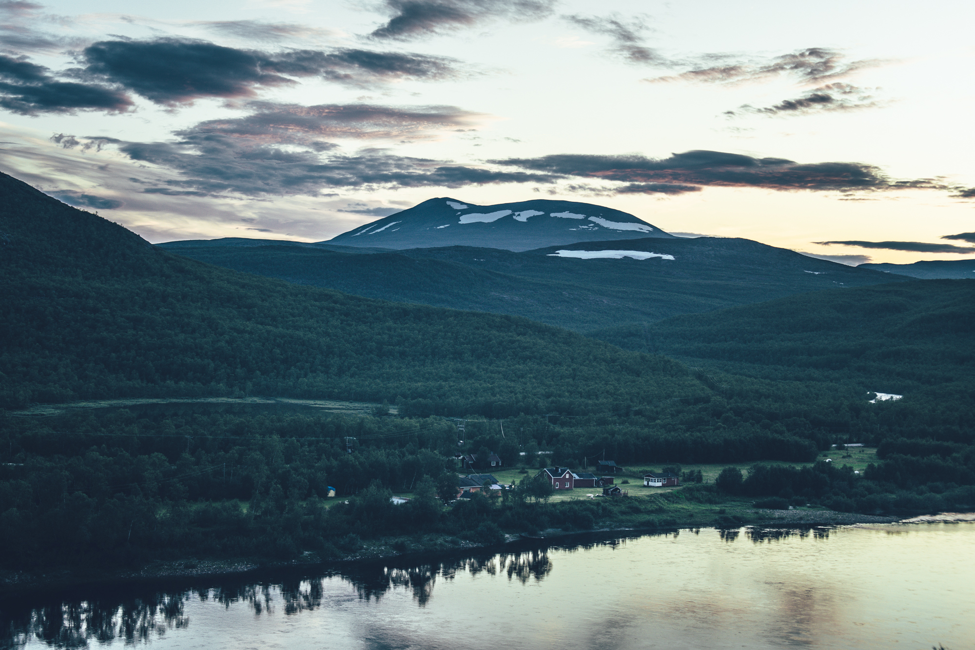
The road in the Teno River valley has for long been said to be the most beautiful road in Finland. When it comes to paved roads, it could well be the case, as the geography of the route is completely different from anywhere else in the country. The steep wall on both sides of the valley can occasionally be up to 300m high, the famous salmon river of Teno flowing freely on the bottom. Despite the route being in the valley, there is a surprisingly lot of climbing, which creates now and then viewing points overlooking the valley.
The Karigasniemi-Utsjoki section has surprisingly little traffic, making it a pleasant and easy ride from village to village, with a chance to spend a night on the route in one of the lodging options on the way. Furthern on between Ustjoki and Nuorgam, there is some regular traffic, though not bad at all in the Western European standars. The route can be done with any bicycle as it’s 100 percent paved and in good condition and despite there being a moderate amount of climbing, none of the climbs are steep, making the tour less strenuous as well.
Logistically, the route is rather straightforward as well, as there is nowadays a bus connection from village to village, though not every day. Some in-advance planning, therefore, is needed to catch a ride back to the starting point.
- Traversing the famous Teno River valley on an easy low-traffic paved back road, connecting the villages of Karigasniemi and Utsjoki. Further on, there is some traffic till Nuorgam, but the scenery stays as splended as ever.
- Views over the valley with occasionally up to 300m walls on the sides of the river, climbing to the Finnmark highlands and Utsjoki highlands
- Great services available in the three villages to take it easy and wait for a bus back to the starting point after the tour.
- The paved routes of Lapland are usually dry already in early May, making this route a great early season alternative when most of the gravel roads are still covered with snow or wet.
- The infamous Lappish räkkä (the high population of mosquitos, black flies, biting midges and horse flies) starts usually by late June and lasts usually till mid August, making the May till early June, or from mid-August till October ideal time to ride the route.
- The route can be ridden with any bike, as it’s 100 percent paved
- The route is e-Bike friendly as the distances between services are doable with nearly any e-Bike nowadays.
- The route is Easy access as it's fully paved.
- Temperatures during the snowless season a lot and week-to-week but expect the spot-on daytime temperatures of 15-23 Celsius from mid-June to late August with nights in the range of 0-10 Celsius. Early June could be warm too but could be significantly colder as well. In late August and September, the temperatures start to drop significantly week by week and the first snow is not uncommon in late September. Especially late in the season, in late September and early October, be prepared for daytime temperatures of 5-10 Celsius and nights getting already below freezing.
- When choosing a sleeping bag, you should assume that the night temperatures can drop to 0 Celsius even during the mid-summer months and then even colder later the season gets. The classic -7 C/ 20 F sleeping bag works like a charm in Lapland, too, with the lower limit low enough for the late-season exploits.
- The midnight sun or “the nightless night” lasts from around 6 weeks in Southern Lapland to up to 3 months in Northern Norway. Getting used to the 24h sun can take a while to get used to…
- The best time to see the northern lights is roughly starting from September and as the nights get darker and longer towards the end of the season, chances are getting better week by week. It’s not uncommon to see the auroras multiple times a week at the end of the season, given that the weather gods are on your side and the sky is clear.
- The route has only digital navigation.
- Always stay on the routes and aim to only use the recommended spots marked on the route map.
- The mobile phone network does not cover the whole route area: in case of an emergency, call 112 or use the 112 app, which automatically shares your location to the emergency services as well. It might be wise to carry a personal emergency beacon, especially when traveling alone.
- The route is located in a traditional reindeer herding area, please read more about the etiquette of traveling in the reindeer herding land here. Please respect any guidelines given for the route use or the use of reindeer herder’s cabins in the route description or on the map. Cooperation and respect for their needs and culture make having these routes publicly available possible.
- Bears, wolfs and wolverines are not an issue at all when wild camping as the arctic predators avoid human contact to all cost. There are practically no encounters, ever. Therefore, there is no need to have a bear bell on handlebars, bear safe food containers or hand your food in a tree for the night.
- The worst of the mosquito season lasts usually from around mid-June to late August, though luckily cycling speed is usually fast enough to keep them away when on the move. During the peak times, a net hat and long sleeve shirt and pants are recommended, if the temperatures allow. As the temperatures drop, the mosquitos disappear, making September (if not also early June, if the roads are dry enough) an ideal time for touring.
- Lodging is available in the villages of Karigasniemi, Utsjoki and Nuorgam, but there are lodging options on the way as well.
- There is an organized campsite on the route in Seitala and Vetsikön leirintämökit
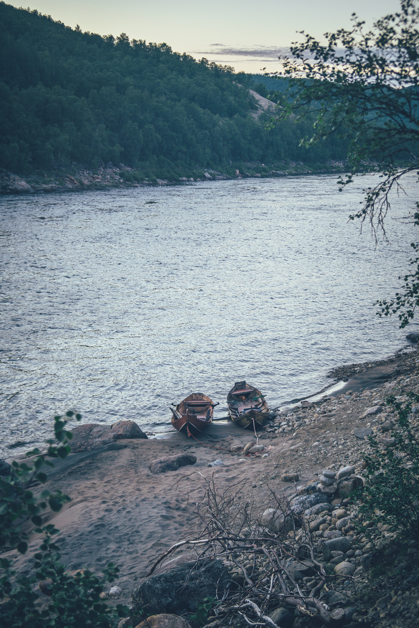
- Camping is allowed and free of charge along the route by All Man’s Rights in Finland, however, due to the geography of the valley, finding wild camping spot might not be easy. The only official wild camping spot on the way is at the Yläköngäs campfire hut.
- There are restaurants, cafés, and grocery stores in the villages of Utsjoki, Karigasniemi and Nuorgam, but nothing much in between the villages.
- The Café of Tenon tunturituvat is the only café/restaurant not in immediate proximity to the villages.
- Water is most of the time drinkable straight from streams, ponds, and lakes, but you never know if there is a reindeer carcass upstream, so better to be safe than sorry: water treatment is recommended.
- Sources of water are plentiful, so you’ll get away with carrying just 1 liter of water.
- Tap water is always drinkable in Finland and they are more than happy to fill your bottles at the service points
- When cooking in the camp, know that making a fire is strictly prohibited during the forest fire warming period.
- The road between Karigasniemi and Utsjoki has surprisingly little traffic, making it a pleasant and easy ride from village to village, with a chance to spend a night on the route in one of the lodging options on the way. Furthern on till Nuorgam, there is some traffic, but manageable. The route can be done with any bicycle as it’s 100 percent paved and in good condition and despite there being a moderate amount of climbing, none of the climbs are steep, making the tour less strenuous as well. The route grants a difficulty rating of 3/10, though we could have given it 2/10 equally as well. Getting into bicycle touring can't be much easier than this, given that you have same basic fitness to tackle the climbs on the way.
- Karigasjoki, Utsjoki and Nuorgam can be reached by taking a train to Rovaniemi (8.5h from Helsinki) and then catching a bus (8-9h) to one of the villages. Additionally, there are frequent flights to Ivalo (1.5 hours from Helsinki, where the journey can be continued to either of the villages by bus. You can book train tickets from vr.fi and bus tickets from matkahuolto.fi
- Between Karigasjoki, Utsjoki and Nuorgam, there is a bus connection a couple of times a week, making it easy to return to the starting point, if doing the route as a standalone tour.
Two-day plan
Riding the route in two days from Karigasniemi to Nuorgam, Tenon tunturituvat offers lodging options at around the half point of the route.
Three-day plan
Riding the route in three days from Karigasniemi to Nuorgam, you could have an easy 30km to start to Seitala, then on day two ride 60km to Loma-Aslakin lomamökit and then on the last day ride 51km to Nuorgam.
Four-day plan
If wanting ride the route in full holiday-mode spending just a couple of hours on the bike a day, four-day plan it is. On the day one do 30km till Seitala, then on the day two 44km to Tenon tunturituvat followed by a 40km-day to Vetsikön leirintämökit and finally on the day four, finishing the last 30km to Nuorgam.
If your plan it to sleep in a tent, the organized campsites are at Seitala (30km from Karigasniemi) and Vetsikön leirintämökit (114km Karigasniemi or 6km past the Utsjoki village). Camping is allowed by All Man's Rights pretty much anywhere, but the occasionally steep valley walls can make finding a decent spot to camp harder than you might think.
NOTE! There is a road on the Norwegian side of the Teno river valley as well, but it’s one of the main logistic routes to northeastern Norway and therefore has heavy traffic of lorries. Similar to the Finnish side, the road is windy and narrow, making it dangerous to cycle.