


Arctic by Cycle: Savotta Gravel Loop
 457 km
 5-7 days
 3392m
3392m 320m
320m 69 %
69 % 1 %
1 % 4
4 100 %
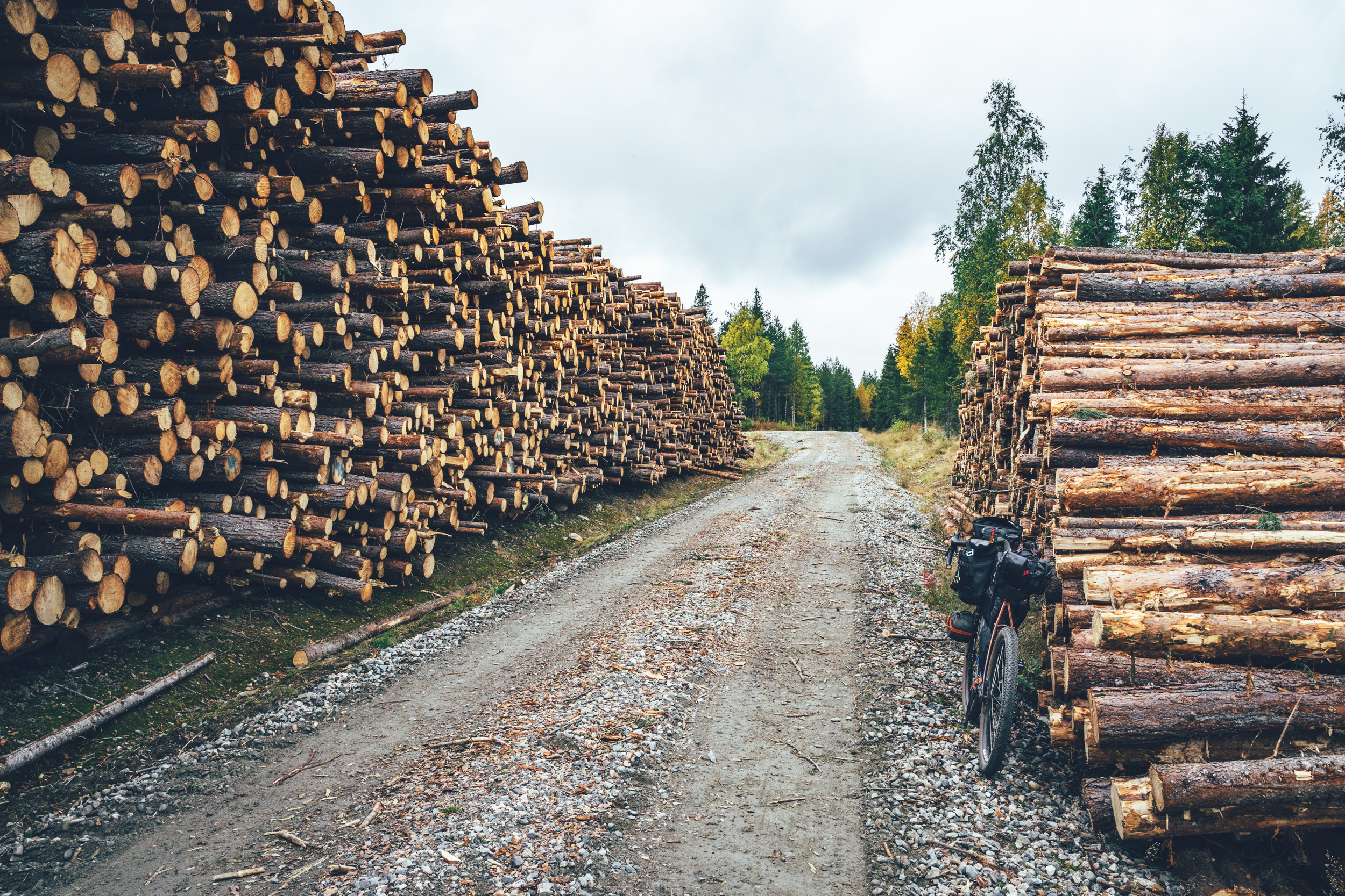
100 %The demand for timber and wood based products increased significantly in the late 18th century, which eventually led to turning Finland into a forest based economy. Despite the extremely slow growth of the trees above the arctic circle, demand of the gold of the arctic taiga increased and eventually large-scale logging started around a century ago. Workforce arrived all over the country and the trees were cut during the winter and then transported in the spring on canalled creeks and rivers for further processing.
The conditions of the workers were very poor and men often slept by a fire or in very simple shelters even during the mid winter months, when temperatures dropped down to -30 C and beyond. The working conditions improved a lot in the 1920’s when the kämppälaki (the law of the logging cabins) was passed. The law ensured that the workers had proper lodging at the site and the old logging cabins from the early 1900’s can still be found all over Lapland, and elsewhere in Finland.
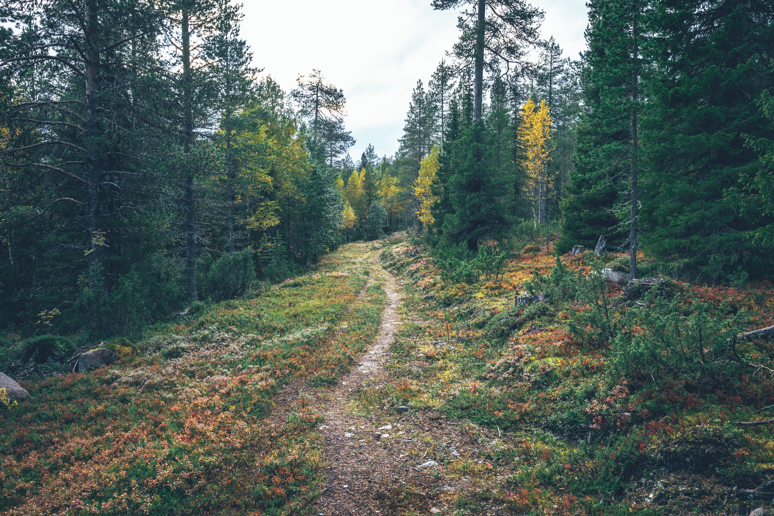
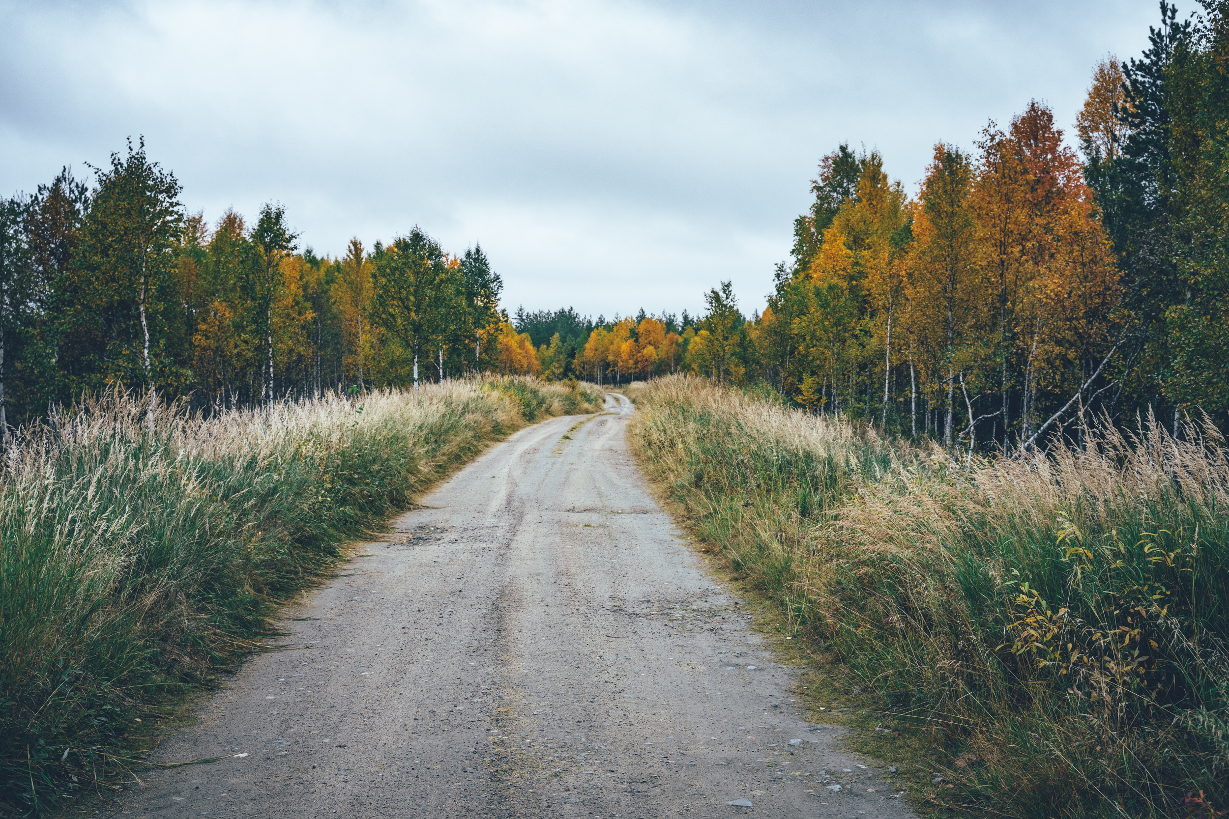
The 478km and 5-7 day Savotta Gravel Loop provides a glimpse into the hard-on forestry and farming based wilderness life in the southeastern Lapland by visiting three old logging cabins, historic Tarkkala wilderness farm and multiple old wilderness shelters in the area. 69 per cent of the route is on gravel and forest roads and 31 percent of the route is on fast and straightforward mostly trafficless paved roads, which connect larger gravel road sections to each other. The route has a couple of rougher roads as well, which do slow you down, but simultaneously are rather welcome change to otherwise easy and fast riding on hard-packed gravel.
If you pace your progress right, you can do a full week of riding having a sauna every single night. The old refurbished open wilderness saunas are an amazing treat especially toward the end of the season in late September and early October, when the temperatures start to drop toward zero. A wash and sauna after a cold day on the bike is a feeling hard to beat. The route is also logistically very easy as it connects the towns and villages to each other, so traveling stays fairly light. Despite the partial remoteness of the route it is very easy to get onto from Kemijärvi, the end station of the eastern branch of the arctic train line.
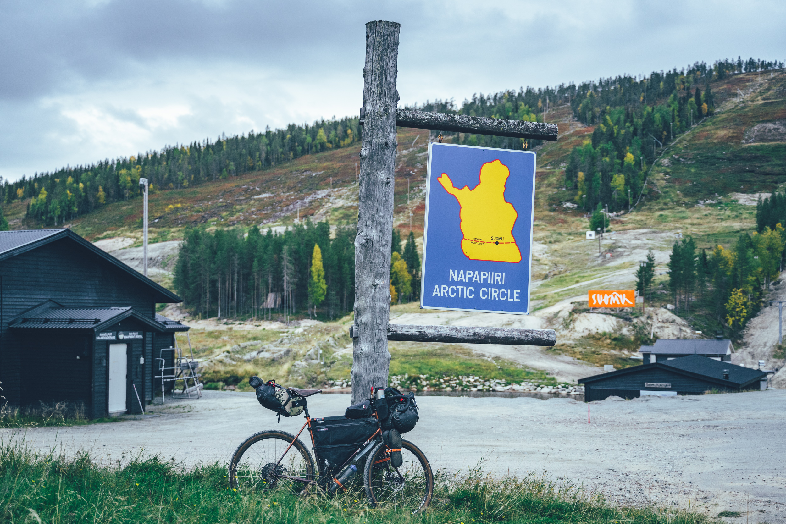
The Savotta Gravel Loop also makes a visit to the gates of the Pyhä-Luosto National Park and the recently founded Salla National Park, making it easy to add visits to both of the national parks on the way. Overall, it’s hard to imagine a better way to get familiar with the East Lapland logging culture and old-time wilderness working life than touring the Savotta Gravel Loop.
Read more about what the route has to offer as well as our take on riding the route in the Trail notes below.
- Saunas available in the end of each riding day, if you pace your progress right
- The old savotta cabins along the route, telling the story of the early forest industry in Eastern Lapland
- Camping and rental sauna at the Tarkkala erämaatila wilderness farm, one of the few wilderness farms which survived WWII. Camping on the historic farm yard is free of charge, but using the sauna by the river is for a fee. The access code to sauna lock can be purchased here.
- Pyhä-Luosto National Park and Salla National Park are along the route, making it easy to add a visit to the reserves
- High quality services along the way in villages and small towns in otherwise wild and remote Eastern Lapland taiga
- Riding on traffic-free endless gravel roads of Central Lapland
- The gravel routes in the arctic are usually open from early June after the routes have dried and hardened up after winter, to mid-October, when the winter sets in again. However, the climate crisis makes seasons more unpredictable than before so the season start and end can vary year to year by a couple of weeks. The route is open full season, with no restrictions requested by the local reindeer herding community.
- The infamous arctic räkkä (the high population of mosquitos, black flies, biting midges and horse flies) starts usually by late June and lasts usually till mid August, making the early June or from mid-August till October ideal time to ride the route.
- The route can be ridden with any bike, as long as the tire size is a minimum of 40 mm and you have smaller gears as well. Though having a beefier tire does not do any harm at all as there are some rough bits and easy single track as well.
- The route can be ridden with an e-Bike if can do 90km fully loaded and book the lodging in advance.
- Food carrying capacity of just 2 days is necessary between Salla and Kemijärvi, so touring stays light
- Water carrying capacity of 1-2 liters is sufficient, as there are high quality water sources regularly on the route.
- Temperatures during the snowless season vary a lot and week-to-week but expect daytime temperatures of 15-23 Celsius from mid-June to late August with nights in the range of 0-10 Celsius. Early June could be warm too but could be significantly colder as well. In late August and September, the temperatures start to drop significantly week by week and the first snow is not uncommon in late September. Especially late in the season, in late September and early October, be prepared for daytime temperatures of 5-10 Celsius and nights getting below freezing.
- When choosing a sleeping bag, you should assume that the night temperatures can drop to 0 Celsius even during the mid-summer months and then even colder later the season gets. The classic -7 C/ 20 F sleeping bag works like a charm in Lapland, too, with the lower limit low enough for the late-season exploits.
- The midnight sun or “the nightless night” lasts from around 6 weeks in Southern Lapland to up to 3 months in Northern Norway.
- The best time to see the northern lights is roughly starting from September and as the nights get darker and longer towards the end of the season, chances are getting better week by week. It’s not uncommon to see the auroras multiple times a week at the end of the season, given that the weather gods are on your side and the sky is clear.
- The route has only digital navigation; for instructions and tips for successful navigation, see here.
- Always stay on the routes and aim to only use the recommended spots marked on the route map.
- The mobile phone network does not cover the whole route area: in case of an emergency in Finland, call 112 or use the 112 app, which automatically shares your location to the emergency services as well. In case of an emergency in Norway, call 113 or use the 113, which similarly shares the location automatically, making finding you fast and easy.
- The route is located in a traditional reindeer herding area, please read more about the etiquette of traveling in the reindeer herding land here.
- There are high quality lodging options available in Kemijärvi, Pyhä, Savukoski, Salla and Suomu.
- Camping is allowed and free of charge along the route by Everyone’s Rights, however, due to the fragile and slow-growing arctic flora, you should always aim to use only the campsites marked on the route map. Also, camping is strictly prohibited outside the recommended camp spots in the Pyhä-Luosto National Park.
- There are 14 wilderness shelters along the way, which serve as official camping areas of the route as well. See the POI details on the map for info, which are best suitable for camping.
- All the camp spots are next to a high-quality water source, unless stated otherwise.
- The grocery stores for restocking are located in every village on the way, which are frequent. Max 2 days of proportions is needed to carry between Salla and Kemijärvi.
- There are restaurants or cafés available mostly in the service centers, and usually nothing in between them.
- Water is most of the time drinkable straight from streams, ponds, and lakes, but you never know if there is a reindeer carcass upstream, so better to be safe than sorry: water treatment is recommended.
- Sources of water are plentiful, so you’ll get away with carrying just 1-2 liters of water. The best spots for refills are marked on the route map.
- All the camp spots are next to a good water source, unless stated otherwise.
- Tap water is always drinkable and the locals are happy to fill your bottle
- When cooking in the camp, know that making a fire is strictly prohibited during the forest fire warning period. See the local restrictions in Finland here.
- Most of the route is hard-packed fast gravel roads, but there are a couple longer rougher roads and two single track sections in the mix as well. Though riding is non-technical and fairly easy throughout the route, despite the rather high total amount of climbing. Logistically the route is straightforward because of the regular interval of the villages, exception being the last 140km from Salla to Kemijärvi, which does not have a grocery store, but still a restaurant at the Suomu. The route can be ridden to both directions and riding direction does not affect its difficulty.
- The route is granted 6/10 for its physical difficulty and 5/10 of its technical and logistical difficulty. Overall the difficulty rating is 6/10. Thinking of tire size, you get away with 40mm tires, but bigger ones make no harm either, giving you some extra comfort when the road gets rough.
- Bikepacking is usually the more comfortable the less you carry, and that is mostly the case on this route as well. The lighter you go, the easier the harder sections get physically and technically. Though, overall the route can well be ridden with either bikepacking setup or panniers, or anything in between. How the bike is packed is not the deciding factor here.
- There is an overnight train connection to to Kemijärvi multiple times a week, reaching the route very easy. Though booking the ticket well in advance is recommended because the bike spots on the train are limited. For train schedules and purchasing tickets, see vr.fi
- The route can be reached flying or taking a train to Rovaniemi and then continuing to Kemijärvi by train or by bus as well. Cycling from Rovaniemi to Kemijärvi along the Central Lapland Gravel Loop is really nice way to get on the route as well.
- Bus connection between the villages works well too, making it easy to bail out if things go wrong and simply ride the route in parts. For bus schedules and purchasing tickets, see matkahuolto.fi
Day 1, Kemijärvi city to Pyhätunturi (90km, 750m of climbing)
The updated route from Kemijärvi onwards starts on the city cycling paths and manages to avoid the rather busy Road 5 apart from a couple of kms before taking a long-ish gravel detour west. The detour off the main road is 55km with one decent campfire hut and some nice gravel sections on the way, and it clocks around 450m of climbing. There will be a shortcut to reach Pyhä directly from these forests, but for now, the route returns again to the mainroad. It’s a half a day sidetour, but at least in terms of safety, it’s worth the extra effort. Also, the Tapionniemi kyläkartano is on the route, which is a village association run village house offering accommodation and summer time café. After Tapionniemi, there is a 8 km section on the Road 5, before turning toward Pyhä-Luosto National Park and the services of the Pyhä holiday village.
Evening sauna: most of the lodging options at Pyhätunturi have one.
Anticipating some future route developments in the Pyhä area the route between Kemijärvi and Pelkosenniemi has now (9/2023) been moved to the west side of the River Kemi. This puts the services of the holiday village of Pyhä on the map and also for this route, gives a better access to the Pyhä-Luosto National Park, if you decide to visit there. However, the earlier route on the east side of the River Kemi via the Rentukka open wilderness hut still works as an completely traffic-free route alternative. Also, half is it is really pretty. See the route alternative on the map here.
Day 2, Pyhätunturi to Tarkkala wilderness farm (85km, 850m of climbing)
Around half of the day two is on pavement, creating some good momentum especially in the morning. 23 km in there is a gas station restaurant and a grocery store in the village of Pelkosenniemi. From there the route stays a while longer on the paved route before diving into the backwoods of the Pelkosenniemi-Savukoski area. Narrow and pleasant gravel roads lead eventually to the old Tarkkala wilderness farm, which miraculously survived the saboutash of the Nazi’s in the end of the WW2. The farm is one of the few traditional wooden farm buildings that was not burned down and the main building, barn and the riverside sauna has been renovated for the public use. The Tarkkala farm area functions as a public free campsite with a treat of the riverside sauna for a fee. Sauna can be booked from the online booking system, which gives you the key locker number code after the payment.
Evening sauna: Tarkkala wilderness farm river side sauna
Day 3, Tarkkala wilderness farm to Tenniön pirtti (91km, 1340m of climbing)
The route out of the Tarkkala wilderness farm starts as rough forgotten forest route, but then gets on smoother hard-packed gravel. The Savukoski village is conveniently located 25km from the start to stock up for food and have a second breakfast. After the village the route takes a loop north toward the Matio nature reserve and visits the old login huts and logging dam of the Alatammi. The huts are not available for public use, but the area by the river is extremely beautiful and great place for a brake or pitching tent for the night, in general. The trail leading to and from the logging cabins are fun to ride partly technical double track as well. Tenniön pirti is yet another old logging cabin, now owned by the local reindeer herding association next to a large spring. The Tenniön pirtti area has a free open wilderness sauna, fire ring and the old logging hut itself. The recently renovated sauna is located right next to the spring with two pools, one for drinking water and the other for cooling down from sauna. There is plenty of flat-ish area to camp, which is your first choice of sleeping for the night. The old hut is still kept open by the reindeer herding association and it functions as an emergency shelter if things go wrong and you need to take shelter from the elements.
Evening sauna: Tenniön pirti open wilderness sauna.
Day 4, Tenniön pirtti to Sallatunturi (66km, 1333m of climbing)
The gravel route onwards from Tenniön pirtti is partly rather remote and there is not much on the route before reaching the Salla center, which has a good grocery store and a couple of restaurant options. The recently founded Salla National Park starts behind the Sallatunturi Ski Center, which similarly has some food and lodging options.
Evening sauna: most of the lodging options have one.
Day 5, Sallatunturi to Riutukka päivätupa (53km, 1160m of climbing)
On the way out from the Salla area the route follows the gravel and easy-single track sections of a new mountain biking route, which creates a backdoor connection back toward the Kemijärvi area. Just out of Sallatunturi area, there are a couple of fantastic shelter options: Hangasjärvi lean-to and Kalliojärvi open wilderness hut, for instance.
The route continues on mostly fast and hard-packed gravel roads with a couple of nice attractions on the way. The Kallioportti ravine is worth a little off-bike detour and there are some historical old reindeer herding stations on the way as well. The day ends on a long downhill to the old Riutukka logging hut, double lean-to and an open wilderness sauna. The hut is for day use only, except for emergencies, but the camping on the yard is great.
Evening sauna: Riutukka logging hut wilderness sauna
Day 6, Riutukka päivätupa to Kemijärvi (52km, 880m of climbing)
The last day of the Savotta Gravel Loop is mostly straight forward starting with some good gravel roads, but then getting down to the Lake Kemijärvi and the most northern cable ferry in Finland. The ferry get people across a narrow isthmus on demand from 6am to 10pm, except during the skipper's breaks. After the ferry the route follows the Kemijärvi lake sides all the way back to the buzz of the Kemijärvi downtown, which many mistake for silence.
Evening sauna: most of the lodging options in the Kemijärvi have a sauna.