


Arctic by Cycle: Santa's Western Gravel Loop
 493 km
 6-8 days
 2782m
2782m 397m
397m 72 %
72 % 1 %
1 % 3
3 100 %
100 %
The 493km and 6-8 day Santa’s Western Gravel Loop bikepacking route starts at Rovaniemi, where the Official Santa Claus Village is located. The village is built precisely at the Arctic Circle, making it a geographically exciting and symbolic entry or exit point to the route. The Santa itself can be visited full year-round as well and his elves are more than happy to take care of your rig, while you’re queuing for high-fives to his office.
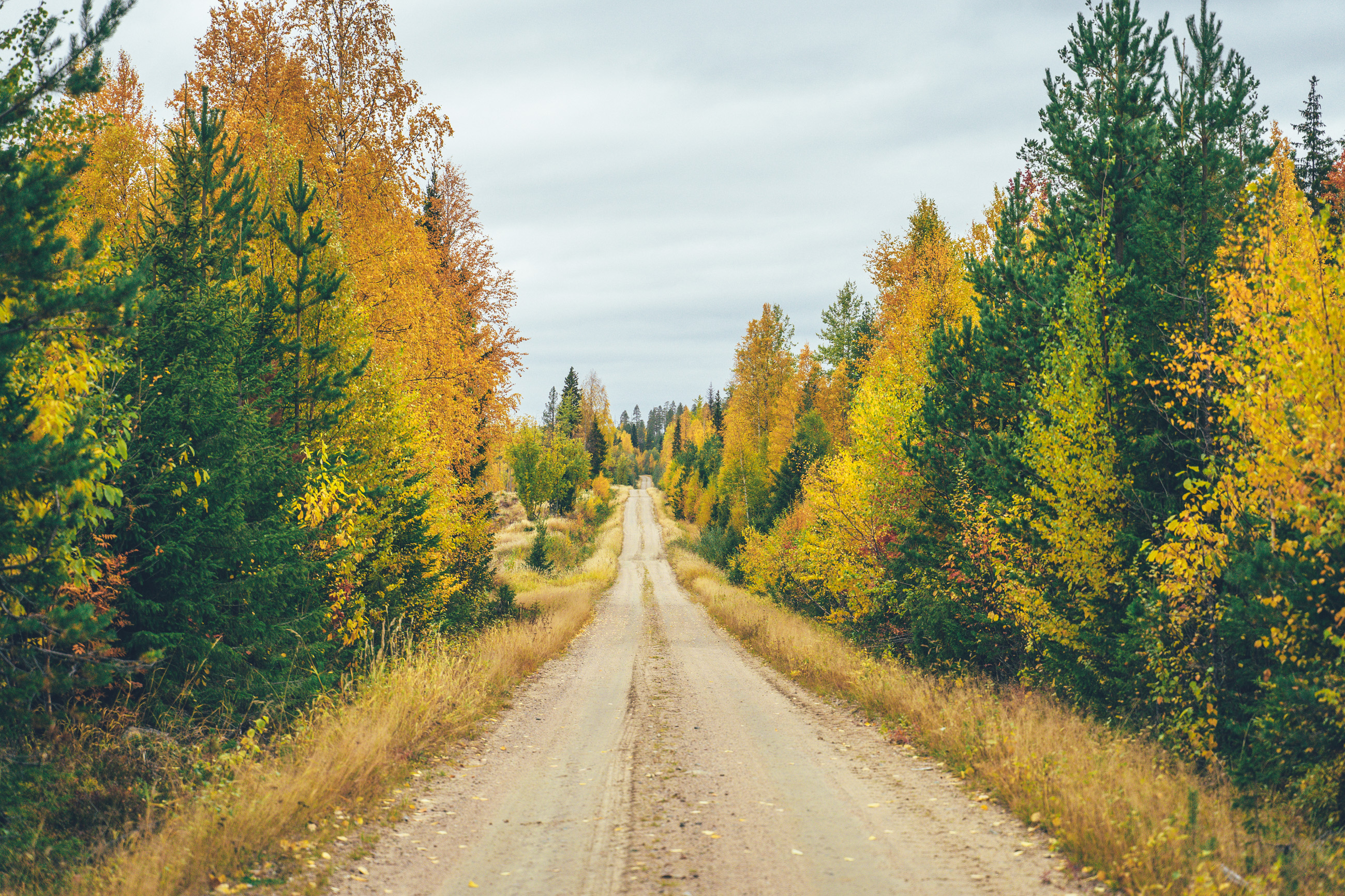
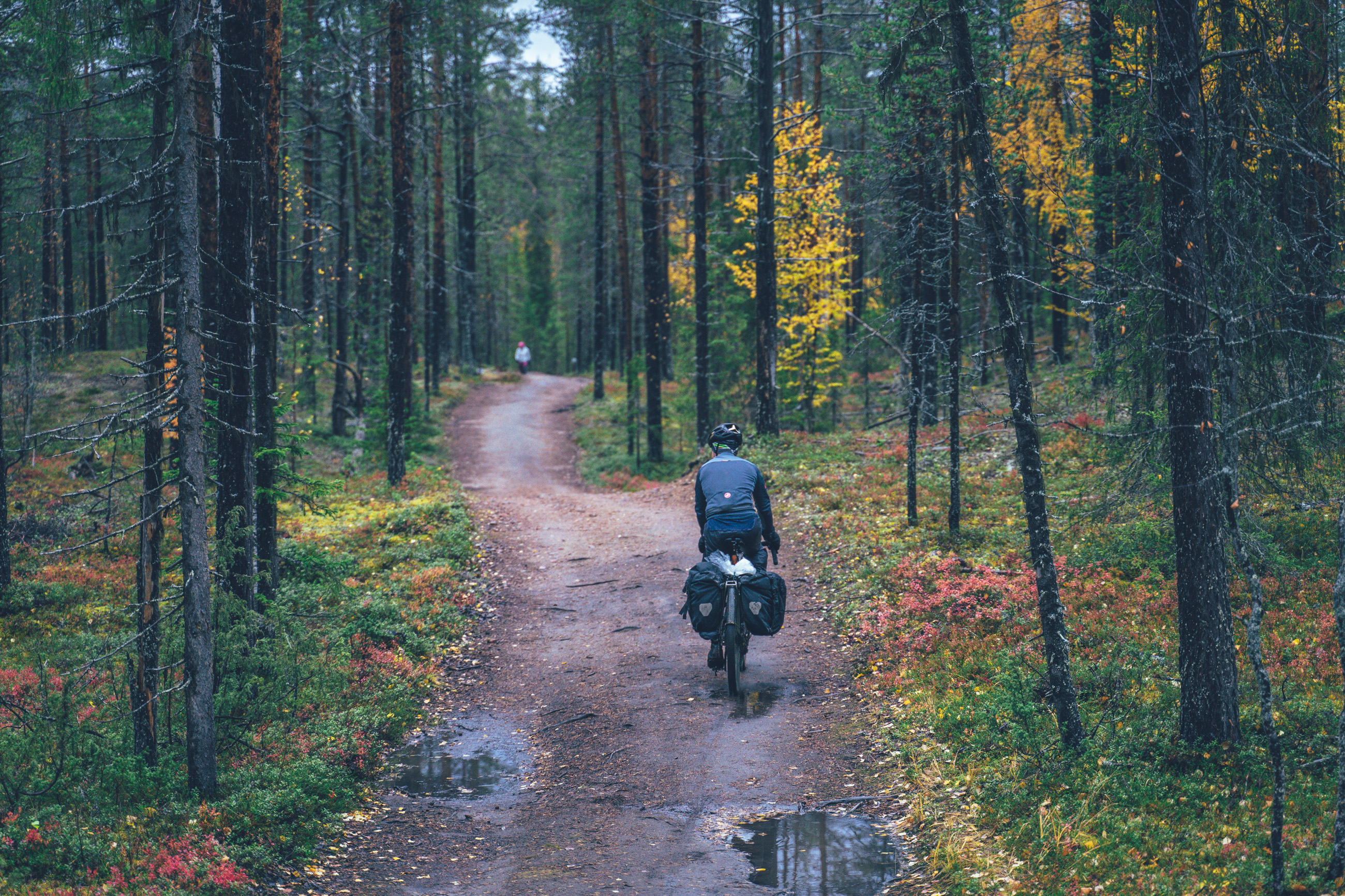
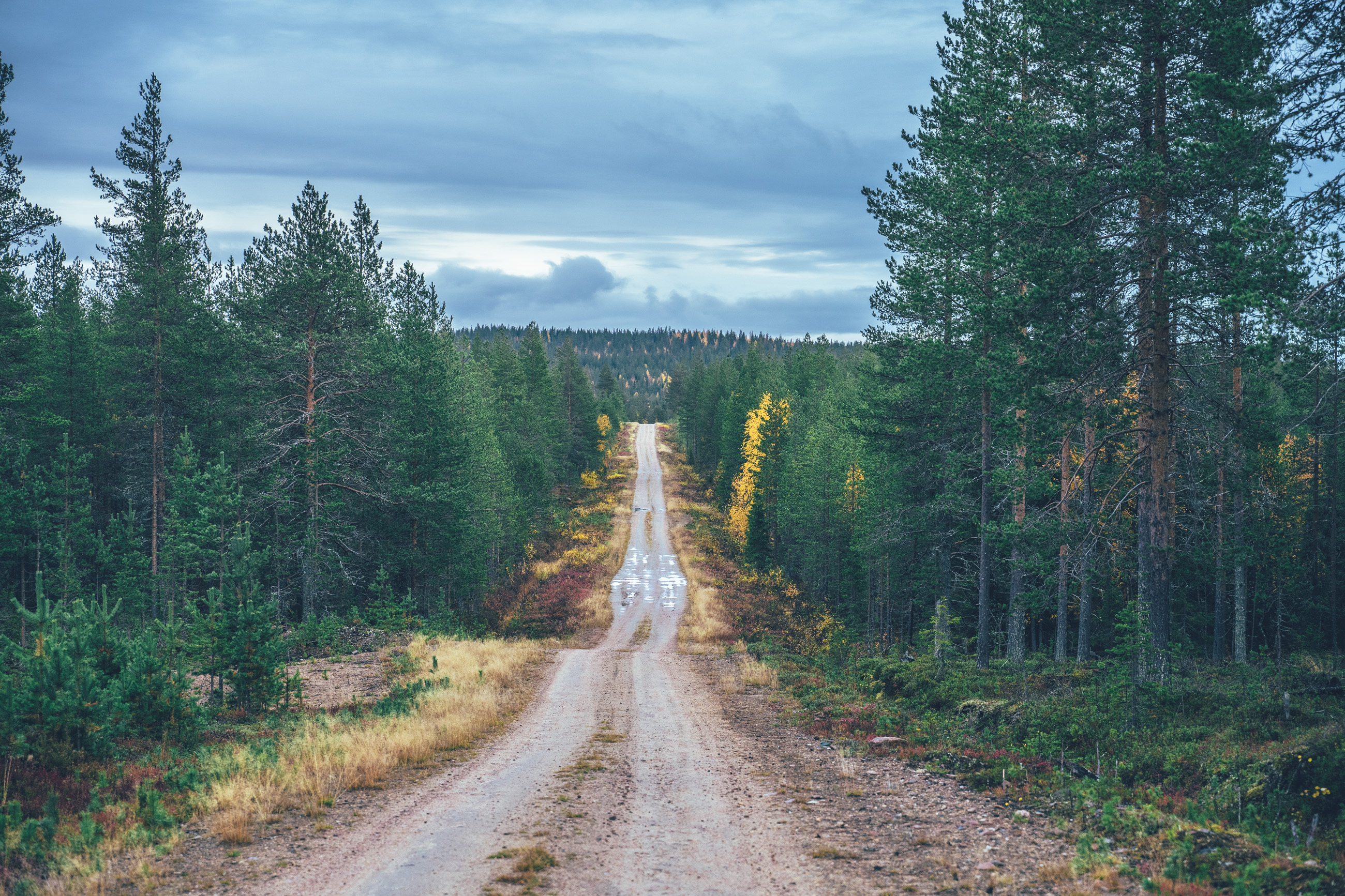
Riding wise the route is composed of hundreds of kilometers of mostly fast, flowy gravel roads, spiced up with a couple of more technical sections linking forest roads deep in the arctic taiga. There are 19 open wilderness huts, day huts, lean-tos, and cooking shelters along the way with firewood provided, giving shelter from the elements and great, often historical, spots for the night. The route also connects many of the guest houses and cabin rentals in the area as well, so there is a lodging option, as an alternative to camping, available for nearly every night, too. Food-wise, bikepacking the route, is really simple as well, as the villages with a grocery store as usually a day’s ride apart, keeping the load light. You also get away with carrying just a liter or two of water, as there is water everywhere.
Overall, the Santa’s Western Gravel Loop is one of the most versatile, surprisingly easy gravel rig-friendly routes on the Arctic by Cycle Bikepacking Route Network making it possible to shape the tour according to your personal preference of daily distances and sleeping arrangements. See more info about the route and our take on the tour pacing in the Trail notes below.
- Easy access to the route by train to Rovaniemi, Pello, or Kolari. Airports at Rovaniemi and Kittilä, as well.
- 19 wilderness shelters, most with firewood provided, offering great historical spots for the night.
- Spot-on frequency of grocery stores, restaurants, and cafés, making touring light and easy food-wise. Water everywhere too.
- Views of the southern fells of the Ylläs-Pallas National Park, from the northernmost point of the route at Ylläs villages.
- Ever continuing, remote but easy gravel roads in the arctic taiga connecting the village of Southwest Lapland.
- Numerous lodging alternatives in the villages, and occasionally between them as well.
- Visiting the Santa Claus Village precisely at the Arctic Circle, with a change of meeting the Mr. S.C himself too.
- Long sand beaches at the crystal clear Miekojärvi and spending at one of the shelters there.
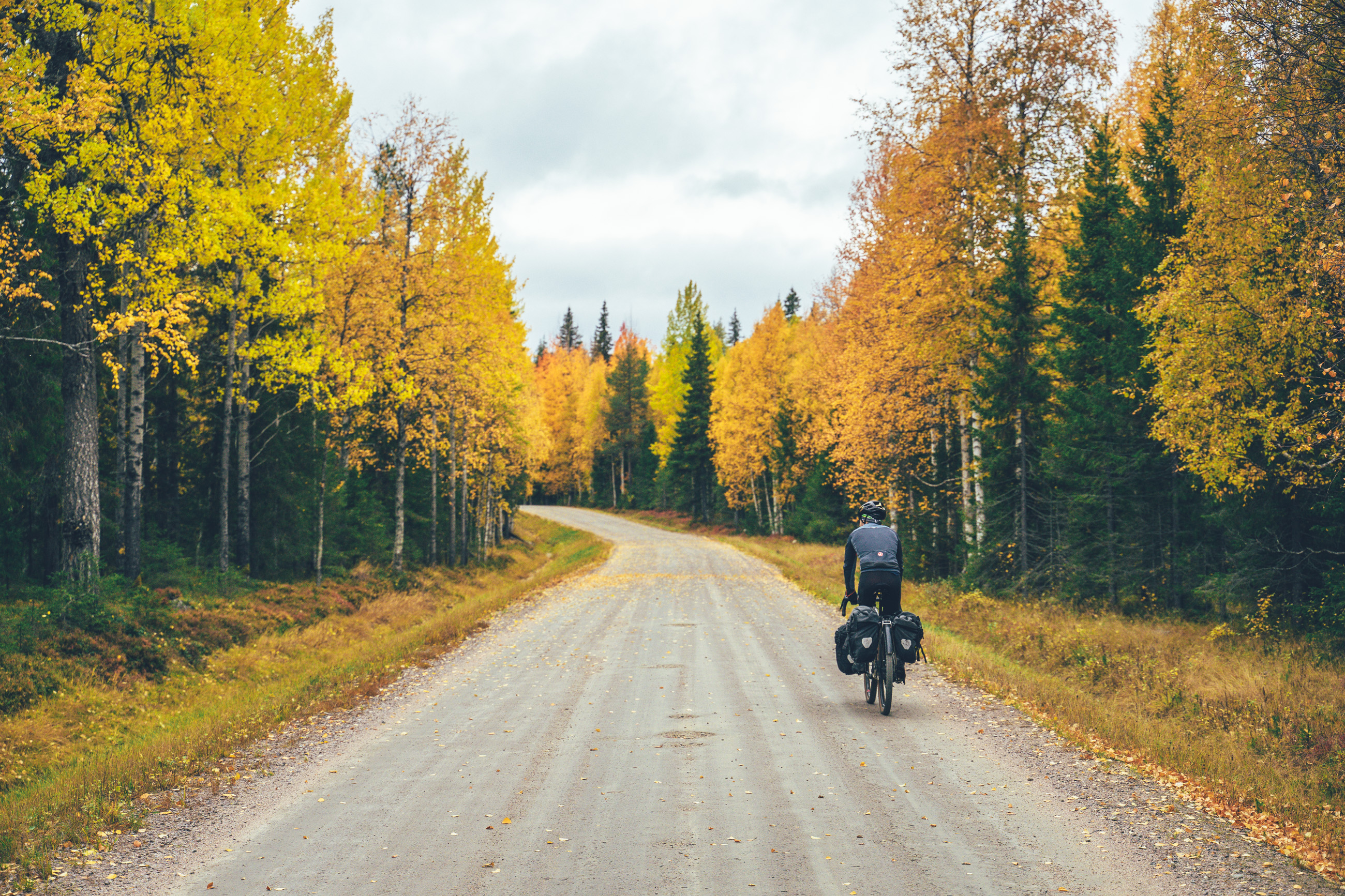
- Northern lights can be seen multiple times a week in autumn, if the sky is clear at night.
- The route is open from the 1st of June till the 30th of September as it is on the map above. Reindeer herding round-ups start on route section between the Kallo and Lohiniva 1st of October, though the route can be taken later as well, if you'll take this reroute instead. Additionally, an alternative route to arrive at Äkäslompolo must be taken 15.9.2022 onwards. See more info on the Reindeer Herding & Route Opening Time info box above.
- The infamous Lappish räkkä, (the high population of mosquitos, black flies, biting midges and horse flies) starts usually by late June and lasts usually till mid August, making the early June or from mid-August till 30th of September ideal time to ride the route. Late season is also great for seeing auroras borealis, which can be seen multiple times a week, given that the sky is clear at night.
- The route can be ridden with any bike, as long as the tire size is a minimum of 40 mm and you have smaller gears as well. Experienced riders can, however, get away with a little smaller tires too, with a cost of comfort though.
- There is an Easy Access version of the route suitable for touring with a trailer or three- or four-wheeled bicycle. See the route link and additional information at Difficulty.
- The route is not suitable for e-Bikes as the longest distance between lodges on the east side of the route is nearly 150km.
- Temperatures during the snowless season a lot and week-to-week but expect the spot-on daytime temperatures of 15-23 Celsius from mid-June to late August with nights in the range of 0-10 Celsius. Early June could be warm too but could be significantly colder as well. In late August and September, the temperatures start to drop significantly week by week and the first snow is not uncommon in late September. Especially late in the season, in late September and early October, be prepared for daytime temperatures of 5-10 Celsius and nights getting already below freezing.
- When choosing a sleeping bag, you should assume that the night temperatures can drop to 0 Celsius even during the mid-summer months and then even colder later the season gets. The classic -7 C/ 20 F sleeping bag works like a charm in Lapland, too, with the lower limit low enough for the late-season exploits.
- The midnight sun or “the nightless night” lasts from around 6 weeks in Southern Lapland to up to 3 months in Northern Norway. Getting used to the 24h sun can take a while to get used to…
- The best time to see the northern lights is roughly starting from September and as the nights get darker and longer towards the end of the season, chances are getting better week by week. It’s not uncommon to see the auroras multiple times a week at the end of the season, given that the weather gods are on your side and the sky is clear.
- The route has only digital navigation; for instructions and tips for successful navigation, see here.
- Always stay on the routes and aim to only use the recommended spots marked on the route map.
- The mobile phone network does not cover the whole route area: in case of an emergency, call 112 or use the 112 app, which automatically shares your location to the emergency services as well. It might be wise to carry a personal emergency beacon, especially when traveling alone.
- The route is located in a traditional reindeer herding area, please read more about the etiquette of traveling in the reindeer herding land here. Please respect any guidelines given for the route use or the use of reindeer herder’s cabins in the route description or on the map. Cooperation and respect for their needs and culture make having these routes publicly available possible.
- Bears, wolfs and wolverines are not an issue at all when wild camping as the arctic predators avoid human contact to all cost. There are practically no encounters, ever. Therefore, there is no need to have a bear bell on handlebars, bear safe food containers or hand your food in a tree for the night.
- The worst of the mosquito season lasts usually from around mid-June to late August, though luckily cycling speed is usually fast enough to keep them away when on the move. During the peak times, a net hat and long sleeve shirt and pants are recommended, if the temperatures allow. As the temperatures drop, the mosquitos disappear, making September (if not also early June, if the roads are dry enough) an ideal time for touring.
- here are lodging options and organized campsites for every night on the west leg of the route to Äkäslompolo, though the East leg, the way back to Rovaniemi has only a few accommodations on the route.
- There are 19 wilderness shelters on the route, which function as official recommended camping sites as well. See the map POIs for more information on the characteristics of the spots.
- Camping is allowed and free of charge anywhere along the route by All Man’s Rights in Finland, however, due to the fragile and slow-growing arctic flora, you should always aim to use only the campsites marked on the route map.
- Open wilderness huts and other wilderness shelters are a treat, but the rules of use are strict to make the system work. The last to arrive has the priority to stay overnight, so make space for people arriving after you. All the near-by-surroundings of the wilderness shelters operate as official camping grounds, to make the huts serve the most, and those the most in need, if you camp and use the hut only for cooking, socializing, and drying wet gear.
- Most of the recommended camping areas have publicly provided firewood available, however, there are some reindeer herder’s cabins and other non-publicly managed wilderness shelters were using the firewood is not allowed or you’re requested to make a little payment for what you use. See the shelter-specific instructions on the map. Collecting and making firewood from nature is strictly prohibited without the land owner’s permission.
- All the camp spots are next to a high-quality water source unless stated otherwise.
- Miekojärvi is a stunning place to camp, if we had to mention one stop not to miss along the way…
- The grocery stores are located roughly one day's ride apart through the route, making the route easy restocking-wise. However, some stores in more remote areas have limited opening hours, which you should check in advance from Google Maps in advance, and carrying some extra food is never a bad idea anyway.
- There is a restaurant(s) available in the villages of Pello, Kolari, Äkäslompolo, Ylläsjärvi, Lohiniva and Meltaus.
- Water is most of the time drinkable straight from streams, ponds, and lakes, but you never know if there is a reindeer carcass upstream, so better to be safe than sorry: water treatment is recommended.
- Sources of water are plentiful, so you’ll get away with carrying just 1-2 liters of water. The best spots for refills are marked on the route map. (Note! Some water sources still missing from the east leg of the route in 6/2022!)
- All the camp spots are next to a high-quality water source unless stated otherwise.
- Tap water is always drinkable in Finland and locals are more than happy to fill your bottles, if necessary
- When cooking in the camp, know that making a fire is strictly prohibited during the forest fire warming period. See the local restrictions here
- The route consists almost completely of easy gravel and forest roads, apart from the off-road arrival to the village of Äkäslompolo and access to the Miekojärvi camping spots. Especially the Miekojärvi access trail can turn partly into hike-a-biking, but the effort is more than worth it. The recommended minimum tire size is 40mm, but going for wider is likely to make you just more comfortable and not much slower at all.
- In terms of technical difficulty, the route gets a grade of 4/10. Physically speaking the route gets a grade of 6/10. In terms of bikepacking challenge, covering the other areas such as the route difficulty (resupply, remoteness, lack of wilderness shelters, duration, etc.) the route balances the remoteness nicely with frequent resupply options, getting a grade of 6/10, forming a total grade of 6/10 as well.
- The trail can be ridden to both directions and the riding direction does not affect the route difficulty. Though we really enjoyed riding the route clockwise, see the Trail notes below. The biggest affecting factor could simply be if you prefer to visit the Santa Claus Village at the Arctic Circle at the beginning or at the end of the tour. :)
- Bikepacking is usually the more comfortable the less you carry, and that also applies to this route, at least partly. On the other hand, riding is non-technical and there are no long or steep climbs, so the route is completely doable with a traditional rack & pannier setup as well with whatever gear you happen to have. As always, it's a treat to have small gears when touring, which makes some of the climbs of this route less strenuous as well.
- Easy access (for family touring and wider rigs)
- There is an Easy access version of the route, which avoids the tricky single track, rocky and rooty sections and steep climbs, when ever possible. Note, that there are still sections with small rocks and roots here and there, which are likely to be ok if just going slow.
- If hauling a trailer and a kid, the bigger tires the trailer has the better. Trailer suspension is a fantastic addition too.
- Lapland is generally easy for family touring because you are allowed to camp basically anywhere by all man's right. So not hitting the daily target is completely all right. Most of the recommended campsites are located by a water source, so if you think you can't make it for the night, just carry a little more for the night and evening.
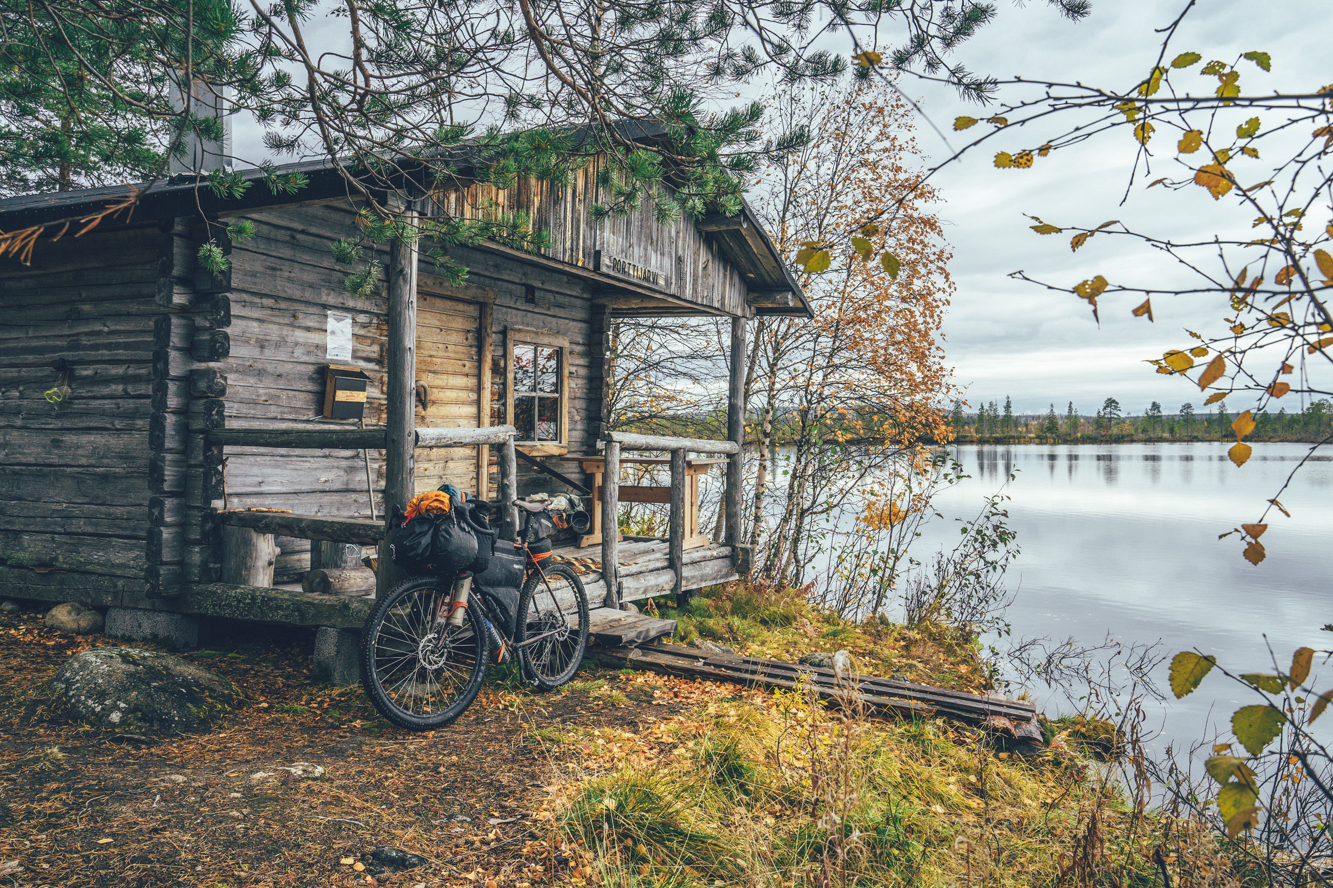
- Two fantastic camping areas (Orhinselkä lapp hut and Porttijärvi wilderness hut) have single track access only, so you would need to skip those. The access trail for those deleted from the map for clarity.
- There are train connections to Rovaniemi (8.5 hours from Helsinki during the day or 12 hours night train) multiple times a day and a night train to Pello and Kolari (13-16 hours from Helsinki) multiple times a week. You can book train tickets from vr.fi
- Booking a spot for a bike well in advance is highly recommended for the overnight train to Pello & Kolari, though there are multiple trains a day to Rovaniemi, which solves the bottleneck problem on this route
- Flying in is easy too, with airports in Rovaniemi and Kittilä with multiple flights a day from Helsinki.
- The route is connected to the Arctic Post Road (MTB and Gravel Version), Ylläs-Levi MTB Route, and the Central Lapland Gravel Loop, making one of the legs (east or west) of the route an ideal start from Rovaniemi to a longer arctic tour
Day 1, Rovaniemi to Lake Mieko wilderness shelters (88km, 1000m of climbing)
The route starts on the cycling lane from the Rovaniemi Railway Station on cycling lanes out of the Rovaniemi City by the River Kemi, before finally diving into the dense arctic boreal forest on gravel. The first reindeer fence gates are soon after, helping to get into the groove of opening and closing them. As a rule of thumb, if the gate is open, leave it open and vice versa.
The first nice spot for a break is after 63km at Lean-to of River Meltos aka Meltosjoki, which has firewood available. Though from there, it’s only around 20km more to the campsite options of the day. The crystal clear Lake Mieko with its never-ending sand beaches has some of the best camping anywhere on the whole Arctic by Cycle Bikepacking Route Network and there are a great campfire hut and two lean-tos in the area as well. The sites are accessible by a partly challenging single track only, though. The trail is 4km one way and part of it is rideable with a gravel bike, but there’s some hike-a-biking as well. If that is not your piece of cake, the Sompanen campfire hut is another great option for the night, though level spots to camp are limited. The campfire hut is located by a large spring overlooking a large swamp - and easily accessible compared to Lake Mieko.
15km further, on the north shores of the Lake Mieko, there are lodging options as well, in addition to a decent lean-to and a grass field to camp, though right by the road.
Day 2, Lake Mieko wilderness shelters to Jouttensuvannon loma camping area (79km, 690m of climbing)
The first restocking opportunity of the route is at the M-Market at Lankajärvi, after a stretch of pavement. In the village of Pello, 50km from Meikojärvi, there is though a full set of services as well, with lodging options, a gas station restaurant, and a grocery store. The Helsinki-Kolari train stops in Pello as well, so Pello is a potential ending or starting point of the whole loop too.
From Pello the routes follow on pavement the Finnish-Swedish border river of River Tornio - the biggest salmon river in the world measured by the volume of water - to Jouttensuvannon loma organized camping area by the river. Before Jouttensuvanto, Naamisuvanto lean-to is another great spot for the night with firewood and plenty of room to camp.
Overall day 2 is pretty relaxed and the progress is quick due to long stretches of pavement, so Kämppäsajo day trip hut could be well reachable as well, making the day two 120km.
Day 3, Jouttensuvannon loma organized camping area to Äkäslompolo village (95km, 885m of climbing)
The third riding day starts with a quick few kilometers on the pavement before diving back into old logging roads to the taiga. The gravel back road to the village of Kolari is partly quick, but some sections can be slow progress as well, especially after rain. Before the Kämppäsajo day trip hut, there is a beautiful little spring behind a publicly owned hut to fill the water bottles with the highest quality water.
The village of Kolari is the furthest you can get by train in the Finnish Lapland, so it’s a gateway to many of the Arctic by Cycle routes on a longer tour. A full set of services is available there with a couple of diners, a grocery store, and a few accommodation options. Before the village center, there is a supermarket of ICA Lahtis on the Swedish side of the river, an easy detour, in case you want to tick a box of Sweden on the way as well. Given that there are no pandemia-related restrictions, there is no border control between Finland and Sweden and the visit is completely hassle-free.
The paved stretch of road continuous for 24 kilometers, before the route turn toward the village of Äkäslompolo on the old main road by the River Äkäs. Hannukainen lean-to is a beautiful spot for a break, or for the night, on the river bank, before a section of small forest roads and easy single track. Full set of services in the holiday village of Äkäslompolo with a selection of restaurants, lodges, a large supermarket, and bike rental stores with some spares and a mechanic as well.
NOTE! The last section from Hannukainen to Äkäslompolo is annually closed from the 15th of September onwards for reindeer herding work at the request of the local reindeer herding community. Take the main road into the village after that date. Cooperation with the local reindeer herding community allows publishing these routes possible and keeping them online, so please follow the guidelines!
Day 4, Äkäslompolo village to Porttijärvi open wilderness hut (48km, 500m of climbing)
There are two ways to do the day 4, shorter and longer. The shorter one to Porttijärvi open wilderness near the village of Kallo is around 50km and the longer one to the village of Lohiniva is 104km & 940m of climbing. The route is mostly fast gravel so the longer version is quite doable as well, though here take the easier, and the prettier way.
The Porttijärvi open wilderness hut is managed by the local village association and well kept with firewood provided for common use. The hut is located by a clear spring lake with access to a mostly rideable single track. Not ideal, but possible to camp as well, if you happen not to fit into the hut for the night.
The connecting route from Äkäslompolo to Ylläsjärvi village is for the season of 2022 on the main road going over the side of the grand fell of Ylläs, but for 2023 a new connection via the National of Pallas-Yllästunturi will be opened, and eventually, the route is moved to that one.
Day 5, Porttijärvi open wilderness hut to Lohiniva (55km, 430m of climbing)
If doing day 4 the short way, it makes day 5 pretty short too, unless you do a long day of 126km & 1075m of climbing to reach the Kotajärvi open wilderness hut. The connection from Kallo to Lohiniva starts on a straightish logging road but eventually gets smaller and smaller ending with a couple of kilometers of 4x4 road linking two gravel roads together.
The smooth forest dirt road on the Ounasjoki bank is dream-like in a partly old forest and one of the best riding along the whole Santa’s Western Gravel Loop. Lohiniva has a small grocery store and a café, though check somewhat short opening times in advance to make sure you reach the place on time if your restocking depends on that. The lean-to by the river is rather close to the road (on the Finnish scale), but the traffic is nearly non-existing at night, making it a decent spot to camp or sleep in the laavu, given it’s not a mosquito season anymore. Firewood is provided by the local community as well.
Day 6, Lohiniva lean-to to Kotajärvi open wilderness hut (71km, 715m of climbing)
Day 6 is easy gravel riding on the less used connecting road between Lohiniva and Meltaus, before getting on the final stretch of gravel toward Rovaniemi City and stopping for the night in the open wilderness hut of Kotajärvi.
There’s a small shop and restaurant at the gas station in Meltaus, which is a great stop before getting on the partly remote route toward the end of the route.
Kotajärvi open wilderness hut is somewhat in poor condition, but a nice alternative if the elements are not on your side, as the stove still just about works, and new firewood is brought occasionally to the hut as well. Not the best area to camp either, but surely enough level area for multiple tents anyway. The alternative is Kiimalampi lean-to 17-18 km further, at the end of a forest road with a short section of single-track.
Day 7, Kotajärvi open wilderness hut to Rovaniemi City (54km, 730m of climbing)
The first half of the last riding day is on a charming smallish and flowy gravel road with a double-track vibe here and there, before reaching the Norvajärvi. The lakeside is littered with houses and huts, so consequently, the road gets much bigger as well, though still gravel.
The Official Santa’s Village is located right at the arctic circle before reaching the city and as might be expecting, it has all the services you could think of, given the international reputation of Father Christmas. Give him a high-five if you arrive at the visiting times and then roll to the end of the route into the Rovaniemi City.