


Arctic by Cycle: Santa's Eastern Gravel Loop
 472 km
 5-7 days
 3458m
3458m 357m
357m 78 %
78 % 1 %
1 % 3
3 100 %
100 %
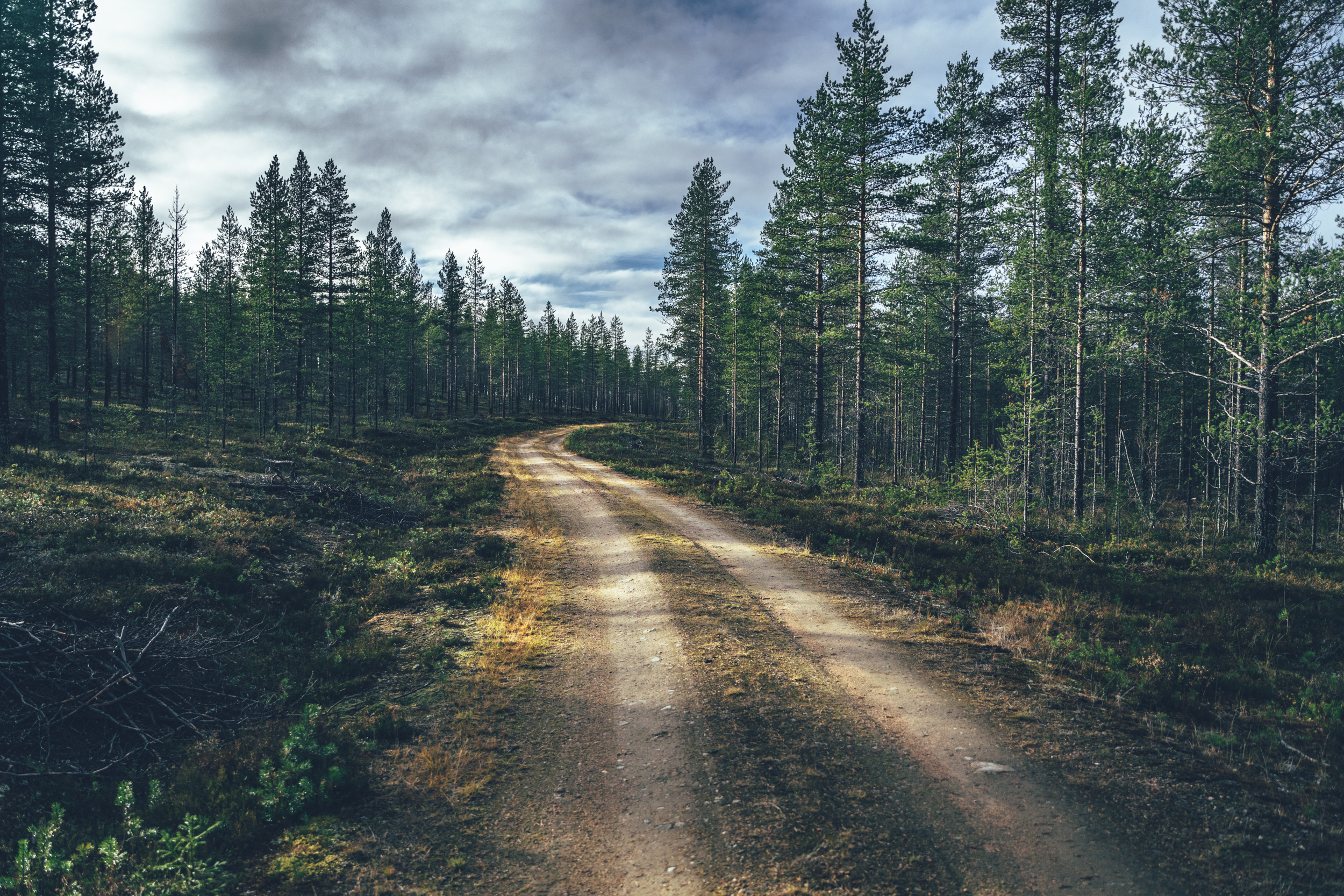
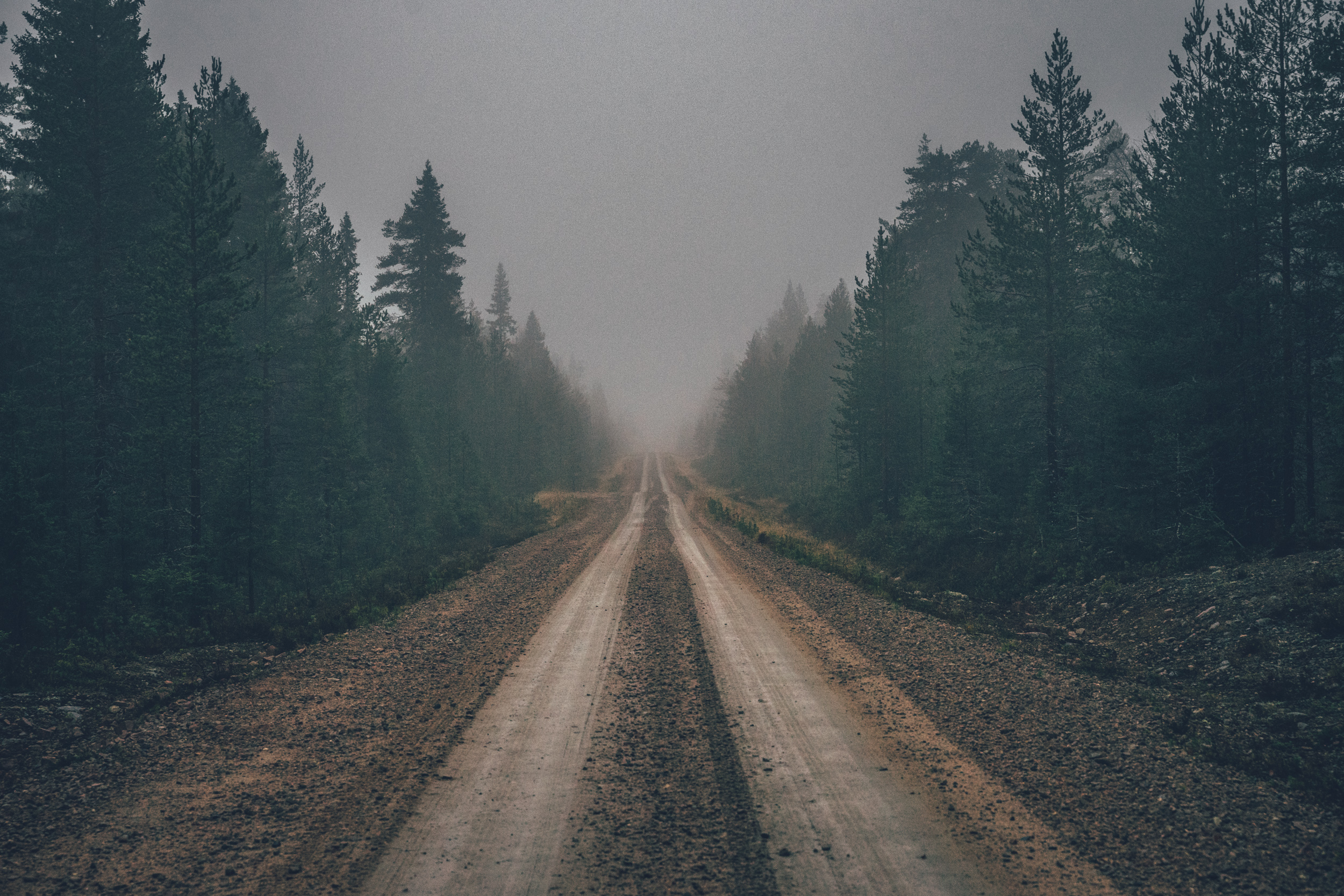
The 472km and 6-7 day Santa’s Eastern Gravel Loop starts from Rovaniemi to Kemijärvi and onward to Pyhä by following the Cental Lapland Gravel Loop and then across the Pyhä-Luosto National Park following roughly the single tracks of the Pyhä-Luosto National Park MTB Loop, though with some magic touch making the route 99% gravel-rig-friendly. However, after that the route loops back to Rovaniemi on previously undiscovered remote gravel roads, which nicely link together the wilderness shelters of the area. If the first part of the route has a nice rhythm of high quality services and places to stock up food and eat pizza, the latter part of over 200km in distance has no services at all.
The route starts from Rovaniemi on recreational routes over the local hill before the route dives into the deeper taiga toward the City of Kemijärvi. The connecting route between the two cities – and the two major railway stations of the area is great riding with a beautiful wilderness cabin and two nice lean-tos on the way. The route onwards the Pyhä-Luosto National Park offers some great forest roads too, though still awaits shortcut to Pyhä area to avoid the busy main road completely.
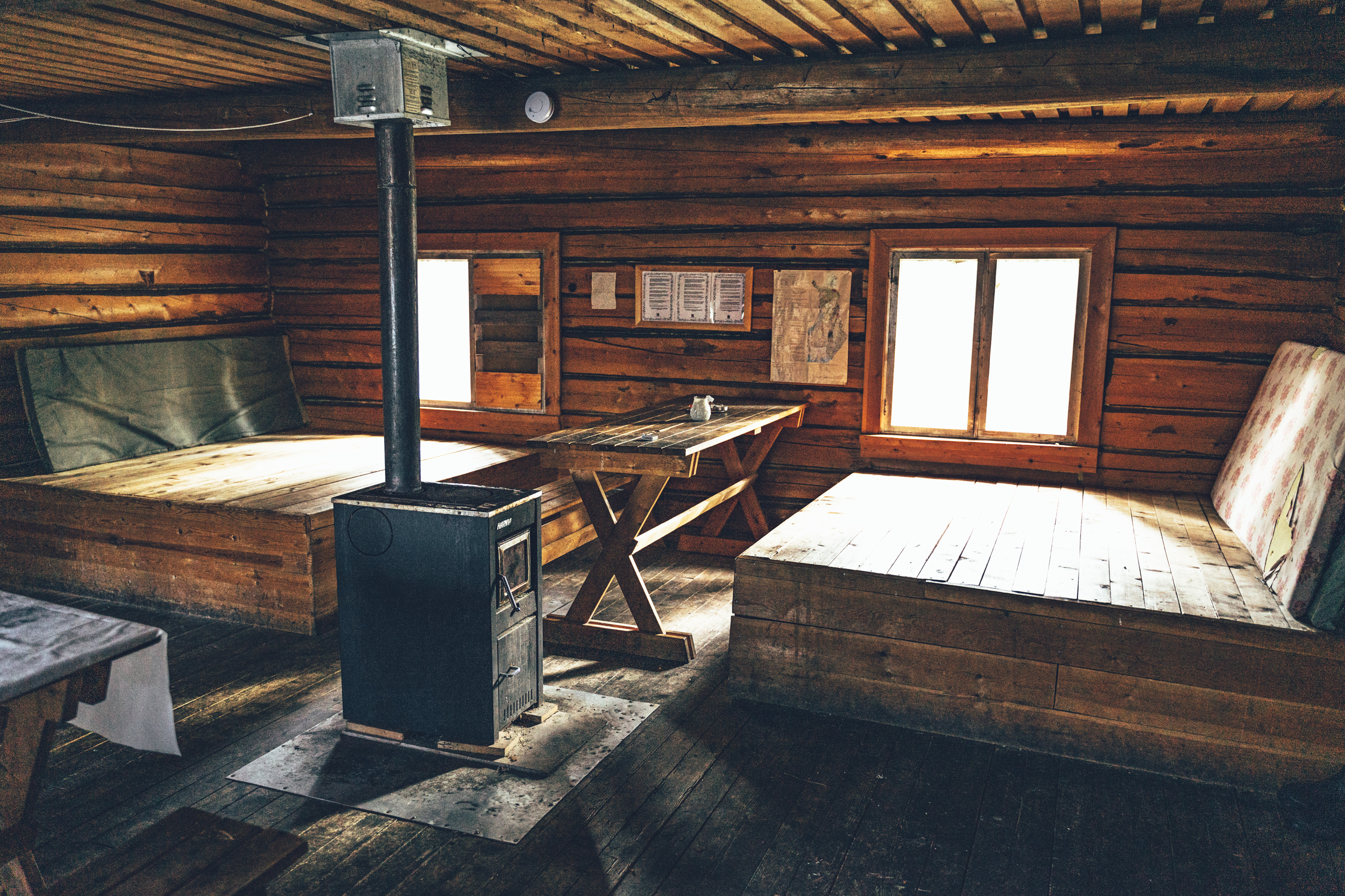
At Pyhä, the route gets on significantly more challenging hiking trails of the Pyhä-Luosto National Park, which have been turned into gravel covered single tracks. Surprisingly, more than half of the national park can now be crossed on a skinny tired bikepacking rig – at least if you have some basic mountain biking skills and can tackle the rollercoaster-like up and downhills of the route. Nature in the national park is stunning with rare old-growth forest and treeless fell tops. Wilderness shelters and great camping areas are numerous too.
After the Pyhä-Luosto National Park the route returns to remote gravel roads again. This time though, there next service point is days away at the end of the route at Rovaniemi. Like in most of the Lapland, high quality water can be found regularly and by the wilderness shelters, but on the last 200km of the route there are no places to restock food at all. Therefore, you need to haul everything you need till the end of the route from Luosto, making it 2-3.5 days depending on your pace.
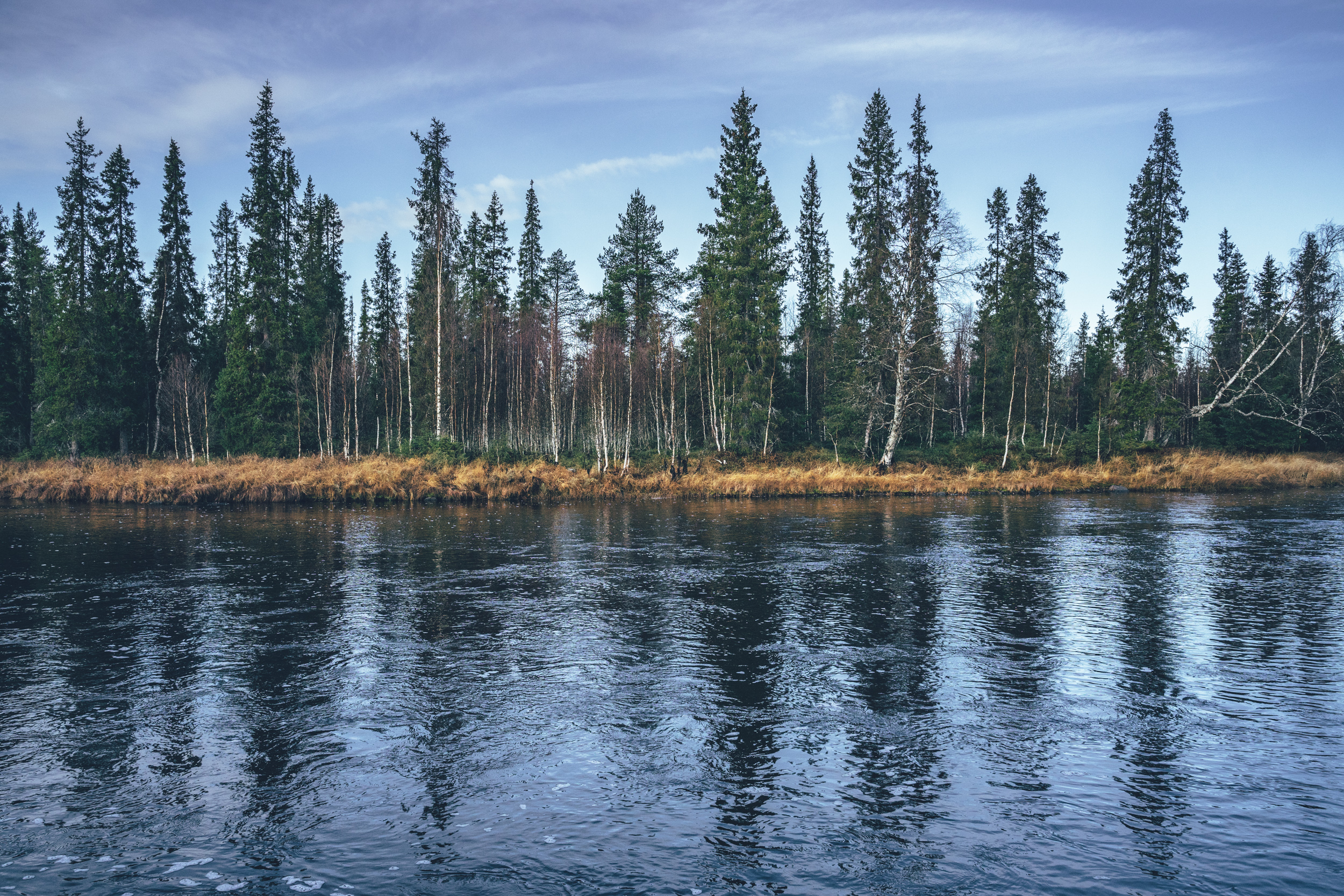
Overall, the route offers an interesting take of the Lapland scenery, nature and wilderness culture by showing some of the best long forest roads, high quality wilderness huts and lean-tos, unique primary forests of the one of the oldest national parks in Finland and some amazing single track. The single track section and the remote return route to Rovaniemi spice up the challenge and breaking the occasionally meditative vastness and endlessness of the Arctic taiga.
Read more about the route and what it has to offer in the Trail notes below.
- Riding on easy single track across the old growth-forests and fells of the Pyhä-Luosto National Park
- Great wilderness shelters on the way, offering comfort, protection as well as wilderness history of the area
- High quality services available in Kemijärvi, Pyhä and Luosto in otherwise wild and remote Cental Lapland taig
- Crossing the 200km section of no services is a nice contrast to the otherwise relatively service rich route.
- Riding on traffic-free endless gravel roads of Central Lapland
- The gravel routes in the arctic are usually open from early June after the routes have dried and hardened up after winter, to mid-October, when the winter sets in again. However, the climate crisis makes seasons more unpredictable than before so the season start and end can vary year to year by a couple of weeks. The route is open full season, with no restrictions requested by the local reindeer herding community.
- The infamous arctic räkkä (the high population of mosquitos, black flies, biting midges and horse flies) starts usually by late June and lasts usually till mid August, making the early June or from mid-August till October ideal time to ride the route.
- The route can be ridden with any bike, as long as the tire size is a minimum of 40 mm and you have smaller gears as well. Though having a beefier tire does not do any harm at all as there are some rough bits and easy single track as well.
- There is an Easy Access version of the route suitable for touring with a trailer or three- or four-wheeled bicycle. See the route link and additional information at Difficulty.
- The route not suitable for e-Bikes because of the long service gap on the west leg of the route.
- You need to be able to carry all the food you need for the last 200 km, meaning 2-3.5 days usually. Water carrying capacity of 1-2 liters is sufficient, as there are high quality water sources regularly on the route.
- Temperatures during the snowless season vary a lot and week-to-week but expect daytime temperatures of 15-23 Celsius from mid-June to late August with nights in the range of 0-10 Celsius. Early June could be warm too but could be significantly colder as well. In late August and September, the temperatures start to drop significantly week by week and the first snow is not uncommon in late September. Especially late in the season, in late September and early October, be prepared for daytime temperatures of 5-10 Celsius and nights getting below freezing.
- When choosing a sleeping bag, you should assume that the night temperatures can drop to 0 Celsius even during the mid-summer months and then even colder later the season gets. The classic -7 C/ 20 F sleeping bag works like a charm in Lapland, too, with the lower limit low enough for the late-season exploits.
- The midnight sun or “the nightless night” lasts from around 6 weeks in Southern Lapland to up to 3 months in Northern Norway. Getting used to the 24h sun can take a while to get used to…
- The best time to see the northern lights is roughly starting from September and as the nights get darker and longer towards the end of the season, chances are getting better week by week. It’s not uncommon to see the auroras multiple times a week at the end of the season, given that the weather gods are on your side and the sky is clear.
- The route has only digital navigation; for instructions and tips for successful navigation, see here.
- Always stay on the routes and aim to only use the recommended spots marked on the route map.
- The mobile phone network does not cover the whole route area: in case of an emergency in Finland, call 112 or use the 112 app, which automatically shares your location to the emergency services as well. In case of an emergency in Norway, call 113 or use the 113, which similarly shares the location automatically, making finding you fast and easy.
- The route is located in a traditional reindeer herding area, please read more about the etiquette of traveling in the reindeer herding land here.
- There are high quality lodging options in the cities and villages, and in between on the southern and eastern part of the route. Though then nothing on the way back to Rovaniemi for 200km.
- Camping is allowed and free of charge along the route by Everyone’s Rights, however, due to the fragile and slow-growing arctic flora, you should always aim to use only the campsites marked on the route map. Also, camping is strictly prohibited outside the recommended camp spots in the Pyhä-Luosto National Park.
- There are 13 wilderness shelters along the way, which serve as official camping areas of the route as well. See the POI details on the map for info, which are best suitable for camping.
- All the camp spots are next to a high-quality water source, unless stated otherwise.
- The grocery stores for restocking are located in Rovaniemi, Kemijärvi, Pyhä and Luosto, but as nearly half of the route does not have any services at all, you need to be able to carry all the food you need for the last 200km of the route, meaning 2-3.5 days of rations usually.
- There are restaurants or cafés available mostly in the service centers, and rarely nothing in between them.
- Water is most of the time drinkable straight from streams, ponds, and lakes, but you never know if there is a reindeer carcass upstream, so better to be safe than sorry: water treatment is recommended.
- Sources of water are plentiful, so you’ll get away with carrying just 1-2 liters of water. The best spots for refills are marked on the route map.
- All the camp spots are next to a good water source, unless stated otherwise.
- Tap water is always drinkable and the locals are happy to fill your bottle.
- When cooking in the camp, know that making a fire is strictly prohibited during the forest fire warming period. See the local restrictions in Finland here.
- Most of the route is easy riding with a nice interval of services, but the roller coaster like single tracks of the Pyhä-Luosto National Park add technical and physical challenge. The last 200km without services also increases the logistical challenge of the route. The route can be ridden to both directions and riding direction does not affect it’s difficulty.
- The route is granted 7/10 for both its physical and technical difficulty and similarly 7+/10 of it’s logistical difficulty. Overall the difficulty rating is therefore 7/10. Thinking of tire size, you get away with 40mm tires, but bigger ones make no harm either, giving you some extra comfort when the road gets rough.
- Bikepacking is usually the more comfortable the less you carry, and that is mostly the case on this route as well. The lighter you go, the easier the harder sections get physically and technically. Though, overall the route can well be ridden with either bikepacking setup or panniers, or anything in between. How the bike is packed is not the deciding factor here, as long as you stay on the lighter side and the carrying system is well-balanced for the easy single tracks sections.
- Easy access (for family touring and wider rigs)
- There is an Easy access version of the route, which avoids the tricky single track, rocky and rooty sections and steep climbs, when ever possible. Note, that there are still sections with small rocks and roots here and there, which are likely to be ok if just going slow.
- If hauling a trailer and a kid, the bigger tires the trailer has the better. Trailer suspension is a fantastic addition too.
- Lapland is generally easy for family touring because you are allowed to camp basically anywhere by all man's right. So not hitting the daily target is completely all right. Most of the recommended campsites are located by a water source, so if you think you can't make it for the night, just carry a little more for the night and evening.
- Between Luosto and Rovaniemi, stock up a lot of food as the stretch is pretty remote and has no services at all!
- The highlight of the whole route, the smooth single tracks of the Pyhä-Luosto National Park could be actually doable with a trailer as trail has recently built to be smooth and mostly 1m wide gravel path. However, there is 2.2km section of natural single track (marked red on the map), which would be partly hike-a-biking with a trailer and there is a 250m duck board section as well, which could be tricky to navigate, but not impossible (if you just suck it up and push the bike and trailer over the swamp). Also, this section has some really steep uphills and downhills, which make progress really slow and tough. Doing the 24km and 410m of climing could take you the whole day. Luckily you can easily avoid that section by just staying on the main road on the side of the national park. Though if you think you can do it, go for it! The national park is amazing and so many great spots to camp there as well. This section is not part of the easy access route version, obviously, so this is just a side note...
- There are route alternatives between Kemijärvi and Pyhä-Luosto National park. The one now on the map avoids the main road completely on the west side of the main river and is a rather efficient connection. There is the Rentukka wilderness hut and sauna on the map now too, but taking that adds another 50km to the total distance.
- Between Pyhä-Luosto National Park and Rovaniemi the nicest place for the night is Kunettikoski wilderness hut, but to get there there is first a swamp and then a rocky single track section, so getting there is likely to be really challenging. Better to camp at the "Heart shape spring" a little before it, which is located near a reindeer herders hut, which provides shelter in the rain and there is plenty of flat area to camp as well in the area.
- There is an overnight train connection to Kolari (16 hours from Helsinki) multiple times a week, with a bus connection to Levi and Äkäslompolo at Ylläs. Both function as natural starting points for the route.
- There are flights from Helsinki to Kittlä multiple times a day, and Levi is located 15 minutes from the Kittilä Airport by bus.
- There is a daily bus connection between Muonio and Levi, but generally no bus connection at all between Äkäslompolo and Levi or Äkäslompolo and Muonio. For bus schedules and purchasing tickets, see matkahuolto.fi
- There are multiple daily train connections to Rovaniemi (8.5 hours from Helsinki during the day or 12 hours night train. As the train goes multiple times a day, you don’t necessarily need to buy the ticket in advance. For train schedules and purchasing tickets, see vr.fi
- The route can be started easily from Kemijärvi as well, where you can get by a night train. Purchasing the ticket way in advance is advised though as the bike spots in night trains are limited.
- Flying in is easy too, Rovaniemi has an airport with connecting flights to Helsinki abroad regularly.
Day 1 - Rovaniemi city to Ulkujärvi open wilderness hut (65km, 735m of climbing)
After crossing the great River Kemi, the route starts with a gentle climb to Ounasvaara recreational area and over the fell on gravel surfaced cycling paths. The only café on the way is located 23km into the route before the route dives into mixed roughness forest roads toward and roughly halfway to Kemijärvi city reaches the Ulkujärvi open wilderness hut. The old traditional-style wilderness hut is located at the shore of the clear-watered Ulkujärvi with space to camp as well. Iso-Herajärvi lean-to is located just a few kilometers further and it’s nicely located just a few meters from the shore, but has car access and lacks a suitable camping area - apart from the gravel parking lot. Additionally, the restaurant and lodge of Wanha Kaivoskylä (Old Mining village) are located as well only 27km further, making it fantastically located between the cities, in deep wilderness.
Day 2 - Ulkujärvi open wilderness hut to Kemijärvi city (77km, 610m of climbing)
Beautiful small gravel roads continue through the day two, Vanha Kaivoskylä restaurant & lodge making a great late breakfast or early lunch spot on the way to Kemijärvi City. Tunturijärvi lean-to after 45km is a great place for an afternoon break with firewood provided as well, by a beautiful wilderness pond. The roughest stretch of the day is located just before reaching the city, though well doable with a gravel rig still, despite some bigger boulders here and there. Full set of services in the Kemijärvi city, obviously.
Day 3, Kemijärvi city to Pyhätunturi (90km, 750m of climbing)
Anticipating some future route developments in the Pyhä area the route between Kemijärvi and Pelkosenniemi has now been moved to the west side of the River Kemi. This puts the services of the holiday village of Pyhä on the map and also for this route, gives a better access to the Pyhä-Luosto National Park, if you decide to visit there. However, the earlier route on the east side of the River Kemi via the Rentukka open wilderness hut still works as an completely traffic-free route alternative. Also, half is it is really pretty. See the route alternative on the map here.
The updated route from Kemijärvi onwards starts on the city cycling paths and manages to avoid the rather busy Road 5 apart from a couple of kms before taking a large gravel detour west. The detour off the main road is 55km with one decent campfirehut and some nice gravel sections on the way, and it clocks around 450m of climbing. There will be a shortcut to reach Pyhä directly from these forests, but for now, the route returns again to the mainroad. It’s a half a day sidetour, but at least in terms of safety, it’s worth the extra effort. Also, the Tapionniemi kyläkartano is on the route, which is a village association ran old village house offering accommodation and summer time café. After Tapionniemi, there is a 8 km section on the Road 5, before turning toward Pyhä-Luosto National Park and the services of the Pyhä holiday village.
Day 4, Pyhätunturi to Luosto (59km, 730m of climbing)
From Pyhätunturi, the route follows the southern leg of the Pyhä-Luosto National Park MTB Loop, though cutting off the less travel-rig-friendly natural single track sections. After 9km warm up on pavement the route dives into the depths of the national park and it’s smooth gravel covered single track roller coaster for 17km. The Pyhä-Luosto National Park offers multiple historic wilderness shelters, which usually have great camping around as well. The route is on the main hiking trail of the national park, so don’t expect to be on the trail or ar the refugios alone, though. Great services in the end of the day at the Luosto village.
Day 5, Luosto to Kunettikoski open wilderness hut (103km, 640m of climbing)
From Luosto starts a fairly remote service-free sections for 200km, so stocking up for the following days at Luosto is necessary. The route continuous from Luosto on some winter cross country skiing routes a little more in the national park and then rolls down mostly on pavement to the Road 4 for 13km. The traffic can be heavy on the Road 4, but it’s a necessary evil given the geology of the area. The rest of the day, 73km, the route goes deeper and deeper into the Lapland taiga where there are no villages and habitation, apart from the rare summer cabins by the ponds and lakes, used by hunters, fisher and harvest season berry pickers. The long solitude day ends to the historic wilderness hut of Kunettikoski, which is located by a river and accommodates more than 10 people easily. As it’s off the beaten path, it does not get many visitors at all. To access it, you need to cross a 100m swamp and then do a short hike-a-bike, so it’s not an ideal spot for a break, but close to a perfect sport for the night.
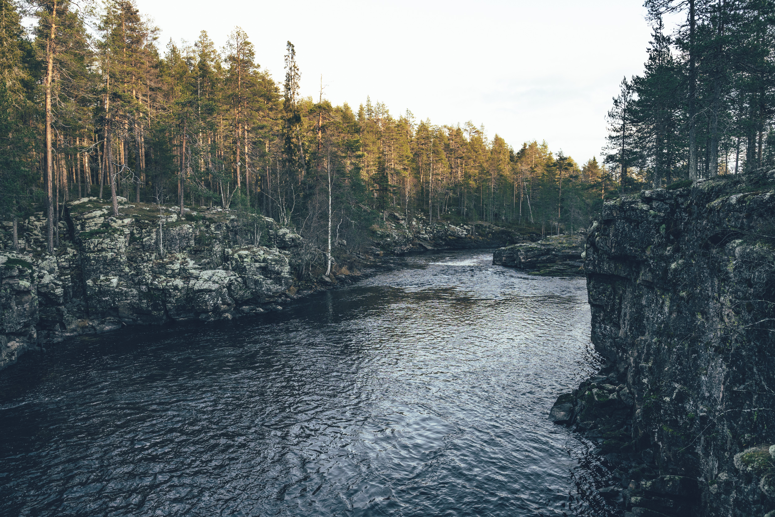
Unarinköngäs is a great camping/ rental hut option for the night. It’s located by a river carved canyon with a suspension bridge and a couple of camping options. Though it’s little off the route.
Day 6, Kunettikoski open wilderness hut to Rovaniemi (103km, 1455m of climbing)
On the morning of the last day, the route continues on remote-feeling small gravel roads across the endless taiga. The old Kotajärvi wilderness hut is located around in half of the day distance wise and it’s a decent spot for a lunch and taking shelter, if necessary. The approach to Rovaniemi is fun riding on small gravel road though hilly, until the size of the gravel road roughly doubles when the first cabins at Lake Norvajärvi are reached. The arrival to the city is straightforward, though don’t forget give hi fives to the Santa Claus at the Santa Claus village, just before reaching the city.