


Arctic by Cycle: Korvatunturi Gravel Loop
 301 km
 5-7 days
 1629m
1629m 329m
329m 89 %
89 % 10 %
10 % 3
3 93 %
93 %
The most northern part of the Finnish Lapland is connected to central Lapland on only two roads due to the restrictions on wilderness areas, national parks, and the construction of the Lokka-Porttipahta Reservoir. This makes the large, but sparsely populated municipality of Savukoski extremely remote, with no roads leading out to the north, east, or southeast. That is possibly why, by the legend, Santa Claus decided to make his home there, in the depths of the Korvatunturi fell.
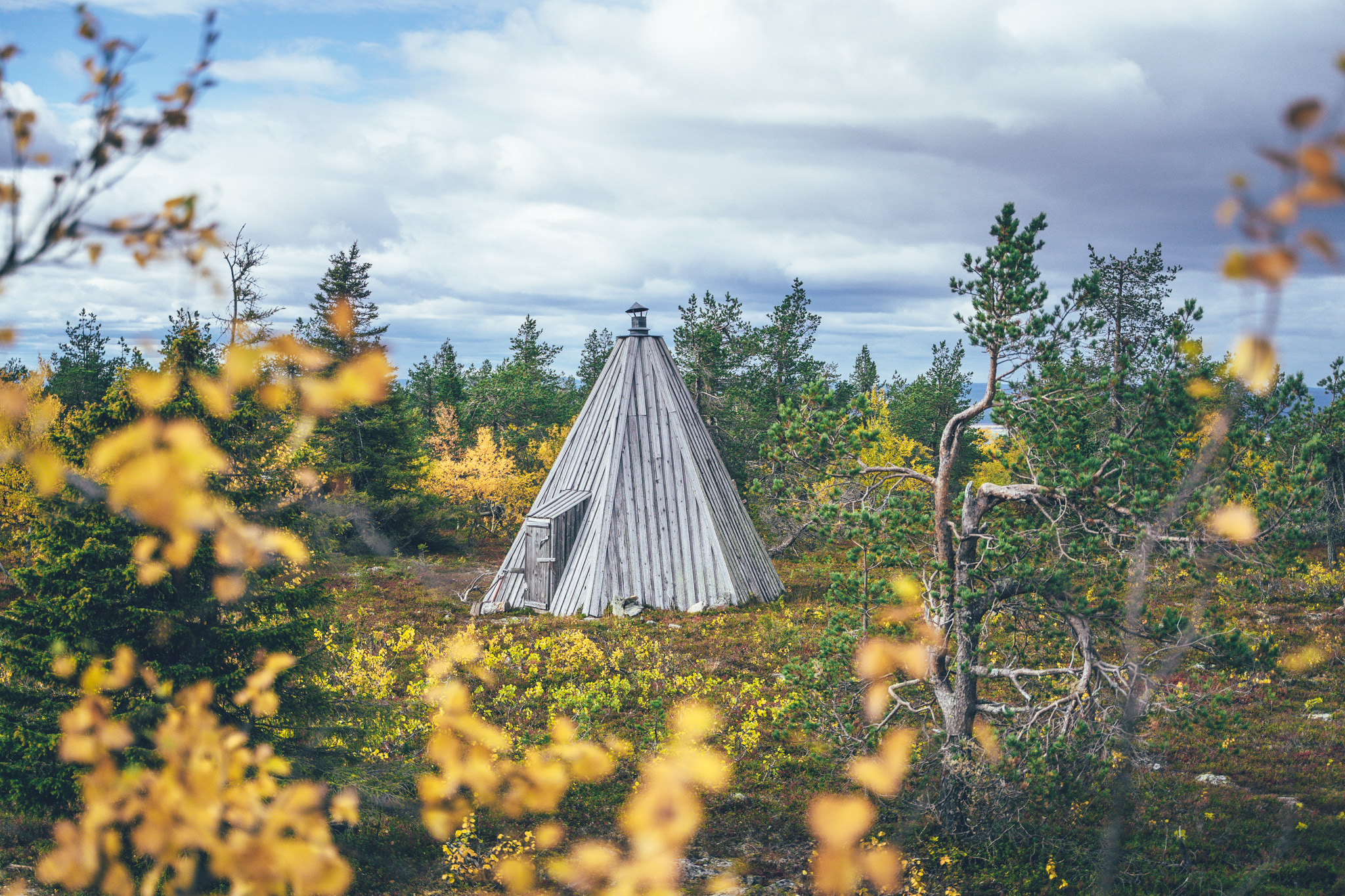
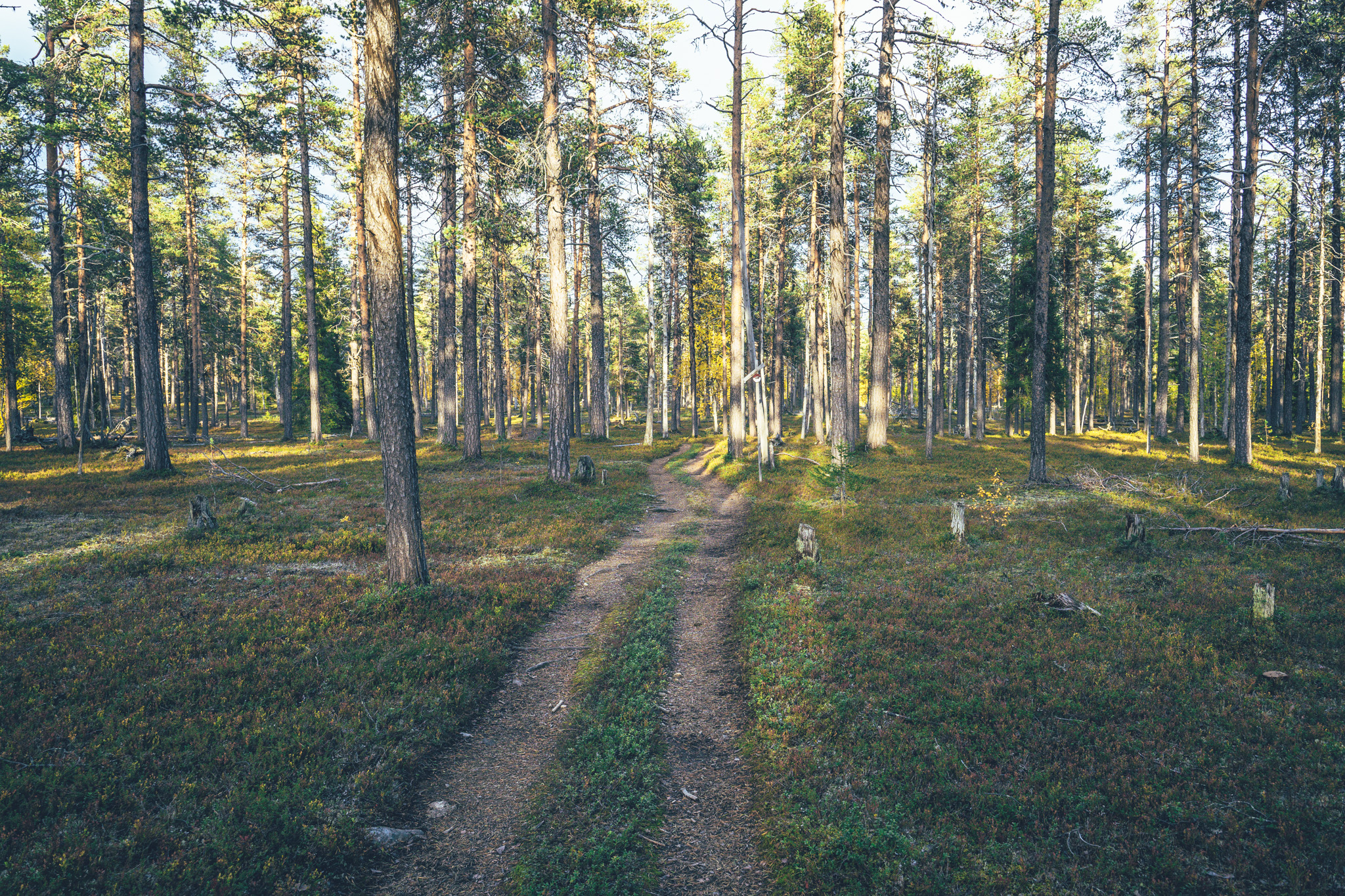
The history of extensive logging in the area in the early 20th century has still some signs here and there in a form of old infrastructure, but most evidently a network of logging roads grids the area. Luckily for cyclists, not all of the roads can be connected even by a 4×4, making parts of the area nearly traffic-free, even during the high season of autumn colors, ruska, in September. There are also many old logging huts in the area, now serving as open wilderness huts for cyclists, trekkers, hunters, and fishermen.
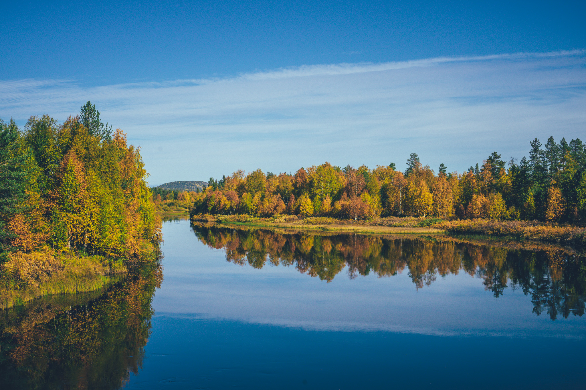
The area is also known for its high-quality fishing, with still good stocks of mid-size brown trout, grayling, and even arctic char populating the creeks and rivers. Where-ever possible, the route follows the river banks and anyway crosses often multiple streams a day, making the Korvatunturi Gravel Loop an ideal bikefishing route. The river sides also have multiple cooking shelters and laavus with often firewood provided free of charge, making riding and spending time by the water pleasant and comfortable. Assuming smelling like a campfire is your personal preferred essence.
The remoteness of the route is balanced by the high frequency of beautiful wilderness shelters, as well as two ‘wilderness centers’ as they are called in Finnish: Kairijoen Eräkeskus and Tulppion majat, with organized camping, lodging options, restaurant, and sauna. They also have some very basic food ingredients for sale, but it’s better to haul most of the food you need for the route from the starting point in Savukoski, minus the meals eaten at the wilderness centers, to be on the safe side.
The route also has an optional visit to Korvatunturi at the Finnish-Russian border area, on a partly rough quad track, seasoned with two great wilderness huts and a wilderness sauna, on the way.
- Endless windy gravel roads of the remote Eastern Lapland.
- Crystal clear rivers and creeks with good stocks of brown trout, grayling, and arctic char.
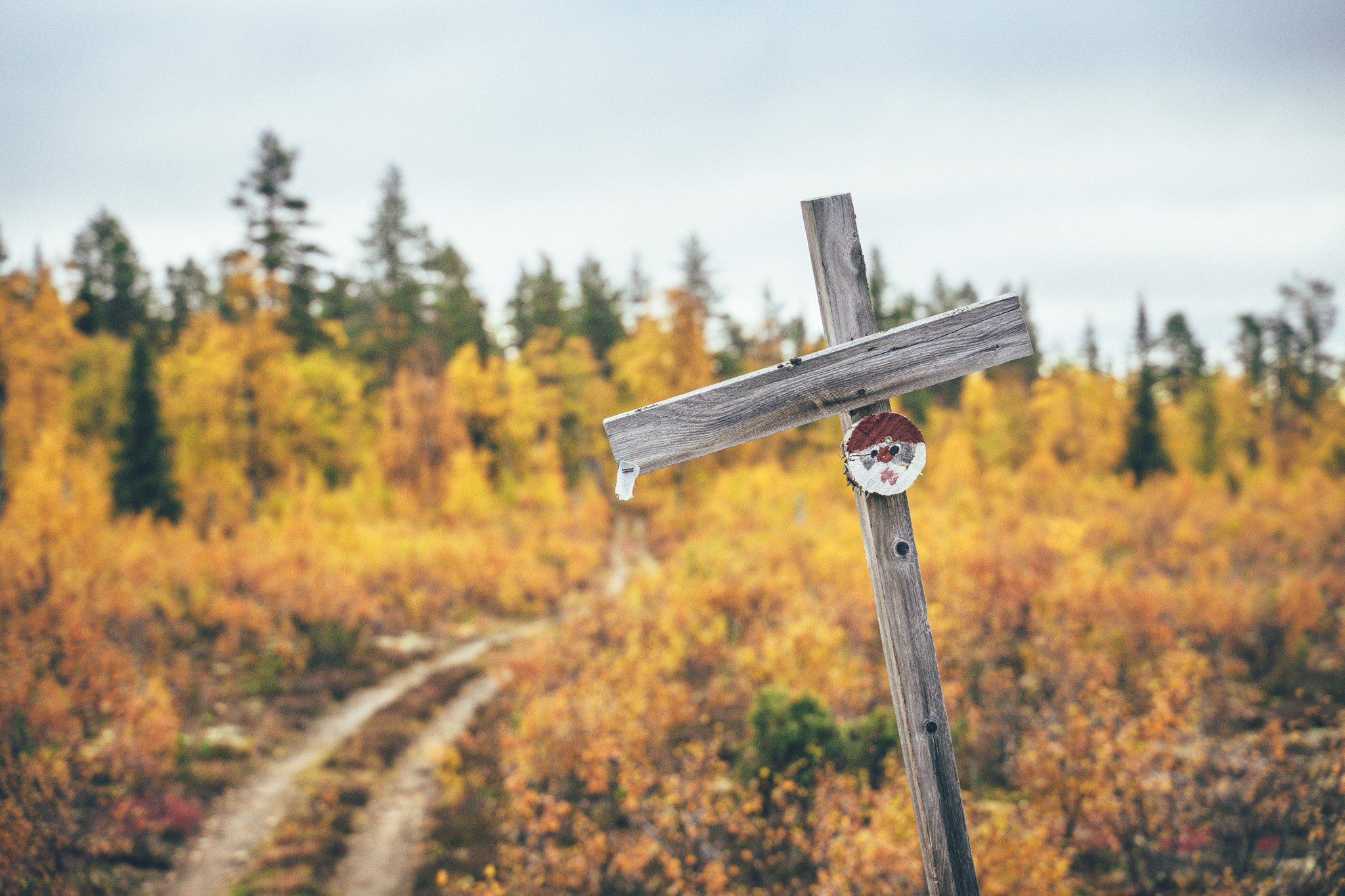
- Lots of wilderness shelters of different types and history.
- Detour to the Urho Kekkonen National Park on single and quad track in old-growth forest, leading to a wilderness sauna.
- Option to visit the remote Korvatunturi fell adding just a half-a-day hike to the plan.
- Wilderness oasis of Tulppio and Kairijoki, the few and only service centers quite literally in the middle of nowhere.
- Northern lights can be seen multiple times a week in autumn, if the sky is clear at night.
- The route is open from 8th of June till 21st of September, by the request of the local reindeer herding community. See more info on the Reindeer Herding & Route Opening Time info box above.
- The infamous Lappish räkkä (the high population of mosquitos, black flies, biting midges and horse flies) starts usually by late June and lasts usually till mid August) making the second week of June or mid-August till 21st of September the best time window to ride the route.
- The gravel routes in the arctic are usually open from early June after the routes have dried and hardened up after winter, to mid-October, when the winter sets in again. However, the climate crisis makes seasons more unpredictable than before so the season start and end can vary year to year by a couple of weeks.
- Making the detour to the Korvatunturi fell, cycling is allowed by the rules of the Urho Kekkonen National Park till Rakitsanajo turfhut, the remaining 9km (18km round trip) is by foot. Also, the trek requires a permit applied in advance as the fell is located in the Finnish-Russia border area. Check the municipality info on applying for permits for the trek.
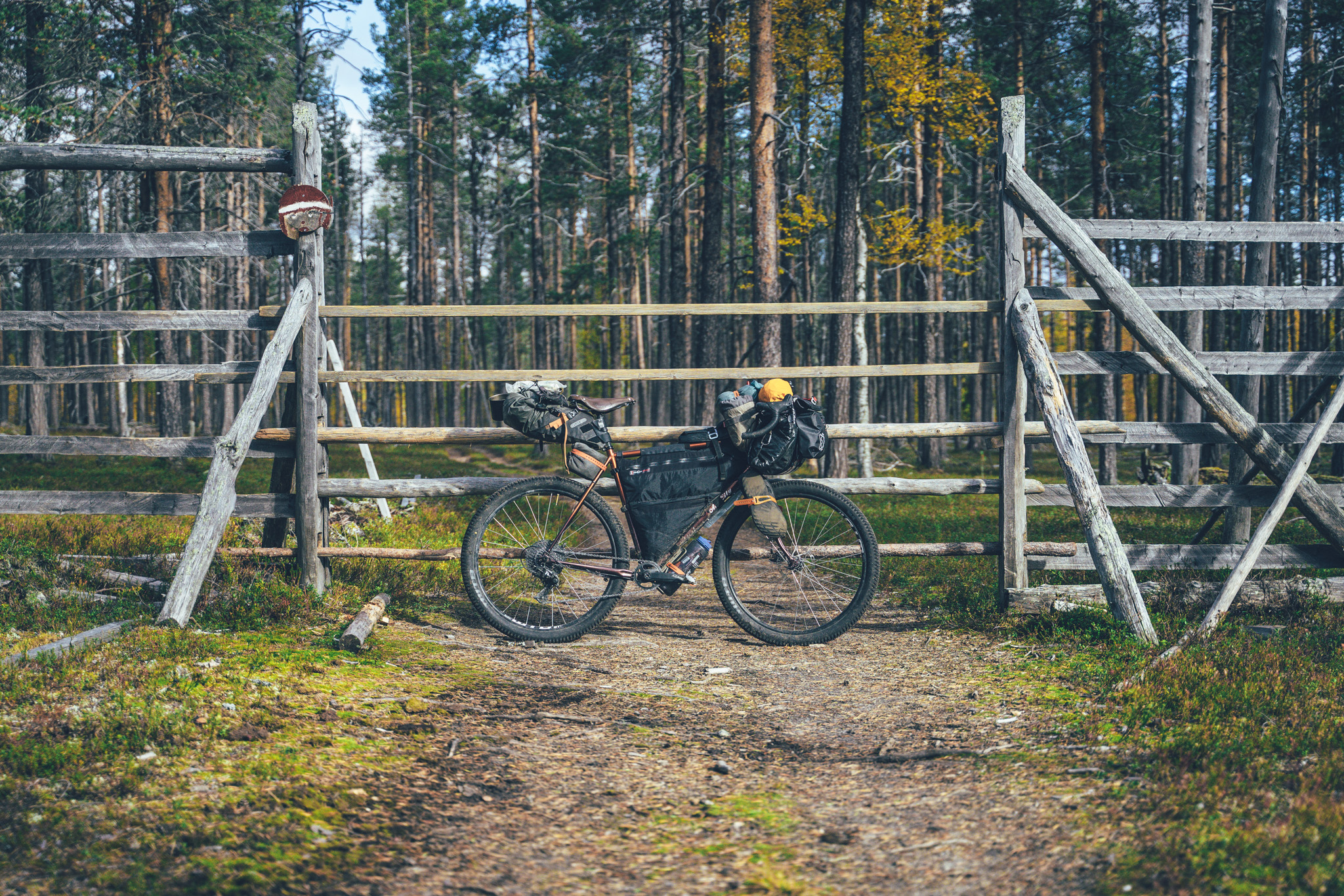
- The route can be ridden with any bike, as long as the tire size is a minimum of 40 mm and you have smaller gears as well. Experienced riders can, however, get away with a little smaller tires too, excluding the optional quad track and single track detour to the Urho Kekkonen National Park, where the bigger the volume the better.
- The route is not suitable for e-Bikes as there is no place to charge up the bike in the northern part of the route.
- The route is not Easy access due to two bridges (one 40cm wide and other made of logs with holes in between) on the way.
- Temperatures during the snowless season vary a lot and week-to-week but expect the spot-on daytime temperatures of 15-23 Celsius from mid-June to late August with nights in the range of 0-10 Celsius. Early June could be warm too but could be significantly colder as well. In late August and September, the temperatures start to drop significantly week by week and the first snow is not uncommon in late September. Especially late in the season, in late September and early October, be prepared for daytime temperatures of 5-10 Celsius and nights getting already below freezing.
- When choosing a sleeping bag, you should assume that the night temperatures can drop to 0 Celsius even during the mid-summer months and then even colder later the season gets. The classic -7 C/ 20 F sleeping bag works like a charm in Lapland, too, with the lower limit low enough for the late-season exploits.
- The midnight sun or “the nightless night” lasts from around 6 weeks in Southern Lapland to up to 3 months in Northern Norway. Getting used to the 24h sun can take a while to get used to…
- The best time to see the northern lights is roughly starting from September and as the nights get darker and longer towards the end of the season, chances are getting better week by week. It’s not uncommon to see the auroras multiple times a week at the end of the season, given that the weather gods are on your side and the sky is clear.
- The route has only digital navigation; for instructions and tips for successful navigation, see here.
- Always stay on the routes and aim to only use the recommended spots marked on the route map.
- The mobile phone network does not cover the whole route area: in case of an emergency, call 112 or use the 112 app, which automatically shares your location to the emergency services as well. It might be wise to carry a personal emergency beacon, especially when traveling alone.
- The route is located in a traditional reindeer herding area, please read more about the etiquette of traveling in the reindeer herding land here. Please respect any guidelines given for the route use or the use of reindeer herder’s cabins in the route description or on the map. Cooperation and respect for their needs and culture make having these routes publicly available possible.
- Bears, wolfs and wolverines are not an issue at all when wild camping as the arctic predators avoid human contact to all cost. There are practically no encounters, ever. Therefore, there is no need to have a bear bell on handlebars, bear safe food containers or hand your food in a tree for the night.
- The worst of the mosquito season lasts usually from around mid-June to late August, though luckily cycling speed is usually fast enough to keep them away when on the move. During the peak times, a net hat and long sleeve shirt and pants are recommended, if the temperatures allow. As the temperatures drop, the mosquitos disappear, making September (if not also early June, if the roads are dry enough) an ideal time for touring.
- Lodging is available in Tulppio, Kairijoki at Korvatunturin kotikontu, and there are organized campsites at Tulppio and Kairijoki with rental sauna available as well.
- Camping is allowed and free of charge along the route by All Man’s Rights in Finland, however, due to the fragile and slow-growing arctic flora, you should always aim to use only the campsites marked on the route map.
- Camping in the Urho Kekkonen National Park is allowed strictly only in the official camping areas of Vieriharju open wilderness hut and Rakitsanoja turf hut.
- Open wilderness huts and other wilderness shelters are a treat, but the rules of use are strict to make the system work. The last to arrive has the priority to stay overnight, so make space for people arriving after you. All the near-by-surroundings of the wilderness shelters operate as official camping grounds, to make the huts serve the most, and those the most in need, if you camp and use the hut only for cooking, socializing, and drying wet gear.
- Most of the recommended camping areas have publicly provided firewood available, however, there are some reindeer herder’s cabins and other non-publicly managed wilderness shelters where using the firewood is not allowed or you’re requested to make a little payment for what you use. See the shelter-specific instructions on the map. Collecting and making firewood from nature is strictly prohibited without the land owner’s permission.
- All the camp spots are next to a high-quality water source, unless stated otherwise - which is rare.
- There are only three restaurants on the whole route: Korvatunturin kotikontu, Tulppio, and Kairijoki. For the kotikontu, you need to book your meal in advance and for the other two, checking the opening times is recommended as well.
- You need most of the food for riding the loop as the restocking possibilities are limited. They sell some basic snacks and simple foodstuff in Tulppio and Kairijoki, though.
- Water is most of the time drinkable straight from streams, ponds, and lakes, but you never know if there is a reindeer carcass upstream, so better to be safe than sorry: water treatment is recommended.
- Sources of water are plentiful, so you’ll get away with carrying just 1 liter of water. The best spots for refills are marked on the route map.
- All the camp spots are next to a high-quality water source, unless stated otherwise - which is rare.
- Tap water is always drinkable in Finland and they are more than happy to fill your bottles in the service points
- When cooking in the camp, know that making a fire is strictly prohibited during the forest fire warming period.
- The route consists almost completely of easy gravel and forest roads, except of the detour to Korvatunturi fell, which is a partly rocky and rooty quad track. Especially on a gravel bike expect some hike-a-biking.
- In terms of technical difficulty, the route gets 4/10 without the detour and 6/10 with it. Physically speaking the route gets a grade of 6/10 if taken with the fairly laid-back pace described in the Trail Notes, despite the quite a hilly route.
- In terms of bikepacking challenge, covering the other areas such as the route difficulty (resupply, remoteness, lack of wilderness shelters, duration, etc.) the route is on the other tricky side because of the lack of resupplies and being extremely remote, but on the other hand, there are more wilderness shelter options than on any other route in the Arctic by Cycle Route Network. Therefore it is granted a 6/10 for the bikepacking challenge, forming a total grade of 6/10 as well.
- The trail can be ridden in both directions, but it’s nicer ridden counter-clockwise, having the last 23km of pavement is at the end of the route, where it feels great again after over 170km of occasionally rough gravel.
- Bikepacking is usually the more comfortable the less you carry, and that also applies to this route, at least partly, as there is at the end of the day quite a lot of climbing per day - at least on the Finnish scale. On the other hand, riding is non-technical, apart from the detour to the National Park, so the route is completely doable with a traditional rack & pannier setup as well with whatever gear you happen to have. As always, it's a treat to have small gears when touring, which makes some of the climbs of this route less strenuous as well.
- The recommended minimum tire size is 40 mm, but as some of the roads can be quite rough, going for wider rubber certainly makes riding more comfortable, if not quicker, as well. For the single track and quad track, MTB tires are a much better choice.
- Traveling to Savukoski from Helsinki can be done by first taking a train to either Rovaniemi (multiple times a day, 8.5 hours) or Kemijärvi (night train multiple times a week, 14 hours) and then taking a bus (2 hours from Kemijärvi, 3 hours from Rovaniemi) to Savukoski. You can book train tickets from vr.fi
- Rovaniemi airport is located a 3-hour bus ride away from Savukoski, making international arrival by flying (via Helsinki) easy.
- In-advance booking of bicycles for the bus rides is likely to be necessary to ensure the bike fits in the cargo hold. You can book bus tickets from matkahuolto.fi
- The route is connected to Pelkosenniemi-Savukoski Gravel Loop and the Central Lapland Gravel Loop, so riding this as a part of a longer tour makes the logistics straightforward, having Rovaniemi or Kemijärvi as a tour starting point.
Day 1, Savukoski to Leukkuhamara Cooking shelter camping area (59km, 969m of climbing)
The journey to Korvatunturi fell at the European & Russian border starts with an easy coast downstream on pavement, before turning north on gravel and eventually starting the first - and biggest climb of the whole Korvatunturi Gravel Loop. 340m ascent ends roughly at the Liittoselkä reindeer herding station, which offers a refuge for a break or a night, when not in use by the local reindeer herding community.
There’s an old campfire hut just a little further as well, though located on top of the highest fell of the area it’s reachable by bike as well, though not without hike-a-biking and occasional rock-to-rock-hopping. The way down to the next river and the old tiny village of Martti, consisting of just a couple of houses and a guesthouse, is flowy, fun, and quick. If you’re camping for the night, there’s just 20km more on quick and often smooth gravel to go to reach the Leukkuhamara Cooking Shelter camping area, which has plenty of room for tents. In the summer of 2021, there was a frame for a tent sauna as well, so in case you’re carrying a heavy-duty tarp…
Day 2, Leukkuhamara Cooking Shelter camping area to Tikkasen Vieriharju open wilderness hut (70km, 1220m of climbing)
Day two starts with a pretty pine forest gravel road back to a little larger, old logging road. The route passes some trout-rich rivers on the way and high-quality wilderness shelters are plentiful. The first rest stop of the day, at 18km, is Seurujoki cooking shelter, which works nicely for camping, but didn’t unfortunately have firewood in 2021. However, the Hirvikaltio open wilderness shelter at 37km might timing-wise work better for a lunch stop, unless you’ll continue to the first of the only two (!) service centers on the whole route: Tulppion Majat.
Gravel touring could not get much more remote than this, so the restaurant, cabins, organized camping, and saunas of the Tulppio are somewhat a miracle in this otherwise rarely-visited part of Lapland. The distance to Tulppio from Martti is around 75km, so if you’re relying on the luxury of lodges, the location is in the sweet spot in that sense too.
There are plenty of great spots for the night, but staying the night at Tikkasen Vieriharju gives you a little rest before the next day's single-track crawling & hike-a-biking if you’re planning to hit the detour.
Day 3, Tikkasen Vieriharju open wilderness hut to Vieriharju wilderness hut & sauna (25km and 230m of climbing by bike + a 18km round trip hike to the Korvatunturi fell)
The day three there are a couple of options: 1) skipping the detour to the Urho Kekkonen National park keeps the tour progressing nicely and avoid the hike-a-biking, 2) riding and hike-a-biking to Vieriharju open wilderness hut & sauna and spending there the night and 3) doing the full deal, rambling to the Rakitsanoja turf hut (continuing further by cycling not allowed) and making the trek to the Korvatunturi fell at the Russian border. The single track/quad track trail to the Rakitsanoja turf hut is fully rideable with a mountain bike, but only partly unrideable with a gravel rig, though the old-growth forests of the area are some of the prettiest in the whole Arctic, so slowing down is not necessarily a bad thing.
When I was there, I went for option two for the sake of the fantastic wilderness sauna by a river and a night in the Vieriharju open wilderness hut. Interested in option 3? Check the municipality info on applying for permits for the trek to the Finnish-Russian border area, where the Korvatunturi fell is located.
Day 4, Vieriharju open wilderness hut to Tuplama-auvakko open wilderness hut (73km & 1190m of climbing)
After the single track and quad track section out from the southern part of the Urho Kekkonen National Park the route follows some dream-like riverside double-track of the Kemijoki with some epic camping spots and cooking shelters on the way. The section is also fantastic for fly fishing, though within the tight local restrictions. Kuttusoja reindeer herder’s hut is a great spot for the night, if not in use by the local reindeer herding community.
Balancing the last two riding days, Tuplama-auvakko open wilderness hut sits roughly halfway, but the second oasis of the area, Kairijoen Eräkeskus (Kairijoki Wilderness Shelter) with a restaurant, cabins, organized camping, and sauna is just another 13km away, as well.
Day 5, Tuplama-auvakko open wilderness hut to Savukoski (69km, 900m of climbing)
From the Kairijoki Wilderness Center, the route directs to an old logging road closed for motorized vehicles, which makes a completely traffic-free shortcut toward the end of the route and Savukoski village. Fast and long gravel descent takes the route back to the lowlands and to a paved road, which makes the last 23km go by quickly as a contrast to the previous slow-going dirt and gravel.