


Arctic by Cycle: Jotka MTB Route
 48 km
48 km 1-2 days
 0m
0m -9999m
 100 %
100 % 100 %
100 % 4
4 97 %
97 %
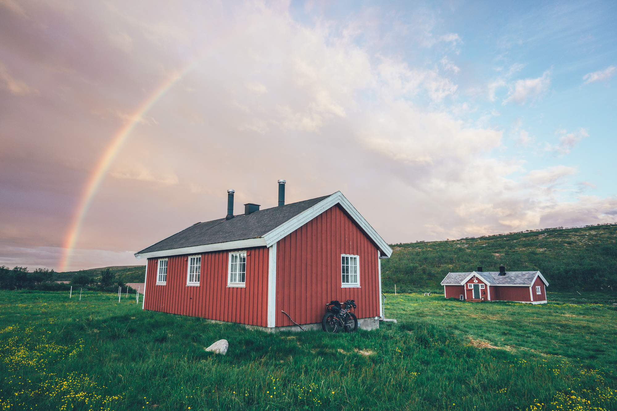
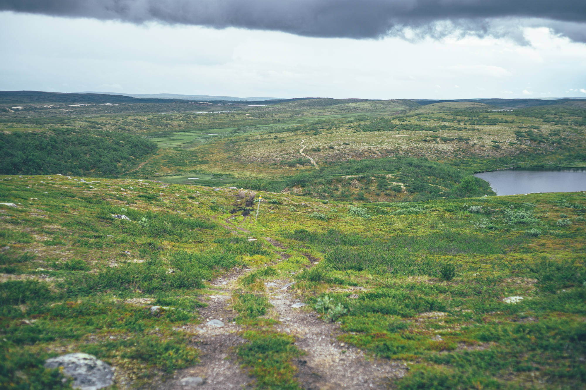
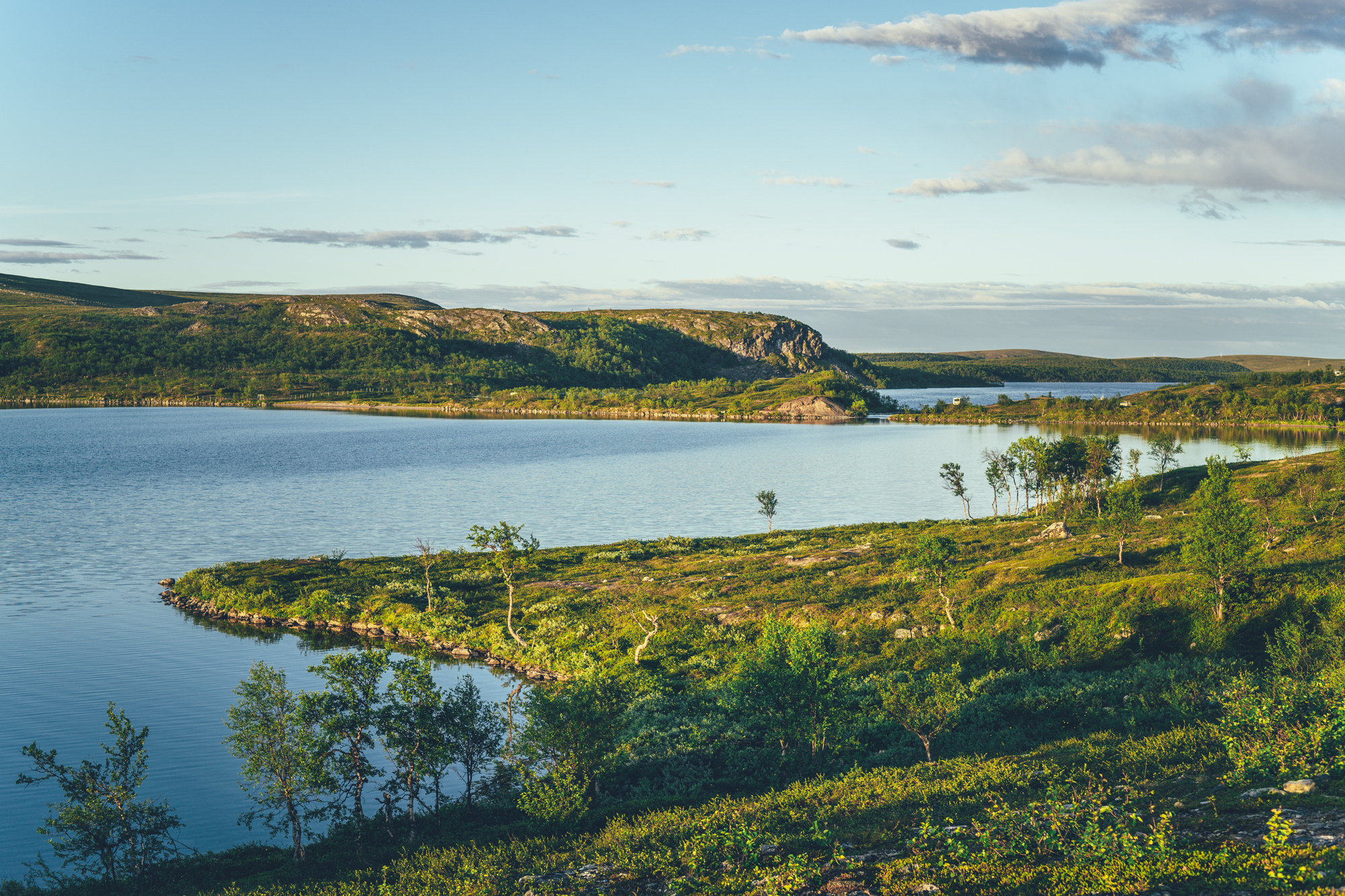
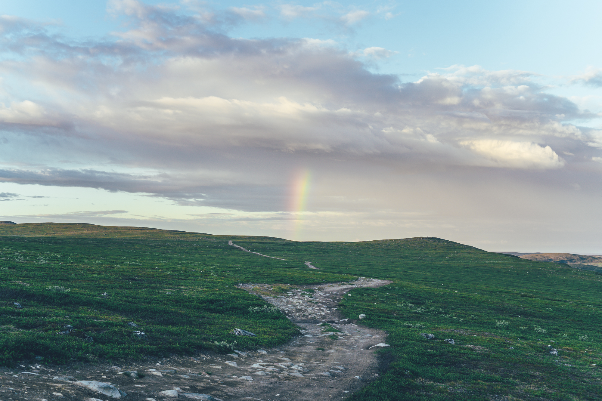
This little connecting route across the Finnmark plateau can be ridden in a day, but you get the most out of the beautiful open landscapes by spending the night along the way in the Ragesluobbalat fjellstue (no services, simple wilderness-style hut with firewood, which can be rented for the night with NOK from the old couple living next door. If you’ll sleep at the hut, the first day makes it only 35km, but the rough quad track makes sure it won’t be the easiest 35km of your life. If you’re camping for the night, a great option is to camp by the crossing of the River Ragesjohka, which has a nice flat area to camp on the north side of the river. World-class grayling and arctic char fishing in the area, so anglers can easily spend a week hopping from the river to river in the area…
NOTE! There are three river crossings on the Jotka trail, making the route possibly impossible to do in early and mid-June when the water levels are high. The crossings can be challenging for inexperienced later on in the season as well, so get on this route only, if you are confident in carrying a fully loaded bicycle knee-deep in swift current.
The route ends on some softer and wetter surfaces to the main road between Kautokeino and Karasjoki. The Suossjavri fjellstue, a wilderness rental hut-style lodge is located just 5km east of the trailhead and it’s a great spot for the night, and great value too. The old couple managing the hut speaks Sami, Norwegian and Finnish, but they can be contacted in advance in English too through their Facebook page or by email at [email protected] for in-advance bookings, though not always necessary. Euros and NOK accepted.
The Alta-Kautokeino-Karasjok bus stops at Suossjavri as well, which makes it possible to cross the Finnmark plateau from Alta all the way here on single track and quad track, and then catch a bus back to the starting point.
- Deep wilderness crossing from the Jotka fjellstue to Suossjavre fjellsute on single and quad track on magnicicant Finnmark highland
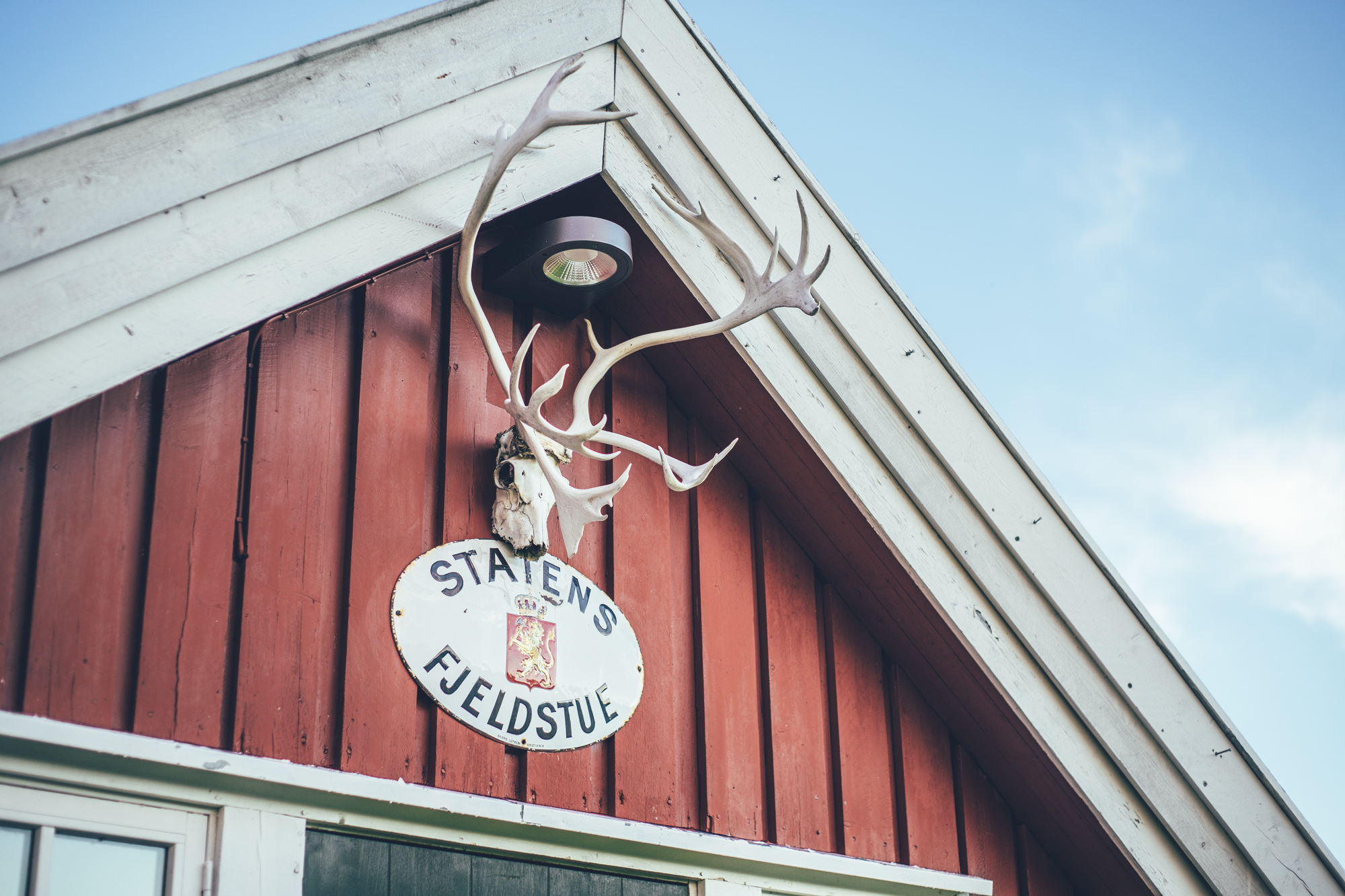
- Jotka fjellstue is an oasis in the wilderness with local delicacies, a well-kept old mountain lodge, a sauna as well as beer and wine. Especially their breakfast with self-cold-smoked arctic char from the lake next door is hard to beat…
- World-class fishing of grayling, arctic char, and brown trout make the area ideal for bikefishing
- Smart shortcut on a longer all-terrain arctic tour avoids the need to visit Kautokeino, on the way from Alta to the northernmost part of Finland.
- Northern lights can be seen multiple times a week in autumn, if the sky is clear at night.
- The MTB routes in the arctic are usually rideable from early July, when the trails are dry enough to ride again after the winter, to early October, when the winter usually sets in again. However, the climate crisis makes seasons more unpredictable than before so the season start and end can vary year to year by a couple of weeks.
- The infamous arctic räkkä (the high population of mosquitos, black flies, biting midges and horse flies) starts usually by late June and lasts usually till mid August, making the mid-August till October ideal time to ride the route.
- Completing the route safely requires good physical fitness and moderate mountain biking and bikepacking skills, therefore it is not for everyone
- There are two potentially tricky river crossings on the route, especially early and late in the season. There is an alternative route, which is safe, but wet and swampy. Avoid the route after multiple days of rain, even in the middle of the summer.
- The route is ideally ridden with a mountain bike with as big tires as you can fit and a full suspension rig or a fatbike, in that matter, is not overkill at all in this route.
- The route is not recommended for e-Bikes because of the two river crossings on the way. Though charging the battery is possible at Suossjavri fjellstue and Jotka fjellstue.
- The route is not Easy access due to it's single track spirit.
- Small gears are highly recommended, though the climbs are not long on the route
- Temperatures during the snowless season a lot and week-to-week but expect the spot-on daytime temperatures of 15-23 Celsius from mid-June to late August with nights in the range of 0-10 Celsius. Early June could be warm too but could be significantly colder as well. In late August and September, the temperatures start to drop significantly week by week and the first snow is not uncommon in late September. Especially late in the season, in late September and early October, be prepared for daytime temperatures of 5-10 Celsius and nights getting already below freezing.
- When choosing a sleeping bag, you should assume that the night temperatures can drop to 0 Celsius even during the mid-summer months and then even colder later the season gets. The classic -7 C/ 20 F sleeping bag works like a charm in Lapland, too, with the lower limit low enough for the late-season exploits.
- The midnight sun or “the nightless night” lasts from around 6 weeks in Southern Lapland to up to 3 months in Northern Norway. Getting used to the 24h sun can take a while to get used to…
- The best time to see the northern lights is roughly starting from September and as the nights get darker and longer towards the end of the season, chances are getting better week by week. It’s not uncommon to see the auroras multiple times a week at the end of the season, given that the weather gods are on your side and the sky is clear.
- The route has only digital navigation; for instructions and tips for successful navigation, see here.
- Always stay on the routes and aim to only use the recommended spots marked on the route map.
- The mobile phone network does not cover the whole route area: in case of an emergency, call 112 or use the 112 app, which automatically shares your location to the emergency services as well. It might be wise to carry a personal emergency beacon, especially when traveling alone.
- The route is located in a traditional reindeer herding area, please read more about the etiquette of traveling in the reindeer herding land here.
- Bears, wolfs and wolverines are not an issue at all when wild camping as the arctic predators avoid human contact to all cost. There are practically no encounters, ever. Therefore, there is no need to have a bear bell on handlebars, bear safe food containers or hand your food in a tree for the night.
- The worst of the mosquito season lasts usually from around mid-June to late August, though luckily cycling speed is usually fast enough to keep them away when on the move. During the peak times, a net hat and long sleeve shirt and pants are recommended, if the temperatures allow. As the temperatures drop, the mosquitos disappear, making September (if not also early June, if the roads are dry enough) an ideal time for touring.
- Jotka fjellstue and Suossjavre fjellstue are great places to spend the night, naturally
- There are a couple of great spots to camp along the way, usually by a river
- Ragesluobbalat fjellstue is a simple rental hut with sleeping platforms for a couple of people and a stove 10km before reaching the end of the route. An old couple living next door rents it out (NOK cash only).
- Camping is allowed and free of charge along the route by All Man’s Rights in Finland and Norway, however, due to the fragile and slow-growing arctic flora, you should always aim to use only the campsites marked on the route map.
- All the camp spots are next to a high-quality water source unless stated otherwise.
- The grocery stores for restocking are located in Hetta, Kautokeino, and Maze, meaning you need to be able to carry 3 days of food in the first part of the route and then a little less afterward
- There are restaurants or cafés available in Jerisjärvi, Pallas, Hetta, Kautokeino, Maze and Jotka fjellstue
- Water is most of the time drinkable straight from streams, ponds, and lakes, but you never know if there is a reindeer carcass upstream, so better to be safe than sorry: water treatment is recommended.
- Sources of water are plentiful, so you’ll get away with carrying just 1-2 liters of water. The best spots for refills are marked on the route map.
- All the camp spots are next to a high-quality water source, unless stated otherwise - which is rare.
- Tap water is always drinkable and locals are happy to fill your bottle
- When cooking in the camp, know that making a fire is strictly prohibited during the forest fire warming period.
- The route is partly technical and slow-going on the rocky, occasionally technical double track, granting the route a grade of 7/10 of technical difficulty. The poor condition trails combined with continuous little up and down, make the route a little physical too, earning a grade of 7/10 for the physicality as well, overall difficulty rating of the route being similarly 7/10 despite its challenging nature.
- The route is ideally ridden with a mountain bike with as big tires as you can fit and a full suspension rig or a fatbike, in that matter, is not overkill at all in this route. The route was scouted with a fatbike, which worked like a charm and made riding on the most difficult terrain rather easy and comfortable.
- Bikepacking is usually the more comfortable the less you carry, and that is true on this route as well. The lighter you go, the easier and faster cycling gets and riding is partly technical and climbs steep and long. The route is not recommended to be attempted with a traditional touring setup with panniers.
- The route can be linked to the Arctic Post Road MTB Route, making it a shortcut toward the northernmost part of Finland on a longer tour
- The Jotka Lakes’ parking lot can be reached by car as well from the 16th of June till the 30th of September when the road to the highland from Alta is open for traffic
- From Suossjavre fjellstue, there is a bus connection to Karasjok, Kautokeino, Maze, and Alta, which can be creatively used to take advantage of this route. For instance, you can ride Maze-Jotka-Suossjavre and then take the bus back to Maze, or start from Alta and ride Alta-Jotka-Suossjavre, and then catch a bus back to Alta.
- There are daily flights to Alta from multiple destinations, making arriving in Alta abroad easy.
It seems a little odd and lonely stretch of trail, but it earns its place on the Arctic by Cycle as a logical shortcut as a part of a longer arctic tour that visits Alta and simply just being a wonderful 50km mountain biking trail with fantastic fishing of grayling, arctic char and brown trout.
It could be also combined with the Jotka-Alta section of the Arctic Post Road MTB Route, making a 116km Finnmark highland traverse from Alta to Suossjavre. Like the Arctic Post Road MTB Route, similarly, the Jotka Trail requires good physical fitness and moderate mountain biking and bikepacking skills. Though it can be done as a day ride as well, making going lighter, easier, and faster, too. The route is ideally ridden with a mountain bike with as big tires as you can fit and a full suspension rig or a fatbike, in that matter, is not overkill at all in this route.
Read more about what the route has to offer as well as our take on riding the route in the Trail notes below…