


 1148 km
 13-16 days
 6306m
6306m 365m
365m 80 %
80 % 2 %
2 % 5
5 99 %
99 %The Lapland covers nearly a third of Finland, the total area being over 100 000 km2, being roughly three times the size of Belgium. Yet, the population of the Lapland area is less than 200 000 people, there are even more reindeer in the area. There are some basic services available in the villages as well as some higher quality lodging and restaurant options in the more touristy area, but they are usually far apart from each other. Partly by this, there is the highest density of wilderness shelters, such as open wilderness huts, campfire huts, and lean-tos anywhere on the planet. There are over 2000 wilderness shelters in the Lapland area alone, which have for centuries been providing shelter, protection, and comfort for travelers, hikers, fishermen, hunters, and reindeer herders. By bikepacking, the Lappish services and wilderness shelters can be linked into multi-day and multi-week bikepacking routes, offering a unique experience of remote wilderness riding, but still within the safety and comfort provided by the shelters and villages on the way.
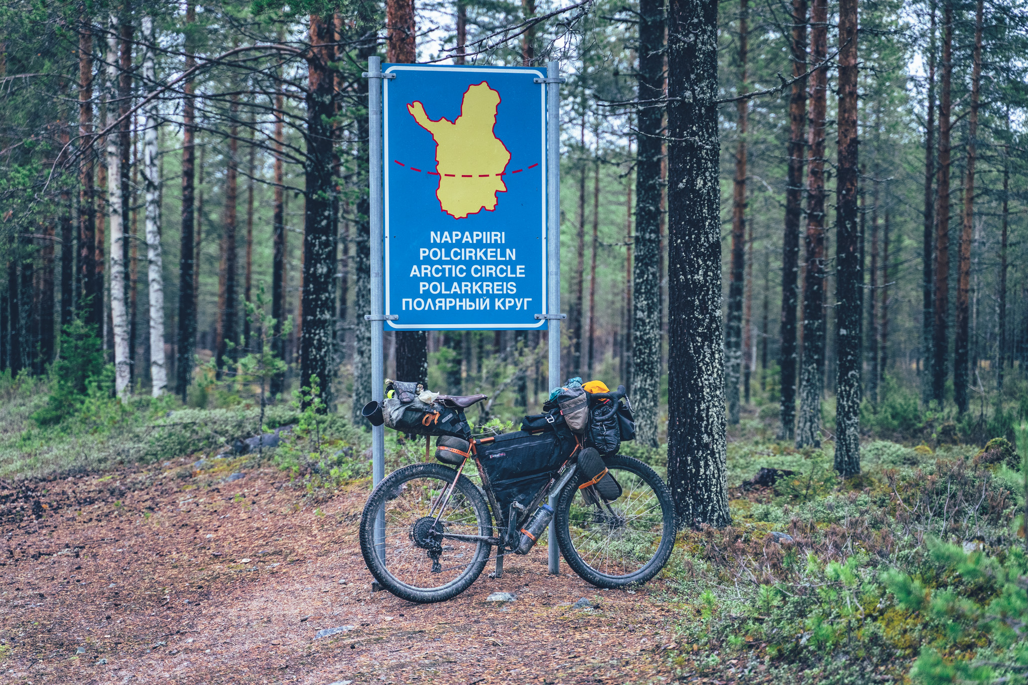
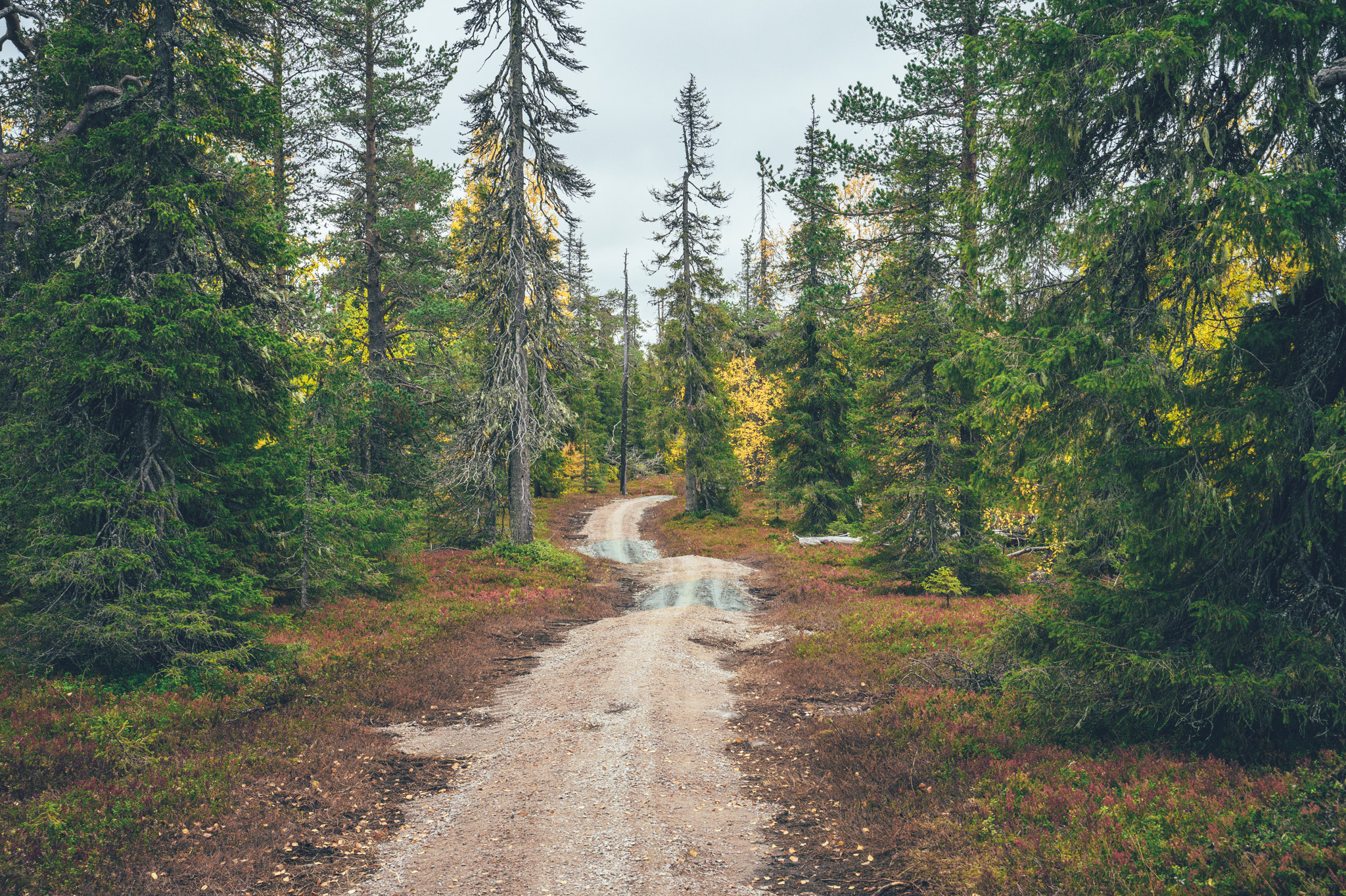
In the Central Lapland area, which is completely covered by mostly thick arctic taiga forest of slow-growing European pine, European and Siberian Spruce, and birch, there is no better way to experience nature and the nature- and outdoor-focused culture than by bikepacking. The 1100km and 13-16 day Central Lapland Gravel Loop offers a wide selection of various types of Central Lapland nature and culture along some rugged and partly extremely remote gravel roads, visiting the national parks, villages, and natural sights along the way. There are 60 wilderness shelters on the route as well, making touring comfortable and safe, even when the elements turn against you.
The route is partly compiled of segments of the shorter bikepacking routes in the area, some published for 2022 and some upcoming for 2023, but especially the north part of the route is a stretch used for purposes of this route only – and for a reason. While the route segments of Santa’s Western Gravel Loop, Savukoski-Pelkosenniemi Gravel Loop and Korvatunturi Gravel Loop have frequent services along the way, the northern segment has barely anything at all. There are no proper restocking possibilities on a 480km section of the route, between Savukoski and Kittilä, making this route suitable for experienced bicycle tourers only.
If no grocery stores, however, there are two full-service wilderness centers as well as an organized campsite on the way through, most of them selling simple foodstuff for travellers and providing meals in their restaurants. Additionally, there is a grocery store around halfway across the 480km stretch 23km off-route, so with a 46km detour, you cut the amount of food needed to be carried in half. Anyway, the route is logistically much more complicated than any other of the Arctic by Cycle bikepacking routes and it’s easily the most challenging gravel route of the whole route network.
Read more about the characteristics of this route as well as the suggested daily rhythm for tackling the route in the Trail notes below.
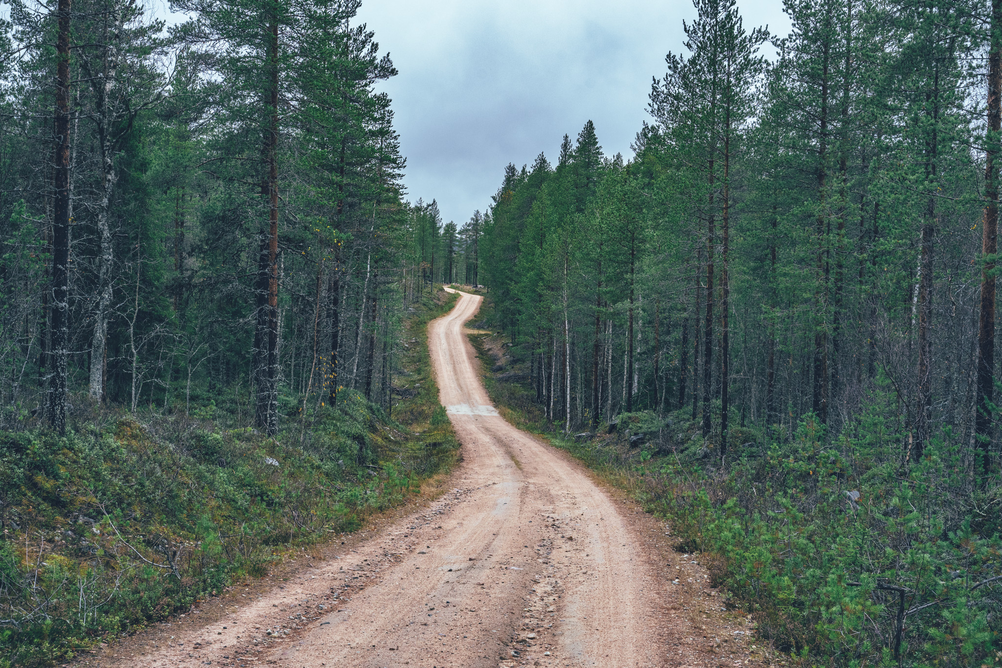
- Over 900km of mostly remote gravel and dirt roads in the Central Lapland area
- 60 wilderness shelters along the route, providing safety, comfort, and Lappish history
- Frequent services of restaurants and lodges in one part of the route, balanced by not many services at all on the north part of the route…
- Tackling the challenge of not having many possibilities to restock on the north part of the route at all
- Visiting the National Parks of Pallas-Yllästunturi and Urho Kekkonen, with an optional detour of adding the Pyhä-Luosto National Park MTB Loop to the tour as well
- Easy access to the route by train either to Rovaniemi, Pello, or Kolari, with multiple bail points by bus back to Rovaniemi as well.
- Northern lights can be seen multiple times a week in autumn, if the sky is clear at night.
- The route is open from the 1st of July till the 15th of September, by the request of the local reindeer herders on the north part of the route. For other parts, follow segment-specific guidelines in the respective route descriptions. Regarding the segment of Rovaniemi-Kemijärvi-Pelkosenniemi, there are no restrictions, thouh. See more info on the Reindeer Herding & Route Opening Time info box above.
- The infamous Lappish räkkä, (the high population of mosquitos, black flies, biting midges and horse flies) starts usually by late June and lasts usually till mid August, making the mid-August till the 15th of September the best window to ride the route. Late season is also great for seeing auroras borealis, which can be seen multiple times a week, given that the sky is clear at night.
- The trail can be ridden with any bike, as long as the tire size is a minimum of 40 mm and you also have smaller gears as well. However, on the detour to Urho Kekkonen National Park, the access trail to Miekojärvi camping spots, and a couple of rougher sections, bigger tire makes you more comfortable and riding less technically demanding.
- The route not suitable for e-Bikes because of the long service gap on the west leg of the route.
- The route is Easy access if you skip the loop to Kemihaara and Korvatunturi area, which has two narrow bridges not passable with a trailer or wider bicycle without carrying.
- Temperatures during the snowless season a lot and week-to-week but expect the spot-on daytime temperatures of 15-23 Celsius from mid-June to late August with nights in the range of 0-10 Celsius. Early June could be warm too but could be significantly colder as well. In late August and September, the temperatures start to drop significantly week by week and the first snow is not uncommon in late September. Especially late in the season, in late September and early October, be prepared for daytime temperatures of 5-10 Celsius and nights getting already below freezing.
- When choosing a sleeping bag, you should assume that the night temperatures can drop to 0 Celsius even during the mid-summer months and then even colder later the season gets. The classic -7 C/ 20 F sleeping bag works like a charm in Lapland, too, with the lower limit low enough for the late-season exploits.
- The midnight sun or “the nightless night” lasts from around 6 weeks in Southern Lapland to up to 3 months in Northern Norway. Getting used to the 24h sun can take a while to get used to…
- The best time to see the northern lights is roughly starting from September and as the nights get darker and longer towards the end of the season, chances are getting better week by week. It’s not uncommon to see the auroras multiple times a week at the end of the season, given that the weather gods are on your side and the sky is clear.
- The route has only digital navigation; for instructions and tips for successful navigation, see here.
- Always stay on the routes and aim to only use the recommended spots marked on the route map.
- The mobile phone network does not cover the whole route area: in case of an emergency, call 112 or use the 112 app, which automatically shares your location to the emergency services as well. It might be wise to carry a personal emergency beacon, especially when traveling alone.
- The route is located in a traditional reindeer herding area, please read more about the etiquette of traveling in the reindeer herding land here. Please respect any guidelines given for the route use or the use of reindeer herder’s cabins in the route description or on the map. Cooperation and respect for their needs and culture make having these routes publicly available possible.
- Bears, wolfs and wolverines are not an issue at all when wild camping as the arctic predators avoid human contact to all cost. There are practically no encounters, ever. Therefore, there is no need to have a bear bell on handlebars, bear safe food containers or hand your food in a tree for the night.
- The worst of the mosquito season lasts usually from around mid-June to late August, though luckily cycling speed is usually fast enough to keep them away when on the move. During the peak times, a net hat and long sleeve shirt and pants are recommended, if the temperatures allow. As the temperatures drop, the mosquitos disappear, making September (if not also early June, if the roads are dry enough) an ideal time for touring.
- There is lodging and organized campsites with sauna available frequently most of the route, but less so in the north part of the route
- Camping is allowed and free of charge along the route by All Man’s Rights in Finland, however, due to the fragile and slow-growing arctic flora, you should always aim to use only the campsites marked on the route map.
- Camping in the Pallas-Yllästunturi National Park and Urho Kekkonen National Park is allowed strictly only in the official camping areas
- Open wilderness huts and other wilderness shelters are a treat, but the rules of use are strict to make the system work. The last to arrive has the priority to stay overnight, so make space for people arriving after you. All the near-by-surroundings of the wilderness shelters operate as official camping grounds, so the huts serve the most, and those the most in need, if you camp and use the hut only for cooking, socializing, and drying wet gear.
- Most of the recommended camping areas have publicly provided firewood available, however, there are some reindeer herder’s cabins and other non-publicly managed wilderness shelters where using the firewood is not allowed or you’re requested to make a little payment for what you use. See the shelter-specific instructions on the map. Collecting and making firewood from nature is strictly prohibited without the land owner’s permission.
- All the camp spots are next to a high-quality water source unless stated otherwise.
- There are frequently grocery stores and restaurants on the west part of the route (Kittilä-Äkäslompolo-Pello-Rovaniemi), the south part of the route (Rovaniemi-Kemijärvi), and the eastern part of the route (Savukoski & Korvatunturi area)
- There are no grocery stores for 480km and just a few restaurants on the north part of the route, requiring you to carry food for up to a week, or with a 46km detour to a shop, for multiple days anyway.
- Water is most of the time drinkable straight from streams, ponds, and lakes, but you never know if there is a reindeer carcass upstream, so better to be safe than sorry: water treatment is recommended.
- Sources of water are plentiful, so you’ll get away with carrying just 1-2 liters of water. The best spots for refills are marked on the route map.
- All the camp spots are next to a high-quality water source, unless stated otherwise - which is rare.
- Tap water is always drinkable in Finland and the locals are more than happy to fill your bottles
- When cooking in the camp, know that making a fire is strictly prohibited during the forest fire warming period. See the local restrictions here
- In terms of technical difficulty, the route is mostly easy riding on various conditions of gravel and dirt roads, which grants the route a grade of 4/10. Considering physical difficulty, the route does not stand out from the other arctic bikepacking routes and the daily riding is not too strenuous, if you just pace your progress right. Though here the long-distance easily piles physical stress over the weeks. That considered the route is granted 7/10 of its physical challenge.
- In terms of bikepacking challenge, covering the other areas increases the route difficulty (resupply, remoteness, lack of wilderness shelters, duration, etc.) the route on the challenging side, is rated 8/10 in that, forming a total difficulty rating of 8/10.
- The trail can be ridden in both directions, but it’s nicer ridden counter-clockwise, having the last 23km of pavement at the end of the route, where it feels great again after over 170 of occasionally rough gravel.
- Bikepacking is usually the more comfortable the less you carry, and that also applies to this route, at least partly.
- On the other hand, riding is non-technical, so apart from the few short sections, the route is completely doable with a traditional rack & pannier setup as well with whatever gear you happen to have. As always, it's a treat to have small gears when touring, which makes some of the climbs of this route less strenuous as well.
- The recommended minimum tire size is 40 mm, but as some of the roads can be quite rough, going for wider rubber certainly makes riding more comfortable, if not quicker, as well. For the single track and quad track, detour mtb tires are a much better choice, obviously, but they count only a fraction of the route.
- There are train connections to Rovaniemi (8.5 hours from Helsinki during the day or 12 hours night train) multiple times a day and a night trains to Pello and Kolari (13-16 hours from Helsinki) as well as Kemijärvi and Misi multiple times a week. You can book train tickets from vr.fi
- Bus connection is good to different parts of the route from Rovaniemi and Kemijärvi, though in-advance booking for a bicycle for the bus rides is likely to be necessary to ensure the bike fits in the cargo hold. You can book bus tickets from matkahuolto.fi
- Booking a spot for a bike well in advance is highly recommended for the overnight train to Pello & Kolari, though there are multiple trains a day to Rovaniemi, which solves the bottleneck problem on this route
- Flying in is easy too, with airports in Rovaniemi and Kittilä with multiple flights a day from Helsinki
- The route is connected to the Arctic Post Road (MTB and Gravel Version), Ylläs-Levi MTB Route, Santa's Western Gravel Loop, Korvatunturi Gravel Loop and Savukoski-Pelkosenniemi Gravel Loop
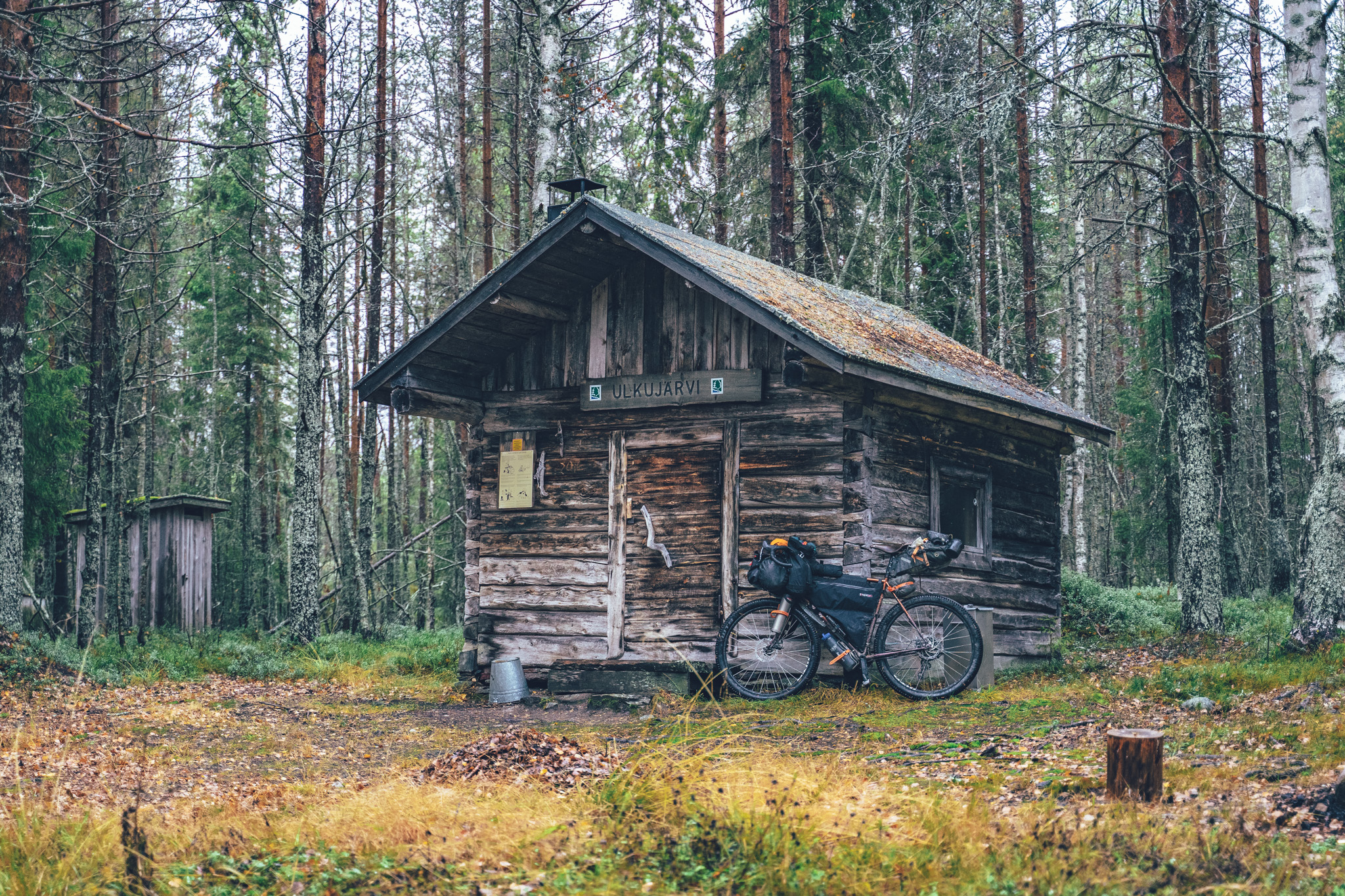
Day 1, Rovaniemi city to Ulkujärvi open wilderness hut (65km, 735m of climbing)
After crossing the great River Kemi, the route starts with a gentle climb to Ounasvaara recreational area and over the fell on gravel surfaced cycling paths. The only café on the way is located 23km into the route before the route dives into mixed roughness forest roads toward and roughly halfway to Kemijärvi city reaches the Ulkujärvi open wilderness hut. The old traditional-style wilderness hut is located at the shore of the clear-watered Ulkujärvi with space to camp as well. Iso-Herajärvi lean-to is located just a few kilometers further and it’s nicely located just a few meters from the shore, but has car access and lacks a suitable camping area - apart from the gravel parking lot. Additionally, the restaurant and lodge of Wanha Kaivoskylä (Old Mining village) are located as well only 27km further, making it fantastically located between the cities, in deep wilderness.
Day 2, Ulkujärvi open wilderness hut to Kemijärvi city (77km, 610m of climbing)
Beautiful small gravel roads continue through the day two, Vanha Kaivoskylä restaurant & lodge making a great late breakfast or early lunch spot on the way to Kemijärvi City. Tunturijärvi lean-to after 45km is a great place for an afternoon break with firewood provided as well, by a beautiful wilderness pond. The roughest stretch of the day is located just before reaching the city, though well doable with a gravel rig still, despite some bigger boulders here and there. Full set of services in the Kemijärvi city, obviously.
Day 3, Kemijärvi city to Pyhätunturi (90km, 750m of climbing)
The route from Kemijärvi onwards starts on the city cycling paths and manages to avoid the rather busy Road 5 apart from a couple of kms before taking a long-ish gravel detour west. The detour off the main road is 55km with one decent campfire hut and some nice gravel sections on the way, and it clocks around 450m of climbing. There will be a shortcut to reach Pyhä directly from these forests, but for now, the route returns again to the mainroad. It’s a half a day sidetour, but at least in terms of safety, it’s worth the extra effort. Also, the Tapionniemi kyläkartano is on the route, which is a village association run village house offering accommodation and summer time café. After Tapionniemi, there is a 8 km section on the Road 5, before turning toward Pyhä-Luosto National Park and the services of the Pyhä holiday village.
Anticipating some future route developments in the Pyhä area the route between Kemijärvi and Pelkosenniemi has now (9/2023) been moved to the west side of the River Kemi. This puts the services of the holiday village of Pyhä on the map and also for this route, gives a better access to the Pyhä-Luosto National Park, if you decide to visit there. However, the earlier route on the east side of the River Kemi via the Rentukka open wilderness hut still works as an completely traffic-free route alternative. Also, half is it is really pretty. See the route alternative on the map here.
Day 4, Pyhätunturi to Tarkkala wilderness farm (85km, 850m of climbing)
Around half of the day two is on pavement, creating some good momentum especially in the morning. 23 km in there is a gas station restaurant and a grocery store in the village of Pelkosenniemi. From there the route stays a while longer on the paved route before diving into the backwoods of the Pelkosenniemi-Savukoski area. Narrow and pleasant gravel roads lead eventually to the old Tarkkala wilderness farm, which miraculously survived the saboutash of the Nazi’s in the end of the WW2. The farm is one of the few traditional wooden farm buildings that was not burned down and the main building, barn and the riverside sauna has been renovated for the public use. The Tarkkala farm area functions as a public free campsite with a treat of the riverside sauna for a fee. Sauna can be booked from the online booking system, which gives you the key locker number code after the payment.
Day 5, Tarkkala wilderness farm to Savukoski (26km, 300m of climbing)
On day five there is only a few hours of riding to Savukoski village to rest a little, do a huge restock and set the plans for the following more challenging week ahead with very limited restocking possiblities The Samperin savotta has great lodging, restaurant and sauna for the night, though they rent the cabins of the nearby camping as well. There is no grocery store on the route for the next 480 kilometers, the next one is located in Western Lapland in Kittilä. The spots to get food on the 480km stretch are Korvatuntrin kotikontu (only with an in-advance booking), Tulppion Majat (restaurant & maybe some basics food ingredients), Kairijoen eräkeskus (restaurant & maybe some basic food ingredients), Kiveliön kala (restaurant & smoked fish for sale) and that’s it. Apart from the restaurant meals, you need to be able to carry food for the whole stretch, unless there is something available at Tulppio, Kairijoki and you stock up on smoked fish at Kiveliön kala.
Unless you are able to load enough food and stick with the pace you committed to reaching Kittilä before you run out of your staples, there is a Plan B luckily as well. The supermarket K-Valinta Sieppi in the village of Vuotso is located 23km off-route along the way the Road 4, the main road to the most northern part of Finland. The detour is doable by half a day on the bike with some lorries and holidaymakers sharing the route with you, or by hitch-hiking both ways, to get some rest for the following miles ahead and having a chat with some curious Finns. Take into account the limited opening hours of the grocery store (in 6/2022 till 6pm on weekdays and till 2pm during weekends).
Day 6, Savukoski to Leukkuhamara Cooking shelter camping area (59km, 969m of climbing)
The journey to Korvatunturi fell at the European & Russian border starts with an easy coast downstream on pavement, before turning north on gravel and eventually starting the first - and biggest climb of the whole Korvatunturi Gravel Loop. 340m ascent ends roughly at the Liittoselkä reindeer herding station, which offers a refuge for a break or for a night, when not in use by the local reindeer herding community.
There’s an old campfire hut just a little further as well, though located on top of the highest fell of the area it’s reachable by bike as well, though not without hike-a-biking and occasional rock-to-rock-hopping. The way down to the next river and the old tiny village of Martti, consisting of just a couple of houses and a guesthouse, is flowy, fun, and quick. If you’re camping for the night, there’s just 20km more on quick and often smooth gravel to go to reach the Leukkuhamara Cooking Shelter camping area, which has plenty of room for tents. In the summer of 2021, there was a frame for a tent sauna as well, so in case you’re carrying a heavy-duty tarp…
Day 7, Leukkuhamara Cooking Shelter camping area to Tikkasen Vieriharju open wilderness hut (70km, 1220m of climbing)
Day two starts with a pretty pine forest gravel road back to a little larger, old logging road. The route passes some trout-rich rivers on the way and high-quality wilderness shelters are plentiful. The first rest stop of the day, at 18km, is the Seurujoki cooking shelter, which works nicely for camping, but didn’t unfortunately have firewood in 2021. However, the Hirvikaltio open wilderness shelter at 37km might timing-wise work better for a lunch stop, unless you’ll continue all the way to the first of the only two (!) service centers on the whole route: Tulppion Majat.
Gravel touring could not get much more remote than this, so the restaurant, cabins, organized camping, and saunas of the Tulppio are somewhat a miracle in this otherwise rarely-visited part of Lapland. The distance to Tulppio from Martti is around 75km, so if you’re relying on the luxury of lodges, the location is in the sweet spot in that sense too.
There are plenty of great spots for the night, but staying the night at Tikkasen Vieriharju gives you a little rest before the next day's single-track crawling & hike-a-biking if you’re planning to hit the detour.
Day 8, Tikkasen Vieriharju open wilderness hut to Vieriharju wilderness hut & sauna (25km and 230m of climbing by bike + voluntary hike to the Korvatunturi fell adds 18km of walking)
The day three there are a couple of options: 1) skipping the detour to the Urho Kekkonen National park keeps the tour progressing nicely and avoid the hike-a-biking, 2) riding and hike-a-biking to Vieriharju open wilderness hut & sauna and spending there the night and 3) doing the full deal, rambling all the way to the Rakitsanoja turf hut and making the trek to the Korvatunturi fell at the Russian border. The single track/quad track trail to the Rakitsanoja turf hut is fully rideable with a mountain bike, but only partly unrideable with a gravel rig, though the old-growth forests of the area are some of the prettiest in the whole Arctic, so slowing down is not necessarily a bad thing.
When I was there, I went for option two for the sake of the fantastic wilderness sauna by a river and a night in the Vieriharju open wilderness hut. Interested in option 3? Check the municipality info on applying for permits for the trek to the border area, where the Korvatunturi fell is located here.
Day 9, Vieriharju open wilderness hut to Tuplama-auvakko open wilderness hut (73km & 1190m of climbing)
After the single track and quad track section out from the southern part of the Urho Kekkonen National Park the route follows some dream-like riverside double-track of the Kemijoki with some epic camping spots and cooking shelters on the way. The section is also fantastic for fly fishing, though within the tight local restrictions. Kuttusoja reindeer herder’s hut is a great spot for the night, if not in use by the local reindeer herding community.
Balancing the last two riding days, Tuplama-auvakko open wilderness hut sits roughly halfway, but the second oasis of the area, Kairijoen Eräkeskus (Kairijoki Wilderness Shelter) with a restaurant, cabins, organized camping, and sauna are just another 13km away, as well. There are also nice spots to camp at lean-tos, in the Kairijoki area as well. If you have legs to continue further, the area of Järvimuotka campfire is pretty and offers great camping, too, 23km from Tuplama-auvakko.
Day 10, Tuplama-auvakko open wilderness hut to Lokka (60km, 710m of climbing)
From the Kairijoki Wilderness Center, the route turns north off the Korvatunturi Gravel Loop on a small gravel road, eventually leading to a bigger and bigger road toward the shores of the Lokka-Porttipahta reservoir. Järvimuotka campfire hut is a great spot for a break or to hold the rain in bad weather.
In the small lakeside village of Lokka, there’s a little guesthouse, Eräpirtti Waitola, which accommodates travelers with in-advance bookings, preferably. Possibly meals are available as well, at least for bigger groups, according to their website. There are no wilderness shelters at all in the area, apart from the lean-to at the shore in the village, which works for the night, given that the road is mostly traffic-free at night - if not most of the day as well.
The next possible spot for the night is around 50km of smooth pavement further at Porttipahta reservoir, where Kiveliön kala offers cabins and camping facilities, though there is a beachside camp nearby as well. If you stretch the day from Tuplama-auvakko to Kiveliön kala, it makes a 108km day with around 1500m of climbing.
Day 10, Lokka to Pahtamukka riverside camp with a possibility to restock detour (88km, 1240m of climbing)
For some, the detour to the supermarket is a necessary evil. With the detour to the supermarket, the day is 94km, 44km of it on the main road with lorries and RVs - assuming you’ll stay the night at the shores of Porttipahka once back on the route. As mentioned before, consider hitchhiking to the supermarket, if in need of a half a day's rest… Kiveliön kala is a great spot for the night with some camping luxuries and a cafe for meals, in addition to the products of their fish smokery. “Sand beach by the lake” marked on the map, is probably the nicest campground by the lake with plenty of space and flat areas to pitch the tent, though it can be windy with west and northwest winds, making the other side of the bay possible a better spot for the night, wind-wise. Great water straight from the lake - as always.
In case the restocking detour wasn’t necessary, the day is a relatively easy 88km with the first 50km on pavement and lunch at the café at Kiveliön kala, before getting on another extremely remote section of the route and along old logging roads to the Pahtamukka riverside camp, next to a large swamp protection area of Pomokairan-Tenniöaava. The spot is located right next to the river with room for multiple tents, with no firewood and no facilities whatsoever. A normal wilderness so to speak, with a responsibility to leave it better than you found it.
NOTE! This section goes through a critical reindeer herding area, which has been requested by the local reindeer herding association to be free of cyclists till the end of June and again from mid-September onwards. Please respect the request to help keep this route online and the travelers accepted and welcomed by the local community.
NOTE 2! The route goes around a Military site, which is used every last two weeks of August for getting rid of explosives by mass explosions 2-3 times a day. During that time the area is strictly monitored, but the route on the map is outside the danger zone and therefore the route stays open through August as well. Just to give you a heads up, if you hear a couple of ballistic level explosions a day in the middle of the summer in the middle of nowhere.
Day 11, Pahtamukka riverside camp to Kittilä village (97km, 780m of climbing)
Day 11 offers another day of great remote gravel riding on old logging roads on the edge of the protected swamp area and then via some back roads to the village of Jeesiöjärvi. There are no services in the village, but an old lean-to by the Hautajärvi lake works for a break or for the night if you still have some food left and can cut the day short.
There is another lodging option as well at the Jeesiöjärvi Eräleirikeskus, which focuses on serving groups, but is likely happy to accommodate cyclists as well. Advance booking is probably needed though, like in most of these remote on-demand basis operating guesthouses in the Lapland area. Give the owner a call at 0400335975 (Juha Turunen) or contact them through their Facebook page.
Anyway, the municipal center of Kittilä is located another 32km away from Jeesiöjärvi with all the services, including a bicycle repair shop. The biggest gold mine in Europe is located near the village, so there are multiple hotels, restaurants, and cafés around as well. Kittilän lomamökit, the ‘Holiday cabins of Kittilä’ is likely to be the budget option, just before reaching the village area.
NOTE! This section goes through a critical reindeer herding area, which has been requested by the local reindeer herding association to be free of cyclists till the end of June and again from mid-September onwards. Please respect the request to help keep this route online and the travelers accepted and welcomed by the local community.
Day 12, Kittilä village to Äkäslompolo village (65km, 500m of climbing)
From the Kittilä the route follows an old forest road around the nearby forest covers fells, before reaching a paved road and taking a less used backroad to Äkäslompolo. The route, though fully paved, crosses the southern part of the Pallas-Yllästunturi National Park through some beautiful old-growth forests, with an optional detour to the holy Äkäsaivo spring lake and campfire hut via easy single track. If you’re touring on a mountain bike, taking the Ylläs-Levi MTB Route’s single-track section into the village of Äkäslompolo is a more interesting option for the paved road. Pyhäjärvi open wilderness hut and Aakenusjärvi campfire hut are great options for the night, if not busy during the summer months. A great selection of services is available in Äkäslompolo with a large supermarket, many restaurants, bike rental shops with mechanics and some spare parts, a great pub, and multiple accommodation options from a hostel to high-end boutique hotels.
Day 13, Äkäslompolo village to Jouttensuvannon loma (95km, 885m of climbing
The departure from Äkäslompolo is quite exciting on a partly single track and small forest roads till the Hannukainen lean-to, which is the first wilderness shelter after the village. The route goes by the qin clear Saivolampi as well, which is a beautiful spot for a swim, before getting on the old gravel main road along the River Äkäs and finally continuing the last 24km to the village Kolari on pavement, partly avoiding the main road.
The Kolari Railway Station is as far north as the train lines reach in Finland and it’s an obvious choice for a bail point, in case you spent longer on the route than you anticipated and need to catch a ride back to the south. Though the last days of the route are not to miss. Kolari has a full set of services available there with a couple of diners, a grocery store, and a few accommodation options. After the village, there is a supermarket of ICA Lahtis on the Swedish side of the river, an easy detour, in case you want to tick a box of Sweden on the way as well. Given that there are no pandemia-related restrictions, there is no border control between Finland and Sweden and the visit is completely hassle-free.
From Kolari the route gets on some old forest roads visiting the Kämppäsajo day trip hut, a relatively new hand-crafted log cabin, which is a great place to a break or camp for the night. There is no water at the hut, but there is a creek before reaching the hut to fill up the reserves for the night or to cook during the day. Jouttensuvannon loma organized campsite has a fantastic location by the river with a shower, sauna, and rental cabins as well.
NOTE! The last section from Hannukainen to Äkäslompolo is annually closed from the 15th of September onwards for reindeer herding work at the request of the local reindeer herding community. Take the main road into the village after that date. Cooperation with the local reindeer herding community allows publishing these routes possible and keeping them online, so please follow the guidelines!
Day 14, Jouttensuvannon loma to Lake Mieko wilderness shelters (79km, 690m of climbing)
The penultimate day on the route has an easy start downstream along the riverside paved road to Pello, with full basic services (except a bike shop). From there the gravel backroads continue Lankojärvi, which has a restocking opportunity for the last night on the route.
The crystal clear Lake Mieko with its never-ending sand beaches has some of the best camping anywhere on the whole Arctic by Cycle Bikepacking Route Network and there are a great campfire hut and two lean-tos in the area as well. The sites are accessible by a partly challenging single track only, though. The trail is 4km one way and part of it is rideable with a gravel bike, but there’s some hike-a-biking as well. If that is not your piece of cake, Sompanen campfire hut is another great option for the night, though level spots to camp are limited. The campfire hut is located by a large spring overlooking a large swamp - and easily accessible compared to Lake Mieko. Lodging is available on the north shores of Lake Mieko as well.
Day 15, Lake Mieko wilderness shelters to Rovaniemi city (88km, 1000m of climbing)
The last day on the route continues on gravel across Miekojärvi region, having a lean-to at Meltosjoki for a break before the gravel approach to the city of Rovaniemi.