


Arctic by Cycle: Arctic Post Road MTB Route
 436 km
 8-10 days
 2937m
2937m 747m
747m 85 %
85 % 45 %
45 % 5
5 98 %
98 %
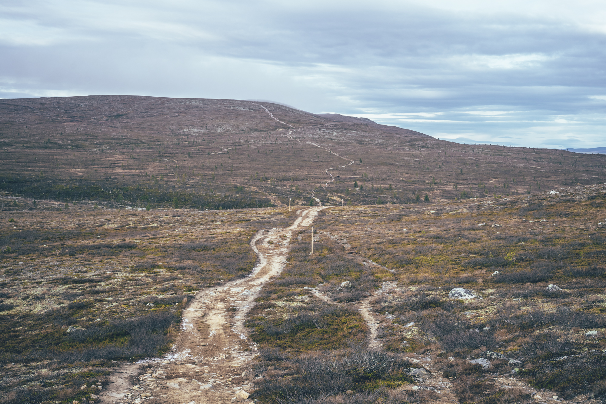
Following the remnants of the old Kopenhagen-Alta post road across the Western Lapland and Finnmarksvidda, Finnmarks highlands, the 438km and 8-10 day Arctic Post Road MTB Route is a unique single-track-rich bikepacking route from the Finnish Western Lapland to the Norwegian Arctic Ocean. The Forbes Travel Guide has ranked the cross-country winter crossing of Finnmarksvidda one of the five most stunning ski tours in the world, and let me argue, it could be the case for summertime crossing as well. Especially, when connected to the southern part of the arctic tundra of the Pöyrisjärvi wilderness area and then to the high fells of the Pallas-Yllästunturi National Park, the route is one of the prettiest anywhere.
Today, some of the mountain lodges still operate as wilderness huts available for the public, most along the main connecting roads, but there are individuals actively operating huts still in more remote locations as well. Especially on the old off-road connection from Hetta to Alta, actively used till the 1950s, many of the huts still operate either as rental huts or full-service guesthouses. Luckily the old off-road connection still exists, where not under the current main road, and it’s mostly easy riding with a mountain bike, which makes connecting the old fjellstues and reaching the Arctic Ocean from Western Lapland by cycling possible.
The Arctic Post Road MTB Route can be roughly divided into two legs: the traverse of the Pallas-Yllästunturi National Park and the Hetta-Alta post road. The first leg offers some of the best views in Finland from the fell highlands of the national park, though with the price of having the most technically and physically demanding riding on the Arctic by Cycle Bikepacking Route Network. The second leg follows the line of old mountain lodges across the Finnmark highlands, crossing the Finnish-Norwegian border in the wilderness and then linking the mountain lodges along the old postal routes to Alta partly on 4×4 roads and rough quad tracks.
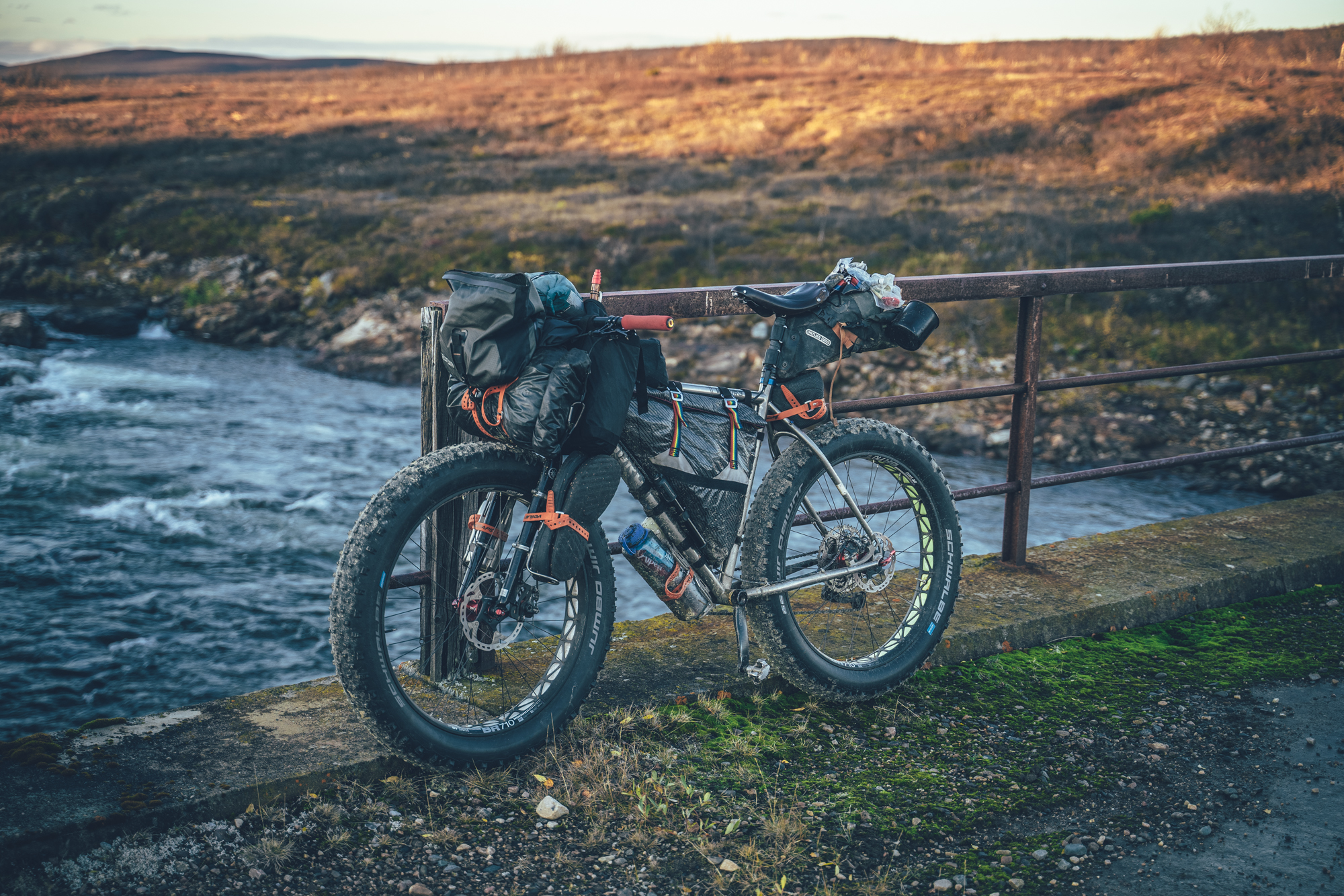
Completing the route safely requires great physical fitness and good mountain biking and bikepacking skills, therefore is not everyone’s cup of tea. The route is ideally ridden with a mountain bike with as big tires as you can fit and a full suspension rig or a fatbike, in that matter, is not overkill at all. A light-weight bikepacking setup is a must on this one. Luckily for those doubting their fitness, gear, outdoor experience or mountain biking skills to tackle the nearly 200km of single-track and occasional remoteness of this route, there is a gravel rig-friendly version available as well: The Arctic Post Road Gravel Route.
Read more about the details of the route as well as our take on the comfortable pace to ride it in the Trail notes below.
- Traversing part of the Finnmark via the Jotka fjellstue, an oasis-like lodge in the wilderness with full services available, despite its remote location.
- Traversing the high fells of the Pallas-Yllästunturi National Park in western Finland on single track and quad tracks.
- Riding the smooth and sandy double tracks of the Pöyrisjärvi Wilderness Area.
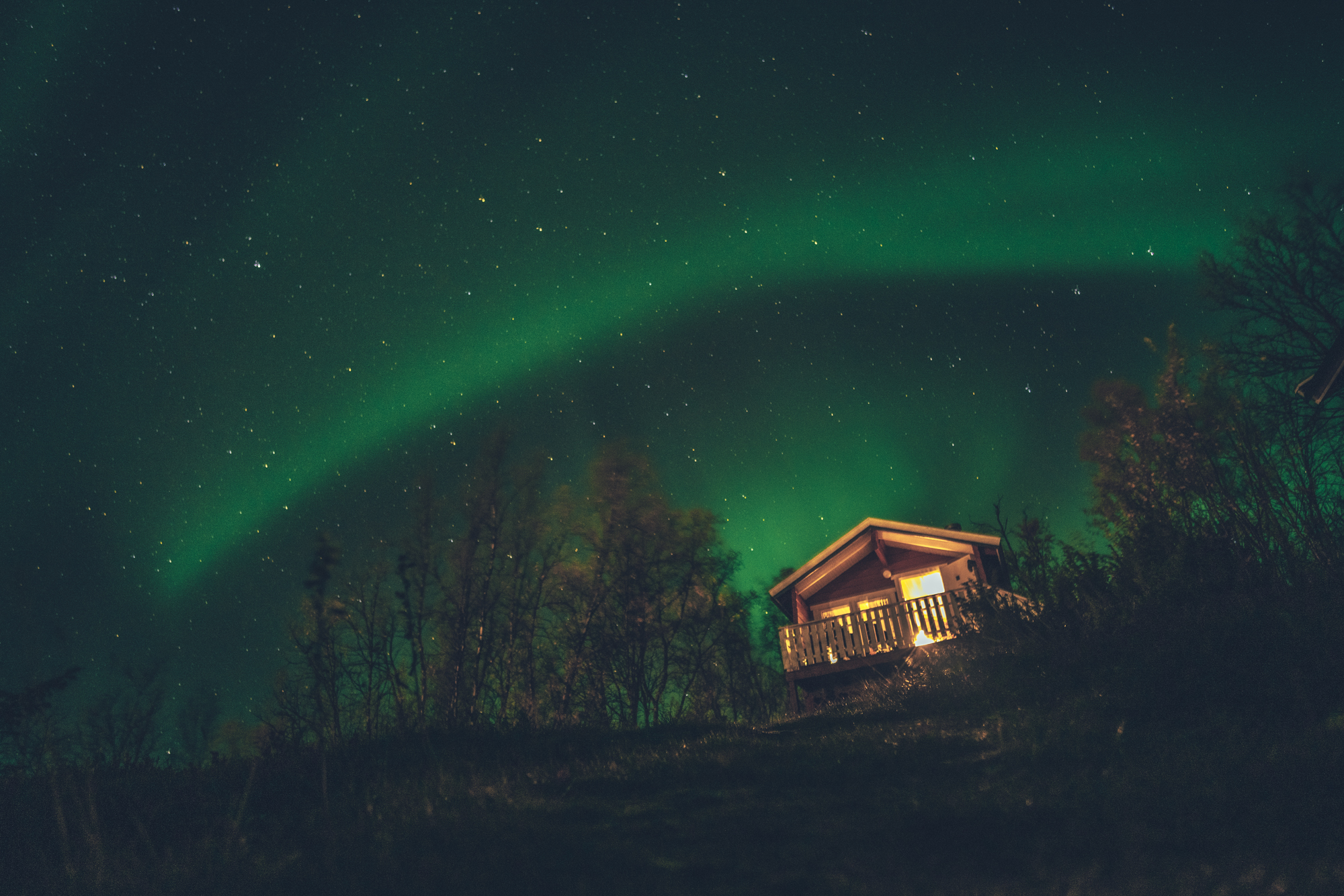
- Northern lights can be seen multiple times a week in autumn, if the sky is clear at night.
- Crossing the Finnish-Norwegian border through a reindeer fence.
- Following the old post road on the Finnmark Highland.
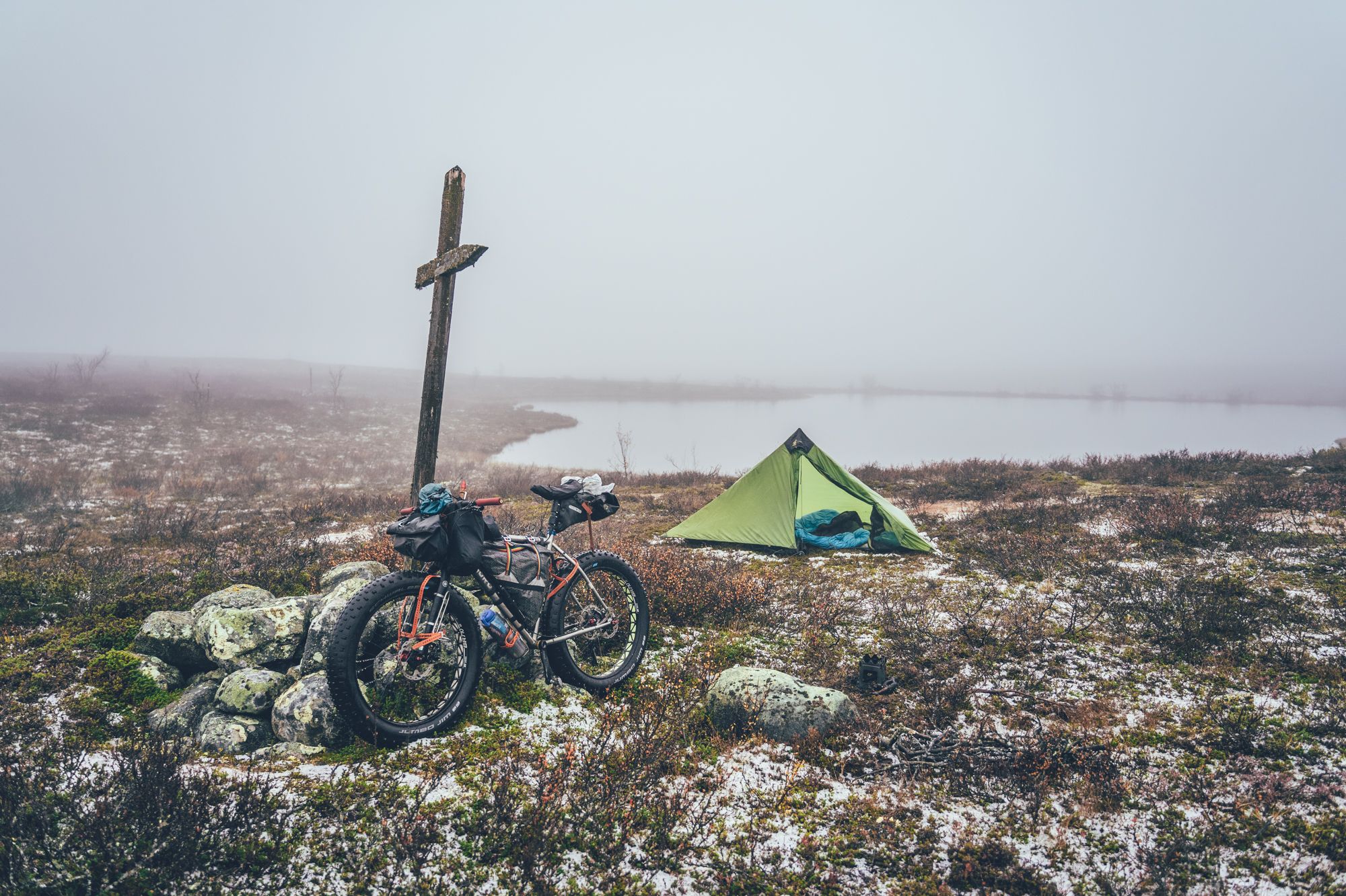
- 16 historic wilderness shelters along the route, offering refuge and comfort as well as usually great camping around
- Views of the fjords of the Norwegian coast from the Alta City.
- Arrival at the Arctic Ocean on single track on the banks of the River Alta.
- The MTB routes in the arctic are usually rideable from early July, when the trails are dry enough to ride again after the winter, to early October, when the winter usually sets in again. However, the climate crisis makes seasons more unpredictable than before so the season start and end can vary year to year by a couple of weeks.
- The infamous arctic räkkä (the high population of mosquitos, black flies, biting midges and horse flies) starts usually by late June and lasts usually till mid August, making the mid-August till October ideal time to ride the route.
- Completing the route safely requires great physical fitness and good mountain biking and outdoor survival and camping skills, therefore it is not for everyone.
- The route is ideally ridden with a mountain bike with as big tires as you can fit and a full suspension rig or a fatbike, in that matter, is not overkill at all in this route.
- A lightweight bikepacking setup is a must on the route, to make often technical route with heavy and steep climbs easier and safer.
- The route not suitable for e-Bikes because of the long distances between guesthouses on the Norwegian side of the route.
- The route could not be further away from Easy access as you might imagine.
- Small gears are highly recommended as the Pallas-Ylläs section of the route has the most demanding climbs of the whole Arctic by Cycle Bikepacking Route Network.
- Temperatures during the snowless season a lot and week-to-week but expect the spot-on daytime temperatures of 15-23 Celsius from mid-June to late August with nights in the range of 0-10 Celsius. Early June could be warm too but could be significantly colder as well. In late August and September, the temperatures start to drop significantly week by week and the first snow is not uncommon in late September. Especially late in the season, in late September and early October, be prepared for daytime temperatures of 5-10 Celsius and nights getting already below freezing.
- When choosing a sleeping bag, you should assume that the night temperatures can drop to 0 Celsius even during the mid-summer months and then even colder later the season gets. The classic -7 C/ 20 F sleeping bag works like a charm in Lapland, too, with the lower limit low enough for the late-season exploits.
- The midnight sun or “the nightless night” lasts from around 6 weeks in Southern Lapland to up to 3 months in Northern Norway. Getting used to the 24h sun can take a while to get used to…
- The best time to see the northern lights is roughly starting from September and as the nights get darker and longer towards the end of the season, chances are getting better week by week. It’s not uncommon to see the auroras multiple times a week at the end of the season, given that the weather gods are on your side and the sky is clear.
- The route has only digital navigation; for instructions and tips for successful navigation, see here.
- Always stay on the routes and aim to only use the recommended spots marked on the route map.
- The mobile phone network does not cover the whole route area: in case of an emergency, call 112 or use the 112 app, which automatically shares your location to the emergency services as well. Carrying a personal emergency beacon is highly recommended from the section between Hetta and Alta.
- The route is located in a traditional reindeer herding area, please read more about the etiquette of traveling in the reindeer herding land here.
- Bears, wolfs and wolverines are not an issue at all when wild camping as the arctic predators avoid human contact to all cost. There are practically no encounters, ever. Therefore, there is no need to have a bear bell on handlebars, bear safe food containers or hand your food in a tree for the night.
- There are 16 wilderness shelters along the way, which are the recommended camping spots on the route as well.
- Lodging is available frequently as well, also outside the villages, giving comfort and luxury on this otherwise demanding route
- Camping is allowed and free of charge along the route by All Man’s Rights in Finland and Norway, however, due to the fragile and slow-growing arctic flora, you should always aim to use only the campsites marked on the route map. Also, camping is strictly prohibited outside the recommended camp spot in the Ylläs-Pallastunturi National Park
- Open wilderness huts and other wilderness shelters are a treat, but the rules of use are strict to make the system work. The last to arrive has the priority to stay overnight, so make space for people arriving after you. All the near-by-surroundings of the wilderness shelters operate as official camping grounds, so the huts serve the most, and those the most in need, if you camp and use the hut only for cooking, socializing, and drying wet gear.
- All the camp spots are next to a high-quality water source, unless stated otherwise
- The grocery stores for restocking are located in Hetta, Kautokeino, and Maze, meaning you need to be able to carry 3 days of food in the first part of the route and then a little less afterward
- There are restaurants or cafés available in Jerisjärvi, Pallas, Hetta, Kautokeino, Maze and Jotka fjellstue
- Water is most of the time drinkable straight from streams, ponds, and lakes, but you never know if there is a reindeer carcass upstream, so better to be safe than sorry: water treatment is recommended.
- Sources of water are plentiful, so you’ll get away with carrying just 1-2 liters of water. The best spots for refills are marked on the route map.
- All the camp spots are next to a high-quality water source, unless stated otherwise - which is rare.
- Tap water is always drinkable and the locals are happy to fill your bottle
- When cooking in the camp, know that making a fire is strictly prohibited during the forest fire warming period. See the Finland's local restrictions here
- The route is by far the most challenging in the Arctic by Cycle Bikepacking Route Network. The partly technical, nearly 200km of single track and double track requires good mountain biking skills, and combining that with the biggest climbs possibly anywhere else in Finland, the route is not for everyone.
- In terms of technical difficulty the route earns 9/10 and in terms of physical difficulty, 8/10 as well. Though there are plenty of resupply points and wilderness shelters and you can get away with carrying 3 days of food, giving the route a grade of 7/10 for the bikepacking challenge. Overall the route grants 8/10 which should not be taken lightly.
- The route is ideally ridden with a mountain bike with as big tires as you can fit and a full suspension rig or a fatbike, in that matter, is not overkill at all in this route. The route was scouted with a fatbike, which worked like a charm and made riding on the most difficult terrain rather easy and comfortable. The trail can be ridden in both directions, but we loved riding it south to north, making the Arctic Ocean a symbolic end point for the route.
- Bikepacking is usually the more comfortable the less you carry, and that could not be more true on this route. The lighter you go, the easier and faster cycling gets and riding is partly technical and climbs steep and long. A lightweight bikepacking setup is a must on this route: the route is not recommended to be attempted with a traditional touring setup with panniers. Don't even think about it.
- Getting to Äkäslompolo
- There is an overnight train connection from Helsinki to Kolari (16 hours from Helsinki) multiple times a week, with often a bus connection to Äkäslompolo (Ylläs) to reach the starting point of the route. Though you can also do a short day on gravel to reach Äkäslompolo from the train station. You can book train tickets from vr.fi
- There are flights from Helsinki to Kittilä Airport multiple times a day and a short bus ride then takes you to Äkäslompolo where the route starts.
- You can also take a train of flight to Rovaniemi and then cycle half (270km) of the Santa's Western Grave Loop to Äkäslompolo.
- Bus connection to Äkäslompolo is still mostly non-existent, however there is daily-ish bus from Oulu/Tornio to Kolari, from where you can cycle the last 48km on the Santa's Western Grave Loop to Äkäslompolo. Some bus companies allow booking the bike spot in advance, but some don't, which means that they'll accept the bike onboard if it just fits in the cargo hold. Tickets and timetables from Matkahuolto website.
- Getting out from Alta
- If not returning to Finland, your options are:
- Fly out directly from Alta. The connection works but it is not as frequent as out from Tromsø, sometimes pricier too.
- Take a bus from Alta to Tromsø (7h) and fly out from there. It's a nice bus trip, so not a bad option. Spot for the bike though cannot be purchased in advance and it fits in if there is space. If you have time, you could get off that bus already at Lyngeidet (after the doing the Olderdalen -Lyngseidet ferry in the bus) and cycle the last 77km across Lyngen Alps to Tromsø. One ferry on the way (Svensby-Breidvik), so needs some planning timing wise though. 52km with low traffic and the last 25km is on the main road.
- Use the Hurtigruten ferry to reach Tromsø. Here the first option is to take either a bus (2.5h) or a ferry (2.5 h) from Alta to Hammerfest and from there get on the ferry (10 hours). The second option is to get on the Hurtigruten ferry is to cycle 120km to Øksfjord (80km along the main road with occasional side roads to avoid the traffic and then 50km with less traffic to Øksfjord) and catching the ferry to Tromsø from there (7h 40min). The ferry doesn't run every day, so this needs some planning in advance.
- If you are returning to Finland:
- Polar Star Travel offers cycle, person and goods transport between Kittilä (FIN) and Alta (NOR) and back between 10th of August 2024 – 28th of September 2024 every Saturday. Find more information about the connection from here.
- There is no other public transportation back to Äkäslompolo at the moment. Ideally, if you need to get back to Äkäslompolo and you have the time, ride the MTB route to Alta and then the gravel version back. There is a bus connection from Alta to Kautokeino, which shortens the way back a little, though on the Finnmarks highlands both versions of the route are not-to-miss.
- Getting back to Finland and the city of Rovaniemi with a bus connection. First take a bus from Alta to Karasjok (3h 15min) and then change a bus from Karasjok to Rovaniemi (8h 10min). The Karasjok-Rovaniemi bus does not go every day, so this connection needs some planning in advance. Tickets to Alta-Karasjok by are sold by Snelandia and the tickets to Karasjok-Rovaniemi bus are sold by Matkahuolto. There are multiple trains and flights from Rovaniemi to Helsinki on daily basis.
- Getting off the Rovaniemi bus at Pikku-Poikela and taking the Central Lapland Gravel Loop to Äkäslompolo is an option too. Kittilä Airport and further on the Kolari railway station are along the route. The section of Central Lapland Gravel Loop from Pikku-Poikela bust station to Äkäslompolo is 202km.
- Travelling by bus with a bike in Finnmark and Tromsø area
- The Finnmark and Tromsø area bus connections are coordinated by Snelandia. The tickets can be only bought through their phone app. The pricing is based on how many regions you travel through and the ticket validity starts immediately when you purchase the ticket. Spots for a bike cannot be booked in advance, unfortunately and the bikes fit only if there is space. Solo travellers get on the buses with a bike pretty easily, I've been told, but in a group of 2 or more you all might not fit on the same bus. Because of the risk of not getting on the bus due to lack of space, buy the ticket only when the driver has confirmed that there is space for your bike.
Day 1, Äkäslompolo village to Mustavaara campfire hut (61km, 873m of climbing)
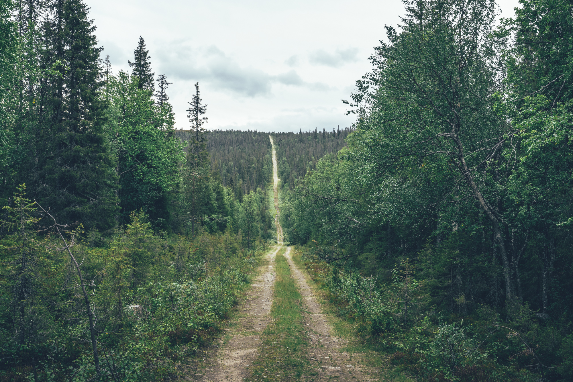
The first riding day has an epic start in the old growth forests of the southern Pallas-Yllästunturi National Park. A wide and partly gravel trail climbs gently between the higher fells of the part till the historic wilderness Café of Kotamaja. From here on the through mountain biking starts on a much narrow and technical trail north. The first hike-a-bike of the day is soon after the wilderness café with a steep and rocky incline to a side of a fell, where an occasionally painfully rocky gentle downhill continues multiple kilometers to the Kutujärvi wilderness hut. After the hut the trail gets significantly easier and smooth again. The turquoise Äkäsaivo spring pond is worth a quick visit and there is a campfire hut with firewood as well. The total amount if single track in the start adds up to 18km.
After the single track section a narrow gravel road continues north alongside the National Park going by the tiny and old Pahtavuoma open wilderness hut around 38km from the start. There is room for a couple of tents by the hut, if necessary.
The rest of the day is easy riding as well, first on fast lakeside gravel road and then on pavement toward the options for spending the night. The Arctic Sauna World with four different saunas at the Hotel Jeris is strategically located at the end of the day, whether you decide to enjoy the luxuries of the hotel and its restaurant or head further on to camp at Mustavaara campfire hut. Though the Hotel Pallas is only 8km further along the route as well. To push the day any longer, you would be entering the rough stuff and the high fells of the national parks, which should be tackled with clear mind and fresh legs…
Day 2, Mustavaara campfire hut to Pahakuru open wilderness hut (47km, 1000m of climbing)
The restaurant of Hotel Pallas offers a great breakfast, before the climb to some of the highest fells in the country. The first ascend is a smooth non-technical, but steep gravel path, which turns into a continuous boulder garden on top. The 7km natural trail between the rocks is 100% rideable with good mountain biking skills, but without the necessary skills, it’s mostly hike-a-biking, which is luckily rewarded with some of the best views in the country. The wilderness shelters are great for a break, cover from the elements, or for the night with firewood and other facilities.
The route avoids the most challenging parts of the national park single track, by getting down from the fells to the road and going back up again when the routes get easier again. After the rough stuff, marked black on the route map, the riding is technically easy on the wide gravel path. The high-speed descent to Vuotisjärvi is fast and fun, but be on lookout for hikers and other cyclists on their way up… At Vuontisjärvi, at the bottom of the fell, there are a couple of lodging options.
After the 12km of fast progress on a paved side road, a smooth quad track to Lake Hietajärvi starts. The turquoise spring lake with its sandy beaches is an excellent spot for the night, but there is a reward for climbing back to the highlands and reaching the Pahakuru open wilderness hut: a wilderness sauna. Actually, the sauna is located another 2km down the trail, but Pahakuru is as far as it makes sense to reach by bicycle. Better to camp at Hannukuru and make an evening visit to the sauna by walking. The national park is the most visited in Finland, so don’t expect to go to a sauna alone…
Day 3, Pahakuru open wilderness hut to Hetta village (26km, 750m of climbing)
Day 3 looks easy and short on paper, but it’s mostly slow going on physically and technically challenging terrain. The route is 100% rideable with good mountain biking skills and good fitness, but for most, it occasionally involves long stretches of hike-a-biking. Sioskuru open wilderness hut and rental hut are great places for the night with some good camping around too. The views from the last and one of the highest fells of the Pallas-Yllästunturi National Park, Pyhäkero (713m) are fabulous and the gravel singletrack again fast and flowy. Hetta village has a full set of services, with guesthouses, a supermarket, organized camping grounds and restaurants. This is also where you'll need to stock up for the following three days/120km to Kautokeino, given that you'll follow the pace here.
Day 4, Hetta village to Pöyrisjärvi open wilderness hut (42km, 955m of climbing)
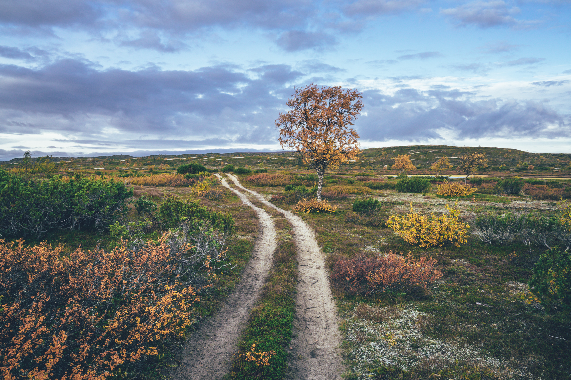
After the high fells of the Pallas-Yllästunturi National Park riding get a little easier, eventually, but not that much yet between Hetta and Näkkälä dispite the route stays at lower elevation. From Hetta, the route continues on natural trails on old quad track, occasionally carved rocky and muddy by quads. Näkkälä välitupa open wilderness hut is located between the villages of Hetta and Näkkälä, from the times of the post road. The terrain changes during the day when pushing on toward the north from boreal forest to treeless arctic tundra.
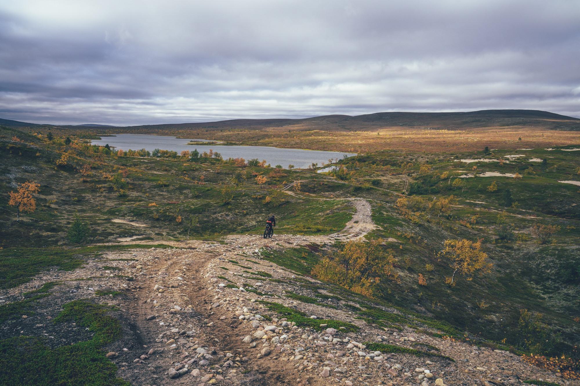
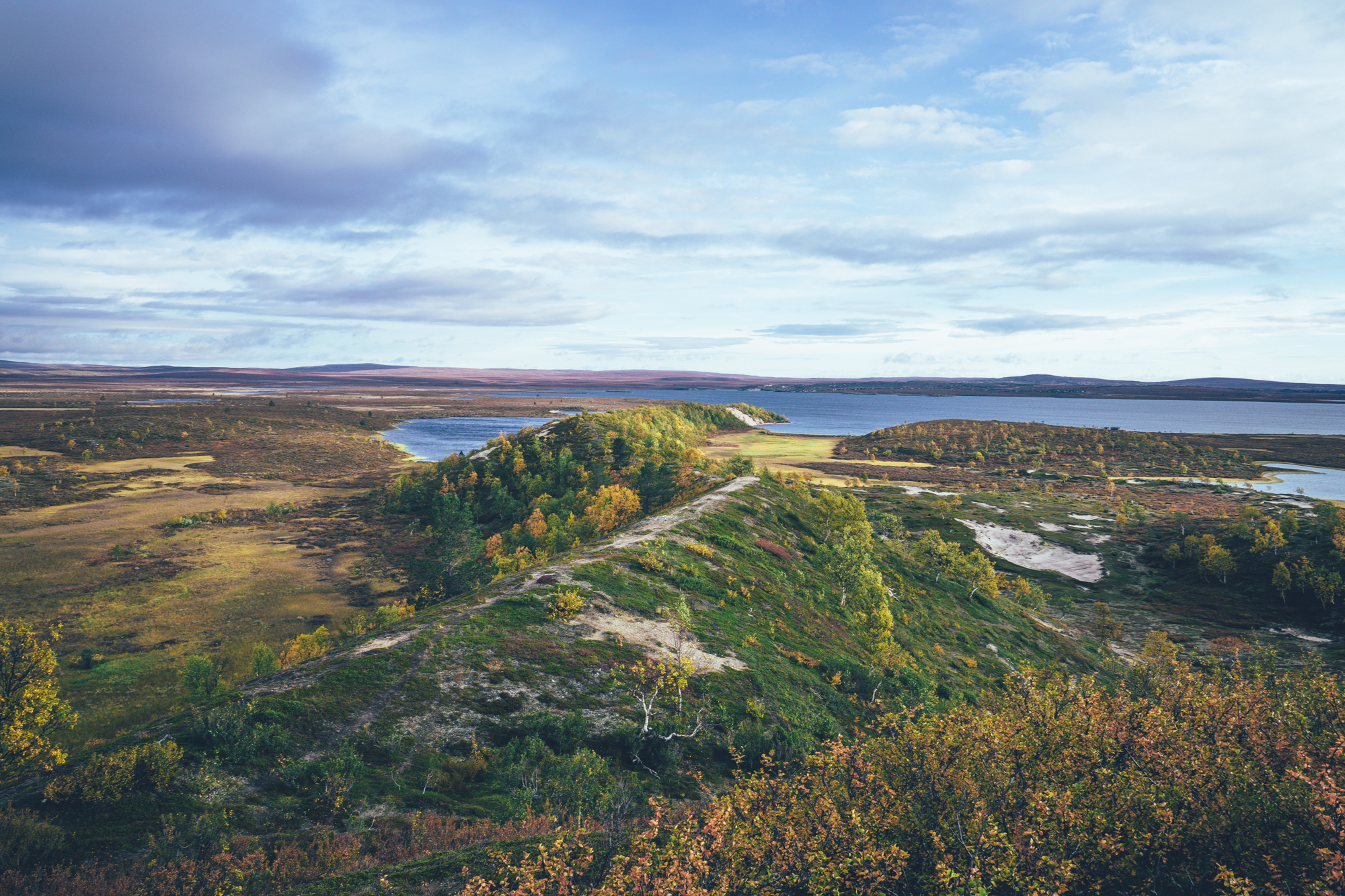
The Pöyrisjärvi Wilderness Area, starting soon after the Näkkälä village has fantastic smooth riding for miles on end, if not sometimes soft to keep the momentum. The old ridges, shaped by the previous ice age, dominate the landscape, with pits of soft sand here and there, as light patches in the arctic miniature vegetation. Pöyrisjärvi open wilderness hut is located by the beautiful Lake Pöyris and has fantastic camping around too.
NOTE 1! The last couple of kilometers before arriving to the village of Näkkälä had been found in very poor condition in July 2022 and the route is getting much rougher before that as well. Quads had carved the trail really rocky and muddy, which made the Hetta-Näkkälä section partially a hike-a-bike... The rough section is now marked on the map with black.
NOTE 2! This day looks on paper much easier on paper than it really is due to the rough Hetta to Näkkälä section and then because of the partly soft and sandy track to Pöyrisjärvi. It's a good full day on a bike for many, easily. If you really want to keep the day light or just need to crock on much further north to sleep, the village of Näkkälä can be reached on the main paved road as well, which saves you a couple of hours of riding time and tons of energy.
NOTE 3! Visiting the deeper Pöyrisjärvi lake and wilderness hut is a detour from the main route and skipping it shortens the route more than half a day. Though this slow detour is also one of the highlights of the whole route with some landscapes and nature not found anywhere else in the north.
Day 5, Pöyrisjärvi open wilderness hut to Suolopjavret north camp spot (47km, 640m of climbing)
There is only 18km back to the original route from the Pöyrisjärvi wilderness hut, but it's easy to spend a half-a-day on this one by stopping to take photos and sucking in the 360 degree views from the high morraine ridge in addition to multiple creek and bog crossings. Parts of the route is also very sandy and uphills steep, so hike-a-biking cannot be avoided either. This section is epic, but slow.
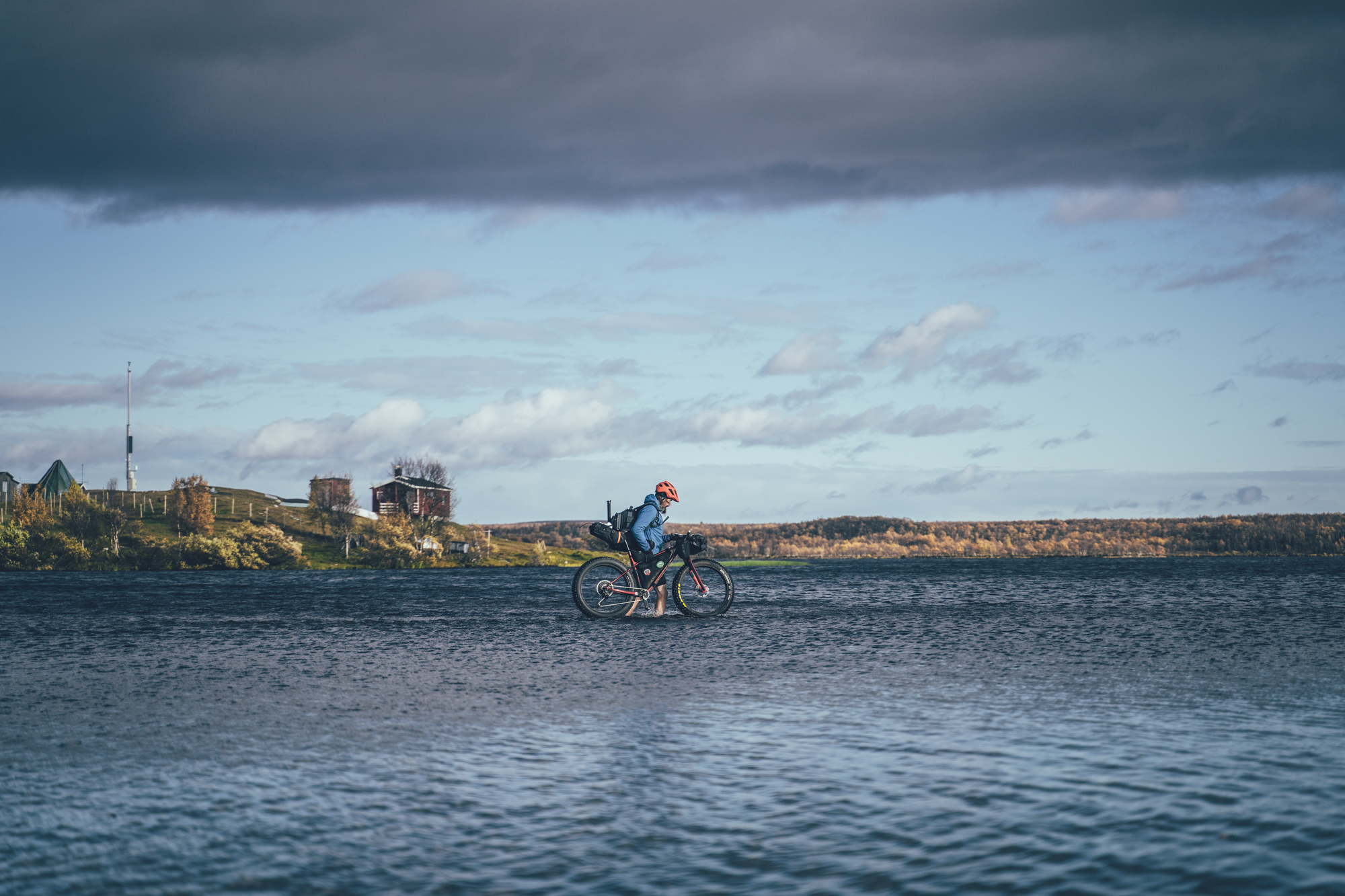
Once back on the main route again the old post route crosses the Finnish-Norwegian border north of the Kaamusjärvi, which has great camping by a sand beach. On the Norwegian side, the route continues as a great double-track till the Šihccajávre fjellstue. The river mouth crossing to Šihccajávre fjellstue can be challenging especially early and late season, as well as after heavy rain, but it is still likely safe to wade as it has zero current. The river mouth crossing usually has a sand bank as well, where the water depth stays at knee deep, but it moves around and it's easy to miss too, so better to be prepared for 80-90cm deep crossing. Overall, the crossing is much easier what it looks.
The owner of the Šihccajávre fjellstue can be reached by Facebook and there might be a possibility to organize a boat ride across the river mouth as well if you plan it in advance, so that the people can keep eye on the river mouth and come to give you a lift at the arrival. The Šihccajávre fjellstue offers lodging and they have a lovely old sauna for rent as well, so it’s a great location for the night, despite the riding day staying on the shorter side.
From the Šihccajávre fjellstue the route stays 8km on a wide 4x4 road, before it gets on a quad track again for the old postal route toward Kautokeino village. The tricky part of this route section is 500m off the 4x4 road in a form of a river crossing. The river is narrow, but it has a short but 60-70cm deep section to cross. No way avoiding to get wet, but it's safe to cross. After that the quad track is most of the time good riding with short boggy sections here and there, especially after heavy rain. The best spot to camp is located 47km from the Pöyrisjärvi wilderness hut, which you should head to as finding level and dry spot to camp is not as easy anymore as it was at the Pöyrisjärvi wilderness area.
Day 6, Suolopjavret north camp spot to Cabardasjohka river side camp (42km, 620m of climbing)
From the campsite, there is only 30km to to go the Kautokeino village, which may not seem that far, but can easily take 3 cycling hours due to slow terrain. 22km is on a partially slow quad track and the remaining 7km on the paved main road. Kautokeino has all the services except a bicycle repair store, so it's a great place to stock up food till Maze (75km and 1.5 cycling days away) for the following days and have a burger & beer. There are a couple of good lodging options too.
From Kautokeino valley the route climbs up to the hills again and passes through the runway of the old Kautokeino airport. 10km of quad tracks eventually lead to a nice river side campsite, though there is decent camping here and there before the best spot marked on map as well. Though you should head to this one, if you can.
Day 7, Cabardasjohka river side camp to Mazejohka river camp (46km, 830m of climbing)
Soon after the Cabardasjohka river side camp the route reaches the main road, which is followed a couple of kms, before the old postal route continues again. Between Kautokeino and Alta, at the Arctic ocean, the current main road was luckily not built on the old post trail, which is a varying condition 4x4 road at the moment and therefore nearly completely traffic-free. Parts of the road are hard packed and fast, but in parts the road is really rough with baby-first sized boulders with loads of water damage here and there. After rain the road is also full of puddles, which can make the road more an obstacle course more than a highway. Some make it through with dry feet, but the most wouldn't.
Another factor in this area is the wind speed and direction. The area is usually extremely windy and proper wind cover is rare. Getting a headwind on Finnmarks highland can slow you down to walking pace and finding a campsite with good wind cover is extremely difficult. There are multiple camping options marked on the map on this section, which have at least some wind cover if things get nasty. The prettiest camp spot of the whole stretch is certainly by the Mazejohka river camp, though in that spot there is no wind cover whatsoever…
Day 8, Mazejohka river camp to Valljegurra camp spot (28km, 840m of climbing)
The mission of the day is to hit the opening hours of the supermarket Oves Varesenter at Mazi. Check the current opening times here, but in September 2023 the shop was open only from Tuesday till Friday 10am-4pm & 7-8pm and on Saturdays 10am-2pm. Masi is located at much lower altitude on the bottom of the Masi Valley, which often feels warm and calm after the heavy cold winds of the highland.
From the Masi valley, the route climbs back to the Finnmarks highland gaining more than 430m of altitude during the following kilometers. Valljegurra camp spot is really pretty by a pond, from where a little creek with small waterfall starts and it's an ideal spot if you want to split the distance between Mazejohka river camp and Jotka fjellstue half. 28km & 840m day might sound short, but the climbs after Masi are steep and technical, which drain you more what you propably assume.
Surely you can also put the days 8 and 9 together and ride straight from Mazejohka river camp to Jotka fjellstue doing the whole 71km at one go. Though that makes a huge day with way more than 1000m of climbing in mostly technical rocky terrain. That's what we did last time though, but paid it with midnight arrival to the Jotka fjellstue after nearly 9 hours on the move... That's why we are cutting the day in half here now.
Day 9, Valljegurra camp spot to Jotka fjellstue (36km, 400m of climbing)
From the Valljegurra camp spot onwards the riding could not get much better. The rolling fells are an absolute joy to blast down, if not occasionally little techy and hars if you don't have a suspension, and there is more decline than incline which you can feel as well. The has fantastic views to the far away fells and ponds with occasional small river crossings and boulder gardens to force to keep your guard up. The last stretch to Jotka is on the most used track on the highlands, which makes it rocky, but still rideable with ok momentum. Still the last kms are slower what you would expect.
Despite being located in a somewhat remote location, Jotka fjellstue has fantastic foods, beer, and wine as well as a fantastic Norwegian breakfast with their self-cold-smoked arctic char from the lake next door. Also, a sauna is available with an in-advance booking. To be 100% sure to access the services - dinner included - send them an email well in advance to let them know that you're coming over. Camping is allowed on the yard free of charge, but sleeping in the old, but well-kept fjellstue, built by the order of the King to support the travelers on the post route, is a splendid choice as well. There are rooms for rent in the upstairs of the main building too.
Jotka fjellstue also functions as a basecamp for some of the most competitive huskies in the world and you're likely to see the trainers taking care of the pack and putting them ready for the days training late morning till midday.
NOTE! The right-hand side main door is the entry to the restaurant of the Jotka fjellstue, don't be shy to step in and grab a cup of hot coffee from the flask. Just report what you've had at check out and they'll add it to the bill. Card payments accepted now, so the cash or bank transfer is history now!
Day 10, Jotka fjellstue to Alta City (63km, 775m of climbing
The climb out from the valley of the Jotka fjellstue is one of the steepest on the whole route, but just around 100m in elevation. From there the rocky double track reached the river crossing just a few kilometers later. The crossing was doable with dry feet, jumping from rock to rock, in late August and late September in 2020, being max knee-deep. After a 6km stretch of asphalt, the single track/ quad track continues again till the end of a ridge on the edge of the Finnmark plateau with a view of the Arctic Ocean. There is a flat area to camp by a pond on the top with magnificent views of the valley and far to the ocean, but no wind cover at all.
The 4x4 track down from the plateau is steep with loose rocks until the route reaches an old mining site and gets on a better-condition coarse gravel road leading lower to the valley. The final descent to the near sea level and the River Alta is on pavement followed by more than 10km of partly hand-built single track on the banks of the river.
NOTE! 2022 spring flooding had carved off the river bank here and there, so can be some rerouting on the river bank not yet marked on the route map...
There are great organized campsites by the river with small cabins as well in Øvre Alta, though the route continues all the way to the downtown of the Alta City, to the start and endpoint of the Finnmarksløppet race, with multiple restaurants and pubs to choose from.