


 333 km
 4-6 days
 1842m
1842m 200m
200m 68 %
68 % 0.5 %
0.5 % 4
4 100 %
100 %Tar, the first export product on the Finnish forest industry, was used as ship coating already from the 17th century on. Production and exports of paper products and sawn goods began in the 19th century and, in the first half of the 20th century, nearly all Finnish exports were wood products. In the 2020s, the role of paper industry in the Finnish economy has reduced significantly yet forest industry products still represent as much as one-fifth of the overall value of exports. As a by-product of forest industry, the number of natural forests in Finland has decreased, and virgin forests only represent around 5% of the entire forest areas in the entire Finland and only a few per mil in Southern Finland.
Forest industry is a dilemma for a bikepacker. Without the forest industry, we would not have the current gravel road network of several hundreds of thousands kilometers but, on the other hand, nature experiences are an important reason for biking. The Green Gold Loop considers both sides of the coin as it passes by the natural forests of the Salamajärvi national park and around Lake Kuivajärvi without ignoring vast clearing areas.The route starts in Viitasaari where it alternates between paved and gravel roads as it heads to the Huopanankoski rapids that played a major role in the birth and development of Finnish fly-fishing culture. After the rapids, it continues into the village of Kivijärvi and toward the national park of Salamajärvi where there are not only several excellent alternatives for taking a break or for setting up camp but also a rental desert cabin that you can get very close to on the back of your bike. After the primeval forests of Salamajärvi, one arrives in the village of Kinnula and above all to the Kinnulan Parlamentti restaurant where a lonely bikepacker is more than likely to find people to chat with. Before the village of Reisjärvi, the route passes by the protected areas in the old forests and swamps of Lake Kuivajärvi with several rental cabins owned by Metsähallitus (Forestry Board). One of the cabins is easily accessible while the others are behind more demanding unrideable sections.
From Kuivajärvi, the route continues first to Reisjärvi and then to Haapajärvi on nice smallish gravel roads. Haapajärvi is the only train station along the trail and, as such, a handy alternative starting point for the Green Gold Gravel Loop. From Haapajärvi, the route continues towards its starting point in Viitasaari first on smaller and partly slow forest car roads before reaching bigger gravel lanes and then pavement straight back to the starting point.
For more info about the route and the recommended pace, please consult the trail notes below.
- The nature and lakeshore lean-tos of the Salamajärvi national park
- The rapids of Huopana and the exhibition on fish history
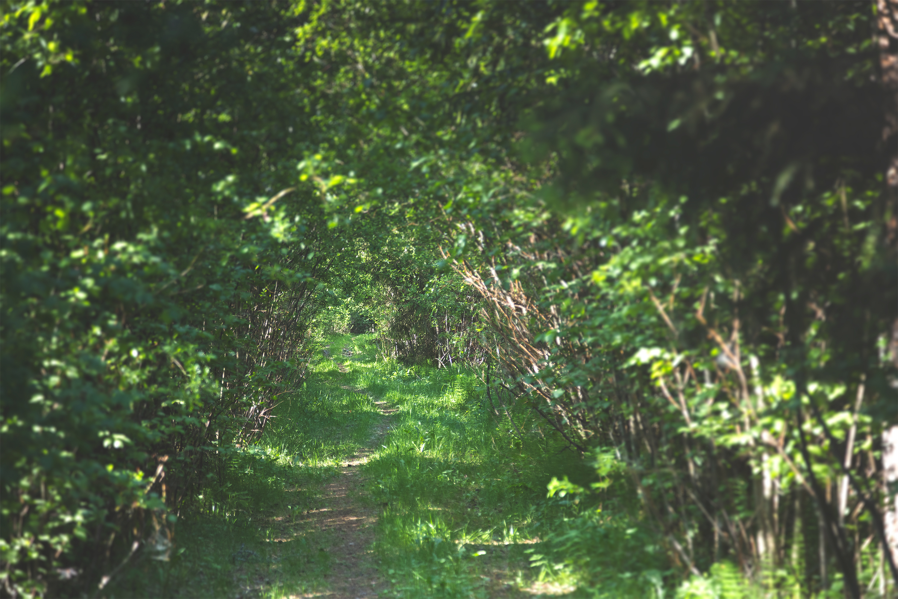
- The long meditative gravel roads
- The Isohiekka beach with its lean-tos and cooking shelter
- The Härkäaho rapids and their waterfall
- The protected areas of old forest around Lake Kuivajärvi with their bookable sauna cabins
- 10 beaches along the route
- Sympathetic accommodation alternatives in small inns or at old farms
- The route can be ridden on any bicycle with a minimum tyre size of 35mm yet the bigger and the better here. Of all the Lakeland by Cycle routes, this has the coarsest road surfaces.
- The best season for bikepacking in the southern part of Central Finland is usually from late May to late September. The day temperatures are within a 12-to-20 degree bracket in early and late summer and between 15 and 25 degrees during summer months.
- When selecting a sleeping bag, it is a good idea to assume that night temperatures can drop well even below 10 degrees at least in the early and late summer.
- The route has digital signage only. Please read the instructions and tips at bikepacking.com for successful route plotting here and here.
- Always stay on trail and try to use only the campsites and break locations recommended in the route description. In addition, follow the Metsähallitus Outdoor Etiquette and the Outdoor Association of Finland’s Mountain Biking Etiquette.
- The entire route area is covered by a telephone network: help is always available by calling the number 112 or via the 112 app.
- Water supply points are often far from each other on the route so be sure to have enough water-carrying capacity at hand especially in summer heat. A minimum capacity of 2L is recommended while a larger one does not hurt either.
- The route can be ridden without camping equipment at a daily progress as indicated in the trail notes when overnight stays are booked in advance.
- The prices of accommodation services vary but the quality-price ratio is usually excellent.
- Camping is permitted and free of charge at all of the campsites marked on the map with the exception of those camping areas and services that are subject to a fee. Some of the campsites subject to a fee are situated in connection with accommodation services.
- As a rule, drinking water is not available at the recommended campsites so carry the water for the night from the nearest water supply point.
- Firewood and outhouses are available at only some of the break and overnight locations.
- There are AirBnB accommodation alternatives along the route but their availability varies.
- Restaurants, cafés, and shops can be regularly found along the route but the opening hours of services especially outside population centres may vary a lot from season to season. Check out their opening hours in advance. The restaurants, cafés, and shops are also among the most important water supply points of the route.
- Usually, the route can be managed by carrying provisions for one day and two litres of water. However, one is more likely to need to carry more water for an overnight stay, and even more may be necessary between water supply points during periods of hot weather. A three-litre drinking water carrying capacity reduces significantly the risk of running out.
- At leans-to and shelters, it is essential to remember that making an open fire is absolutely forbidden when a forest fire warning is in effect. For information about regional forest fire warnings, click here.
- As a rule, drinking water is not available at the recommended campsites so carry the water for the night from the nearest supply point.
- Tap water in Finland is usually of high quality and suitable for drinking. The roadside restaurants, cafés, kiosks, and shops are happy to fill riders’ bottles.
- Lake water can also be used for drinking or cooking but only if it is purified first.
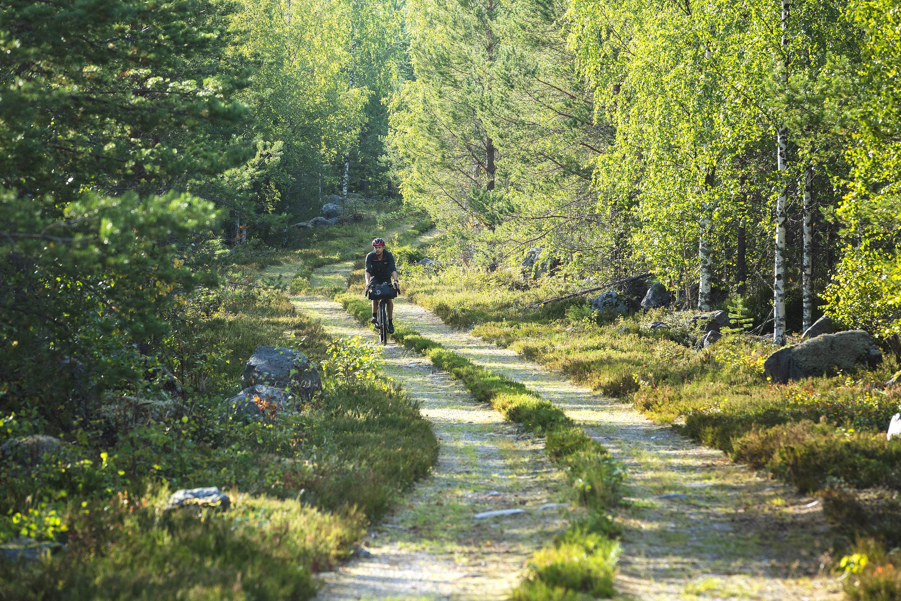
- Part of the route is easy gravel and forest roads but there are also more stretches of coarser and softer gravel than on the other Lakeland by Cycle routes, which makes progress slow at times. There are, however, no more technical unrideable sections that require mountain-biking skills. The paved, sand, and forest roads as well as the trails have been separated from each other by colour codes in the map. To find out more about the difficulty gradings in the route map, click here.
- The route is made physically more demanding by some sand roads in weaker condition, and there is also so much elevation gain that the trail cannot be considered a flat one. There are fewer roadside services than on the other Lakeland by Cycle routes, with e.g. no restauration services at all along the first daily leg.
- At the pace suggested in the trail notes, the physical load also varies considerably from day to day depending on the locations of accommodation services. Daily elevation gains vary from 450m to 1,200m. Bikepacking with a tent adds flexibility and enables a more even pacing of the daily legs.
- From the point of view of physical difficulty, the route rates as high as 6/10 while its technical difficulty is 4/10.
- As an overall bikepacking challenge, the route is a rather easy one even though there are less services available than along the other Lakeland by Cycle routes. If carrying enough supplies for half a day is enough on the other routes, one copes with a full day’s provisions here. The only challenges are how to carry enough water and how reach the next services in order to replenish water supply during their opening hours. As a bikepacking challenge, the route rates as 5/10.
- The route can be ridden in both directions and the direction of travel does not affect its difficulty. The overall difficulty of the route grades as 6/10 so it still remains a fairly doable one in spite of the physical challenge involved.
- The lighter the equipment and the more comfortable bikepacking often is, and this route is no exception given its coarser road surfaces. Bikepacking bags are always a lighter and more aerodynamic alternative to conventional rear carriers and panniers but you can use any equipment systems. The recommended tyre size is 40mm due to the occasional coarser gravel and soft spots but the ideal rims are in the 45mm-to-50mm range.
- There is an excellent bus connection to Viitasaari along Highway 4.
- An alternative starting point in Haapajärvi is handily accessible by train. However, advance booking of a place for a bike on a train well ahead is recommended if a flexible choice of a train is not an option.
- There are working bus connections from one part of the route network to the other but some of them run more regularly than others.
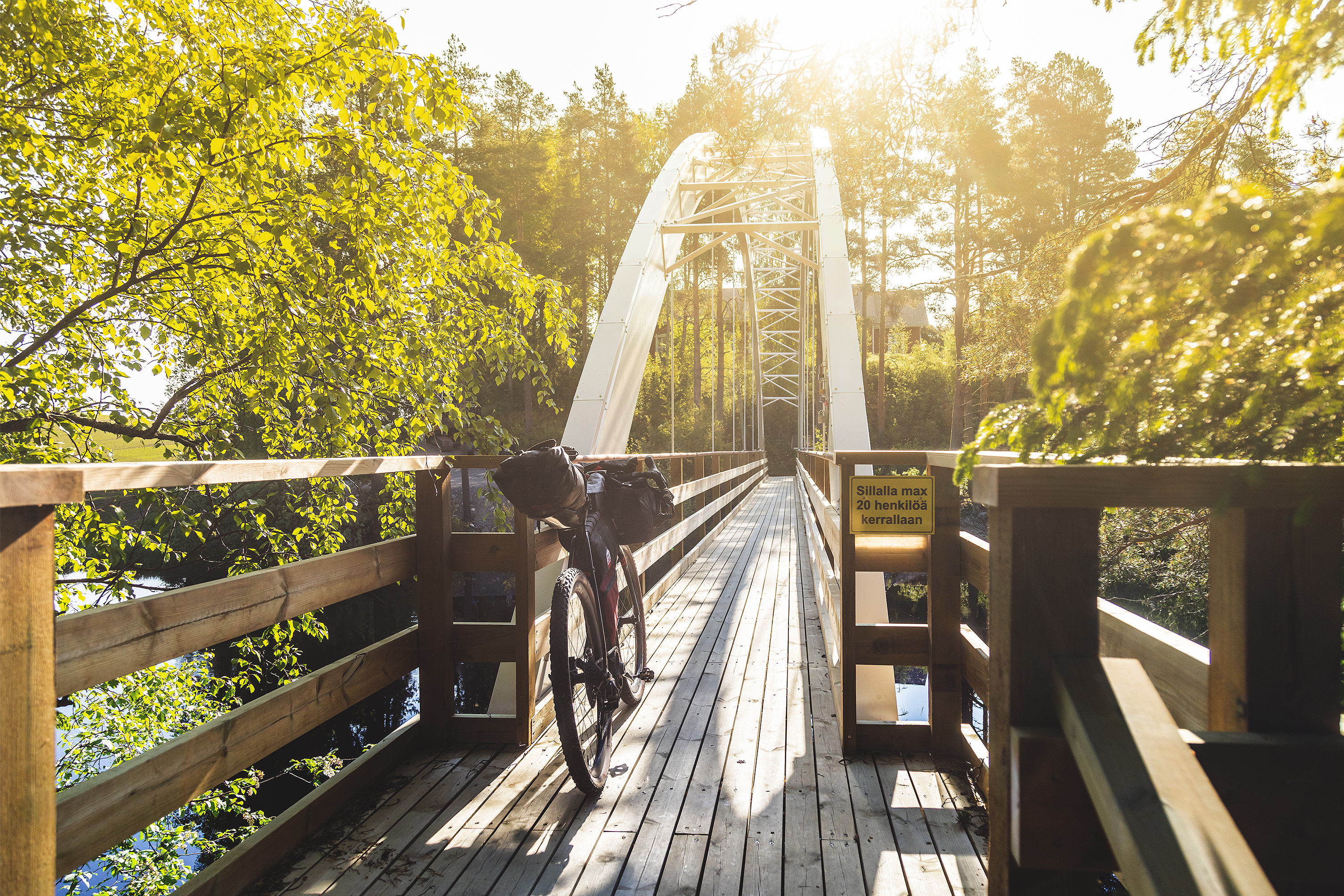
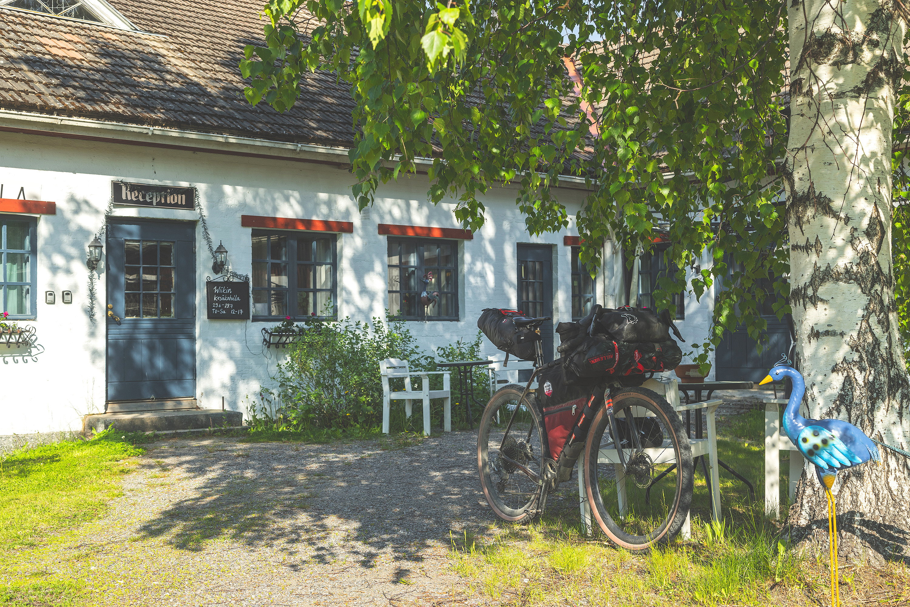
The route starts from Viitasaari on a paved road first south and then west to the Blue Highway, a heavily-trafficked road section that the route tries to avoid by using old parallel roadbeds and gravel roads instead. Some of the roadbeds are partially paved with old asphalt while others are pure gravel.
The highlight of the day at the Huopanankoski rapids less than 20km from the starting point is the birthplace of Finnish fly-fishing culture and well-known for its salmons. The kiosk on the grounds is an excellent location for a break or for some lunch while one learns about the history of Huopanankoski on the culture trail around the rapids.
From Huopanankoski, the route parallels the edges of the Blue Highway. The southernmost section of the Green Gold Gravel Loop consists of fragments of asphalt and gravel roads. Even though the southern part has more asphalt, the roads are small and calm.
Thanks to easily-ridden road sections, the journey from Viitasaari is lighter than the other daily legs. The first overnight stay is at the Piispala Youth Centre before which the route passes by the Kannonkoski population centre with two shops, a restaurant in a gas station, and a bar.
The best campsite in the area is on the Isohiekka beach quite a bit off the route north of the Blue Highway. It is, however, well worth a detour if its location coincides with the need to set up camp.
Day 2: Piispala Youth Centre – Koirasalmi Nature Information Hut, Salamajärvi National Park (58km, elevation gain 1,170m)
The second day starts from the Piispala Youth Centre and is northbound while the proportion of gravel roads increases. The way to the population centre of Kivijärvi alternates between gravel and paved roads but is overall a nice stretch to ride. There are shops, restaurants, and a few alternatives for staying the night in Kivijärvi.
From Kivijärvi, the route switches to more remote gravel roads and continues north. Once more, the road surfaces vary a lot but coarse-crushed rock has been used only here and there. The rest of the surfaces is finer crushed rock and already compacted gravel. The single biggest elevation gains of the Green Gold Gravel Loop coincide with this day so progress is relatively slow.
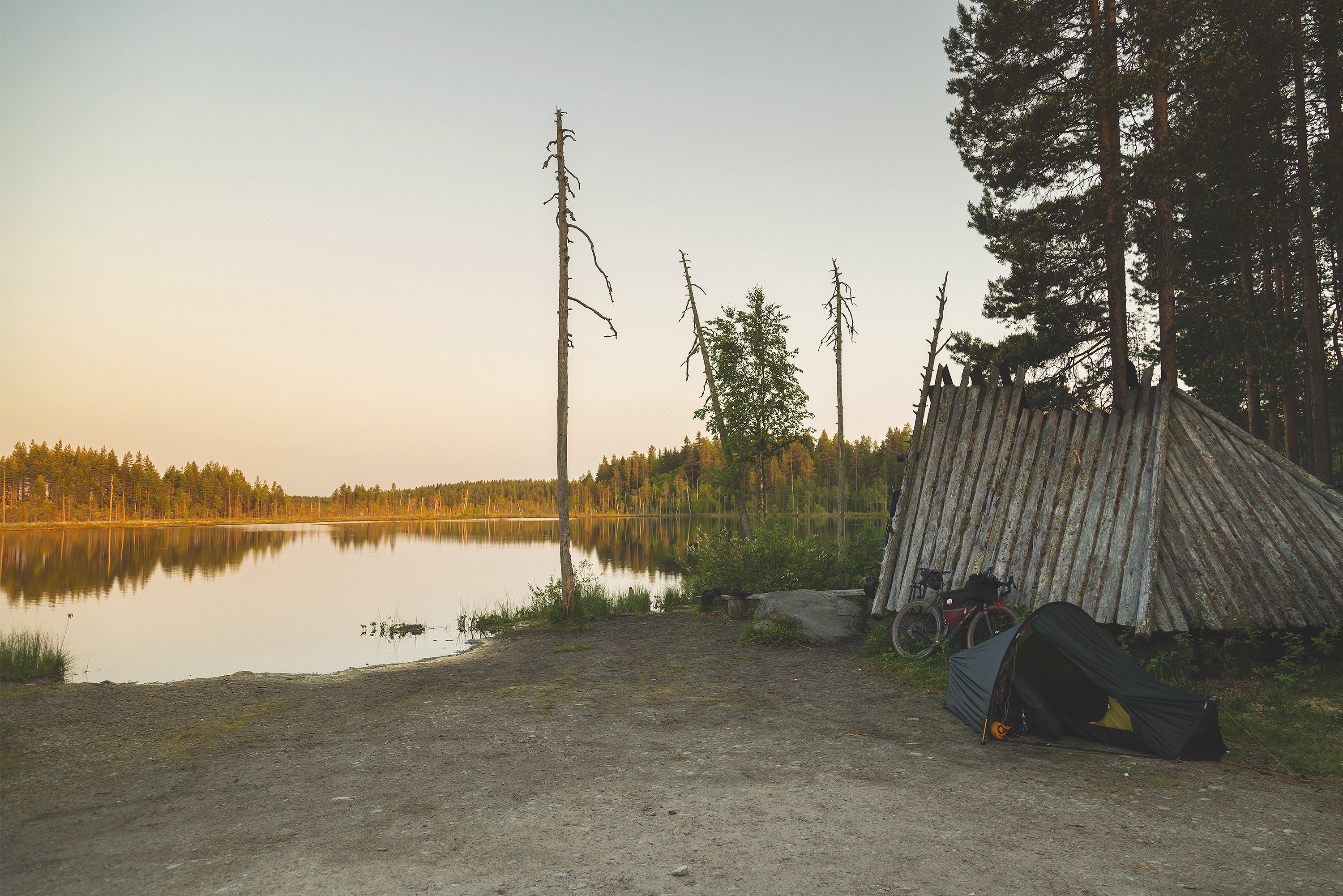
The scenery becomes gradually more w-like due to the arrival in the national park of Lake Salamajärvi. The Koirasalmi nature information hut is an excellent location for an overnight stay but the lean-to shelter by the Heikinlampi pond has also place for a camper to pitch a tent. At Heikinlampi, one is very likely to get in touch with local culture since the site is a popular recreational fishing spot where an evening is easily spent sitting by a campfire.
Day 3: Koirasalmi Nature Information Hut – Kuivajärvi Conservation Area (66km, elevation gain 650m)
From Koirasalmi, the route continues on straight gravel roads to Kinnula. Some of them are covered with fine-crushed rock, and the thick dust cloud that rises when a car overtakes remains in the air for a while under dry weather. The early part of the route is mainly uphill yet the gravel road is easy to travel on and peaceful. It is a good idea to replenish food and drink supplies in Kinnula and to pay a visit to Kinnulan Parlamentti restaurant and café. The “representatives” who gather at this common living room of locals are well placed to tell you how the world turns.
From Kinnula, the route continues for 18km on an asphalt road after which nearly all of the remainder is on small roads. The Lake Kuivajärvi area is home to several separate nature reserves and to Metsähallitus-owned rental cabins in the middle of beautiful old forest scenery. Some of the cabins are easier to reach while others require walking the bike for a longer spell. Some of them have a sauna too so the challenge of unrideable stretches may well be more than worth the trouble.
Day 4: Kuivajärvi Nature Reserve Area – Haapajärvi (48km, elevation gain 450m)
From the Kuivajärvi area, there are a good 15km to Reisjärvi where food shops and restaurants can be found. On a summer day, there is an ice-cream stand open on the Reisjärvi beach so it is a fine place for a break. From Reisjärvi, the route continues on asphalt road but soon switches to nice gravel. The way back to Haapajärvi is easy gravel road. The last destination of the day is Kalaskivi, an erratic block that stands 8m tall and is 29m in circumference.
Day 5: Haapajärvi – Niemenharju Tourist Centre (83km, elevation gain 840m)
Before leaving Haapajärvi, it is a good idea to still check the drinking bottle and food situation since the next shop is 45km away and since there are no services whatsoever available in between.
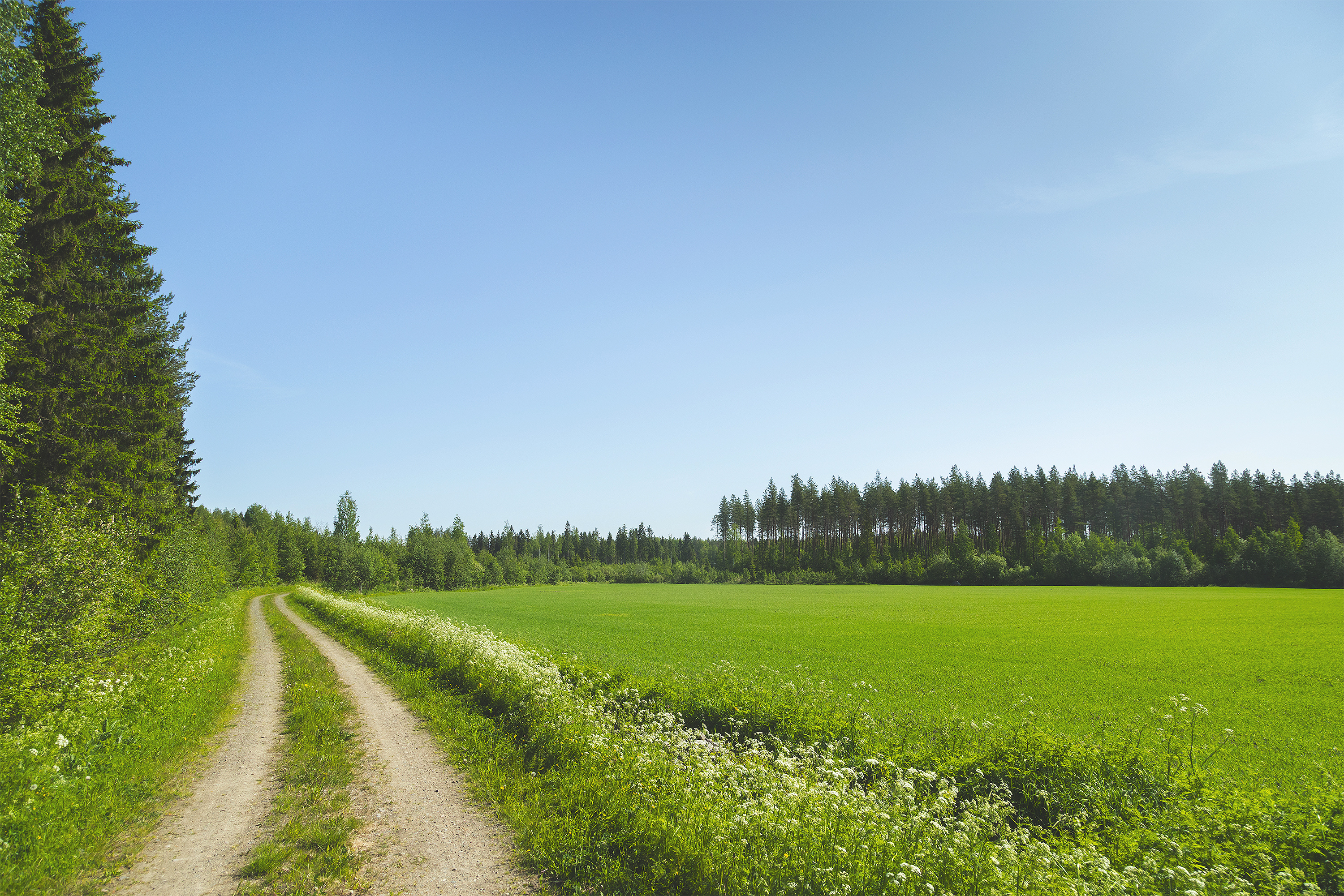
One leaves Haapajärvi on bicycle paths toward beautiful field landscapes. After crossing the Haapajärvi bridge, the route soon changes into a wide gravel road surrounded by country landscapes in the form of fields and outbuildings. There is another bridge to cross right around a bend, and this time it is the Lemmensilta (“Love Bridge”) on the railings of which you can check out love locks.
After crossing the Lemmensilta bridge, the route continues on a wide gravel road in good condition to the Härkäaho rapids. The beautiful rapids are well worth photographing. The route does not follow the gravel road from there but turns downstream on a smaller trail instead. There is a beautiful verdant cart road bed with a trail that is easy to ride on. A magnificent short singletrack section to start quite a long daily leg with!
The route then crosses a railroad, and the occasional changes between gravel and pavement cease when the route switches to a remote gravel road. The road surface variations here bear witness to the active forest industry since this section also includes somewhat coarser-crushed rock colloquially known as “log truck gravel” or “sauna stone”. The bigger the wheel size of the bike and the nicer the progress. Fortunately, the condition of the gravel road improves closer to the population centre of Muurasjärvi.
In case of need to do some purchases at this stage of the journey, there is a charming village shop called MeiJän Kauppa (“Our Store”) in Muurasjärvi. The route does not pass by it so getting there requires a short extra leg of about 5km.
Before Muurasjärvi, the route turns to smaller gravel roads in the middle of country landscapes. The remaining 14km to Pihtipudas is paved roads. Before Pihtipudas, one can still swing by the lean-to at Heinäjoki, leave the bike there for a while, and visit the nature trail that begins from there.
Pihtipudas has lots of services available including basic equipment for a cycle too if needed. Apart from food shops, there are cafés and restaurants in the population centre. The daily leg still continues from Pihtipudas a bit further south to the Niemenharju Tourist Centre.
Day 6: Niemenharju Tourist Centre – Hännilänsalmi Camping (58km, elevation gain 600m)
From the Niemenharju Tourist Centre, the route continues on the last day of the Loop on a paved road in the midst of beautiful esker scenery. The paved road continues a little further on the occasionally heavily-trafficked Viitasaarentie road until the route switches to gravel for a good 5km before following the edge of the main road for another few kilometres.
It finally leaves the Pihtiputaantie for good east of Löytänä in favour of gravel roads. These are in good condition and their surfaces vary between sand and hardened clay. A beautiful and roomy campfire hut along the gravel road section serves as a location for a break in case of need. It is situated virtually on the top of a hill so the road from there to Viitasaari in the middle of country landscapes is mostly downhill.
Depleted drink and food supplies can be replenished in the centre of Viitasaari. This population centre has a nice range of services available, and the lean-to in Paniaisniemi and the swimming place in Hiekka are fine places for a pause. There are several restaurant options. The Lyhty Viitasaari in an old wooden schoolhouse and the Kontti for example are great alternatives of which the latter at least is worthy of a special mention.
A short trip on bicycle paths and on the Äänekoskentie road separates Viitasaari from the Hännilänsalmi Camping area if the plan is not to take the bike and hop straight away on a bus home.