


 349 km
 4-7 days
 3313m
3313m 226m
226m 72 %
72 % 0.5 %
0.5 % 3
3 100 %
100 %The Weichselian glaciation came to an end about 10,500 years ago when the last of the continental glacier melted in Northern Finland. The ice age started 116,000 years ago and lasted for more than a hundred millennia. The ice mass deformed the Finnish soil and eroded bedrock as it retreated, grew, and moved leaving behind a moraine layer of an average thickness of 7m. The moraine layer evolved eventually into terminal moraine ridges and eskers. However, the ice mass also created moraine-free areas of base rock, ravine valleys, and gorges. As a result today Central Finland has its unique geology of rolling forest-covered hills, occasional base rock formations with steep-sided cliffs surrounded by thousands of lakes and ponds.
The Hitonhauta (Goblin’s Gorge) gorge is one of the most rugged of its kind in Finland. More than 500m long and 20–25m deep, it is believed to have taken its final shape as a result of meltwater streams at the end of the Weichselian glaciation. Apart from its unique shape and geology, the gorge is important for its biodiversity as well and it received a protected status since the mid-1980s. The ravine and its area are home to several threatened species of plants and biotypes. The Hitonhauta or Goblin’s Gorge owes its name to a folktale goblin named Hitto (also used as a mild Finnish curse that translates approximately as “damn”) who used to scare people for his personal enjoyment. One can even find Hitto’s petrified face in a rock wall of the gorge if you just know where to look and have some imagination. Please note, that the Hitonhauta Gorge has been temporarily removed from official use due to a identified safety issues, and a safety assessment will be conducted during 2025. Although all signage and official maintenance will be discontinued, the area remains accessible under everyman’s rights at one’s own risk.
The Goblin’s Gorge is though just a cherry on top of what the route has to offer. Overall, the route is a fine collection of some of the pretties gravel roads east and southeast of Jyväskylä City, which link nicely from village to village and sight to sight. Of the three Lakeland by Cycle routes, it stands out especially by having 20 beaches on the route, making the route an easy choice during the hot summer months.
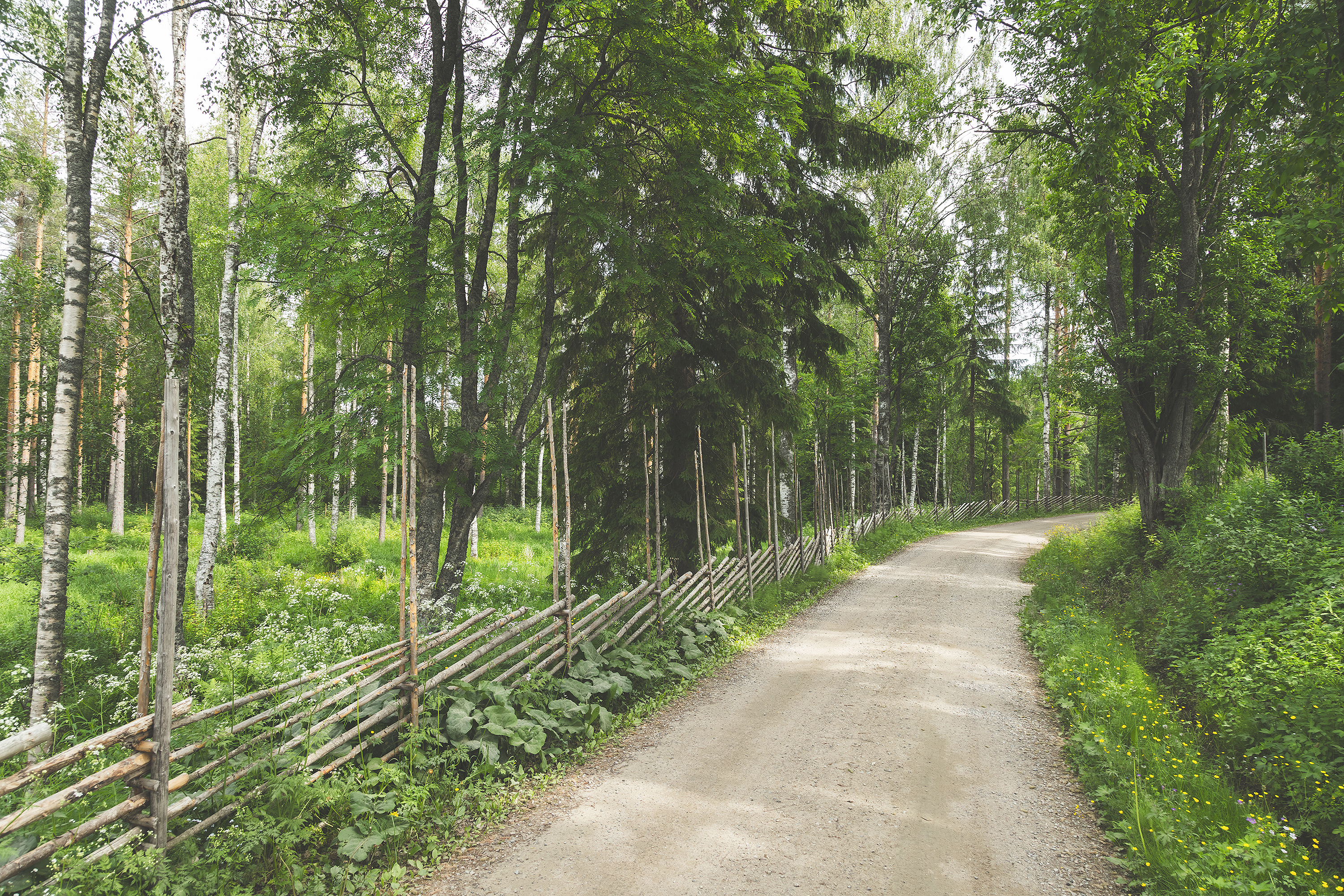
The route starts from the Jyväskylä downtown on a mostly paved side road and then finally after 17km gets on gravel and to the shores of the great Lake Päijänne. On the way to the southern point of the route, Joutsa, the route passes the Leivonmäki National Park, which offers some of the best gravel riding, untouched nature, and epic campsites found anywhere in the country. After Joutsa, old trafficless gravel roads visit the villages of Toivakka and Lievestuore. The northern part of the route is mostly really nice rollercoaster-like gravel as well, though it has lots of individual sights and attractions as well. Saraakallio rock paintings, the little Kirkkoniemi nature reserve (closed in 2024 for bridge renewal), the rapids of Kuusankoski and Kapeenkoski as well as the Goblin’s Gorge itself are located along the northern section. The westernmost section of the route is characterized by the epic gravel roads of the Uurainen area, which eventually lead to the hustle and bustle of the City of Jyväskylä.
In addition to great riding and great natural sights, the route is favored by many one-of-a-kind farm lodging options. The lodges on the way happen usually to be an easy riding day apart, so the route can be toured at a relaxed pace from lodge to lodge when you just book your stays well in advance. The route is tough at its best when combining some of the best campsites by the lake and the best lodging options. In terms of logistics, the route is easy and straightforward. No need to carry more than half-a-days rations and you get away with a couple of litres of liquids.
Despite the route being rather hilly and rollercoaster-like, it is suitable for pretty much everyone as there are basically no single-track sections or much of a rough stuff, that would need any bike handling skills. The beauty of the route is that if the route gets too physically challenging, there are loads of campsites and lodging options on the way to set the daily pace to one’s liking.
Read more about the route and a suggested relaxed-ish daily pacing in the Route notes below.

- 20 beaches by the lakes at regular intervals through the route
- Lots of services and restocking spots make bikepacking light and easy
- The Mämminiemi outdoor area with its camping area, beach, and sauna
- Idyllic and unique farm accommodations along the route
- The Hitonhauta Gorge in the northern part of the route - NOTE! Hitonhauta is out of official use due to safety reasons. .
- Gently rolling flowy gravel roads from village to village and from service to service
- The Lean-to island of Nyrölä accessible only by a short rope-pulley ferry
- Leivonmäki national park , with its scenic gravel roads, old forests, and lakeside campsites
- The Kirkkoniemi nature reserve with its lake-side lean-to and lake view (CLOSED IN SUMMER 2024 FOR BRIDGE RENEWAL)
- The route can be ridden on any bicycle with a minimum tyre size of 35mm. The surfaces vary from baby smooth gravel till mid-rough and soft-ish, so bigger tires don't do any harm at all.
- The best season for bikepacking in the southern part of Central Finland is usually from late May to late September. The day temperatures are within a 12-to-20 degree bracket in early and late summer and between 15 and 25 degrees during summer months.
- When selecting a sleeping bag, it is a good to assume that night temperatures can drop well below 10 celsius at least in the early and late summer.
- The route has digital navigation only. Please read the instructions and tips at bikepacking.com for successful route plotting here and here.
- Always stay on the route and aim to use only the recommended campsites and resting areas. In addition, follow the Metsähallitus Outdoor Etiquette.
- The entire route area is covered by a telephone network: help is always available by calling the national emergency number 112.
- Water supply points are often far from each other on the route so be sure to have enough water-carrying capacity at hand especially in summer heat. A minimum capacity of 2L is recommended, though
- The route can be ridden without carrying camping equipment at a daily progress as indicated in the trail notes when overnight stays are booked in advance.
- The prices of accommodation services vary but the quality-price ratio is usually excellent.
- Camping is permitted and free of charge at all of the campsites marked on the map, except on the organised camping sites with services. Additionally, some of the lodging options offer camping for a fee as well.
- As a rule, drinking water is not available at the recommended campsites so carry the water for the night from the nearest water supply point.
- Firewood and outhouses are available at only some of the recommended camp spots and other shelters on the way.
- There are AirBnB accommodation available here and there along the route.
- Restaurants, cafés, and shops can be regularly found along the route but the opening hours vary from season to season. Check out their opening hours in advance. The restaurants, cafés, and grocery stores are the most important water supply points on the route.
- You get away with carrying one days rations and two litres of water, however if camping you need the capacity to carry all the water you need in the camp as well. Also, if the weather gets hot, take into account that the water demand shoots up significantly.
- Making an open fire at the lean-tos and other wilderness shelters is strictly forbidden during forest fire warning. For information about regional forest fire warnings, click here (in Finnish).
- As a rule, drinking water is not available at the recommended campsites so carry the water for the night from the nearest water supply point.
- Tap water in Finland is of high quality and suitable for drinking. The roadside restaurants, cafés, kiosks, and shops are happy to fill riders’ bottles.
- Lake water can also be used for drinking or cooking, though treatment is necessary.
- Majority of the route is on easy and flat gravel and forest roads but there are some rougher and softer sections too. There are no technical sections, which would require mountain biking skills apart from a few very short exceptions. This makes the route well suited for everyone. The paved, gravel, and forest roads as well as the rare single track sections have been separated from each other by colour codes on the map. To find out more about the route difficulty ratings click here.
- The route is occasionally physically demanding at times due to some rollercoaster-like gravel roads but the uphills are often short and on the easy side. At the pace suggested in the Trail notes, the daily elevation gain and the consequent daily physical challenge remain moderate, and the good service frequency enables a slower progress too. The physical difficulty of the route can easily be increased by simply doing longer days, which the route is well suited as well as the services are plentiful. In terms of the physical difficulty, the route gets 6/10 while its technical difficulty stays on the lower end 3/10. The route can be ridden in both directions and the direction of travel does not affect its difficulty.
- In terms of resupply and logistics, the route is an easy one since the services are regularly paced and the distances between them are not long. However, keep in mind to carry enough water and make sure that you can replenish your water supply during the services’ opening hours. Thanks to the good traffic connections in the Jyväskylä region, getting back to Jyväskylä from various parts of the route is easy if the trip comes to a premature end or if one just wishes to ride it in parts. Among the services, only the bike maintenance spots are fewer and further between, and solving major problems may force a return to Jyväskylä. Overall in resupply and logistics, the route gets a difficulty rating of 5/10.
- The overall difficulty level of the route is 5/10 despite its occasional more physical sections, so its well suited for pretty much anyone.
- Bicycle touring on gravel is often the more comfortable the lighter the setup, and this route is no exception given its rollercoaster-like character. Bikepacking bags are always a lighter option to racks and panniers, but the route can be tackeled with any rig as long as you have light gears too. The recommended minimum tyre size is 35mm due to occasional coarser gravel and soft spots but an experienced rider will do with even narrower tires. On the other hand, going for larger than 35mm will increase comfort and is not likely to slow progress much at all.
- There are excellent train and bus connections to the starting point of the route in the centre of Jyväskylä from nearly everywhere in Finland. Booking of a place for a bike & seat well ahead is recommended if you don't have flexibility getting on and off the route area.
- The Lievestuore railway station is on the route as well, offering an alternative entry and exit point to the route.
- There is an excellent bus connection to Jyväskylä from nearly every major village along the route.
Day 1: Jyväskylä – Nukula (36km, 600m of climbing)
The first day starts in the heart of Jyväskylä at the train and bus station. The route passes by the Lutakko harbour park and the beautiful Kuokkala bridge via pedestrian and bicycle paths out of the city. The first 15-plus-kilometre section comprises mainly paved roads and pedestrian and bicycle paths. On the aptly-named Elviskuja alley, it is a good idea to check if Elvis-tupa – Little Graceland is open. Located at about 14km from the start, it offers coffee and snacks.
After the Presleyan experience, one still rides a while on a paved surface until the route switches finally to gravel roads, which may have some summer season traffic. The first gravel roads sections feature nice altitude changes, and some of the uphill stretches are steep. Note, that these climbs can easily obstruct visibility, so be careful with traffic on this particular section.
The gravel road is relatively narrow towards the shores of Lake Päijänne and the old Nukula farm. Nukula has accommodation and food available. This is where the short first daily leg ends but those who prefer to sleep in a tent might do well to head three kilometres further to the Mämminiemi recreational area.
Day 2: Nukula – Räykkälä Sheep Farm, Leivonmäki National Park (37km, elevation gain 630m)
The riding on the second day from Nukula is on nice gravel roads. A real treat awaits early on: the Mämminiemi recreational area is the first-night destination of tent campers. It features superb pause and camping possibilities and a rental sauna. On a hot summer day, there are numerous swimming spots, and you are guaranteed to stumble on other happy outdoor people and boating enthusiasts here.
From Mämminiemi, the route continues on an interesting gravel road with nice altitude changes. The gravel is a bit coarser and might be unsteady under the tyres on a few spots, especially in downhill sections. Before the village of Rutalahti, the route follows a narrow paved road for a while but heads soon after Rutalahti to the grounds of the national park of Leivonmäki.
One would do well indeed to savour the splendid gravel roads of Leivonmäki. It is a real pleasure to ride in such a magnificent environment on an excellent forest road. The lakeside camping structures of the Rutajärvi national park are within easy reach on a gravel bike. Both Lintuniemi and Joutsiniemi are excellent destinations for campers. The Karoliinan puistokahvila park café serves tourists on the parking lot.
The route switches for a while to a narrow paved road north of Lake Rutajärvi but the traffic is quiet and the accommodation of the second daily leg is only about 5km away. The Räykkälä sheep farm has excellent accommodation services and a sauna. There is a great place for a tent in the north end of Lake Harjujärvi 4km after the Räykkälä sheep farm.
Day 3: Räykkälä Sheep Farm – Tampinmylly Camping (33km, elevation gain 340m)
After the Räykkälä sheep farm, there is a short section of narrow paved road. Before long, however, the route moves to the splendid landscapes of the southern part of the national park of Leivonmäki. The gravel road made of magnificent compact sand in a dry pine forest is surrounded by beautiful pine ridges and small waterways. The cooking shelter by Lake Harjujärvi is a good location for a break and for setting up camp.
Even though the route soon leaves the national park, the gravel road remains excellent. Coarser materials have been used only here and there to repair the ever-changing forest road. The gravel road ends as it joins the Korpilahdentie road, but one only needs to ride a little over 1km before further gravel roads to Joutsa.
The section before Joutsa goes through farms and open fields on a wide gravel road in good condition. There are big agricultural machines moving on this road so attention is required even though visibility is good. One reaches the centre of Joutsa via a pedestrian and bicycle path that goes under Highway E75.
A wide range of easily accessible services is available in the compact population centre of Joutsa. One can go and enjoy provisions or a pause at the clean and pleasant local beach. The Haihatus Art Center and Residence is yet another interesting place to stop by. As Joutsa is the southernmost point of this route, what follows goes north.
After a short section of gravel road and the connecting asphalt road, the route reaches the accommodation at Tampinmylly Camping. Some spots of the narrow asphalt road are under heavy traffic so watch out. This goes on for about 4km. Tampinmylly Camping has several accommodation options available as well as an area for tents.
Day 4: Tampinmylly Camping – Toivakka (50km, elevation gain 1,000m)
From Tampinmylly Camping, the route continues on gravel roads in good condition towards the village of Leivonmäki. The last 5km of sand road are under regular log-truck traffic due to the roadside wood depot. The Hyvän mielen kauppa shop and the Karoliinan kahvimylly café can be found in the village of Leivonmäki.
One leaves Leivonmäki on a good gravel road that a short asphalt link connects with another gravel road of a more varied surface quality. There are occasional crushed-stone passages and some steep uphill and downhill stretches along the road. It is a good idea to watch out for soft rock material especially in the downhill sections.
At 24km after Leivonmäki, one arrives to the beautiful lean-to of Pirttijärvi atop an esker with a clear lake below. There is a firesite but no firewood at the lean-to. The path to the lean-to has already been a bit taken over by vegetation but if you look closely enough you will find it especially thanks to a hint on the map. A perfect spot for a break!
The fourth daily leg ends soon after the Pirttijärvi lean-to in the sympathetic population centre of Toivakka that has shops and a restaurant available in addition to accommodation services. The ceiling paintings by Pellervo Lukumies in the church of Toivakka are well worth a stop. The Huikon Huilaus lean-to a little more than 10km after Toivakka is a good spot for a tent even though it is situated a bit off the route.
Day 5: Toivakka – Kapeenkoski (63km, elevation gain 950m)
From Toivakka, the route keeps cllimbing north. The day begins with a short transfer on asphalt and soon continues on gravel. Ar first, the gravel road is a wide country one with more traffic but soon changes into a smaller one and occasionally becomes a narrow cart track. The condition of the gravel road west of the lake varies from coarse crushed stone all the way to an even clay bottom. There are also steep altitude changes ahead! A varying and interesting section.
The next population centre, Lievestuore, has all the necessary services available with the exception of bicycle maintenance. There is also a restaurant called 13-tien Grilli a bit before Lievestuore if one is too hungry to make it all the way to the village. Lievestuore has a train station in addition to shops and restaurants. No wonder, then, that the route after Lievestuore is on a gravel road next to the railroad by the edge of a field covered with flowers in the summertime. The route continues on small sand roads and for a moment along an excellent trail.
The gravel road widens a bit east of Lievestuore yet swings still by a beautiful village road before the Mustan Korpin Saluuna restaurant. The Kirkkoniemi lean-to north of the Saloon is well worth a visit as an excellent location for setting up camp or for taking a break. Take what firewood you need from the pile on the parking lot because, as a rule, there is not more wood at the lean-to than what previous campers have taken there.
NOTE! The Kirkkoniemi reserve and lean-to are not accessible in the summer of 2024 due to bridge renewal.
The route continues from the Kirkkoniemi lean-to to the Kuusa canal on a gravel road in good condition through scenic field landscapes. The Saraakallio rock paintings about halfway from Kirkkoniemi to Kuusa along a 7,000-year-old water route are the oldest ones in Fennoscandia. At Kuusa, one can study the canal area, and the accommodation services of the Varjola farm, the Koskikahvio café, and the Kuusankoski lean-to are all nearby.
The route continues toward Suolahti and swings for a moment by a paved road after the Kuusa canal. The gravel road sections make use of the sand roads and the recreational trail beds that vary from soft sand to hard surfaces. The route passes by the services in Suolahti whose centre has a wide selection of restaurants, accommodation, and shops. A little before them, the route follows a nice lakeshore trail by the Ahoniuksenpuisto park.
The fifth daily leg comes to a worthy conclusion via a short connection from Suolahti to Kapeenkoski. It starts on the bed of a recreational trail with occasional unrideable sections that are easily overcome even with a fully loaded gravel bike. The Kapeenkoski area has several lean-tos and good camping opportunities in addition to the Kapeenkosken Majatalo guesthouse.
Day 6: Kapeenkoski – Marjoniementila (44km, elevation gain 640m)
The sixth daily leg begins in the beautiful scenery of Kapeenkoski. The route to the Hitonhauta ravine is mainly on pavement roads but finally changes into a fast gravel road after the clear waters of the Suolampi pond.
The trail comprises beautiful forest roads and even short unrideable path-like sections. Please note, that the Hitonhauta Gorge has been temporarily removed from official use due to a identified safety issues, and a safety assessment will be conducted during 2025. Although all signage and official maintenance will be discontinued, the area remains accessible under everyman's rights at one's own risk. Similar ravine valleys are few and far between in Finland. If you decide to visit Hitonhauta, excercise caution and leave the bikes by the forest road where the challenging trail to Hitonhauta starts.
The route continues after the ravine valley on a rougher clearing road toward the Iso-Hirvanen beach in the village of Vehniä. There are activities at the equestrian facility in Tikkakoski north of Lake Luonetjärvi, and the sand road that is part of the route is in daily use for horseback riding. Ride the section calmly and give way to horses that come from the other direction or overtake you. If you are not sure about how to overtake or be overtaken safely, ask a rider for instructions. As the route heads north to Uurainen, there are no more signs of horse traffic on sand roads.
The village of Uurainen has restaurant and shop services on offer. There remains a short connecting stretch from the services in the centre to the day’s accommodation at the Marjoniementila farm. The gravel road to the farm is a very beautiful one and the farm is a sight in itself.
Day 7: Marjoniementila – Jyväskylä (57km, elevation gain 640m)
The last leg back to the starting point in Jyväskylä begins from the services at the Marjoniementila farm. There is at first a 5km-or-so asphalt connection to the west of Lake Kyynämöinen. The gravel road west of Kyynämöinen is part of a rolling flow route that is fun to ride on. Early on, you can already swing by the Huutoniemi beach for a swim or take a look at the pine tree known as Esan petäjä at the end of a short nature trail. The large Hietajärvi Camping site is also situated by the shore of Lake Kyynämöinen. Please note that there may be lots of car traffic on the sand road during the holiday season.
The good flow continues all the way to the small village of Höytiä in the centre of which an enchanting and very proper lean-to can be found as a location for a break. The nature reserve area of Konttivuori is also along the way to Höytiä. From Höytiä, the route goes south on gravel roads in good condition. In the village of Nyrölä, one can swing off from the route to the lean-to island of the same name. The island has a pause spot made of several lean-tos and a jetty for swimming and is readily accessible by a ferry that takes two cyclists and their bikes with ease. The distance to cover by ferry is a short one and one does not have to wait long for one’s turn to get aboard.
From Nyrölä, the route continues on nice remote gravel roads all the way to the Keuruuntie road. There is the short paved stretch of about 1km on the Keuruuntie road before it is back to gravel via a steep uphill section. Jyväskylä is not that far anymore, and its recreational trails are already there after crossing the Keuruuntie road and the short asphalt section in Ruoke.
The return to the cycle paths of the city of Jyväskylä is via the recreational trails of Laajavuori where roadbeds vary from sand to forest road. The route finally rejoins its starting point in the centre of Jyväskylä after a downhill stretch.